 UAV Navigation, a company that specializes in designing guidance, navigation and control solutions for UAS, has developed a new feature for its GCS software, Visionair. The goal is to improve surrounding traffic visualization for drones, enabling safe integration with manned aircraft.
For UAS to coexist with manned aviation, a new generation of airborne collision avoidance systems (ACAS) that allow UAS operators to visualize surrounding traffic is necessary, according to a news release. The same technology used in manned aviation makes it possible to auto-split the unmanned traffic, giving Air Traffic Control (ATC) the ability to identify risks and recommend actions.
“The UAV autopilot (FCC) is a key part of the unmanned traffic management system and its integration in the controlled airspace as it is the core of the platform’s flight control system,” according to the release.
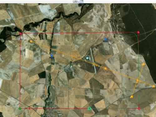
The company’s VECTOR range of autopilots receives the information from the transponder IN and relays it to the GCS software in real time, giving UAS operators surrounding air traffic information.
With this information, operators can take action if aircraft approach or have a crossed trajectory with any aircraft sensed, avoiding dangerous situations. The autopilot, by means of the transponder, sends information about its speed and location in the airspace to surrounding aircraft.
The system features an intuitive interface. Icons of surrounding aircraft have a different shape and color depending on response time. It also displays an indicator of the vertical speed for improved situational awareness.