Skimming for 8 hours over the Caribbean sounds like a dream, but for the BOREAL UAV it was just another working day. The long-endurance aircraft played a key role in an international meteorological campaign based from the island of Barbados in early 2020.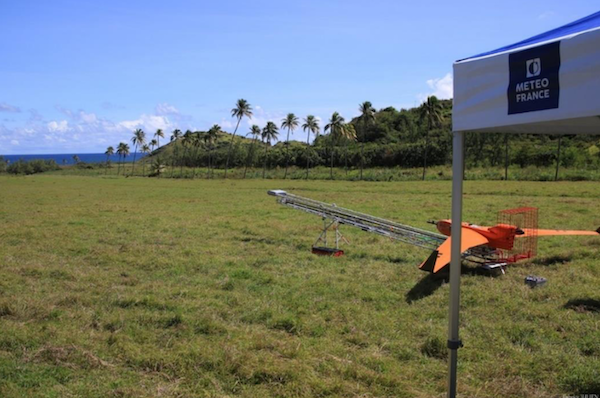
A Campaign with Unprecedented Resources
The EUREC4A project (Elucidating the role of clouds-circulation coupling in climate) involved more than a hundred European and American scientists in understanding current climate issues.
Understanding the effects of climate change on the tropical zone, and more particularly at the level of trade wind clouds, is a major challenge. Detecting property changes, even tiny ones, around these phenomena is essential as they illustrate the imbalances in heat exchanges that control the climate.
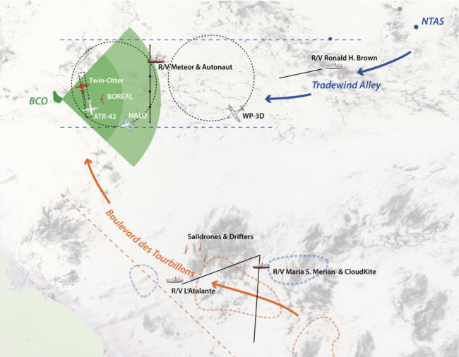
BOREAL’s role (in center of green fan shape) among many vessels and aircraft investigating the Caribbean tradewinds. BCO is the island of Barbados. Courtesy M3.
This meteorological campaign is one of the most important of the last ten years, mobilizing more than ten international laboratories specializing in the study of the climate. Co-directed by the Max Planck Institute for Biophysical Chemistry in Hamburg, Germany and the Dynamic Meteorology Laboratory in Paris, France, it also involved the Meteorological Research Centre of Météo France. From January20 to February 20, 2020, five oceanographic vessels, numerous instrumented floats, land-based observation means (aerosols, balloon releases), four meteorological research aircraft and, as a great novelty, UAVs, including the BOREAL of Météo-France, operating from the coast of Barbados.
A New Feature in This Campaign: UAVs
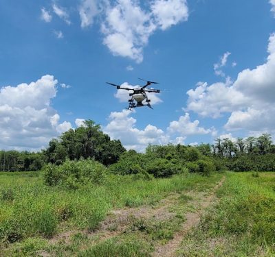
Various UAVs were deployed during the campaign. The BOREAL is the only one which flew in long range (over 100 km), in coordination with several meteorological aircraft, to collect measurements of radiometry, aerosols, temperature, humidity and turbulence in the lower layers of the atmosphere. The use of UAVs in a meteorological collection campaign is a first. The layers very close to the surface are poorly known because they are under-instrumented by scientists, even though they are precisely where the energy exchanges between the ocean and the atmosphere take place. This lack of data is due to the danger for scientific aircraft to fly so low (10 to 50 m above the surface).
The Key Qualities of the BOREAL
The campaign showed the interest of using a UAV like the BOREAL as a complement to the measurements of scientific aircraft. The BOREAL is capable of taking measurements very close to the surface thanks to its on-board radar, and has been able to take trajectories less than 50m from the surface of the Atlantic Ocean for several hours at a distance of more than 100 km from the open sea.
This campaign is the result of a close collaboration between the BOREAL and Météo France. The latter’s expertise in the meteorological field made it possible to develop and integrate innovative and tailor-made sensors for the UAV to meet project goals.
The BOREAL UAV demonstrated that its range and endurance were its strong points by carrying out flights lasting several hours in sustained winds, sometimes in stormy weather, with the instrumentation on board, while at the same time making it take off at its maximum load (nearly 25 kg). The UAV also proved its ability to land on poorly accessible ground due to the steep terrain in the east of the island.
Finally, the EUREC4A project has demonstrated that it is possible to deploy long-range UAVs such as the BOREAL among other aircraft in a coordinated manner, thanks to its satellite positioning and communication system shared with all the operators on the ground, making it visible in real time to all other aircraft.
For further details on BOREAL’s long-distance exploits in this and other campaigns, see BOREAL, Flying Far for Science from the December/January issue of Inside Unmanned Systems.