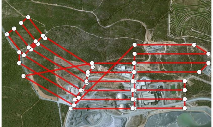
Capturing the Andalusian Mina de Aguas Teñidas A growing number of mining companies are employing unmanned aerial vehicles (UAVs), also known as unmanned aerial systems (UASs), remotely piloted air systems (RPASs) or simply ‘drones’. Equipped with digital cameras, such remote-controlled small aircraft generate high-resolution aerial imagery which can be further processed to produce highly precise orthophotos, point clouds and 3D models. Surveyors and engineers can use this data to make statements and forecasts about the development of the mine, document changes as well as calculate volumes of spoil and stockpiles. In mines with both aboveground and underground areas, UAVs can provide important information about the state of the aboveground area, thus improving the safety of the workers underground. This was practised in an 80-hectare area of the Mina de Aguas Teñidas in Andalusia, Spain. UAVs can assess hazardous areas by air that conventional equipment cannot reach, thus ensuring staff safety and offering numerous benefits in the mining industry. Which UAV is suitable for which mine depends on the desired result. In general, fixed-wing UAVs are used to map large areas. In contrast, rotary UAVs – multicopters with four to eight rotors – have shorter flight times, but can provide […]
Click here to view original web page at www.gim-international.com


