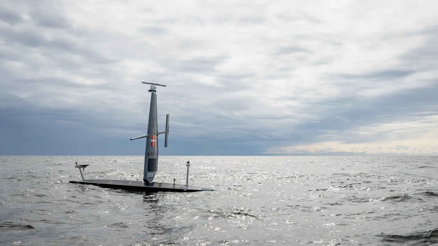
With its fleet of autonomous USVs, Saildrone is tackling a range of maritime missions that are less costly, carbon-intensive or dangerous than those using crewed ships—from mapping Exclusive Economic Zones (EEZs) to detecting illegal fishing and monitoring subsea cables for tampering.
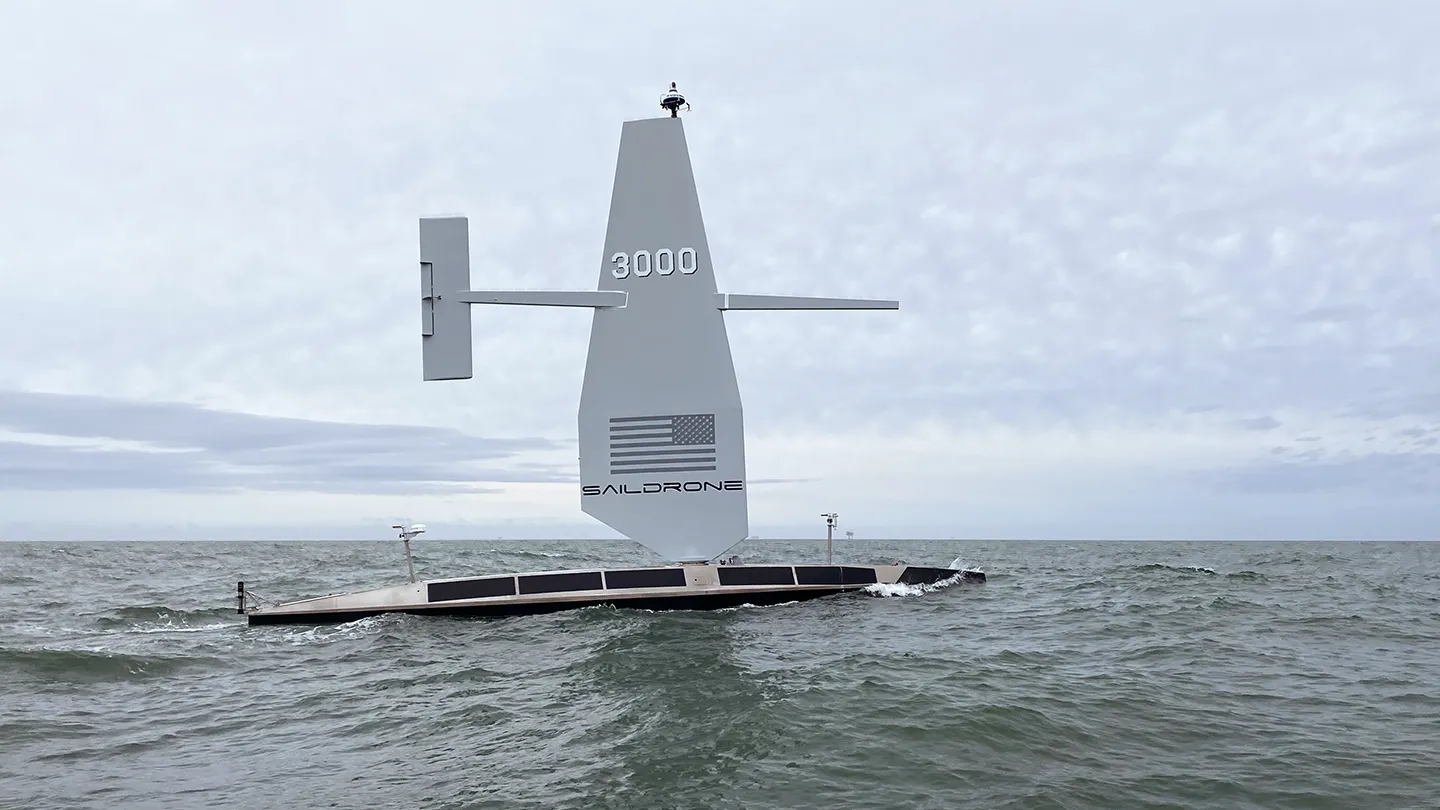
In a conversation with Inside Unmanned Systems, vice president of ocean mapping Brian Connon emphasized that this is creating a new, safer standard for managing ocean data and protecting undersea assets in contested, resource-rich waters.
“We’re probably half the cost of a traditional survey ship,” Connon said. “But more than that, we reduce risk. You’re not putting 30 or 40 people at sea—and if something happens to our USV, you don’t lose a life.”
A NEW BLUEPRINT FOR SUBSEA SURVEY
The Saildrone-Meta partnership emerged from the problem of capacity constraints in traditional survey fleets, and the carbon footprint associated with diesel-burning vessels. Meta, expanding its portfolio of undersea cables to support its data-intensive infrastructure, saw an opportunity in Saildrone’s low-emission, long-duration USVs.
Saildrone performed demonstrations along both existing and planned cable routes. The key challenge: proving that the company’s deepwater-capable USVs could meet technical standards for seabed mapping, identifying bathymetric hazards like sea mounts, canyons or coral reefs, over areas 8–10 kilometers wide.
Saildrone passed the test. Using high-resolution multibeam sonar and high-bandwidth communications enabled by Starlink, the company delivered near real-time imagery from deepwater survey routes without deploying a crewed vessel.
“High-bandwidth satellite communications have been a game-changer,” Connon said. “You have to be able to see that route in near real time in order to reroute around hazards. Now we can do that without anyone being at sea.”
MAPPING WITH MISSION
Saildrone’s work goes beyond commercial efficiency. In Connon’s view, it’s a national and global security imperative, particularly in shallow waters, where cables and pipelines are most vulnerable to trawling, anchor drags and sabotage.
“The idea of protecting critical undersea infrastructure is really about developing a system of systems,” he explained. “A Saildrone on the surface can monitor radar, cameras and AIS [Automatic Identification System] to detect ships that might have paused over a cable route or turned off their AIS.”
This surveillance can cue other assets—aircraft, ships or subsurface sensors—to investigate further, enabling what Connon described as “intercept and prosecute” operations. As cable owners increasingly instrument their systems to detect anomalies, Saildrone platforms could be employed to verify or trigger a response to incidents.
“If the cable detects something strange, or if a vessel suddenly drops off AIS, we can be redirected in,” he said.
Such responsiveness is critical. In March 2024, a Houthi missile strike on the Red Sea-bound cargo ship Rubymar resulted in three undersea cables being cut—demonstrating how conventional conflicts, as well as sabotage and accidents, can rapidly imperil global data flow.

BEYOND DATA: PIPELINES, BIODIVERSITY AND ENFORCEMENT
Saildrone’s Voyager-class USVs, which carry high-resolution shallow-water sonar, are also tailored for energy infrastructure like pipelines. While many subsea cables are buried, pipelines are often exposed, making them easier to detect—and to damage.
“Pipelines aren’t buried. If there’s a leak—oil or gas—we can capture that in the water column using sonar,” Connon said. “You can literally see a break.”
This capacity extends to environmental applications. Saildrone USVs are increasingly deployed to monitor marine protected areas (MPAs) and EEZs, where illegal fishing and unauthorized resource extraction can threaten both biodiversity and national sovereignty.
“You might be protecting biology, not infrastructure, but it’s the same surveillance challenge,” he said. “The illegal fishing fleet isn’t going to stop just because a line is drawn in the water.”
Saildrone’s EEZ mapping of the Cayman Islands—funded philanthropically—may become a template for other island nations.
“They’ll know where to run cables, where to define fishing zones or marine protected areas,” Connon said. “They’ll be able to model ocean conditions better—and potentially identify critical minerals. That’s the blue economy in action.”

BUILDING THE BALTIC WATCH
Given recent cable sabotage incidents in the Baltic and growing tensions in the region, Saildrone’s expansion into Denmark is significant. The new office positions the company close to a theater of active concern for NATO, the EU and private stakeholders.
“That’s one of the reasons we opened our Denmark office—maritime security in the Baltic,” Connon confirmed.
From there, the company hopes to build out capabilities for cooperative security missions, both in partnership with governments and with cable owners like Meta or telecom firms. These actors have mutual incentives: uptime and sovereignty.
“It costs a lot of money to send a repair ship out. The more you can do to protect a cable, the better it is for everyone,” Connon said. “But if something needs intercepting, that’s going to be a defense mission.”
A SYSTEM OF SYSTEMS FUTURE
Ultimately, Saildrone envisions a layered defense where its uncrewed platforms patrol the surface, underwater sensors detect anomalies, cable instrumentation flags tampering and government or military units respond to validated threats.
It’s a model that blends climate stewardship, maritime domain awareness, national defense and corporate resilience. From mapping Meta’s transoceanic cables to detecting tampering near Baltic pipelines, Saildrone’s uncrewed surface vehicles are reshaping how nations monitor the seabed. These activities all point toward the larger mission: safeguarding the underwater critical infrastructure that powers the digital age. “Whether you’re protecting a cable or an endangered fishery, the ocean’s health is the Earth’s health,” Connon concluded. “You can’t manage what you haven’t mapped. And you can’t protect what you can’t see.”