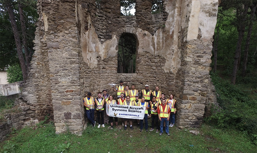
Embry-Riddle students in a study abroad program in Kosovo used a UAV to capture this image in StanTërg, in front of cathedral ruins dating to the 13th century.
It was quite a summer for the Embry-Riddle Aeronautical University (ERAU) students, who traveled both to Oklahoma and to Kosovo to perform a variety of UAS operations and to enhance their skills and their education.
Under the guidance of ERAU’s Nickolas “Dan” Macchiarella, Ph.D, Professor, Aeronautical Science, nine Daytona Beach students went on a UAS Disaster Study Away trip in May to support Oklahoma Emergency Management and Dept. of Wildlife Conservation efforts to survey the aftermath of large rangeland fires that raged across hundreds of thousands of acres in Oklahoma in April.
Then in July, 16 Embry-Riddle students armed with small unmanned aerial systems (sUAS) worked to complete photogrammetric work in support of cultural heritage preservation at a half-dozen sites in Kosovo, as part of another study abroad program this summer.
During the Kosovo trip, students took an upper-level social studies course in Political Violence and Terrorism, taught by the Rochester Institute of Technology Kosovo (American University Kosovo – AUK). The trip kicked off with a tour of the Balkans, including Albania, Croatia, Montenegro, Northern Macedonia, Serbia and Bosnia-Herzegovina. The Kosovo program was organized by the Office of Global Engagement on Embry-Riddle’s Daytona Beach, Fla., Campus.

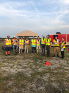
The students and faculty after completion of preparatory training on May 10.
Oddly enough — and certainly without any complaints from anyone — Oklahoma did not experience any tornadoes this spring and summer, troubling weather disasters that have been a problem all too often in recent years. That’s part of the reason the students’ program ended up dealing with wildfires.
“We were studying UAS disaster response, and we made a relationship with the State of Oklahoma, to work with the Oklahoma Emergency Operation Center,” Macchiarella said. “We offer our services and they dispatch us. We use unmanned systems either to first help first responders perform their job and, or to provide imagery afterward.”
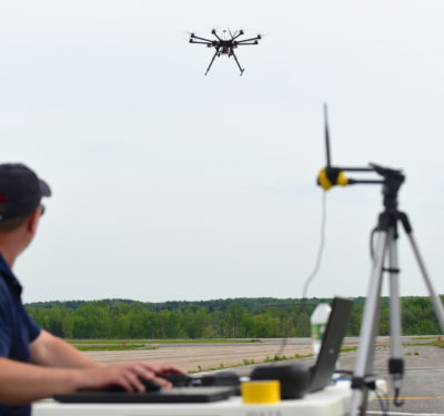
The project involved using some FLIR thermal imaging cameras as well as some regular visible light cameras on the UAS flights. Additionally, the students would process the data and images and work with orthomosaics and 3D models. Students operated the senseFly eBee and DJI Inspire 1 UAS to collect and share still and full motion imagery while gaining a deeper understanding of the operational requirements and coordination associated with UAS in support of disaster relief operations.
“This year, unbelievably the State of Oklahoma didn’t have a tornado in the month of May, which is not bad thing,” he said. “We don’t want anyone else’s hardship just to allow us to work on disaster response. But what they did have was a giant fire in April. The fires were known as the 34 Complex and Rhea Fire.”
With some extra training under their belts, the Unmanned Aircraft Systems Science degree program students performed a service learning project in Oklahoma for two weeks, flying unmanned systems at the direction of the Oklahoma State Emergency Management Agency.
“The state used us to assess wildfires this year and we primarily used the multispectral Parrot Sequoia to assess the aftermath of the Rhea fire and 34 Complex fire,” said Macchiarella, noting these fires burned about 300,000 acres.“We post processed images and created normalized difference vegetation index (NDVI) reports. The NDVI reports were useful for determining recovery and, most notably, how prescribed burning protected various areas.”
The researchers also used FLIR products as part of an effort to assess the impact of the fire upon large mammal populations such as elk.
“We went out and imaged the aftermath of those fires and we used multispectral cameras and then processed them and created orthomosaics and provided that to the state,” he explained. “What was really fascinating for us and for our students was to see the effects of the controlled burn.
“Because in the land where they had a program of controlled burning over the years, as the wildfire occurred, it didn’t kill all the plant life. Basically in the sense it was almost another controlled burn because it happened so regularly, so the plants were rebounding. In 30 days they were coming back.”
The imagery illustratedvegetation recovery in certain areas, but also indicated how the prescribed burning had protected various areas.
“It was a great experience for the students and another thing we did was professional education and outreach,” the Embry-Riddle professor added. “We met with firefighters all throughout the region. The state is divided into districts for emergency management, so we would go in and talk with them and show them what possibilities unmanned systems have for their type of work. That was to me real rewarding.”
The students in the university’s unmanned systems sciences degree program have goals upon graduation that include becoming a professional UAS operator or program manager. Studies working with projects like the Oklahoma wildfires and the Kosovo UAS operations dealing with various cultural heritage sites and the preservation of ancient ruins around the country make for great educational and eye-opening opportunities for the UAS industry.
“Most of our graduates move into larger systems, but as the regulatory environment increases in America, there are more and more small UAS (sUAS) opportunities and some of the students are moving into that,” he said. “It’s like we’re in the barnstorming age. It’s like airplanes were first being used for World War I.”
For the trip to the Balkans, Embry-Riddle had a grant from the U.S. Embassy in Kosovo, and the team worked with NGOs (non-government organizations) such as one called Cultural Heritage without Borders. https://news.erau.edu/news-briefs/eagles-help-preserve-kosovos-cultural-heritage/
“We documented significant cultural heritage sites, imaged those using techniques to create orthomosaics and 3D maps, and it was an amazing experience. Everybody was very appreciative and we’re going back next summer. I didn’t spend much time home last summer, but it was very rewarding.”
The projects were very rewarding indeed, for all parties involved – students, educators and the local organizations who benefited from the UAS technology and the data collected.


