Edgybees’s before-and-after photos of a disaster situation. Photo courtesy of Edgybees.
The U.S. has experienced record-breaking disasters over the past year, which has put rescue workers on overtime and increased the number of airborne drones helping out. Sometimes, though, drone imagery doesn’t tell responders all they need to know.
Edgybees, a visual intelligence technology company based in Gaithersburg, Maryland, has been working with Hood Tech Aero of Hood River, Oregon, which provides air-borne imagery. Together, they are taking much of the mystery out of disaster imagery.
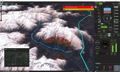
Combining Edgybees’ video analytics software and Hood Tech’s sensors, what they’ve come up with has the potential to improve situational awareness for firefighters and others by superimposing what amounts to labels in real time over imagery the drones have captured.
The annotations, which might say something like “hospital,” “school” or “police department,” can help firefighters decide where to apply water or other resources, or assist rescue workers in finding key structures among rubble.
“In firefighting, the main thing is to get situational awareness,” said Garrett Bryl in a video interview. Bryl, a Joshua, Texas, volunteer UAS pilot, has been involved with disasters such as storm damage, fires and floods, and partners with his local fire department in growing their use of drones. “Edgybees enhances the capabilities that we already have from drones,” he continued. “So, if you were looking to figure out what streets to route an engine or brush truck to, that’s available from the air rather than having to try to decipher what you’re seeing in the visual against a map. It just adds the information right on top and you can make decisions quicker and better.”
Adam Kaplan, CEO and Co-Founder of Edgybees, said that, “The major output of a drone is an image of a video, but when people look at the image, they have difficulty understanding it. What we did was to build a software that allows you to understand what you’re looking at and we do that in real time. We can take any type of data and imagery and allow you to fuse that together to give you full awareness.” The system, he explained, can, for example, utilize satellite imagery or radar, and can be used from satellites and space.
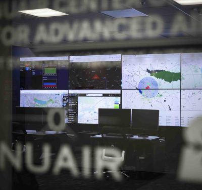
Games to Awareness
Edgybees originated as a gaming company that built an augmented reality game on a drone— initially the game was like “the Death Star [a reference to “Star Wars”] coming in on an IPAD.” That, said Kaplan, helped the team realize the importance of combining data with images—the original company, founded in 2017, had pivoted into infrastructure and government spaces by 2019.
Edgybees approached Hood Tech Aero about a year ago, said Johnny Young, Vice president of Hood Tech Aero, which supplies arrays of multiple advanced sensors. The company is part of the Hood Tech conglomerate, which supplies its camera turret payload to Boeing and other users. “We use basically the same payloads [with our sensors] and were able to discover that using their software we could enhance situational awareness using both our manned and unmanned systems,” Young said.
Edgybees’ Kaplan elaborated on potential uses. In a National Football League (NFL) game, for example, you can label the ten-yard lines, he said. But disaster situations are where Edgybees hopes to make the greater impression. “Suppose a fire is heading towards a pipeline,” he said. “You want to know where that is.”
“You can identify any kind of critical infrastructure,” he elaborated, pointing out the value to responders, relief agencies, FEMA, mining companies, insurance companies, border patrol and anyone else who needs real time data visualization.
“An insurance company could visualize which buildings they are covering, police or firefighters could see where people are in relation to potential emissions,” Kaplan said. The Edgybees software saw use during Australian wildfires in 2020, in wildfires in northern California and during hurricanes, such as Irma. “We can look at a flooded street and label critical structure,” he added.
With Edgybees, much of the mystery can be solved.