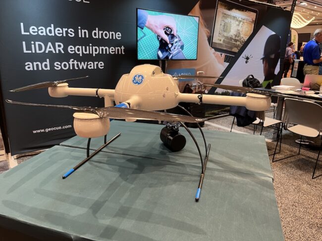
Surveyors and engineers who needed overlapping LiDAR images looking straight down would have found a solution at the GeoCue Group Inc. exhibit at last week’s Commercial UAV Expo in Las Vegas.
Chad Dillard, manager direct sales North America, for the Madison, Alabama-based company, talked about its new higher-end LiDAR scanner, the TrueView 655/660, released two weeks ago. “We added a third nadir camera which points straight down” he explained, “and which gives additional overlap in the middle.” The company received numerous requests for such a product, he noted, and that the market includes a range of users including larger engineering firms.
At the show, Dillard said, “We’ve also been talking about our LP360 Drone LiDAR Data Processing Software.” The product, formerly EVO Drone Mapping Software, processes data collected from drone LiDAR or point clouds derived from photogrammetry. As explained on the GeoCue website, the software can create and manipulate point cloud data directly from LAS files without time-consuming importing or converting processes. This provides tools for rapid visualization including 3D point clouds, as well as additional abilities when included in other systems.
GeoCue offers integrated drone LiDAR solutions, targeting surveyors, mappers and engineering firms that need to do topographic mapping. Customers buy its sensors and can then process data through its software. The company sells a package including a drone (from a third party) with the sensor package already integrated. It also will integrate its sensors onto a customer’s drone when the customer ships it to GeoCue.
GeoCue also offers monthly rental options for customers who only have occasional need for the equipment.