AirData and Wingtra Collaborate to Support Professional VTOL Drone Mapping and Surveying Operations
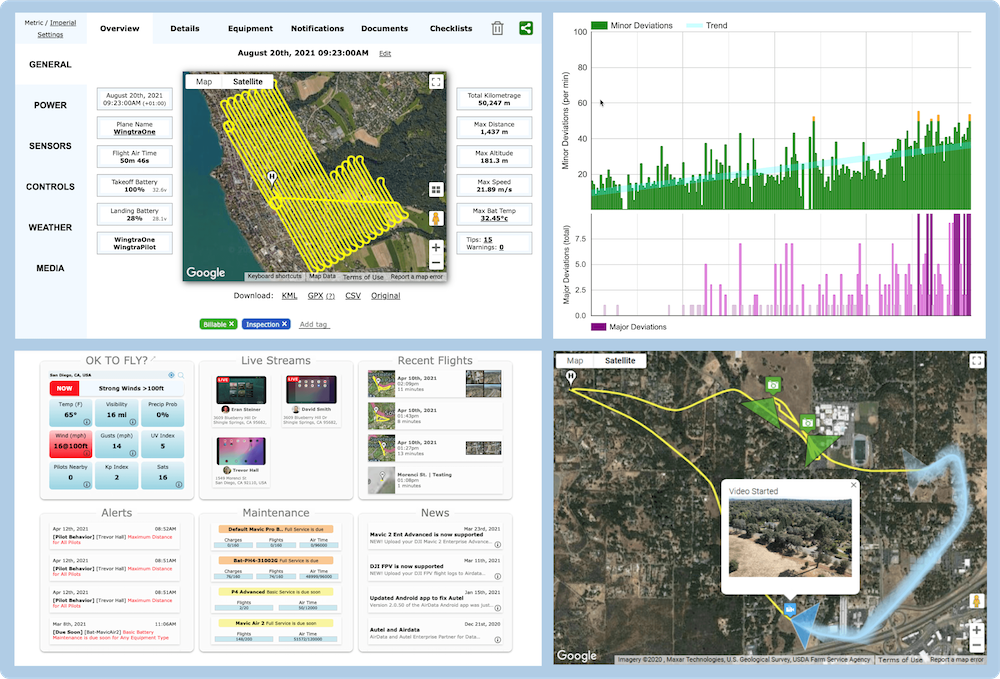 As of October 19, AirData UAV and Wingtra are excited to announce a new partnership which enables AirData, the leading drone data management platform, to process and analyze flight logs from the world’s most efficient and reliable VTOL on the market. The Wingtra-AirData collaboration provides surveying and mapping pilots a streamlined, reliable way to track and manage flight data and aircraft maintenance, providing efficient access to FAA-mandated record keeping and valuable data benefitting the organization’s flight programs.
“Wingtra’s key aim has always been centered around making life easier and more successful for our customers,” said Julian Surber, product manager at Wingtra. “We’re happy to announce that WingtraOne data is now streamlined and completely compatible with the AirData flight management platform, which shares our focus on easing data management so clients can focus on quality data and achieving their goals.”
Wingtra brings an accurate and intuitive solution to support the surveying and mapping needs of any industry. Both AirData and Wingtra pride themselves on eliminating risk and increasing accuracy, improving efficiency, and providing a full spectrum intuitive solution. AirData and Wingtra are excited to provide surveying and mapping customers with a powerful collaboration to advance their programs safely.
“We are proud to partner with Wingtra to provide customers with fleet management and flight log analysis of the Wingtra platform. This dynamic aircraft excels in high-performance accuracy and reliability, and is a powerful tool combined with AirData’s abilities to reduce flight risk, manage equipment, and maintain compliance,” said Eran Steiner, founder and CEO of AirData.