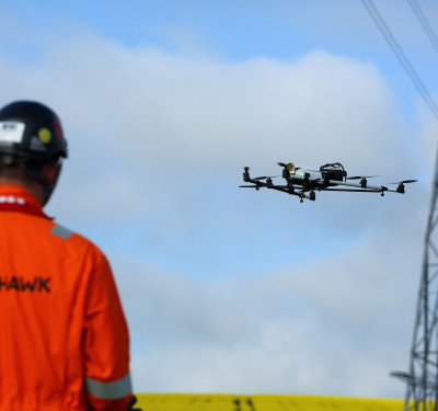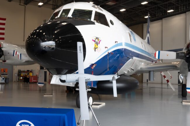
LAKELAND, Florida—The National Oceanic and Atmospheric Administration (NOAA) launched an ALTIUS 600 unmanned aircraft into Category 5 Hurricane Ian last year and showed the small aircraft could not only fly for nearly two hours in the storm but send data to a manned P-3 Orion aircraft up to 130 miles away.
For this hurricane season, NOAA wants to stretch the ALTIUS 600’s envelope even more by flying it longer and sending the data farther. The vehicle, built by Area-I, a subsidiary of Anduril, set records for drone endurance, wind speed and communications, said Dr. Joseph Cione, lead meteorologist at the NOAA Oceanographic & Meteorological Lab’s Hurricane Research Division.
“The crazy thing is, we didn’t even get to the tip of the iceberg of what this thing can do,” he said at a recent NOAA press briefing on the upcoming hurricane season here at NOAA’s Aircraft Operations Center. “We think we can double the endurance, probably go a little longer, and if it can handle a Category 5, unless we put this on another planet, we’ve already shown it can handle whatever Mother Nature can throw at it.”
NOAA has used drones to study hurricanes for years, but their performance was limited. The Coyote, the precursor to the ALTIUS, could only communicate with the P-3 up to 20 miles. “So, now we have 130 miles, and I think we can probably go even more than that,” Cione said.
ALTIUS Aloft
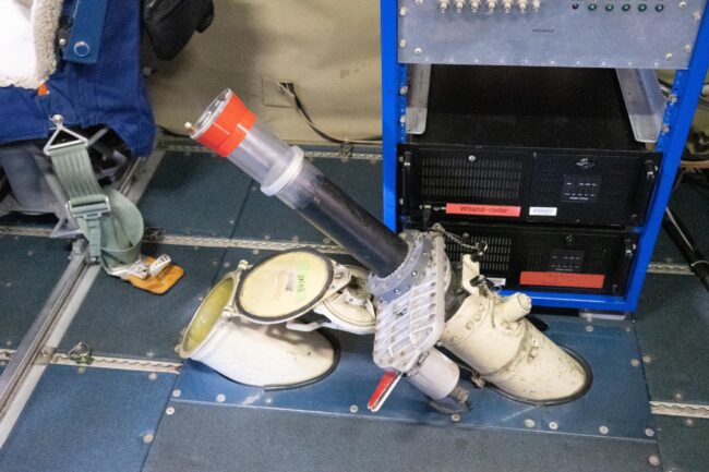
The ALTIUS—an acronym that stands for Agile-Launched, Tactically Integrated Unmanned System—can be launched from ground, sea or air. In this case, it’s pushed through a tube at the bottom of the P-3 Orion, next to the smaller tube where dropsondes—expendable monitoring devices that drop through the hurricane—are launched.
“It’s an attritable asset,” said Patrick Sosa, an aerospace engineer at Area-I, said of the ALTIUS, meaning once the vehicle hits the water, it’s gone. It’s launched from the P-3 and then conducts its flight autonomously. “We don’t interfere with their mission,” Sosa said of the scientists on the P-3. “We don’t change their mission profile at all. It’s an independent sensor that just provides extra capabilities to their mission.”
The ALTIUS actually carries the same instrumentation as the Finnish-made Vasala dropsondes, measuring wind speed, temperature, barometric pressure and humidity. The difference is the ALTIUS can keep them in the air much longer.
“This platform is bigger and can fly longer. So, longer is more data. More data? Better,” Cione said. “Any scientist is always looking for more data.”
The vehicle weighs up to 27 pounds and has a flight time of four-plus hours, which NOAA intends to put to the test. The agency has six ALTIUS 600s this year available for flights, versus the single flight conducted in 2022.
“As the technology has evolved, our ability to sample more over longer periods of time with less risk to humans, flying into areas that we would just never be able to go into, has been significant,” said John Cortinas, director of the NOAA Atlantic Oceanographic & Meteorological Laboratory. “We’ve opened up to a whole new set of observations that we’ve never seen before.”
Ultimately, the goal is to improve hurricane forecasting to save lives and money.
The ALTIUS, and another small UAS, the Black Swift Technologies S0, will fly well below where the crewed P-3 can operate, from zero up to 4,000 feet.
“Why do we want to fly down there? Because that’s where all of us live,” Cione said. “It’s also where the storm gets its energy from, from the ocean. It’s an incredible layer that we don’t understand scientifically very well.”