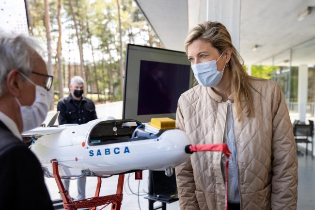
Belgian Minister of the Interior Annelies Verlinden inspects the drone. All imagescCourtesy SCK CEN.
The Belgian nuclear research center SCK CEN and the Belgian aeronautical specialist Sabca have developed drones to carry out radiological measurements.
The nuclear sector can now rely upon the assistance of unmanned aircraft as part of the monitoring program or during decommissioning projects or emergency planning, to carry out radiological measurements without any human intervention. “That will result in a significant step up in terms of radiation protection,” says Eric van Walle, the Director General of SCK CEN. The measurements will be indispensable for the purpose of characterizing forms of radiation and carrying out the radiological monitoring of nuclear sites and their surroundings.
“The drones will be first used as a preventive measure to study areas for potential radioactive contamination,” added Belgian Minister of the Interior, Annelies Verlinden. “We are also preparing for possible remediation. Thanks to the detector, measurements can be performed during crises without any human intervention. This maximizes the protection of collaborators.”
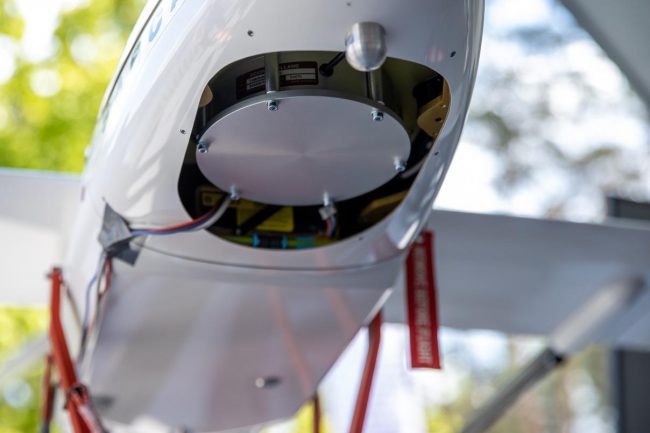
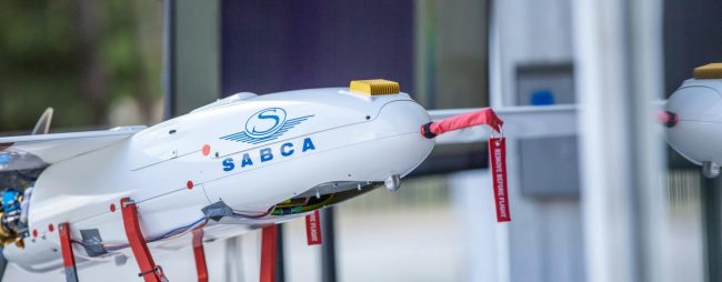
Scintillation detector attached to drone fuselage.
Sabca provides two types of drone: a fixed-wing drone that can fly autonomously for hours and the multicopter, which can carry heavier detectors without sacrificing flexibility. A scintillation counter is attached to the drone. “The device measures radioactivity by counting flashes of light caused by the influx of ionising radiation, which in turn indicates the magnitude of the radiation dose. The more light, the more radiation,” explained Johan Camps.
“Drones allow us to chart every last nook and cranny,” explained the Sabca scientist, “which is something we cannot achieve using measurements carried out by hand or from a helicopter. In contrast to traditional measurement techniques, the information is actually already being received while the drone is still in the air. We therefore receive information in real-time from a larger number of specific locations.”