GeoCue, a provider of geospatial hardware and software, in collaboration with CHC Navigation, a company known for its precision positioning technology, have unveiled the TrueView 540 LiDAR system. Announced at Geo Week 2024 in Denver, Colorado, this new system integrates LiDAR technology with LP360 3D Point Cloud Processing Software, aiming to enhance survey-grade LiDAR applications across North America.
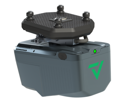
Developed by CHC Navigation, the TrueView 540 is designed to provide enhanced data density, accuracy, and precision for aerial surveying. The system combines high-precision LiDAR, an accurate positioning and orientation system, and a full-frame industrial camera in a compact, lightweight package suitable for various drones, including the DJI Matrice 350 and other UAVs.
Frank Darmayan, CEO of GeoCue, and George Zhao, founder and CEO of CHC Navigation, both emphasized the strategic nature of their collaboration. They highlighted the system’s potential to address the need for reliable and efficient 3D data acquisition in complex surveying environments.
The TrueView 540 features include high-precision LiDAR technology comparable to high-end industry-standard payloads in terms of range, density, and accuracy. It will be made available through GeoCue and its authorized distributors. The system promises to streamline data processing with GeoCue’s LP360 Drone software and offers a competitive price point in the UAV LiDAR market.
Vivien Heriard-Dubreuil, CEO of GeoCue’s parent company mdGroup, pointed out the system’s potential to provide a cost-effective solution for geospatial professionals, aiming to improve efficiency and return on investment in surveying projects.


