At Xponential 2024 in San Diego, Inside Unmanned Systems interviewed Mike Horton, CEO of GEODNET, to explore how the company is expanding GNSS reference networks with its innovative blockchain-based participatory model.
IUS: Today with us, we have Mike Horton, who’s the Chief Executive Officer of GEODNET. And for those of you who don’t know, GEODNET is building the world’s largest GNSS reference network. Welcome, Mike. We’re really happy that you’re here.
Mike Horton: Thanks for having me.
Richard Fisher: It’s a pleasure. So if you could express to us what the fundamental value proposition is that GEODNET brings to the drone community?
Mike Horton: GEODNET is a huge RTK network with over 5400 stations registered, providing RTK coverage throughout North America, Europe, and several developing economies such as India. We’re also expanding into Brazil and Southeast Asia. The fundamental value is that it’s really easy to get RTK with your drone. Connect to GEODNET, and you’ll have an RTK fix within a few seconds, deployable almost anywhere.
IUS: That sounds like a standard reference network until you consider the underlying business model, which is really disruptive. Can you tell us about that?
Mike Horton: Sure. First, to highlight the growth, we’re adding about 150 stations to the network per week. The core of this rapid growth is the participatory model and the blockchain nature of the project. You can add a GEODNET station to the network in a permissionless fashion. Once the station is added and producing high-quality geodetic-grade data, you start earning GOD tokens, which are actively traded on several crypto marketplaces. This provides earning power for the station host and allows the network to grow globally.
IUS: So all those station operators are actually earning tokens?
Mike Horton: Yes. In the GNSS community, we have operators on the blockchain side, but many are also in the UAS, farming, and survey communities. They operate stations for the economic benefit of earning tokens and for the utility of having access to RTK data.
IUS: It seems like you’re building a community, not just offsetting costs.
Mike Horton: It really is a community and an ecosystem where you have partial ownership and control over your contribution. If you need reference stations in a certain area, you can add them yourself, helping your business and your neighbors who may also need precision GPS data.
IUS: Now that we understand the business model, let’s dive into performance. How does GEODNET stand up in terms of precision, accuracy, and convergence time?
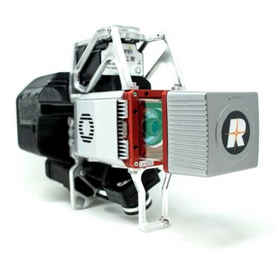
Mike Horton: Our stations are geodetic-grade, supporting all constellations and frequencies like GPS, Galileo, and BeiDou. The network is new, with consistent receivers and antennas, all calibrated and monitored 24/7. This ensures high-quality data when you log in and use the RTK service.
IUS: What about convergence times?
Mike Horton: Convergence time depends on the quality of the rover. Typically, it ranges from a few seconds to a couple of minutes, depending on sky conditions and the receiver’s quality.
IUS: What’s the fundamental value proposition for GEODNET corrections compared to what UAS integrators and service providers are likely using now?
Mike Horton: Many in the UAS space still use mobile base stations, which can be inconvenient. With GEODNET, you get a super convenient, affordable RTK network. It’s much less expensive than owning and maintaining your own base stations, and it’s scalable. We also offer post-processing workflows for areas without cellular coverage.
IUS: How significant is the cost differential?
Mike Horton: It’s quite significant. You could have a subscription to GEODNET for more than 10 years before you pay back the cost of a base station. For some base stations, it might take 30-40 years. Using our network saves you money over a long period.
IUS: Can you talk about integration and interoperability with GNSS receiver manufacturers?
Mike Horton: GEODNET is broadly compatible with all receivers because our stations support all constellations and frequencies. This compatibility ensures consistent RTK fixes regardless of the receiver. We support RTCM and NTRIP, making it easy to integrate with various GNSS receivers.
IUS: What’s your vision for GEODNET in the next year or two?
Mike Horton: Our goal is to have 20,000 stations globally within two years, providing consistent coverage in populated areas. We see drones and UAS systems as a major part of this, supporting applications from drone delivery to mapping and cinematography. More stations mean better redundancy and resilience against interference.
IUS: How does GEODNET help create a more resilient and robust solution?
Mike Horton: Higher density of stations means that if there’s interference in one area, other stations can cover the RTK needs. We’re also exploring using our network to monitor and understand interference, adding another layer of protection and robustness.
IUS: Any final thoughts for our readers?
Mike Horton: GEODNET is free to try. Sign up on our website, get an NTRIP account, and test it yourself. We offer enterprise-friendly tools to manage accounts, making it easy to integrate RTK into your operations on your terms.