 The global market for LiDAR in mapping surpassed $900 million in 2019, and is expected to surpass $4 billion by 2026, according to a recent report by market research and strategy consulting firm Global Market Insights.
The report found that the rise in the use of LiDAR for mapping is primarily attributed to the rising demand for surveying and excavation activities across the world for various planning and mining applications.
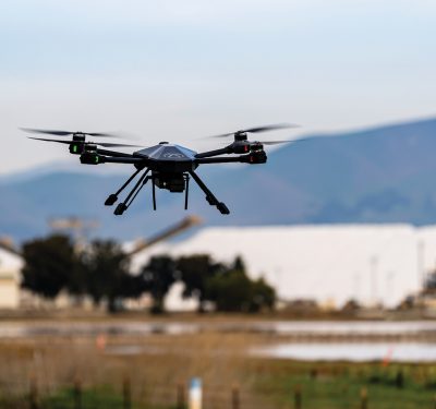
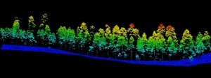
Drones equipped with LiDAR technology for survey-grade topographic mapping needs helps reduce human risk and hazardous operations as well as costs associated with mapping in difficult terrain and extreme weather conditions.
According to the report, the fixed-wing drone is expected to grow at a Compound Annual Growth Rate (CAGR) of over 30 percent from 2020 to 2026 due to their ability to carry large payloads for long distances with less power.
Drone solution providers are introducing advanced fixed-wing drones to support those LiDAR-based applications. In 2018, for example, commercial drone solution provider Delair introduced the DT26X LiDAR fixed-wing UAV, which combines LiDAR sensing with RGB camera data to provide highly accurate 3D images for LiDAR-based aerial surveying and 3D mapping.
The report also indicated that the transportation sector in North America will grow at a CAGR of over 35 percent, led by an increase in the global adoption of autonomous vehicles equipped with LiDAR mapping technology. LiDAR sensors are being deployed in fully autonomous level 4 and 5 vehicles, and as the technology matures, LiDAR solution providers are mass producing sensors to reduce the cost of production and sustain in the rapidly growing market competition.
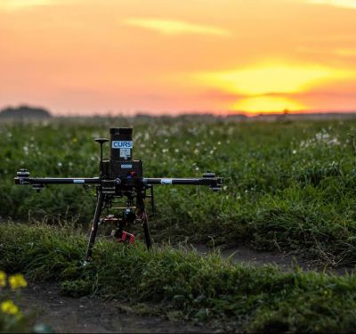
The use of LiDAR mapping also helps farmers to enhance their farming patterns and increase productivity. Therefore, the agriculture and forestry application segment is expected to grow due to rapid adoption of LiDAR mapping for detecting soil type, yield forecasting, soil erosion and analyzing draught stress among crops.
Additionally, the increase in LiDAR use is driven by efforts to reduce the risks of major natural disasters and assess post-disaster loss, governments seeking alternative sources of energy, private companies that are using the technology to identify locations to place pipelines for oil and gas, and an overall growing popularity of LiDAR mapping service providers.
Furthermore, governments around the world are forming alliances with key market players for their various mapping and surveying projects. In the Asia Pacific region, for example, there is an increased need for improving disaster management systems in the wake of earthquakes, floods and volcanic eruptions.
Additional key findings of the report point to urban planning efforts in light of a rising urban population as well as the development of smart cities and the real estate sector, which is increasingly deploying the technology for ground surveying.
To calculate the market size and factors contributing to growth, the Global Market Insights report considered revenue generation from drones (fixed wing, single rotor and multirotor) terrestrial platforms (stationary and mobile LiDAR) and the airborne market, including helicopters and airplanes. It also considered revenue generated from hardware (laser scanner systems, GPS and INS) as well as data analytics, mining and modeling.
Finally, the report considered revenue generated from various applications such as corridor mapping, construction and surveying, agriculture and forestry, mining and quarrying, education, environmental, transport, emergency services and others.
Click here to request a free sample of the report.