CORRECTION CONNECTIONS
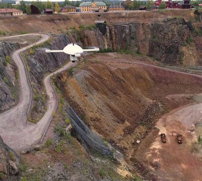
Topnet Live is employed in many high-profile construction projects, eliminating the need for on-site base stations in many of them. Large highway projects, airport runways and machine control operations all benefit from the reliable accuracy and performance of Topnet Live GNSS reference networks.
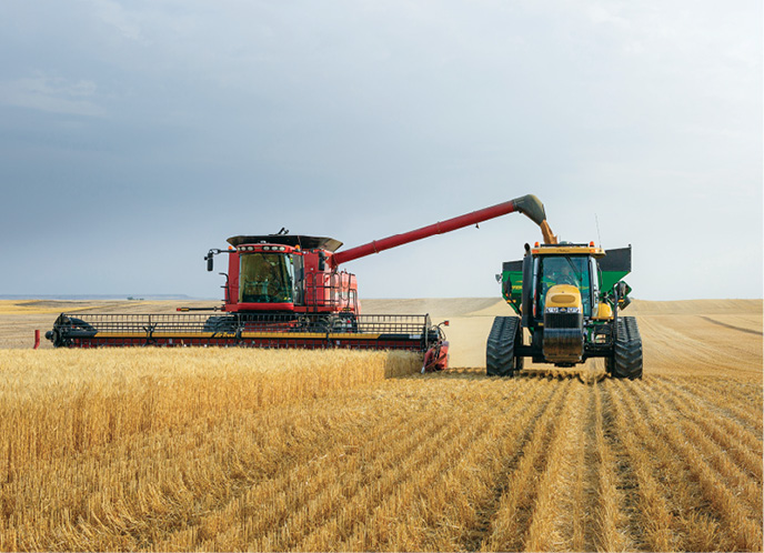
The agriculture industry also benefits from the Topnet Live networks advantage. The network-positioning service is ideal for delivering consistent and accurate positions to precision agriculture machines with fast initialization and reliable positioning any time of the day or night.
“When our ag and construction customers find themselves in challenging environments, such as up against tree lines or operating in urban canyons, Topnet Live’s multiple GNSS correction service can provide consistent positioning where GPS alone might not have worked,” Snow said.
Topcon rolled out a new service for the ag community in January 2021, and that same summer, a rollout of its new PPP solution, Skybridge, which is a standalone service, was brought to market. Skybridge provides and maintains position accuracy in cases where RTK services are interrupted. With regional or local coverage delivered via satellite, it activates seamlessly and automatically, for surveying, construction and agriculture.
“You have flexibility in the field—and backups,” Morris said. “If you have issues with your RTK for any reason, a loss of network from a dodgy cell modem connection, you’ve now got options. Historically, with that outage you’d be waiting, or running over and sticking the pole out somewhere else, trying to get that signal back again.”
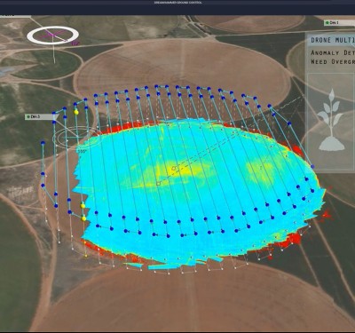
For example, it allows agricultural professionals to compare different types of information, such as crop yield, soil type and fertility, for better decision making. The technology is used for machine operations and all associated tasks where tracking location data is relevant to crop optimization, including soil preparation, seeding, crop care, and harvesting.
Morris added, “With the Skybridge service, the receiver switches automatically over to the PPP service, and continues on its own, up to 20 minutes, which typically will be more than enough time to reacquire the cell modem again. Then the receiver automatically switches back to your RTK solution. This can happen an unlimited number of times in a single survey.”
Stilgoe continued, “Skybridge can also be used as an RTK extension for base stations on radios when there is an outage. The receiver is still working in RTK mode, the engine inside the receiver realizes that the correction sources has dropped, so it switches to Skybridge. And then when it picks up that correction service again, it switches back into the RTK.”
TAILORED TO FIT, EVER EXPANDING
From Topcon’s beginnings in the traditional survey community and early support for machine control, it grew organically into service for precision into agriculture, bringing its reputation for reliability with it.
“Where 20 years ago, you would use a local base station,” Morris said, “now we have users subscribing to our networks because they don’t have to worry about the extra equipment, the base station, and you don’t have to worry about the security of setting it up, making sure that it’s not stolen. They can get a subscription, connect the network and get the data for the positioning. Same in construction.”
Topcon has followed the explosion of positioning applications and now has an increasing number of systems running autonomous operations, on mine sites and in auto steering applications. Topcon has positioned itself to provide precision solutions wherever technology expands into new areas.
Stilgoe said, “Accuracy and precision is addictive across all market segments, particularly for those in the GIS community, because it’s technically possible and affordable. In these times, people want instant positioning with precision.”
While Topnet Live can drive operating efficiencies, significantly improved productivity, reduce company inputs, and drive output, it’s also an enabler of sustainability. Stilgoe points to the global focus on public transportation as an example. “Sustainability can only happen if people accept the experience. A good example is the number of scooters available in major cities around the world. They’re popular, fun and extremely sustainable. Another example is machine automation, which helps reduce waste. We’ve delivered machines with high precision correction services to everything from lawn mowers to excavators. There’s no application that can’t benefit from correction services to reduce waste,” he added.
Looking forward, Topnet Live will also take advantage of the new Galileo High Accuracy Service (HAS).
“We’re looking at putting logic for the HAS to our receivers,” Morris said. “This is what we’re developing now that uses all options, for whatever application of positioning that our customer has.”
Whatever the need, at whatever level of precision, Topcon’s Topnet Live GNSS corrections service has an offering tailored to fit. Even further, it has flexible tiers of service that its customers can immediately adapt as their situations—or the signal quality or availability—change. One feature built into Topnet Live from the start, distinguishing it from other GNSS corrections, is its scalability. So large, small or in-between, Topcon will wrap its service around the requirements of your business.
Morris concluded, “We’re looking at adding accuracy and position logic to our receivers. In all cases, we are not trying to make decisions for professionals, but instead, give them the tools to meet the unique needs of their customers.
To learn more – visit Topcon.