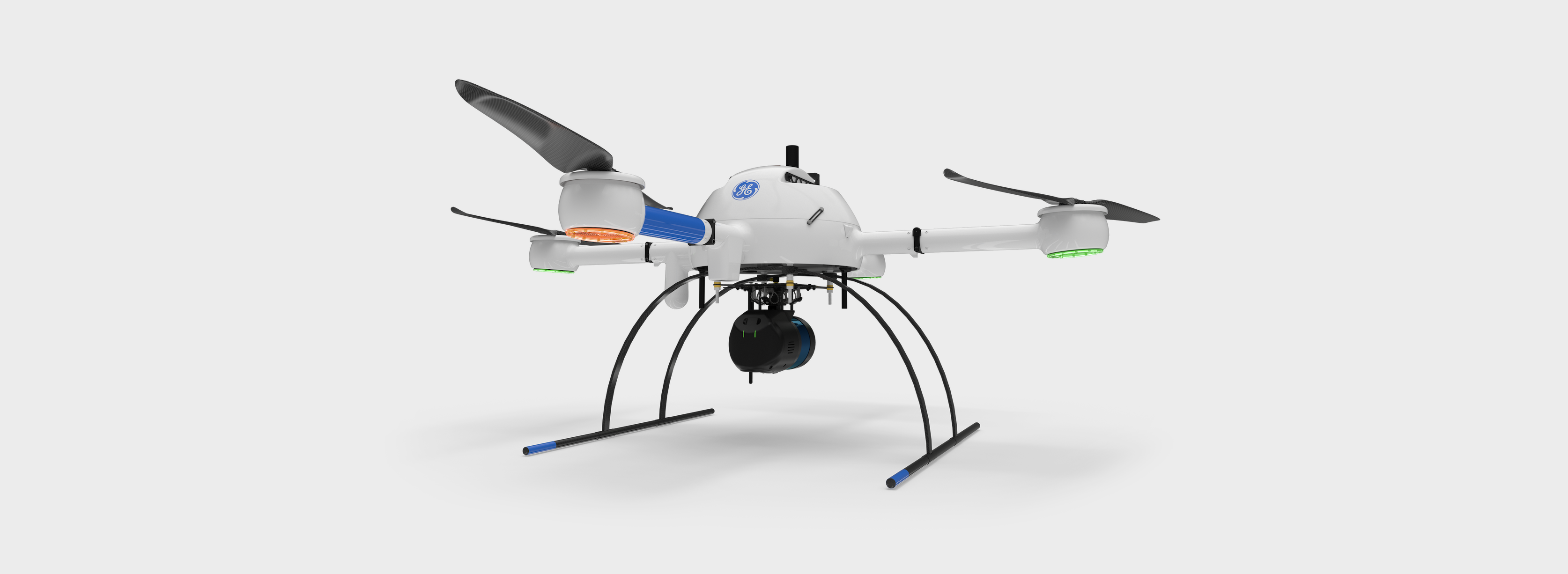
The new mdLiDAR1000LR-aaS uses longer-range LiDAR and a photogrammetry-grade camera to expand data collection and cover more area per flight.
On July 7, high-end UAV solutions company Microdrones and multinational conglomerate GE entered into a licensing partnership to provide powerful aerial surveying technology worldwide.
Microdrones will bring the new GE industrial drone line to market, providing efficient, accurate, safe and profitable aerial surveying. On its part, GE enters the professional UAV market to provide industrial marketing expertise and scale. Microdrones survey equipment will be an essential tool for the creation and maintenance of digital twins, digital terrain models, maps and other geospatial products. These in turn will empower professionals in land surveying, construction, precision agriculture, mining power line inspection, forestry management and more.
Microdrones CEO Vivien Heriard-Dubreuil commented on the alliance’s ability to create and leverage the GE industrial drone line as “modular, expandable, upgradeable and simple to use in the production of high-quality geospatial data.” He continued: “We create data intelligence that enables [customers] to predict and resolve complex, real-life issues, increasing uptime, safety and profitability. The GE brand on our products makes it visible and credible for everyone. It also opens the door to more industry verticals that GE already services and will unlock the potential of additional industrial applications.”
GE Licensing Senior Managing Director Thomas Buccellato concurred: “The GE industrial drone line is a powerful extension and fit for the GE brand worldwide. We can provide field-proven inspection, surveying and geomatics technology that complements our key industrial segments. This is just the beginning of something very promising as we work with Microdrones to scale this up and offer a very powerful drone surveying solution to our industrial customers worldwide.”

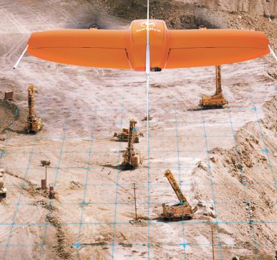
This interactive 3D visualization was created with data collected by an mdLiDAR1000HR, in which an 1,800-acre creek basin survey was completed in only three days. Photo courtesy of Microdrones.
That process has already begun, as the line is adding a new product to Microdrones technology portfolio. Expanding the proven mdLiDAR1000 line, the mdLiDAR1000LR system will combine longer-range LiDAR with a photogrammetry-grade camera, and will expand data collection and allow for covering more area per flight. Both capabilities align with the scope of some of GE’s more massive projects.
Heriard-Dubreuil saw the Microdrones-GE collaboration as another milestone in his company’s development. “I think it’s really a transformative event for us,” he said, “like when we decided to focus on land surveying in 2016, invest massively in LiDAR and data analytics technology, or the release of mdaaS [Microdrones as a service] model last year. The partnership with GE is the foundation to reach the next level of our development.”
The GE industrial drone line is manufactured at the Microdrones facility in Siegen, Germany, and systems will be sold and supported across six continents. Enhancements will augment flight efficiency and safety. GE has become an investor in Microdrones’ parent company, mdGroup, with a GE representative joining its board in an observer role. The end-to-end Microdrones3000 line will continue to be sold under the Microdrones brand.
“This is a win for both GE and Microdrones,” Heriard-Dubreuil said, “and most importantly our mutual customers.”