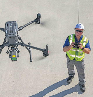
First responders are deploying drones to quickly assess damaged cell phone towers as well as to establish temporary networks, both applications that are improving communications and response efforts in the wake of disasters.
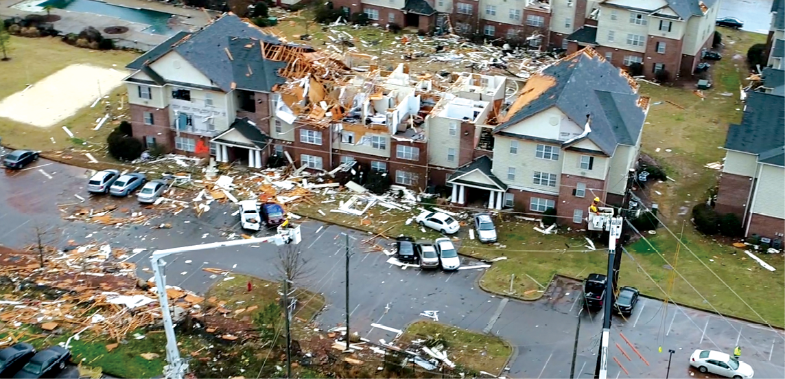
After hurricane Ian hit the Southwestern coast of Florida last year, the more than 6,000 residents who call Sanibel Island home found themselves cut off from the mainland. The powerful storm took out the causeway bridge that connects the barrier island, making it difficult to access.
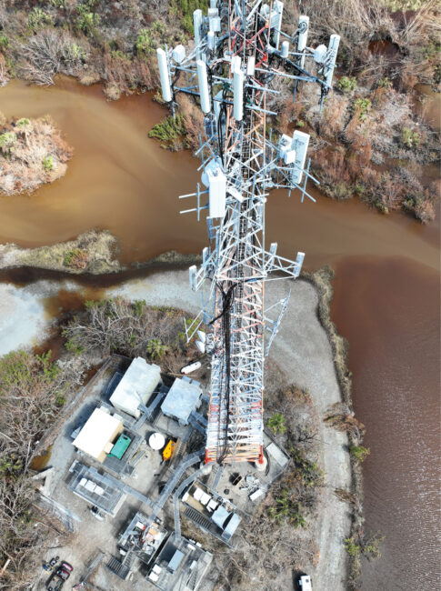
Fiber lines providing service to cell towers were also damaged, compromising communications for the entire island. Repair crews couldn’t get there to assess what repairs and equipment were needed, so the state brought in a tool that could: drones. UAS were deployed to capture images of the cell towers, allowing response teams to quickly identify problems and then send the appropriate resources to the island once they were able.
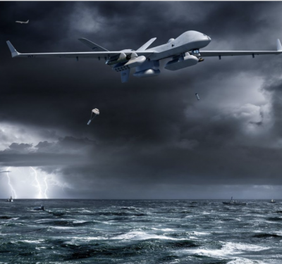
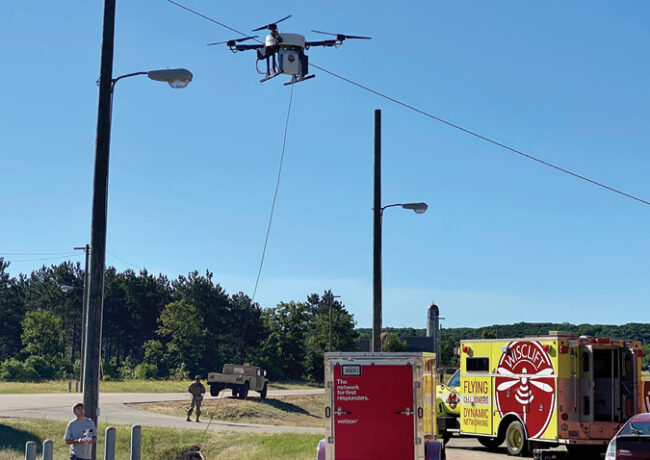
While that work was ongoing, the team also needed a way to communicate, and drones once again provided a solution. Verizon launched a flying cell site, essentially a tethered drone equipped with a cellular node, that served as a temporary network while long-term infrastructure fixes were made, Verizon spokesperson Matthew Tuck said. The node provides cellular coverage 300 feet in the air for a 5 to 7-mile radius and can fly up to 1,000 hours, which allowed first responders to share critical information and those impacted by the storm to reach worried loved ones.
Paul Filla, who oversees the radio systems for Lee County Florida Public Safety and was part of the team covering Sanibel Island, said before Hurricane Ian he hadn’t really thought much about using drones for disaster relief. That changed when he saw what the technology could do. Now, he’s working to stand up a drone program for the county and plans not only to fly after a storm wreaks havoc but before, creating a record of what the area once looked like.
“People can sit in a back room and look at pictures and videos of the impacted areas and what’s changed, and then make judgements on what is and isn’t needed instead of sending a crew from Verizon to a radio tower to inspect and then sending a crew from AT&T to climb another tower,” Filla said of the benefits of flying drones after a storm. “It allows those carriers to restore services faster and have better situational awareness about what is and isn’t impacted, without mobilizing a tower crew.”
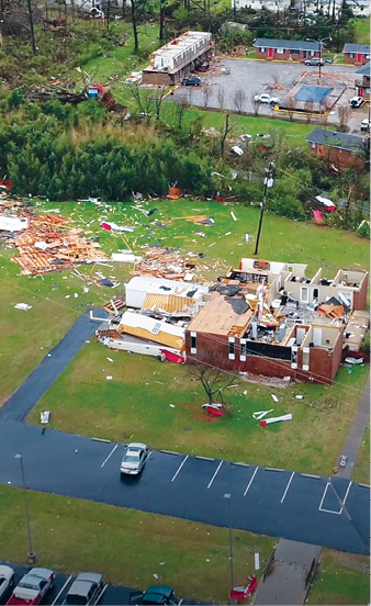
Drones were first deployed in full force for storm response in 2017 after hurricanes Harvey and Maria, and since then more and more emergency teams have leveraged the technology. Applications range from identifying victims stuck on roofs to escape flooding to inspecting utility poles and other infrastructure after a disaster hits. Delivering supplies is another growing use.
Mesh networks and flying cell sites, such as what were deployed in Florida, are also starting to become more common, though that’s been a slower process, said Mike Rogers, vice president of public safety and training for Skyfire. Agencies and governments are more likely to invest in technology they’ll use every day, and these communication solutions are only needed in certain situations. But as more agencies develop drone as first responder (DFR) programs, it will be easier to deploy the technology for disaster response as the infrastructure will already be in place, with the solutions providing more coverage than traditional methods.
“The more you can invest on a good day,” Skyfire Founder and CEO Matt Sloane said, “the better prepared you’ll be for a bad day.”
ASSESSING THE SITUATION
Essentially, drones can be leveraged in three areas to help with communication restoration: flying before the storm to map an area, flying immediately after to assess the damage and create 3D models, and serving as comms networks, Sloane said.
Capturing imagery before a disaster will tell responders what infrastructure is most vulnerable to severe weather and give them proof of what an area looked like before a disaster, which could be useful for both response efforts and insurance purposes, Filla said.
“We can do the pre-landfall flight using a path that we program into the drone, and then post landfall we can use that same flight, going the same speed and same distance, and then compare and contrast the imagery using software,” he said. “We can see something is missing on an antenna that wasn’t before the landfall, and then share that information, which is the most important piece.”
Repair teams can then focus their resources, Filla said, prioritizing where to send crews and what equipment they’ll need to have with them.
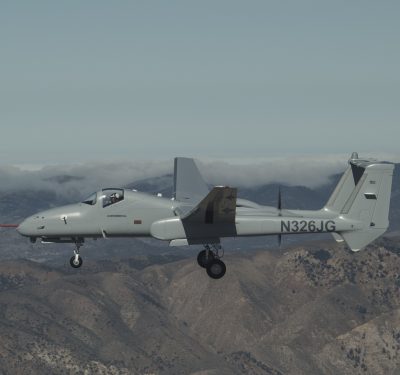
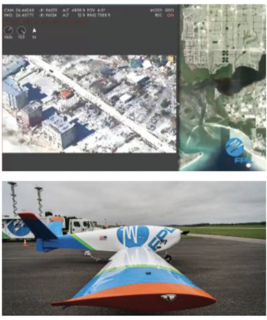
Florida Power & Light (FPL) has deployed drones for routine inspection and storm response for years, and recently introduced its large-scale FPLAir One UAS. The team has used drones to capture imagery of offline cell towers surrounded by flood waters after hurricanes, helping determine if the cause was wind damage or other issues, like the generator running out of gas, said Eric Schwartz, manager of technology and innovation for FPLAir, the utility’s drone program. During hurricane Idelia, the team deployed a drone to confirm the antenna at the top of a tower wasn’t broken, eliminating the need for a crew to go out to the site and that tower.
“The old way of doing this was putting someone in a boat, an off-road vehicle or a Marsh Master and sending them into a flooded location,” Schwartz said. “Now, flying a drone is the proper tool for that.”
Drones can safely fly into these locations and not only help crews determine if there’s an outage, but also tell them exactly how many poles, wires and towers are down so they can pre-stage equipment. And drones don’t need to wait for debris to be removed or for flood waters to subside; they can go in right away. They can also tell crews what conditions are around the tower, providing critical situational awareness.
FPL has equipment on a handful of barrier islands on the West Coast of Florida that are only accessible by boat or barge. It could take an entire day for crews to get to one of these islands to assess towers, only to find out they didn’t bring everything they needed to get the job done. During Ian and Idelia, FPL deployed drones to gather that information, allowing them to reallocate crews to handle other tasks.
Drones and the images they quickly capture reduce time to action, Schwartz said, and that can be critical during a storm response.
“A crew can climb one to two towers a day, while a drone can fly three to six,” Tuck said. “So, that ability to hit more sites quicker speeds up the process of trying to get back to pre-event performance.”
FLYING CELL PHONES
When cell towers go down, drones can establish a temporary network that’s 300 feet in the air, said Travis Hull, User Experience Domain Lead at the First Responder Network Authority, compared to the 50 feet or so satellite poles and other solutions offer. This expands coverage to between 20 and 40 miles. Drones can go up quickly and give both first responders and those impacted the ability to send text messages and make calls, everyday conveniences that become crucial during a disaster.
Both tethered and untethered solutions can be deployed, Rogers said, with the drone equipped with a comms payload. Tethered solutions are connected directly to electrical or generators, allowing the network to run 24 hours without the need for a battery change—a once-limiting factor for this type of application. Teams typically use mesh networks, making it possible to put up a node wherever there’s a drone. The nodes connect to each other and allow first responders to share videos and text messages, or whatever it is they need to effectively communicate.
In some cases, the network may consist of limited-range radios set to a bandwidth only first responders can access to communicate back to the main base, or it could be made of cellular repeaters that can be rolled out over any major network for customers to access, said Jack Anderson, general manager of Australia’s Isidore, which recently joined forces with the U.S.-based, first-responder focused Spooky Action. With tethered solutions like Spooky Action’s Superfly, everything needed to deploy can be designed into a trailer solution or the back of the emergency response vehicle itself.
Drones can be deployed as quickly as teams find the optimum spot to place them, Rogers said, with the process even faster if a DFR infrastructure is already in place.
The comms payload on the drone is similar to what would be deployed on a portable mast, Tuck said, but the difference is the heights a drone can reach, resulting in a larger coverage area. The height is equivalent to that of a cell tower, and drones can get there instantly without any construction costs, Anderson said. There’s no large infrastructure required, which also makes it easy to move the drones around.
Leveraging satellites onboard is critical for these systems, as is the lift capability of the tether, adequate power for radios, and the ability to make controlled landings if necessary. Being able to guarantee consistent communications will open up the door to vehicle-to-vehicle comms, Tuck said, while one pilot controlling multiple aircraft is another goal that will move this application forward.
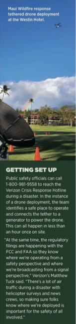
“Tethered drones can be deployed rapidly and are a really great back up service while we restore the infrastructure itself,” Tuck said. “During the wildfires in Maui, we were able to stand up a tethered system inside of an hour and provide service to people there while still dealing with how to repair the infrastructure that was destroyed. This gave those impacted the ability to call 911 and connect with loved ones immediately after the event.”
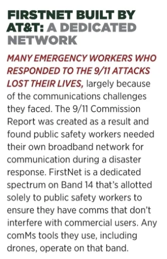
FirstNet, built with AT&T, offers Flying Cells on Wings (COWs) to provide temporary communications to first responders during a disaster. Every solution is operated on Band 14, a dedicated spectrum for public safety use. This allows first responders to communicate with each other without interfering with commercial users trying to call loved ones or reach 911.
The solution includes two tethered drones and a trailer, which provides backhaul connectivity to fiber or local networks, Hull said. First responders don’t need a unique device to communicate, they can use radios and their smartphones to send and receive texts, videos and location information for overall situational awareness.
The eNodeB traditionally within the LTE connectivity is on the drone itself, Hull said, essentially “taking pieces of a cell tower and putting it in the air and connecting it to the drone.”
COWs have been deployed in different hurricane scenarios to provide connectivity when there wasn’t an infrastructure in place, Hull said, as well as in search and rescue (SAR) applications. The team expects to deploy 5G soon, providing first responders with “that seamless operational experience they’d get on a day-to-day network in a disaster environment.”
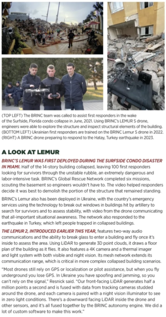
BRINC drones also have become popular during disaster response, enabling comms and flying inside collapsed buildings and underground to provide situational awareness. The newest drone, the Lemur 2, features a mesh networking radio integrated into the airframe. The radio can build its own network with any number of BRINC drones, even if they’re miles away, founder and CEO Blake Resnick said. One drone can push data to another, which might be uploaded via 4G LTE and sent to anyone on a disaster site. It can do that with private mesh network IP radios or via cellular.
The BRINC drone basically has all the electronics a cell phone does, Resnick said, including 4G LTE, a big speaker microphone and a DSP chip for sound quality.
“The drone has a phone number,” he said, “so somebody can dial it up and call into the drone and use it like a flying cell phone.”
When communications go down during a disaster, it leads to extra stress for those impacted, their loved ones and first responders. Drones can quickly set up temporary networks, some dedicated to public safety workers with others open to anyone. Battery and endurance limitations made this difficult in the past, but tethered systems changed that, providing a solution that covers more ground than traditional options like satellite poles.

“Around 85% to 90% of 911 calls come over a cell phone, so the sooner we can restore cellular communications, the more likely loved ones out of the impacted area can reach loved ones in the impacted area,” Filla said, “and that lessens the burden on 911 centers.”
CHALLENGES TO CONSIDER
One of the biggest barriers for agencies looking to deploy tethered drones as a comms solution is the financial investment, Rogers said. Most don’t have them yet simply because it’s not an everyday need. The key is to find aircraft that can perform multiple types of missions, so the investment makes more financial sense.
Regulations are always a challenge when deploying drones, particularly BVLOS, but when you add comms payloads, you also have to consider FCC regulations, Anderson said. Teams from both the comms and the drone side must check the area for existing cell signals, for example, to make sure they’re not interfering with an existing network.
The drone industry is currently focused on getting to BVLOS, with those rules expected to come out in the summer of 2024, but the next hurdle to overcome will be access to the spectrum.
“If LTE is down and you have fixed drone boxes everywhere, unless you have spectrum and comms outside of LTE, you can’t fly or operate your drone,” Schwartz said. “That’s going to be the next roadblock that people don’t see, the next wall that stops everything from moving forward. Once you have BVLOS and LTE, spectrum won’t work if you want to fly out five miles, so you’ll need to get something bigger and that will require approval from the FCC.”
LOOKING AHEAD
In terms of making those after-disaster assessments and comparisons to pre-event maps and 3D models, Schwartz expects AI and machine learning to be leveraged more and more, analyzing the hundreds, even thousands, of images collected during a storm response to quickly and accurately detect analomies that show something is wrong with a cell tower.
The cameras deployed will continue to improve, Tuck said, and sensors like LiDAR and infrared will play a larger role. Connectivity is critical, as it allows drones to livestream video and images to remote engineers and oversight who can have the remote pilot adjust camera angles in real time to get the view needed of a cell tower, without having to wait for images to be post processed. The ability to command and control the drone over a wireless network for edge computing opens up many possibilities, particularly when there’s one operator controlling many drones.
As flying cell towers advance, the solutions will likely evolve from tethered to untethered systems that are long duration and mobile, Tuck said. Imagine a large drone providing cell service through low Earth orbit (LEO) satellite technology, standing up networks wherever the aircraft exists. More mesh networks that can provide communications anywhere, even in remote areas, will be established, with manned and unmanned aircraft working together to provide connectivity. And all of it will be accessible after a disaster hits.
“As we partner with the FAA and FCC, we’re talking about treating this more like a tower and less like a drone,” Tuck said of the Verizon solution. “It has a limited battery that’s meant for safe landing, not for flying. They are not meant to stay up for a month at a time, though they can, they’re meant to quickly establish communications while assessment and recovery is ongoing.”
While today’s focus is that pop-up network activity, Hull sees that expanding to more independent, private network bubbles to fill in the last-mile gap where first responders traditionally don’t have comms. This could prove especially useful during wildfires or SAR activities after disasters in more remote areas, giving firefighters “situational awareness like they’ve never had before.”
Drones will increasingly work together to extend each other’s signals, serving as cellular repeaters to expand 4G and 5G coverage, Resnick said. UAS will become more autonomous and will continue to get smaller, with more drones deployed together to provide extended coverage. So, if an earthquake hits, instead of one operator flying a drone to conduct those initial assessments or set up a comms network, he might open a case and send 30 drones to various sites, all of them traveling autonomously to cell towers or other infrastructure and sending alerts to operators as they identify problems or survivors.
“It’s only going to grow,” Anderson said of the flying cell sites. “The tech is there and can be put into practice both safely and effectively. I expect tethered drone systems to start to replace the cell on wheels that exist in every emergency response team fleet in the next three or four years.”