Corps Focuses on Training and Protocols, Speeds Mission Approval Time.
The U.S. Army Corps of Engineers (USACE) has a daunting portfolio: it’s responsible for operating more than 1,200 dams, 5,000-plus recreation areas, 153 hydroelectric powerplants, 25,000 miles of navigable waterways, tens of thousands of miles of canals, and more.
It operates half of all federally owned dams and manages more than 25 million acres for the U.S. Army. The Corps conducts surveying and mapping over locks, dams and other infrastructure, provides military engineering support to warfighters, and also responds in the wake of natural disasters and other emergencies.
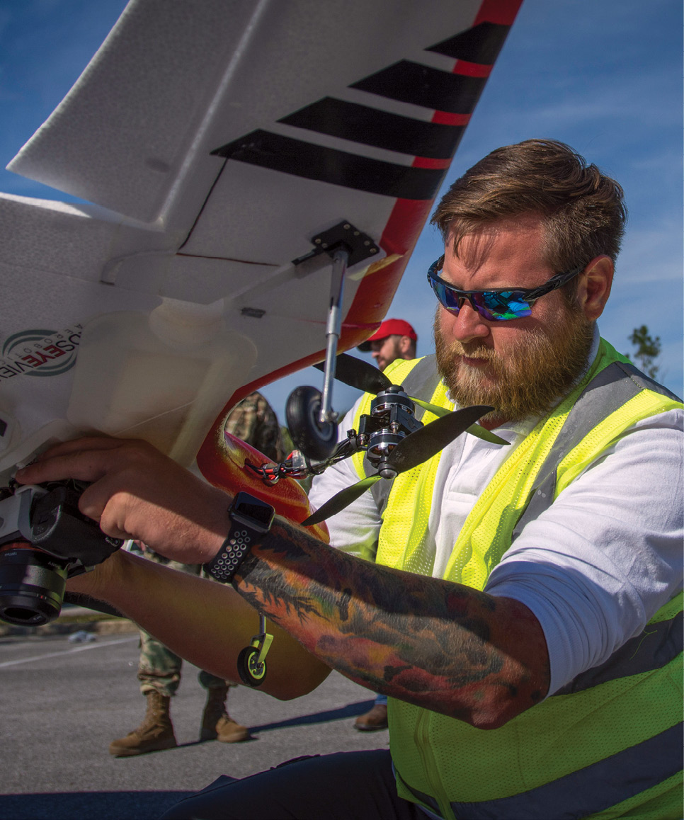
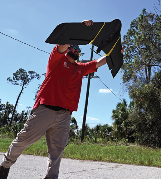
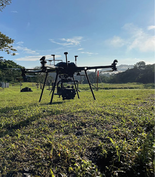
To handle all that responsibility, the Corps is increasingly turning to unmanned systems for the dull, dirty and dangerous work, particularly drones. It’s a relatively new proposition for the sprawling agency, which launched its drone program in 2016, although there had been some experimentation before then.
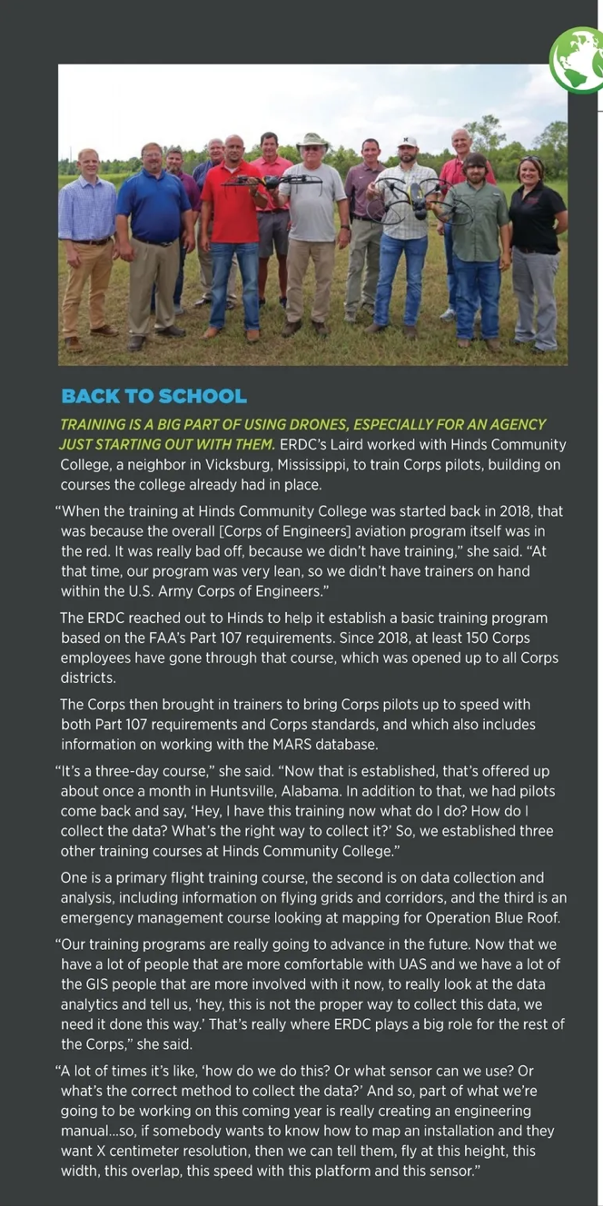
Jenny Laird, the UAS program manager and team lead, SME for platforms and sensors at the Engineer Research and Development Center (ERDC), the premier research and development center for the U.S Corps of Engineers, said her office had decided as far back as 2014 to use drones to track feral hogs, which can cause damage to facilities.
“As we did a little bit more investigation, we realized there were a lot of other groups within the U.S. Army Corps that were already operating UAS,” including for surveying and mapping, she told Inside Unmanned Systems.
“Once we saw that there were more people getting involved, the way operations with UAS were done, it was kind of haphazardly,” she said. ERDC then officially started its drone program in 2016. “It was really bringing all seven laboratories together to say, how are we doing UAS operations? How can we do it better? How can we streamline it? And, really look and see how everybody was utilizing UAS for their research purposes,” she said.
In the years since, the ERDC and the Corps have initiated training programs and developed an in-house software management suite for drones that has drastically cut the time required for mission approval, and removed the liability risk for flight operations from the shoulders of the operators in the field.
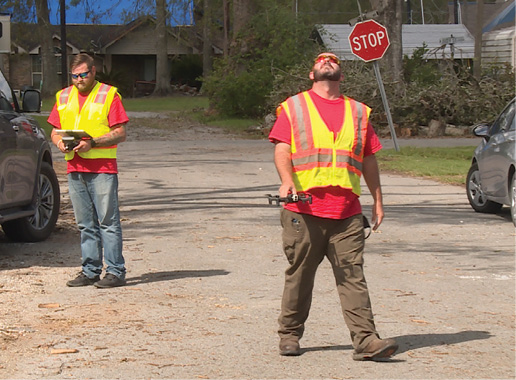
The Corps of Engineers now has 399 trained remote pilots for flying small UAS, 144 of which were trained just in fiscal 2023. In fiscal 2022, 639 missions using drones were approved, with 7,600 days authorized for flight operations across the Corps’ domain.
“The team did a fantastic job with this whole standard training and oversight. We took Part 107, we took the Army regulations…we crosswalk everything. We made sure that our folks are flying the way they’re supposed to. Our mantra is standards, training and oversight to keep us legal, safe and effective,” she said.
GOING TO MARS
Mission approval times have gone from a mind-boggling 84 days in 2017 to three hours now.
Enabling that three-hour approval is up to a mission management system named MARS, for Management Information System for Aviation & Remote Systems. Laird described it as “TuboTax for compliance with our regulations.”
In the recent past, one request for a drone survey had been approved, but it took so long that the seasons had changed and the person couldn’t make the flight.
Laird said taking those 639 missions on the books in fiscal 2022, taking the 84-day approval time and 40 hours of paperwork down to three hours, and factoring in that data collection can be done seven times faster with unmanned aircraft than with traditional methods means that’s 45 man-years of time not wasted on red tape and waiting.
Laird said MARS was developed and is maintained in house. “We look at personnel, platforms, sensors, areas of interest that we’re flying, but we’re also doing risk assessments, but then we can also track all of our flights and our briefs within the database,” she said. “So, it’s really a nice one-stop shop for mission planning and for overall situational awareness of where U.S. Army Corps UAS operations are occurring.”
When an operator prepares for a flight, MARS will pop up information about structures and facilities in the area—prisons, schools, airports—the operator needs to know about, within a five nautical mile radius.
“It really makes the pilots and the planners think about what risks are in this area, whether it can be a power line or treetops that we see on the Google Earth maps,” Laird said. “Maybe things you don’t see until you’re on the ground, but also to include environmental conditions [and] wildlife. We also look at crew risk, too. So, we make sure every time before we fly that our crew is set to go and that they’re at the standard that they need to be before they fly.”
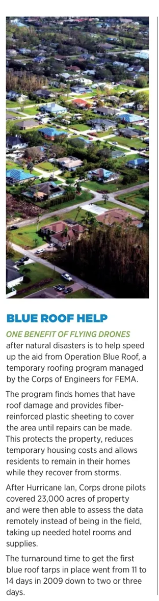
Consistent training is also important. After Hurricane Michael hit Florida’s panhandle in 2018, it took a while to pull a crew together because nobody was trained the same way. The Corps finally did get some crews flying and surveyed 150 homes over 90 days, trying to see which needed blue tarps put on damaged roofs before the next rain.
By the time Hurricane Ian stormed through in 2022, the Corps drone team conducted 119 flights over 15 days, taking 70,000 images and covering 23,000 acres.
EXPLOSION AFTERMATH
In March 2023, the first stage of a Vulcan Centaur rocket, built by a joint venture of Boeing and Lockheed Martin, exploded during testing at NASA’s Marshall Space Flight Center in Huntsville (incidentally, delaying the launch of several payloads, including the Navigation Technology Satellites-3, or NTS-3, intended to test ways to make GPS signals more resilient against jamming or spoofing).
The Corps drone team needed to survey the damage in their own backyard, which included a 150-acre debris field. But the Huntsville Engineering Support Center personnel were already flying elsewhere in the country and a storm was approaching, which would wipe out a lot of the scene.
Luckily, one junior engineer was available and was able to fly and within five hours had a 3D model, a 2D map and high-resolution video up close to the area that hadn’t even been accessed yet by people on the ground. And, he beat the storm.
Laird said this wasn’t a one-off, or an outside-the-lines mission. “The big piece is, nobody did anything outside the lines to make that mission happen. That was done based on our standards, based on our training, right? Based on the oversight mission approval, and it was all legal, safe and effective.”
Within four hours of the mission request, the small, ad-hoc team had covered 183 acres in less than 45 minutes of flight time, with 700 images collected at one-inch resolution. Numerous 4K videos were taken and a 3D textured mesh model and 2D orthophoto mosaic were developed.
GOING FORWARD
In the near future, Laird and the Corps have several goals: to expand the use of drones throughout the Corps of Engineers, to work with ERDC to bring in more cutting-edge capabilities and to work with outside partners.
The Corps has 35,000 employees, but doesn’t have that many people flying, and would like to have more. The agency also wants to work with partners, including state, local and tribal governments whose support and cooperation will be needed in the wake of emergencies.
As for the technical side, Laird said she hopes for smaller and better sensors in the near future.
“I would really like to see it progress to more of these sophisticated sensors that are very large right now. I would love to see the SWaP [size, weight and power] be decreased to where we can really pull a lot of the needed information together in a more effective and efficient time manner,” she said. Her wish list also includes on-board data processing to help ease that burden once the drone lands.
“The UAS, it’s the platform to fly the sensor…I think that’s where we have to get to in the future, to really make it a serviceable, usable tool for field users.”