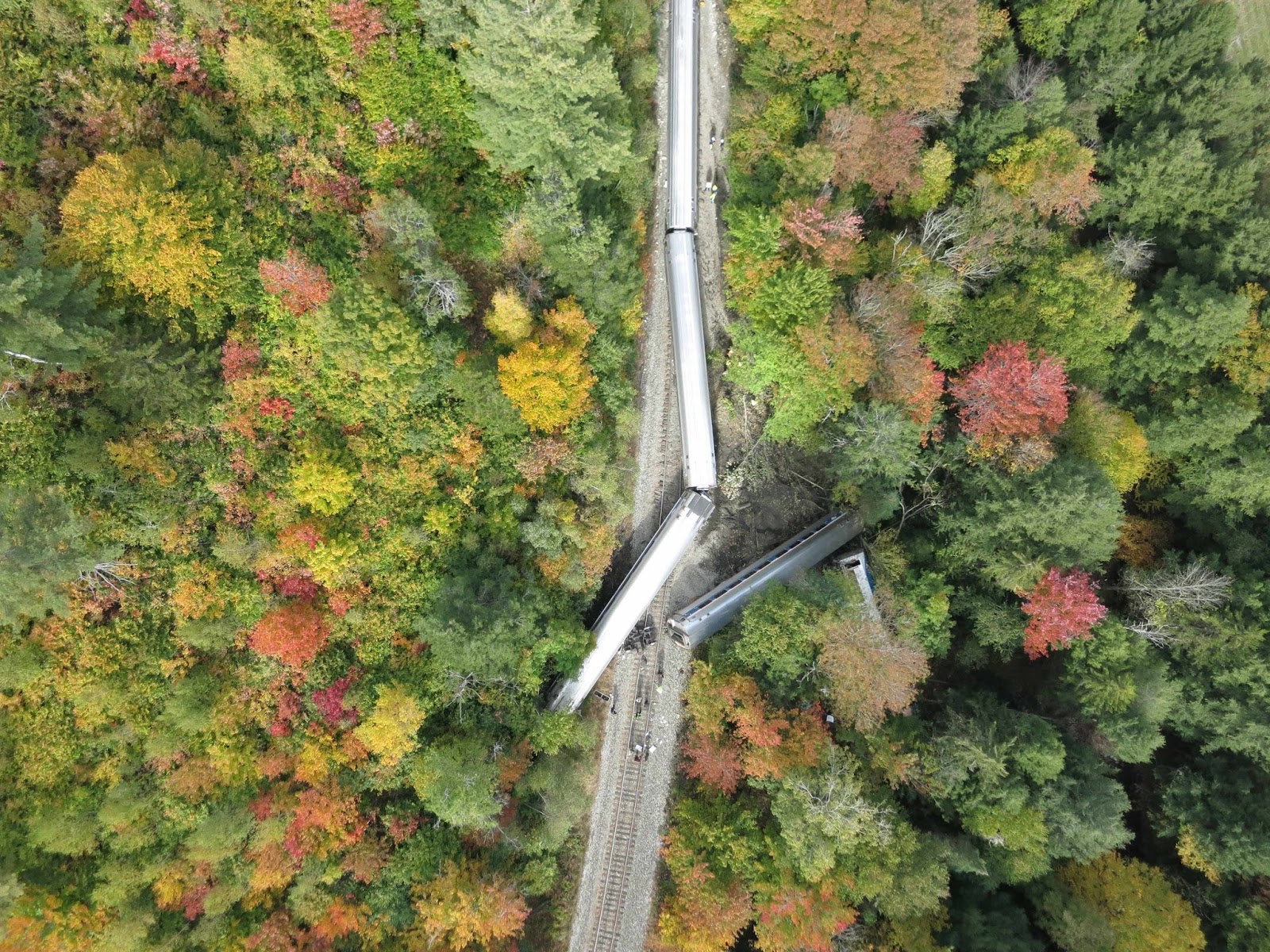
Train derailment site.
On a beautiful October day, Jarlath O’Neil-Dunne and his team at the University of Vermont’s Spatial Analysis Lab got a call from the Vermont Agency of Transportation. An Amtrak Vermonter train had just derailed in Northfield, Vermont, and the agency wanted to learn more about what caused the derailment.
A team of four volunteers from the lab gathered their Sensefly eBee unmanned aerial system, headed to the site and were ready to fly within a few hours of the call. O’Neil-Dunne and his team had worked with the Vermont Agency of Transportation in the past, he said, so the agency knew firsthand what the eBee was capable of and its ability to provide mapping-grade data.
Once the volunteers arrived on site, they coordinated the acquisition area with disaster management and began flying the eBee to capture still imagery. Each image was geotagged during flight, making it possible for the team to generate a KML file after the aircraft landed. Every image was tied to a location on the ground and could easily be displayed via Google Maps, O’Neil-Dunne said. About an hour after arriving, the team gave incident command more than 280 photos of the derailment site and the surrounding area.
Team members then went back to the lab and created an orthophotomosaic of the entire area for accurate mapping, O’Neil-Dunne said. The orthophotomosaic was loaded into GIS software for mapping, measuring and integration with other mapped data.
“The train derailment happened because of an unstable bank nearby that pushed rocks onto the track,” said O’Neil-Dunne, who is the director of the Spatial Analysis Lab. “We were able to overlay the data the eBee collected with terrain data that showed a 3D view of the area. This gave investigators greater insight into what caused the train to crash. The ability to overlay data like that isn’t possible if you’re just shooting video from a drone or taking pictures from the ground because they don’t have the precise coordinates. The coordinates are key.”
The ability to offer investigators images right away is a huge advantage UAS offers during these types of disasters, O’Neil-Dunne said. If they’d flown a manned aircraft to collect images, the aircraft would have had to find a place to land before sending the data, increasing the turnaround time. It also can be difficult to send data over a cellular network in Vermont, making the ability to turn over data right away even more important to investigators.
Officials from both Amtrak and the Vermont Agency of Transportation were happy with the data the lab provided, O’Neil-Dunne said, and they now have a mapped record of what the situation looked like right after the derailment. They can refer to this data as they continue to investigate the crash.
O’Neil-Dunne sees this type of application as a great fit for UAS technology, especially when the team operating the UAS can get on site to gather the imagery right away.
“Having this geospatial record is important, and using UAS technology you can gather this data more safely and at a low cost. It’s much cheaper than using a manned aircraft,” O’Neil-Dunne said. “The other benefit is the quick turnaround time in terms of getting this data to incident command and then generating other mapping products anyone working on the investigation can use.”