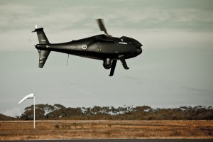
Drone programs in the U.S. and Europe are enhancing railway monitoring, improving efficiency and preventing accidents through advanced aerial surveillance and data-driven maintenance strategies.
Rail safety in the United States is at a critical juncture, with aging infrastructure and increasing rail traffic pushing conventional preventive maintenance and inspection methods to their limits. The Federal Railroad Administration (FRA) reports thousands of rail-related accidents annually, many stemming from preventable infrastructure failures and environmental factors. More than 40% of U.S. rail bridges are over a century old, and deferred maintenance exacerbates safety risks, particularly in high-traffic corridors. Given these mounting challenges, government agencies, research institutions and the commercial sector are turning to unmanned technology to modernize rail inspection capabilities and mitigate risks to operators, passengers and cargo.
CHALLENGES OF TRADITIONAL INSPECTION METHODS
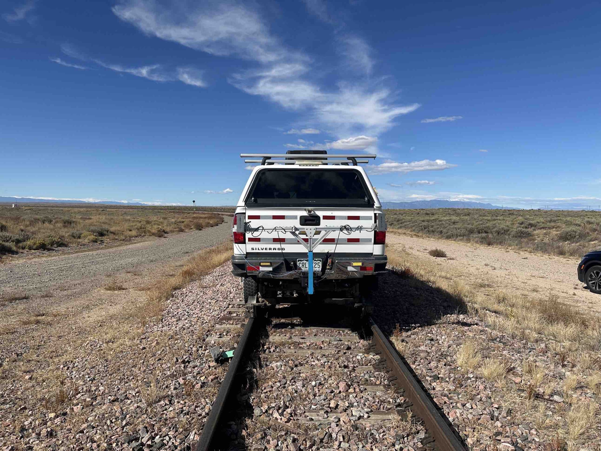
Dr. Yu Qian, an associate professor at the University of South Carolina (UofSC) specializing in railroad infrastructure, highlights the limitations of traditional inspection methods: “One or two crew members drive a high-rail truck along the track, visually identifying geometric defects, obstructions, and missing or broken components. It’s highly demanding, subjective and labor-intensive.” It’s with this backdrop that the team at South Carolina has worked toward the development of a drone-based, portable and affordable inspection platform to increase accuracy and efficiency.
In collaboration with CSX Transportation, UofSC developed and tested a drone-based inspection platform equipped with a stereo digital image correlation (StereoDIC) system for railroad bridge inspections. This drone-based approach enables non-contact measurements of structural deformations and stresses, offering a more efficient and consistent alternative to traditional visual inspections. Field tests conducted on a CSX-owned bridge in Columbia, S.C., demonstrated the system’s effectiveness in assessing infrastructure integrity.
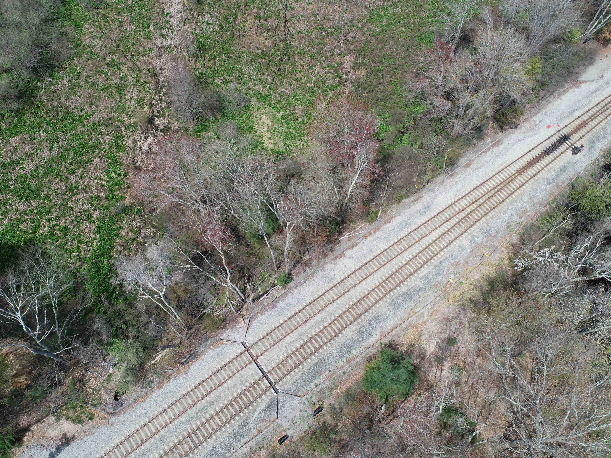
In Massachusetts, the Department of Transportation (MassDOT) Aeronautics Division’s Advanced Aviation Technologies Group has been at the forefront of drone-based rail monitoring in dense population centers, like the Boston suburbs. The FAA has granted MassDOT a comprehensive waiver permitting drones to operate BVLOS of their remote operators. This authorization enables MassDOT to conduct extensive drone inspections across the entire state rail network, enhancing the efficiency and safety of rail infrastructure assessments.
The waiver employs a blended performance-based approach, allowing flexibility in operations based on factors like geography and urban density. For flights up to 50 feet above rail lines or obstructions, drones can operate BVLOS without visual observers. This initiative has expedited data collection and analysis, facilitating timely maintenance and improved rail safety throughout Massachusetts.
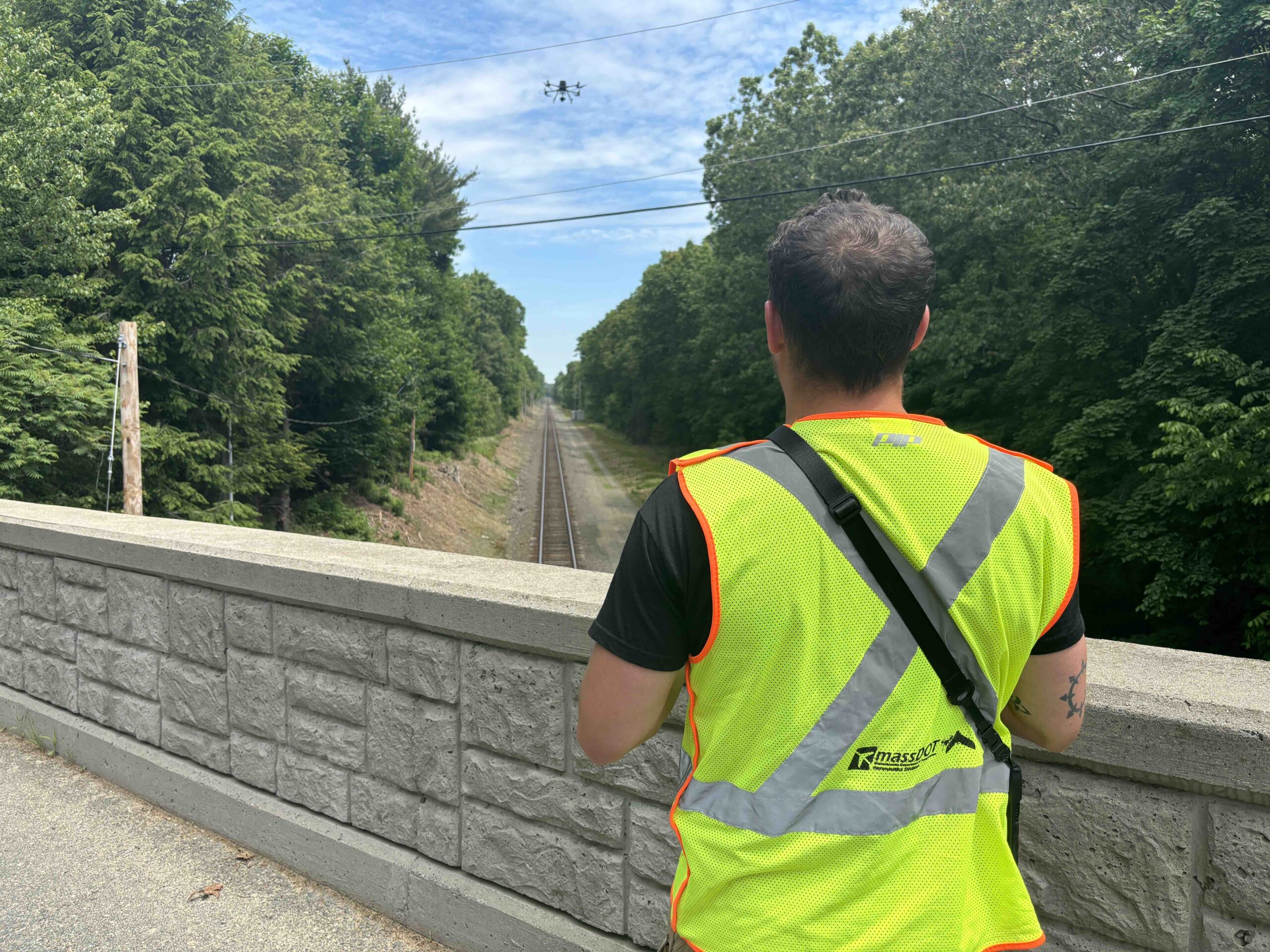
MassDOT Aeronautics Division’s Chief Scientist Dr. Scott Uebelhart noted, “A key part of the BVLOS effort has been supporting our drone flight team operations. We’ve been collaborating with the Massachusetts Bay Transportation Authority [MBTA] for years because BVLOS is particularly well-suited for long linear infrastructure like rail lines.” MassDOT’s UAV program enables regular monitoring of more than 400 miles of rail track, increasing data capture significantly. “We’ve cut that timeline in half, and my ambition is to continue reducing it so we can start detecting changes in infrastructure on much shorter timeframes,” Uebelhart explained.
Dr. Qian expanded on the broader challenges. “The current inspection practice in the railroad industry operates on two levels,” he said. “The first is a high-frequency inspection where a crew member manually drives along the track, observing defects in real time. But this method is prone to human error and inefficiencies. The second approach involves autonomous inspection vehicles outfitted with instrumentation, but these produce enormous data sets that require extensive analysis. What we needed was a portable system that could be deployed quickly and provide immediate insights.”
ADVANTAGES OF UAV DEPLOYMENT
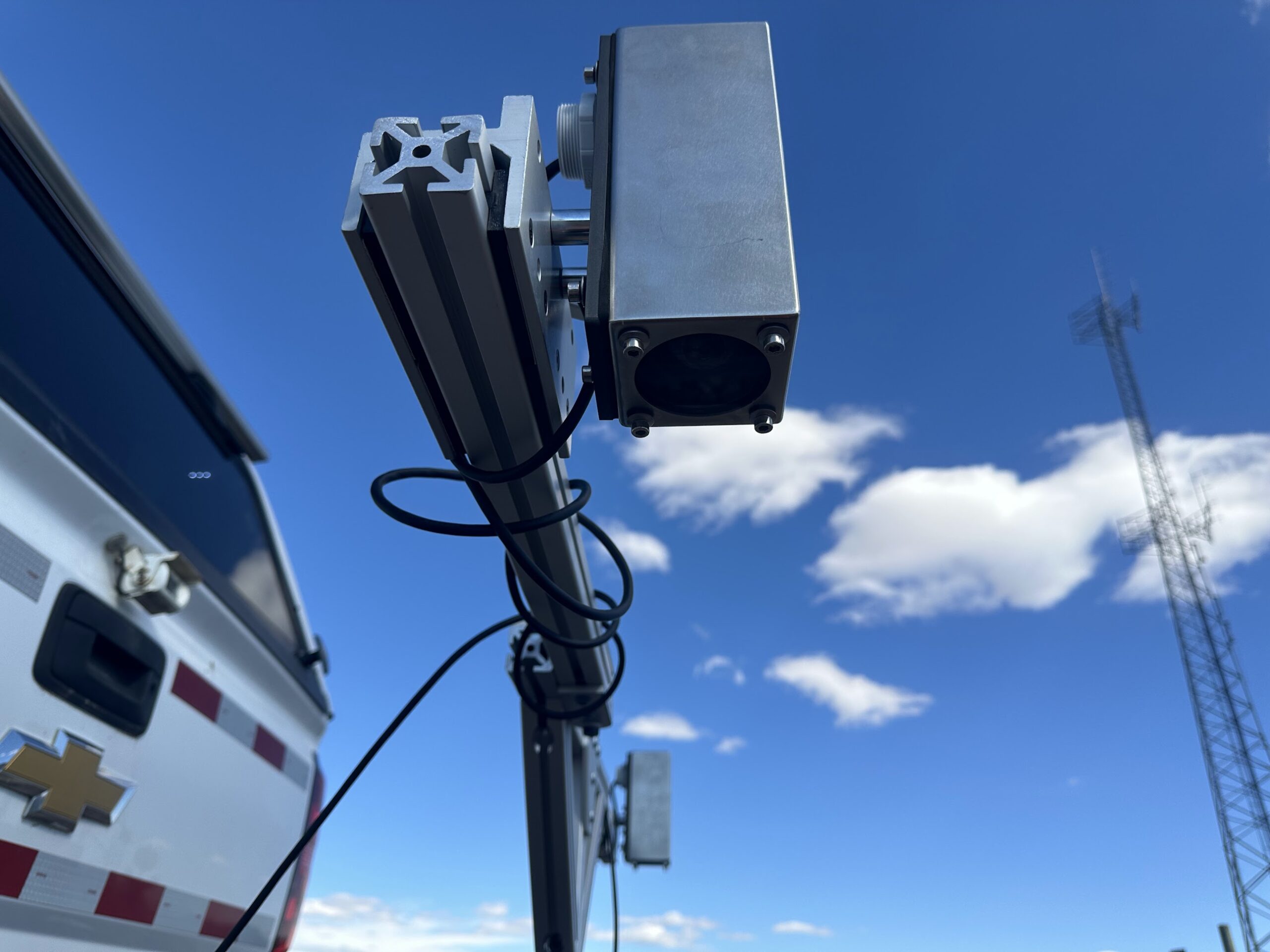
The move to UAVs offered a balanced solution. “Initially, we mounted sensors onto high-rail vehicles and railcars, but these still required track occupation. That’s when we realized UAVs could eliminate that problem,” Dr. Qian noted. “However, the challenge with UAVs was ensuring stable imaging. Unlike a fixed camera, UAV-mounted sensors move constantly, influenced by height, angle and lighting conditions. We had to develop a way to stabilize image capture and process data accurately.”
One of the most significant advantages of UAVs is their ability to operate without requiring track closures. “One key advantage is that UAVs do not require extra protection or track time,” Dr. Qian explained. “Traditional inspections often disrupt service, but UAVs can fly 100 feet above the track without interfering with rail traffic.”
Beyond standard inspections, UAVs also play a crucial role in post-disaster assessments. In recent years, extreme weather events have caused rail infrastructure failures, requiring immediate inspections to prevent further damage. “Previously, railroads had to send personnel to manually inspect hard-to-reach areas after a storm,” Dr. Qian said. “Now, UAVs can be deployed to gather real-time data safely and efficiently.”
Dr. Qian further emphasized the potential of UAVs in reducing rail-related accidents. “We’ve worked closely with CSX, Brightline and Norfolk Southern to develop UAV systems that can identify track intrusions, whether that’s fallen trees, unauthorized pedestrians or vehicles obstructing crossings. The ability to detect these anomalies early and send real-time alerts to first responders could prevent tragedies.”
MassDOT’s UAV program is driving efforts to integrate UAV-collected data with GIS and digital twin platforms. “Our imagery is uploaded to GIS systems and integrated with historical data,” Uebelhart explained. “This enables us to track infrastructure deterioration over time and efficiently disseminate data to those who need it.”
EMERGENCY RESPONSE IMPROVEMENTS
One of the most pressing concerns is the impact of rail blockages on emergency response times. “For example, our College of Engineering is surrounded by rail tracks, and frequent blockages impact traffic flow,” Dr. Qian said. “More critically, emergency responders often get stuck at crossings. We’re developing a system that integrates railroad dispatch data with 911 systems to predict blockage times and optimize emergency response routes.”
Dr. Qian recounted a personal experience that inspired further innovation: “I was once trapped for over 20 minutes due to a blocked rail crossing, and behind me was an ambulance with its sirens on, unable to pass. That moment reinforced how crucial it is to integrate real-time rail traffic data with navigation systems to prevent delays in emergency response.”
The vision is for increasingly autonomous inspections. “The next step is BVLOS operations where UAVs take off, follow the rail and conduct inspections autonomously,” Dr. Qian said. MassDOT is also looking to extend current operations: “Our waiver allows us to choose between obstruction shielding or visual observers to maintain situational awareness. That flexibility has been crucial in expanding our operations,” Uebelhart explained.
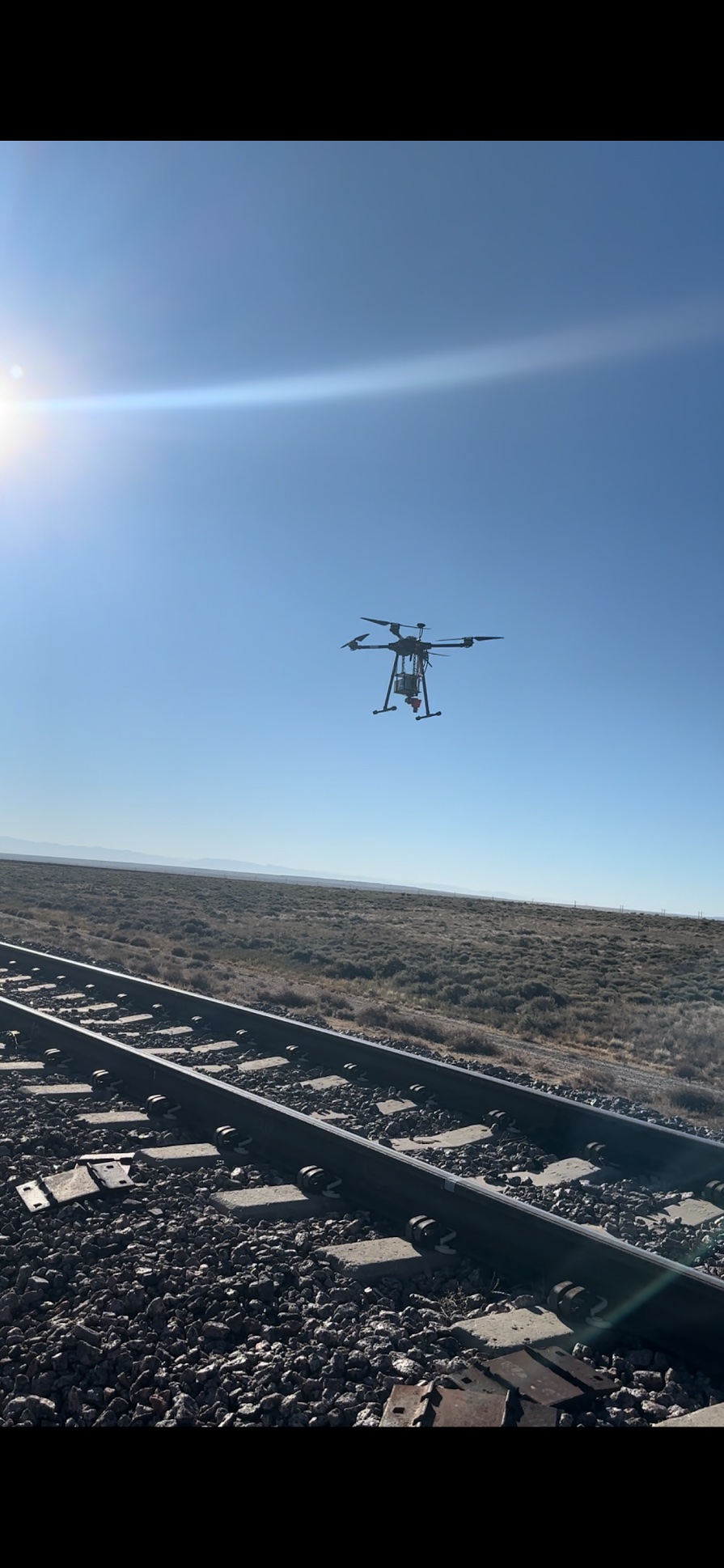
Dr. Qian highlighted another innovative approach: “For autonomous UAVs, we’re using railway tracks themselves as a natural navigation guide. Since tracks constrain vehicle movement, UAVs can use them as a reference point for maintaining precise flight paths, even in GPS-denied environments.”
Rail safety cannot wait. With infrastructure aging and rail traffic increasing, traditional inspection methods alone cannot keep pace. Unmanned technology represents a scalable, cost-effective and efficient solution to mitigate risks, enhance maintenance operations and ultimately save lives.
EUROPEAN RAIL SAFETY INNOVATIONS: AUSTRIA AND SWITZERLAND
While the U.S. continues advancing UAV rail inspections, Europe has taken notable strides in deploying drone technology for railway safety, particularly in Austria and Switzerland.
Austria boasts a dense rail network with almost 10,000 kilometers of track and more than 1,000 stations and stops, forming the backbone of a comprehensive and environmentally friendly transport system. Austrian Federal Railways (ÖBB) is widely regarded as one of the safest and most punctual rail networks in Europe. To maintain this status, ÖBB has recently launched an innovation partnership with Frequentis, aimed at advancing hangar-based automated drone flights for railway inspections.
“The use of drones for route inspection is an important building block for the digital railway of tomorrow,” said Johann Pluy, board member of ÖBB-Infrastruktur AG, according to a press statement. “Especially in difficult-to-access terrain, we can get a precise overview of the situation and necessary measures in a time-saving manner. Our customers benefit from this.”
The project focuses on preventing railway incidents through routine maintenance flights, early detection of infrastructure damage, natural hazard monitoring, and emergency management. In the event of adverse weather or major events, these drones will provide rapid insights without the need for manual inspections in hazardous conditions.
Frequentis CEO Norbert Haslacher emphasized the technological leap. “The hangar-based drone flights are the technological answer to the rapidly growing drone ecosystem,” he said, according to a press release. “Frequentis has developed a highly automated solution that can be fully integrated into control centers and workstations of large infrastructure companies and is easy to use for our customers’ employees.”
Through this collaboration, ÖBB and Frequentis aim to refine automated BVLOS drone operations. These efforts will enhance efficiency, increase service availability, and minimize operational disruptions.
In Switzerland, Nokia and Swisscom Broadcast are partnering to deploy one of Europe’s largest Drone-as-a-Service (DaaS) networks for railway inspections. This initiative leverages Nokia’s UAV Traffic Management (UTM) system, combined with Swisscom’s robust connectivity infrastructure, to enable automated rail inspections across the country’s extensive rail network.
By integrating AI-driven analytics with real-time drone surveillance, the system aims to proactively identify track defects, structural issues and encroaching vegetation before they escalate into major safety concerns. This will minimize rail disruptions and ensure continued operational excellence.
The use of drones for rail inspections in Switzerland aligns with the country’s commitment to maintaining one of the world’s most advanced railway infrastructures. By deploying an extensive fleet of UAVs for monitoring and emergency response, Swiss rail operators are setting a global benchmark for next-generation railway safety.
ADVANCED DATA PROCESSING FOR UAV RAIL INSPECTIONS
Both the American and European UAV rail inspection programs rely heavily on sophisticated data processing techniques to convert vast amounts of raw imagery and sensor data into actionable insights. In the U.S., programs like MassDOT’s UAV initiative and UofSC’s research focus on integrating drone-captured images and other sensor data into GIS and digital twin platforms. These systems enable engineers to conduct temporal analyses, comparing current images with historical data to detect track deterioration, vegetation encroachment or structural wear.
Machine learning models can further enhance this process by automatically identifying anomalies, such as missing fasteners, misaligned rails or subsidence, reducing the need for manual review. Additionally, real-time data transmission from UAVs to command centers allows for improved situational awareness, particularly useful for emergency inspections following extreme weather events or derailments.
In Europe, data processing plays an equally crucial role in automated rail monitoring efforts. The ÖBB and Frequentis partnership uses AI-powered analytics to interpret high-resolution drone imagery, detecting infrastructure defects before they become safety risks. The system can incorporate automated change detection algorithms that highlight deviations in track geometry or structural elements over time, minimizing the need for human intervention. In Switzerland, Nokia and Swisscom’s DaaS model integrates UAV surveillance with networked communication systems, ensuring all captured data is securely transmitted and analyzed in real time.
These initiatives leverage cloud-based platforms and edge computing to process vast amounts of sensor data efficiently, allowing for rapid deployment of maintenance crews when anomalies are detected. By combining AI-driven analytics, GIS integration and automated alerts maximize the efficiency and effectiveness of UAV-based railway inspections.
The momentum in both the U.S. and Europe signals a growing recognition that traditional inspection methods alone cannot sustain the safety and efficiency required for modern rail systems. As Dr. Qian aptly put it, “This is the future. I hope more and more people recognize the potential of UAVs in rail inspection and start working on it.”