United States Air Force taps into ability to view live 3D maps of any area

Transparent Sky, a company pioneering the future of Wide Area Motion Imaging (WAMI) with a first-of-its-kind product that creates 3D maps of any area in real-time, announced today an innovative new aircraft-based sensor to be available for public commercial purchase. As one of Transparent Sky’s first customers, the U.S. Air Force has purchased the company’s WAMI sensor for use in future military Intelligence, Surveillance and Reconnaissance (ISR) operations.
Traditional WAMI systems cost millions of dollars to build, deploy, and operate and are not capable of producing immediate 3D immersive viewing experiences; rather, they only view the world in 2D. Transparent Sky’s revolutionary new type of WAMI sensor builds 3D models of surveilled areas instantly, as the data is being collected, and creates a live 3D view of the world at a fraction of the cost of the industry standard, while retaining high image quality. Additionally, because of the company’s unique 3D capability, its drone-based WAMI will be the only system available capable of producing real-time imagery of enormous areas requiring constant surveillance.
“We are proud to officially introduce our WAMI systems to the rest of the world after years of research and development to ensure our sensors are market ready,” said Steven Suddarth, Director of Transparent Sky. “As the only company with live 3D, we anticipate an endless number of use cases to transform the ISR industry and we look forward to being the primary proprietors of this revolutionary sensor across the sector.”
Transparent Sky’s WAMI sensors are designed to be used by the Armed Forces; federal, state, and local entities for tasks like disaster relief, border security, coastline and port security, traffic monitoring, large-event crowd control, as well as natural motion studies. For example, soldiers can use real-time situational awareness to see imminent danger, or a city planner can use the system to track traffic patterns. This technology has immediate relevance to the current climate: “Transparent Sky’s WAMICam systems uniquely meet the needs of affordable, small, lightweight wide area imaging, covering areas that rival large multimillion dollar systems. The unprecedented ability to image the World in live 3D provides WAMICam with immersion, precision, and stability in situational awareness. This capability will alter the equation in military operations and we are moving these systems forward with urgency,” said Matthew Creedican, director of General Technology Systems LLC, a provider of military technology to the U.S. and friendly nations – including critical support for Ukraine operations.
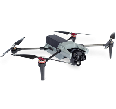
WAMICam III’s smaller, lighter predecessor, WAMICam II, is already available on the market for purchase. “Precision Integrated purchased 4 WAMICam II systems from Transparent Sky,” said Matt Parker, President of Precision Integrated. “These units are the only commercially-available systems on the market and they fit perfectly into our Lockheed-Martin Stalker UAVs, providing unprecedented imagery for live viewing of large areas. The systems are surprisingly easy to use and reliable and we are eager to use the much larger and more capable WAMICam III systems as they become available.”
To learn more about Transparent Sky or to inquire about purchasing a WAMICam™, please visit www.transparentsky.com.


