Nearly four years ago, Tropical Storm Irene brought major flooding to Vermont. Woody debris fell into the state’s rivers and streams during the storm, contributing to the flooding that washed out roadways and caused bridges to fail.
This storm was the catalyst for a UAS project funded through the U.S. Department of Transportation and led by Jarlath O’Neil-Dunne at the University of Vermont’s Spatial Analysis Lab. O’Neil-Dunne wanted to know if they could use unmanned systems to collect accurate volumetric measurements, and provide decision makers with the images and information they need to make quick decisions during these types of situations.
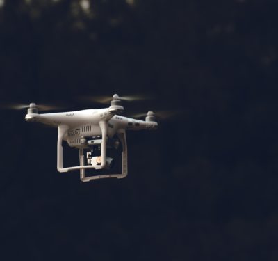
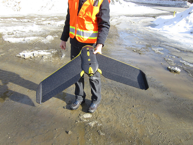
In 2012, the lab received a grant from the U.S. Department of Transportation to begin the research, O’Neil-Dunne said, with the second phase of funding coming in 2014. This phase is what O’Neil-Dunne calls the operational phase, and has given the team the opportunity to conduct various projects with their eBee UAS from Sensefly, including debris mapping and construction site monitoring.
“Before our imagery was limited to satellites, which don’t work very well in Vermont because it’s so cloudy. And it can be expensive,” said O’Neil-Dunne, who is the director of the university’s Spatial Analysis Lab. “It’s wonderful for a lot of applications, but it didn’t have the resolution we needed. The state also collects images by a manned aircraft in 5 to 10 year cycles, and while they were wonderful images they weren’t up to date. When you want to conduct debris mapping or collect detailed images of a stream that’s changing, none of those data sets are a good enough source.”
The Projects
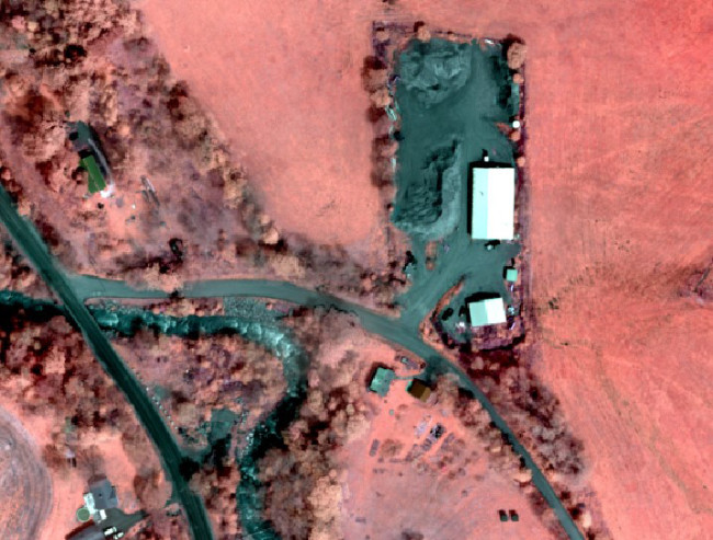
O’Neil-Dunne and his team have kept busy over the last year with several projects to test UAS capabilities. One major project involves debris mapping. Woody debris is a problem in areas where there’s extreme erosion, which can lead to flooding. It’s also difficult to get an inventory of just how much woody debris is in a stream.
They’ve used the eBee to fly over Great Brook in Plainfield, which was one of the towns that suffered from major flooding after Irene.
“We’ve flown that area through the winter and spring and we’ve been able to get a very good accounting of the debris because we can see the trees with the imagery we collect,” O’Neil-Dunne said. “We couldn’t do that with a fixed wing. It’s too expensive. And field surveys are difficult because there’s a lot of erosion, which makes it difficult to walk. With the UAS we’re able to get information to decision makers they didn’t have before.”
They’ve also worked with an engineering firm that is preparing to move a road, he said. The road sits next to a stream that suffered from major erosion after Irene. The firm completed traditional engineering surveys of the area, but O’Neil-Dunne and his team were able to provide high-resolution imagery and a 3D topographic model.
During another project, O’Neil-Dunne and his team worked with an environmental firm to complete a comparative analysis of a stream severely impacted by Irene. That firm is working to restore the stream and make it more resilient to storms like Irene. They completed a traditional cross section survey, and through the eBee, O’Neil-Dunne provided a 3D model of the stream.
“They can now do a cross section at any location and have better information when they want to do hydrologic modeling,” O’Neil-Dunne said. “They have images and more detailed 3D modeling of all the areas.”
The team is also helping with a major interstate construction project, O’Neil-Dunne said, providing a record of the project’s progress over time. They’ll also provide imagery to support pedestrian and bike studies. Currently the state only has 50 cm resolution imagery they collect in 5 to 10 year cycles. Through the eBee, O’Neil-Dunne can provide current 3 to 4 cm resolution images, offering a much more detailed perspective for planning purposes.
Why the eBee
When the UAS team started this project, they knew they didn’t want to build their own system, O’Neil- Dunne. They wanted something that was lightweight and safe, and that was easy to use. They were able to train on the eBee in just a few days, he said, and the 1.5 pound system gave them everything they needed to keep their focus on what they do best: spatial data analysis.
“The eBee offered us an integrated system with planning software, data collection and post processing,” O’Neil-Dunne said. “We can fly for an hour or two and then come back to the lab and process data for a few hours.”
The Future
O’Neil-Dunne expects to keep busy flying the eBee and collecting data in the coming months, and plans to continue to use the eBee to monitor several streams in Vermont. O’Neil Dunne said they’ve seen a lot of interest from consulting firms that want to augment traditional surveys with images and data the UAS can provide, or even use them to conduct more expensive, labor-intensive surveys such as construction projects and dam removal.
This is an exciting time, and O’Neil-Dunne can’t wait to see what UASs will be able to accomplish in the future.
“We’ve just never had access to imagery of what we want whenever we want it before,” he said. “To be able to do this at a very low cost and give information to decision makers the next days is very exciting. It’s a new frontier in remote sensing.”