By Scott McGowan, CEO, Kestrel Group
MORE-AFFORDABLE LiDAR SENSORS: A Real–world Deep Dive Explores Whether Smaller, Lighter LiDAR Solutions Deliver
LiDAR has always been the shiny object of the UAS industry. Usually relegated to big-budget projects, UAS LiDAR has generally been the unobtanium for the majority of the industry. Has that changed with the new, inexpensive Chinese LiDAR sensors that are hitting the market?
To answer that question, we’ll test and assess the Phoenix LiDAR RECON-XT via a real-world series of actual client projects. This solution is representative of the new generation of less expensive and small LiDAR integrations on the market today. Integrator versus integrator or unit versus unit comparisons have been covered ad nauseum on the forums and YouTube videos. This will, more importantly, review the efficacy of this new generation of more affordable and smaller LiDAR sensors, and how they might be a good business choice. Price and the learning curve for getting into the realm of LiDAR can be daunting—I know; I’ve been there. But it’s worth staying the course to consider the most disruptive UAS tech out there.
This is not intended to be an infomercial for Phoenix LiDAR, though thanks go to them for providing this unit for testing and evaluation. The version tested was a pre-production prototype, but Phoenix LiDAR confirmed the production version would carry just a few cosmetic changes and tweaks.
The seven projects chosen to put Phoenix through its paces ran the gamut from a quick-and-dirty 35-acre woodlot to a large multi-terrain 680-acre area. These sites were chosen because they all required the same basic scope, 1 foot contour topo, and represented an aspect of the industry where LiDAR has made some of its largest penetrations to date. Actual field testing of LiDAR capability took place under conditions that prevail outside a planned environment, which allowed for evaluating performance in the realm of wind, rain, spotty internet and cellular, and over an assortment of terrain from flat cow pastures to the nastiest briar-infested pine forest.
As a veteran of more than 500 successfully completed LiDAR projects I’ve got a decent handle on what works and what doesn’t. Or more importantly, what will pass muster to a paying client and what won’t.
INSIDE THE SYSTEM
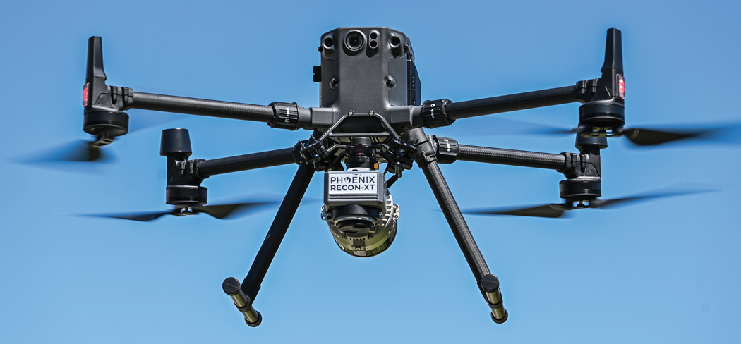
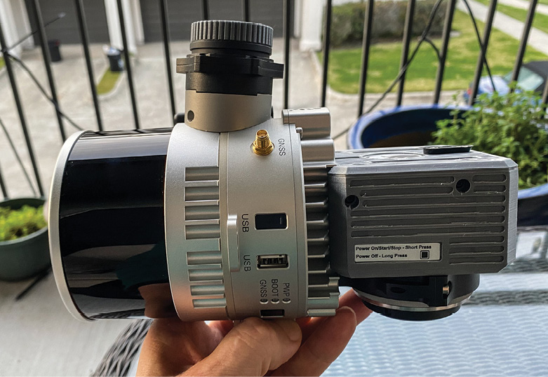
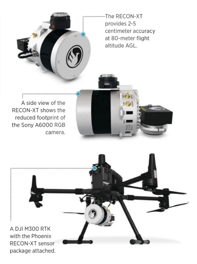
Before reporting out on performance, let’s run through the system being using in this project—a Phoenix RECON-XT mounted on a DJI Matrice 300 RTK. The RECON-XT is a combination of the Hessai Pandar XT 32 LiDAR Sensor, a Sony A6000 RGB camera, and Phoenix LiDAR’s proprietary Navbox and an IMU. Having been used to the massive undertaking of transporting and carrying afield the Sherpa-worthy gear associated with a DJI Matrice 600, 48 batteries, RIEGL VUX-1 UAV, notebook computer etc., this small pile of boxes was refreshing and appreciated. The DJI Matrice 300 RTK comes complete in its provided case, which is slightly larger than your average Samsonite weekender. I actually flew with it to GEO Week and didn’t get the usual $250-$400 upcharge the airlines usually charge for the larger heavy lift cases. Frequent flyer status makes it gratis, which is nice!
The LiDAR sensor itself comes in a small black box slightly larger than the classic playmate lunchbox (dating myself here?). Inside is all the equipment needed to deploy it. Phoenix has done a miraculous job at cable reduction by enclosing most of the linguini inside the actual mount itself. Just connect the GPS antennae cable, which is a quick attachment, insert the LiDAR unit into the stock DJI gimbal, twist ‘til click and you are good to go. Phoenix doubles the standard single rubber vibration dampers with a dual unit. Oh, and don’t forget to add the USB stick for the data! Phoenix has even had the internal foam liner cutout so the sensor can be housed with the stick deployed in the unit; nice touch.
Batteries are stored in the new DJI battery charger/balancer case. This case and its batteries have caused some dissention in the ranks of the UAS cognoscenti, but I love them. Yes, the batteries are expensive, at $1,400 a pair. Yes, they can’t be flown on an airplane because of the over-the-limit watt hours. But the case keeps them safe, keeps them charged and also charges the additional remote controller batteries and any additional USB devices. After many years in the field trying to manage keeping all battery related equipment charged, I really appreciate the utility of having everything I generally need to fly the UAS platform in one comprehensive case.
I should, however, mention that actually using this case/charger in the field does require 1,000 watts of juice, so this isn’t going to plug into your SUV’s lighter and crank up. Personally, I use a small Honda generator in the field for this purpose. Why Honda? It’s quiet, reliable and relatively maintenance-free. Contending with a loud contrary generator is just cruel and unusual punishment. Believe me.
The GPS head used was a simple quality CHC GPS model capable of supplying the needed static accuracy. We used our SECO 5119 tripod because they always work and are of solid quality.
LiDAR isn’t all created equal. Like any sensor or camera, different scenarios require different equipment and levels of accuracy. This is important when looking at the new LiDAR offerings versus the older or higher- end products. The LiDAR I flew over the past 5 years were all of the high-end variety. We used to euphemistically call them “flying McLarens” because yes, they seemed to be that expensive. These sensors were capable of sub survey grade accuracy in a multitude of different environments. These larger units all required heavy-lift UAS platforms and generally flew for 12-16 minutes on a good day. The greater swaths of coverage these high-end units offer somewhat made up for the reduced flight times but you still didn’t have very long time in air collecting data. As the goblin in WOW always reminds you “Time is money, friend.”
The data produced by these units tended to be very clean, highly granular and very accurate. You got what you paid for. Hard-surface targets that would require planimetric line drawings or to quantify gaps in steel plate deflection or weld condition were all able to be discerned. Many of these units could even do dual duty by being strapped to helicopters as well as UAS platforms.
The middle range of LiDAR sensors weren’t quite as expensive, but were slightly less accurate and a bit dirtier in the data generated. Many solutions in this range used more laser shots per second versus multiple returns to achieve similar results as the high-end units, but at a lower price point. These units were used successfully in land development in less vegetated areas, determining the encroachment of trees and vegetation into powerlines and dirt takeoffs on construction sites.
The last group I call the anomalistic LiDAR sensor group. Why? Because that is really what they are best used for. Many times LiDAR is used to find objects through vegetation or other terrain obstacles where the goal is not to necessarily know whether the object found is within 1.5 inches on the surface of the earth, but rather that it has been found and generally located. Think of the Mayan temple that was unearthed in a central American jungle: it’s less important where that temple is on Earth than its existence in the first place. Archaeology, pipeline and power transmission scouting, and landscaping modeling are all good uses of this technology.
PUTTING PHOENIX TO THE TEST
Over a 6-week evaluation period, we logged more than 60 flights, captured 2,700-plus acres of data and flew in every environment we’ve experienced over the past 5 years.
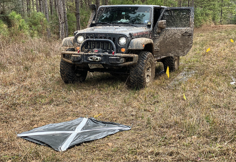
The game plan involved the same time-tested process we have refined for years: plan the flights based off a Google Earth .kmz. Phoenix Lidar’s flight planner was used to set all the parameters for the LiDAR sensor and camera. You can flight plan your work day in advance, load it into the DJI controller and once at the field just power it up. We used the usual black and white ground targets for our GC later in post. All these would be shot by a licensed surveyor for post processing integration. GPS head collecting static for a minimum two hours per site as is standard, Initial site risk assessment was performed and any small UAS recon missions were flown prior to launching the LiDAR missions. Any necessary FAA permitting, or NOTAM filing was handled by LLANC. Phoenix recommends a kinematic sequence prior to launching the automated portion of the flight plan by executing a straight line followed by a figure eight, and then in reverse at the end of the flight. It’s a fairly common requirement if you have been in the LiDAR game before.
Duration was a striking operational takeaway. What a game-changer flying LiDAR for 25-26 minutes is—that’s close to twice the duration I was used to, and the amount of acreage covered in a typical work day was amazing. The DJI controller has all the telemetry info needed as you are flying, and you can easily toggle from FPV to map view. Multi-battery flights are easily handled on the controller with a pause-and-resume function.
The DJI M300 RTK was a dream to fly. It has none of the heavy-lift awkwardness of the M600. DJI has really knocked the ball out of the park with this bird, which performed flawlessly day in and day out. I should add that the braking on the M300 is rather abrupt; I believe DJI wanted to make sure this baby stops when its avoidance sensors encounter something, and I mean it STOPS. Hang on to your coffee.
Data collection went off without a hitch. All pertinent files are loaded onto the external Samsung 256 gig USB drive. The RECON-XT combines the LiDAR data with the RGB camera in the same data file folder. We used Phoenix LiDAR’s improved LiDARMill post processing software as part of this evaluation. Post processing has always been one of the deal-breakers in pursuing a LiDAR capability. Collecting data is just the first stage, and some rare clients may just want that raw stuff, but in reality, you have to process all those gigabits into a deliverable the client will pay for. It’s the Black Magic, the Secret Sauce, the alchemy of LiDAR. The good thing is most of the major integrators are beginning to offer online portals to get you going. I don’t know that they are all ready for prime time or able to provide what your clients are going to want but they are getting better. There wasn’t another option just a few years ago so it’s a work in progress, but its improving greatly. Impressive results came out of the LiDARMill initial processing; I have the luxury of experienced experts in post processing finishing the deliverables but for what its worth, Phoenix is on the right track here. Just sayin’.
THE JURY IS IN
So how was the data? DID it perform to expectations and within the claims of the integrator?
A resounding YES—the results of all seven projects were outstanding. I won’t say there wasn’t some serious anxiety prior to the final deliverables, given these were real jobs for real clients paying real money. But the point densities even in the densest foliage were as good as most of the data I was used to out of the big-money units. In some instances, I almost collected too much data because of the 32 lasers firing in unison, but that was easily adjusted by upping the speed a bit. Remember that altitude, speed and overlap are your friends; get to know them well and they will carry you far in this game. The photos were simple to integrate in the LiDARMill software and made for stunning colorized LiDAR deliverables.
We compiled the deliverables and then sent them out, holding our breath. Across the board, every project passed muster and even got some rare kudos. Rare kudos? Yeh they are rare, because in this business no news is generally good news. If they are calling after submission it’s rarely good!
In summation, this new generation of smaller and lighter LiDAR sensors is really going to find a home in the middle market of the LiDAR industry. I have just received my production unit and it’s awesome!! I’m proud to have been a part of this R&D process and to have had the privilege to use one of these little gems. Love LiDAR!!


