LAKELAND, Florida—Hurricane Ian smashed into Florida in the fall of 2022, jumping from a category 3 hurricane to a category 5 in less than 24 hours. When it was done, it had killed approximately 160 people, mostly in Florida, and caused economic devastation estimated at $116 billion or more in the United States alone.
The National Oceanic and Atmospheric Administration has been studying that rapid intensification for years, seeking to understand it to improve its forecasting, and for the 2023 hurricane season it’s bringing more: More unmanned systems, more sensors, more money, more techniques for getting sensors into the storms, new forecast models.
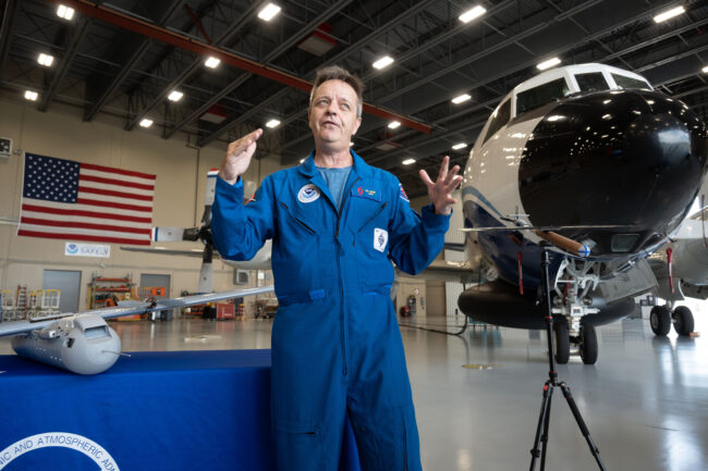
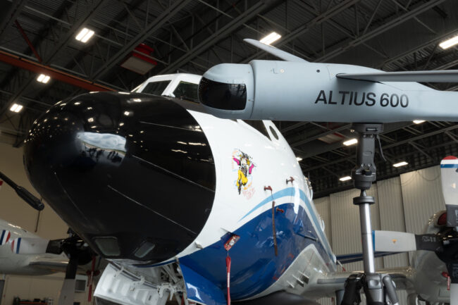
In 2022, NOAA successfully launched the ALTIUS 600 unmanned aircraft from Anduril into the eye of hurricane Ian from the P-3 Orion nicknamed “Miss Piggy,” getting new wind data to better understand rapid intensification.
“We went from crawling, we skipped over walk and run, and went right to sprint,” Capt. Bill Mowitt, director of NOAA’s Uncrewed Systems Operations Center, describing the launch of ALTIUS during a press briefing here at NOAA’s Aircraft Operations Center on June 27, where NOAA displayed the various technologies for this season before they are pressed into service. “A really successful test flight and a really promising technology.”
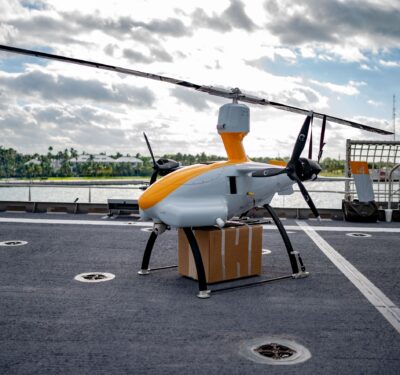
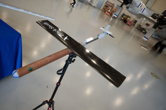
This year, NOAA and its partners will do that, and more, he said, including launching the smaller Black Swift Technologies S0, a smaller system that will take many of the same measurements. Another new platform, a hand-launched platform from Arizona-based Dragoon, may make its debut this year as well. It’s a long-duration platform that would fly around the storm, making measurements at much lower altitudes than the P-3 can.
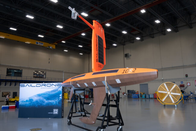
Further below, as many as a dozen Saildrones will be on the surface in the Atlantic, Caribbean and Gulf of Mexico, including a standby system that could be rush deployed to get it in place before a hurricane arrives. “We’re providing our scientists with a new understanding of air-sea interaction,” Mowitt said. “…We’re hoping that translates to better models and eventually into better forecasts.”
Under the surface, as many as 30 gliders from the U.S. Navy and academic partners—unmanned vessels that move up and down in the water column—will be providing temperature and salinity observations as deep as 1,000 meters.
“In terms of what’s new for 2023, one thing this year is just more,” Mowitt said. “Thanks to some increased appropriations from Congress, we’ve gone from having five Saildrones in 2021 to seven in 2022, we’re going to have 10 in 2023. We want to get these things in front of a storm, it’s kind of a numbers game.”
On the air side, both of the systems “are now fitted with a turbulence probe, so in addition to measuring horizontal winds, we can also measure vertical winds and they’re telling us more about energy flowing from the ocean into the storm,” he said.
“The final new thing for 2023 is just increased coordination between these platforms. You can imagine if we can get the glider, the Saildrone, and uncrewed aircraft all measuring in the same place at the same time, that gives our scientists a really incredible picture of that air-sea interaction and dynamics.”
Miss Piggy
Among those aboard Miss Piggy—a venerable P-3 Orion that has been flying into hurricanes since 1976—will be Dr. Joseph Cione, lead meteorologist at the NOAA Oceanographic & Meteorological Lab’s Hurricane Research Division, and a pioneer of using unmanned systems to study storms.
I’m looking at different technology to make our jobs easier but also to meet the objectives that we have,” Cione said, adding that many technologies are tried but few pass the filter needed to become an operational part of a mission.
The P-3 flies high, but the drones can provide information it can’t, such as what is going on in the critical boundary layer between sea and air, Cione said. “It’s also where the storm gets its energy.”
“It’s going to give us much improved knowledge. … we have to transfer that knowledge to the forecast capabilities that NOAA is responsible for. So, we use that understanding to improve the physics of the model. Once we improve the physics of the model, the forecasts themselves should improve,” he said.
Drones provide information on “what the winds are doing at that minute, right then, that we send in real time to the Hurricane Center and the modeling center, so they can use that information to make critical life or death decisions with regard to evacuating or not evacuating,” he said.
The ALTIUS can fly longer than the S0, but the smaller Black Swift has a trick up its small sleeve: It carries a laser that can measure the distance to the waves below. That’s not just for measuring wave heights, but to help keep the system from running into them.
“If we’re flying low, we don’t have a surface. Where’s zero? Am I going to hit a wave here?” Cione asked. The laser enables the S0 to fly as low as 60 to 70 meters, far lower than the P-3 would dare.
In addition to deploying the S0 and the Altius 600, the P-3 will be dispensing dropsondes, which make measurements as they fall to the ocean, and streamsondes, a new lightweight variant from the Finnish company Skyfora, which will flutter in the atmosphere much longer as they descend.
“All these platforms give us a better way to sample,” Cione said.
Asked if the P-3’s work could one day be handled entirely by UAS, Cione said probably yes, eventually, or at least most of it.
“I think it’s this sort of crewed-uncrewed mix that is going more and more—like life—is going more and more toward the uncrewed…but that’s a slow transition,” he said. “We’re certainly going to be flying the P-3 and C-130s for many years to come, but eventually, you’re talking decades out, we’re probably going more towards that direction.”


