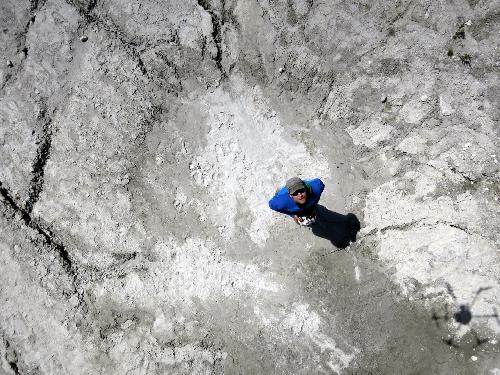
SAN FRANCISCO — While some dream of the day that aerial drones deliver their online purchases, scientists are using the technology today to deliver data that was never available before. About 5,000 meters high in the Peruvian Andes, the scientists are mapping glaciers and wetlands in the Cordillera Blanca mountain range with 10-centimeter precision to gauge how climate change will affect the half-million local residents who rely in part on those glaciers for their water supply. Their strategy provides a template for research teams that are investigating water security in other areas of the world with much larger populations, including China and India. This is a UAV selfie. Ohio State University doctoral student Oliver Wigmore takes his own picture from the view of an unmanned aerial vehicle (UAV) he built in order to do climate research in Peru. The shadow of the UAV can be seen in the lower right. Credit: Photo by Oliver Wigmore, courtesy of The Ohio State University. Though the study is just beginning, one early finding is that the Cordillera Blanca has a healthy groundwater system, said Oliver Wigmore, a doctoral student in geography at The Ohio State University. “In this area, glacier melt provides […]
Click here to view original web page at www.sciencecodex.com