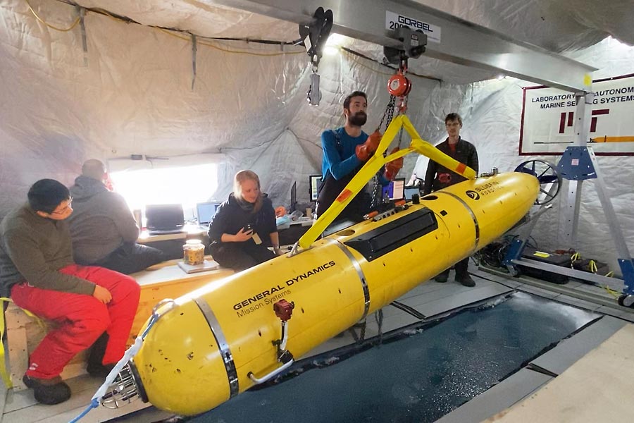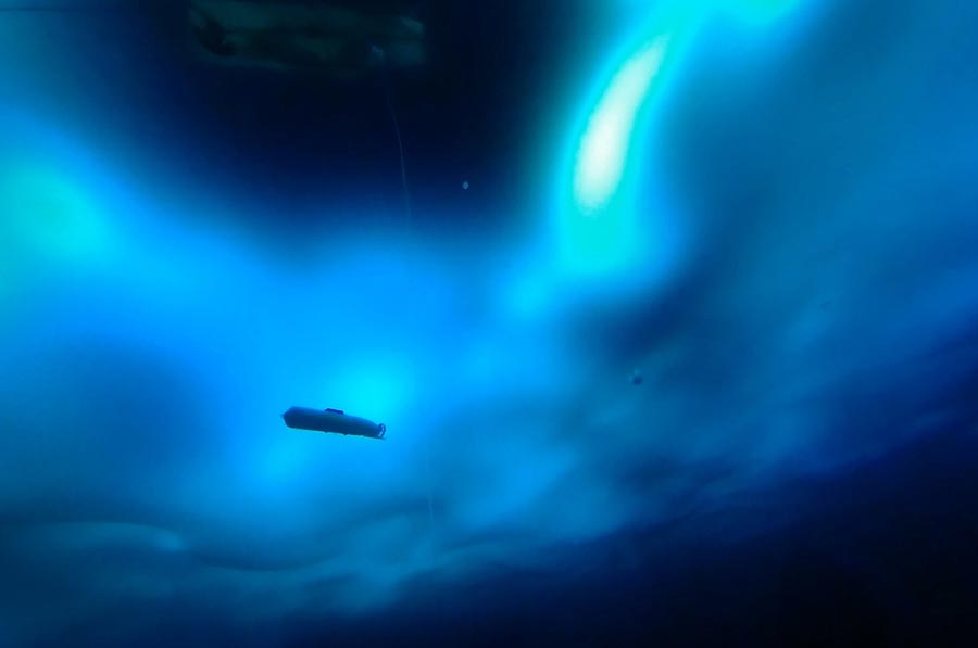
The research team prepares to deploy an autonomous underwater vehicle built by General Dynamics Mission Systems to test their navigational concept. Credit: Daniel Goodwin LCDR, USN
As the polar icecap melts, the waters of the Arctic Ocean assume ever-growing strategic and commercial importance. To enable U.S. Navy submarines to operate safely and effectively for extended periods under the ice, new navigation methods will be required. An autonomous underwater vehicle (AUV) spent some time deep in the dark, frigid ocean last spring, proving out one such method involving sound waves.
The technique could become critical for the Navy because its submarines use sonar to communicate, and to track and identify foreign vessels. Water variables such as temperature, salinity, and pressure affect the speed of sound through the medium. As temperature falls, sound waves slow down; as pressure (or depth) increases, they speed up. Sound waves also refract toward water layers where the speed of sound is lower. As ice melts in the Alaskan Arctic and ocean temperatures shift, the temperature and position of ocean water layers shifts, too.
To successfully navigate throughout the Arctic requires understanding how these changes in sound propagation affect a vehicle’s ability to communicate and navigate.
During an ICEX 2016 scientific camp, Massachusetts Institute of Technology (MIT) researchers established that warmer Arctic waters, in particular a marine region called the Beaufort Lens, impact how sound travels in the water. The Beaufort Lens acts as a sonic superhighway between Alaska and the Northwest Territories. The Lens consists of three layers: a layer of mixed warm and cold water near the ocean’s surface, a second layer of colder water at between 100 and 200 meters of depth, and 200 or so more meters beneath those, a layer of warmer water.
The changes this wreaks on sound travel, combined with further effects of changing ice composition, stimulated the researchers’ curiosity. They returned to the area as participants in ICEX 2020, a three-week program hosted by the U.S. Navy, in which military personnel, scientists, and engineers performed a range of research projects and missions. MIT sent a team from its Laboratory for Autonomous Marine Sensing Systems (LAMSS) to prove out the new navigation method.
Using an autonomous underwater vehicle (AUV) built by General Dynamics-Mission Systems and a system of sensors rigged on buoys developed by the Woods Hole Oceanographic Institution, the MIT scientific team has demonstrated a new integrated acoustic communication and navigation concept. The framework enables vehicles to travel through the water with GPS-level accuracy, using oceanographic sensors for data collection.
The first step taken at the Arctic Submarine Lab’s ice camp in March 2020 was deploying several conductivity-temperature-depth probes to gather data about the Arctic aquatic environment.
“By using temperature and salinity as a function of depth, we calculate the sound speed profile. This helps us understand if the AUV’s location is good for communication or bad,” said Bradli Howard, a graduate students in the MIT-Woods Hole Oceanographic Institution Joint Program in oceanographic engineering.
Because of the way sound bends in water, sine-like pressure waves collect in some parts of the water column and disperse in others. Understanding the propagation trajectories is key to predicting good and bad locations for the AUV to operate.
To map the areas of the water with optimal acoustic properties, Howard modified the traditional signal-to-noise-ratio (SNR) by using a metric known as the multi-path penalty (MPP), which penalizes areas where the AUV receives echoes of the messages. As a result, the vehicle prioritizes operations in areas with less reverb.

For scientists to understand the role the changing environment in the Arctic Ocean plays in global climate change, there is a need to map the ocean below the ice cover. Credit: Troy Barnhart, Chief Petty Officer, U.S. Navy
These data allowed the team to identify exactly where the vehicle should be positioned in the water column for optimal communications that produce accurate navigation. Meanwhile a colleague focused on how sound is projected and reflected off the ever-changing ice on the surface.
To get these data, the AUV was outfitted with a device that measured the motion of the vehicle relative to the ice above. That sound was picked up by several receivers attached to moorings hanging from the ice.
The data from the vehicle and the receivers were then used to compute where the vehicle was at a given time. This location information, together with the acoustic environmental data, offer a new navigational concept for vehicles traveling in the Arctic Sea.
“The U.S. Navy’s goal is to preserve peace and protect global trade by ensuring freedom of navigation throughout the world’s oceans,” Howard added. “The navigational concept we proved during ICEX will serve to help the Navy in that mission.”


