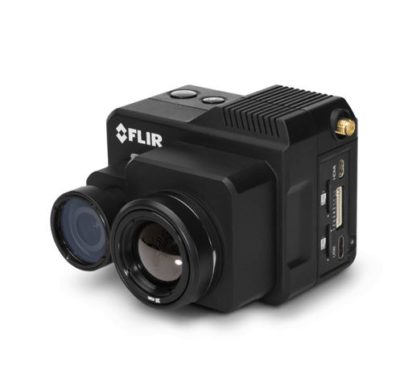
Take thermal to new heights with the FLIR Duo Pro R, a compact, lightweight, dual-sensor thermal and visible light imager…
Inside Unmanned Systems

AUVSI XPONENTIAL 2018
XPONENTIAL 2018, held at the Colorado Convention Center, puts the power of knowledge in your hands through a comprehensive educational…
25th ITS World Congress
This year’s Intelligent Transport Systems & Services (ITS) conference will be held in Denmark in September. ITS World Congress will…
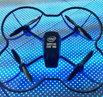
Drones, Autonomous Cars Key to Big Intel Announcements at CES 2018
At this week’s opening keynote for CES 2018 in Las Vegas, Intel CEO Brian Krzanich demonstrated how Intel is powering…

NovAtel Joins Baidu’s Apollo Autonomous Driving Ecosystem as Official Partner
NovAtel and its line of NovAtel SPAN GNSS+INS products designed to provide position, orientation and time as a critical component…
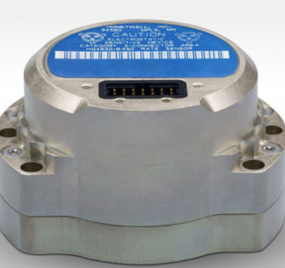
Honeywell IMUs Bringing Pinpoint Navigation Accuracy to New Industries
Long established as a key component within defense applications, navigation technology from Honeywell is now available to a wide range of new…
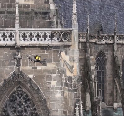
Intel Falcon 8+ Drone Being Used in Inspection of Cathedral
The 15th century Halberstadt Cathedral in Saxony-Anhalt, Germany is getting help from 21st century technology: the Intel Falcon 8+ drone….

Aeronyde’s $4.7M Seed Funding To Help Develop Drone Infrastructure
Aerial systems company Aeronyde announced on December 12 it had $4.7 million in seed financing to develop its end-to-end infrastructure…
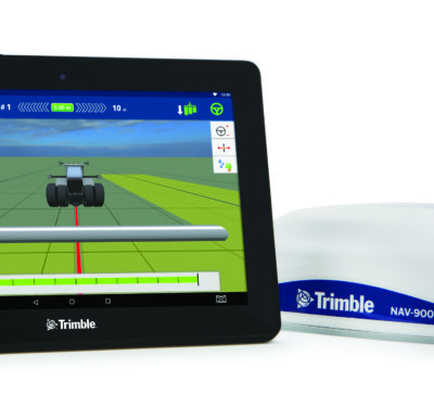
Trimble’s ISOBUS-Compatible GFX-750 Display System Designed for Precision Agriculture Applications
Trimble recently introduced the Trimble GFX-750 display system for agriculture applications. The display system comes with the simple-to-install, roof-mounted NAV-900…
Jan 30 – Feb 1, 2018 – PTTI 2018: Precise Time and Interval Meeting, Reston, VA, USA
Precise Time and Time Interval Systems and Applications The Precise Time and Time Interval Systems and Applications (PTTI) meeting is…
Feb 6-18, 2018 – AUVSI Unmanned Systems Defense: National Harbor, Maryland, USA
AUVSI Unmanned Systems – Defense. Protection. Security. (USDPS) is THE destination where military and government agency decision-makers go to discover…
Feb 13-15, 2018 – The Unmanned Systems Expo (TUSE) and RoboBusiness Europe 2018, WTC Rotterdam: The Netherlands
3 Days of Unmanned Systems TUS Expo is part of the 2nd International Robotics Week in Rotterdam. It provides a…
March 5-7, 2018 – Munich Satellite Navigation Summit 2018, Residenz Munchen: Muncih
Meet high-level experts in the heart of Bavaria The Munich Satellite Navigation Summit is an conference with global impact dealing…
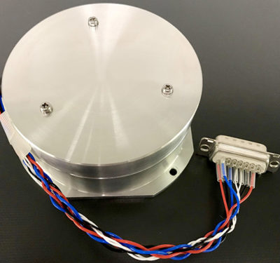
Fiber Optic Gyro from Tamagawa Designed for ADAS, Mobility Applications and More
Tamagawa Seiki, an advanced inertial sensing technology provider for aerospace, military and automotive applications, is launching a new, low-cost, tactical…
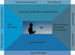
Inside Unmanned Systems Webinar: Security Risks with Commercial Drones
Security Risks with Commercial Drones – How Serious is this Risk and What’s the Latest in Detection and Mitigation? REGISTER HERE…
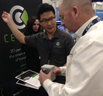
Cepton’s SORA 200 3D LiDAR Designed to Bring UAV Mapping to New Heights for Partner LiDAR USA
Cepton Technologies, Inc., a provider of 3D LiDAR sensing solutions for automotive, industrial and mapping applications, announced the launch of…
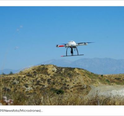
Solve Gas Detection Problems with Microdrones mdTector1000 CH4
LAS VEGAS, Oct. 24, 2017 /PRNewswire/ — Microdrones is excited to announce the release of a new professional aerial methane detection…
