Worldwide effort could lead to new methods of forecasting by using drones alongside radiosondes and and weather balloons.
The torrential flood that deluged parts of New York City with more than eight inches of rain in September caught many residents by surprise, with minimal warning beyond a travel advisory issued by city emergency officials 12 hours in advance.
Predicting extreme weather phenomena such as a record-breaking rainstorm depends on the accuracy and timeliness of atmospheric data. The platforms meteorologists now rely on—weather balloons equipped with radiosondes and commercial airplanes carrying sensors—often do not provide enough timely information to forecast hyperlocal weather events.
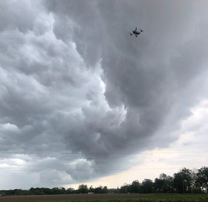
Integrating drones into weather forecasting, however, could provide more precise monitoring of localized atmospheric conditions. To find out whether unmanned aircraft systems could improve weather forecasting, the World Meteorological Organization (WMO) is planning a seven-month worldwide demonstration campaign for a series of drone tests beginning this spring.
“We are trying to demonstrate that this is a valid technology that could be used operationally,” said Pekka Rossi, scientific officer for the WMO, based in Geneva, Switzerland. “These national weather services throughout the world could then use them to fill in the gaps in these observation networks.”
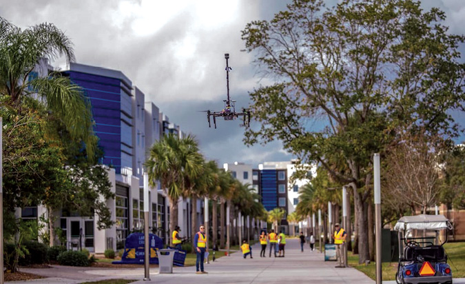
An estimated 40 drone operators from government, academia and industry will voluntarily launch their drones in a massive data collection of atmospheric conditions in the United States, Europe and Asia from March through September 2024. The participants will then upload the data, which will be analyzed by meteorological experts to see how the information can impact weather forecasting.
The project will conclude at a conference of the International Society for Atmospheric Research using Remotely piloted Aircraft (ISARRA) Sept. 3-6 at Oklahoma State University in Tulsa. The conference will be followed by Flight Week, an in-person drone demonstration in the Tulsa area.
“This is just one other way to coordinate these demonstration efforts and maybe look at a different forecasting problem and bring the people and sampling areas closer together,” said James Pinto, a research scientist at the National Center for Atmospheric Research in Boulder, Colorado, and an organizer of the project. “Prior to that, they will be scattered around the world.”
WEATHER FORECASTING GAP
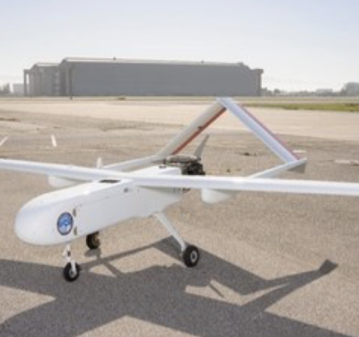
While drones have been used to monitor damage from extreme weather episodes, such as hurricanes and tornadoes, they have had limited deployment in weather forecasting. Most of the projects that have incorporated drones into meteorological monitoring have been for research conducted by universities and governmental agencies.
Drones have not been extensively used in weather forecasting because of the need to develop detailed unmanned systems to monitor the atmosphere, the expense of building these types of UAS, and the federal regulations that prohibit them from being deployed beyond visual line of sight. For the demonstration campaign, participants in the United States will need to seek waivers from the FAA to be able to fly their small drones above 400 feet.
“Part of the point of the demonstration campaign is to show what the current state-of-the-art is, what the utility of UAS is, and to get these agencies to start thinking a little bit more outside the box in line with these operations,” Pinto said. “The operators are pushing the envelope every day and so airspace is getting freed up. It’s just a matter of time.”
One participant in the demonstration campaign is Embry-Riddle Aeronautical University in Daytona Beach, Florida, which has been developing UAS for atmospheric monitoring for the past decade. The university will test recording weather conditions in the boundary layer, the lowest region of the atmosphere.
Despite its proximity to the Earth’s surface, the boundary layer is where there is a dearth of data about weather conditions. Extending upward about a third of a mile, the boundary layer has a variety of microclimates because of the diverse land uses on the Earth’s surface, which each produce different weather patterns.
“We all live and breathe and exist in this lower portion of the atmosphere,” said Kevin Adkins, an associate professor at Embry-Riddle who directs the Unmanned Vehicle and Atmospheric Investigation Lab. “A lot of people would guess that we have a lot of observation of it, but we just don’t, and that has a disproportionate impact on the quality of the weather forecasts.”
Since the mid-twentieth century, weather balloons equipped with radiosondes—battery-operated instruments that measure the atmosphere’s parameters and transmit them by radio to a ground receiver—have been used throughout the world. When weather balloons are released, which typically occurs twice a day, they ascend quickly above the lower atmosphere and are then carried on the winds. Once they reach the upper atmosphere, they disintegrate, making them a single-use instrument.
“That’s not very sustainable for the environment,” Rossi said. “When it falls down on the ground, there’s a lot of waste.”
Drones, on the other hand, are reusable and their batteries can be recharged for months, making them a more sustainable approach, an advantage that aligns with WMO’s new strategic plan to enhance environmental sustainability.
“These UAS-based profiling methods enable multiple uses so when the drone flies and comes down, you can repeat that,” Rossi said. “That is one of the benefits and drivers for this campaign.”
While small drones could be placed in an unlimited number of locations, stations where weather balloons are launched across the world are sparse, with hundreds of miles between them. In the United States, there are one or two monitoring stations in each state.
The other method used for weather forecasting—using sensors attached to commercial airplanes—also does not provide accurate data on the lower atmosphere because the aircraft ascend and descend too rapidly to capture enough information for detailed measurements.
“Taking off and going through that layer doesn’t give you any information,” Adkins said. “A commercial airliner passes through 5,000 feet very, very quickly so you don’t get a lot of observations.”
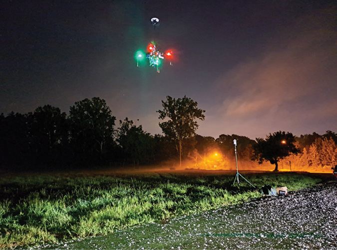
For the demonstration campaign, Adkins and his team of students plan to deploy several small fixed-wing and multi-rotor aircraft from a variety of locations in Daytona Beach, including the campus and the beach. Adkins said he will apply for waivers from the FAA so the drones can reach at least 1,000 feet in the atmosphere.
“The hope here for everyone is that once we make the case—once we show that this can be done successfully and produce good data—that we could undertake these types of drone-based observations autonomously,” Adkins said.
That could be achieved by deploying UAS from launching pads, enabling them to make observations and then return to their home base to get recharged, which would increase the frequency of data collection. “We can control the drone, and not just get observations where the wind wants to take us,” Adkins said. “And we can do it more economically and in a more environmentally friendly way.”
APPLYING THE RESULTS
During the demonstration project, the drone operators will be required to upload the data in a standardized global format into a centralized data exchange platform. Rossi hopes the data will be transmitted within a short time frame of up to two hours so the campaign can demonstrate that drones can provide real-time atmospheric measurements.
“This data would be included in weather forecasting,” Rossi said. “This is essentially one of the key outcomes of the campaign — whether the data will improve the weather forecast and what kind of impact it would have.”
The data generated during the campaign will also be analyzed by modeling centers around the world that develop weather forecasts, including the National Center for Environmental Prediction in College Park, Maryland. These centers will use the data to conduct their own experiments and assess the impact on weather forecasting.
“The key thing is to demonstrate this technology from end to end so the operator gets it reformatted, uploaded to the cloud and the modeling centers pull the data back down and take a look at it,” Pinto said. “At that point, it will open up a lot of opportunities for other researchers to assess the potential impact on various weather conditions around the world.”
If the centers determine the demonstration campaign has generated data that improves weather forecasting, the WMO will likely include a recommendation to incorporate drone technology in the guidelines it sends to national weather services in its member countries.
That recommendation could direct agencies to consider drones “as a potential upper air observation source when you’re investing in new observation technology in your country,” Rossi said. “It could be a reliable alternative solution that you can use to fill in the gaps in these legacy, atmospheric profiling networks.”
Beyond any recommendations from the WMO, a positive result from the demonstration campaign could also lead the drone industry to consider adding weather forecasting sensors to UAS being deployed for commercial applications. Adkins envisions a drone ecosystem that would incorporate weather sensors on drones delivering packages or transporting people.
“This can help them basically make the business case,” he said. “You can put together a sensor package relatively cheaply and you don’t have to keep people on the ground. So, there’s a good business case to be made for having drones make these observations and actually increasing the bottom line.”
For a private drone operator, for example, the ability to predict an extreme weather event such as a severe thunderstorm could enable the company to delay a planned package delivery and potentially save money, Pinto said.
Weather services around the world may also choose to adopt drones to measure atmospheric conditions if they can justify the costs. Purchasing a UAS equipped to generate weather forecasting data can cost about $100,000, but running a station that deploys weather balloons on an annual basis can cost the same amount, Pinto said.
“The weather services might do it if they find that it’s having a huge impact on their ability to predict high-impact weather events,” he said. “So, I think the studies have to be carried out and presented to the weather services so they can determine if it’s worth the funding that it’s going to require.”