A consortium composed of Swiss and Austrian companies has embarked on an innovative project to conduct extensive laser scanning of the Swiss Alps using drones, marking an advancement in environmental and energy research. The collaboration involves Dufour Aerospace, RIEGL, BSF Swissphoto, and the WSL Institute for Snow and Avalanche Research SLF, with the aim of conducting a series of test flights across the mountainous region.
This initiative seeks to provide high-resolution, current, and cost-efficient data to meet the increasing demands of both private and public sectors, especially in areas prone to alpine environmental hazards and those relevant to energy production. Traditionally, airplanes and helicopters have been utilized for large-scale, high-resolution laser scanning. However, the consortium’s tests aim to prove drones as a more efficient and environmentally friendly alternative, potentially offering substantial cost savings.
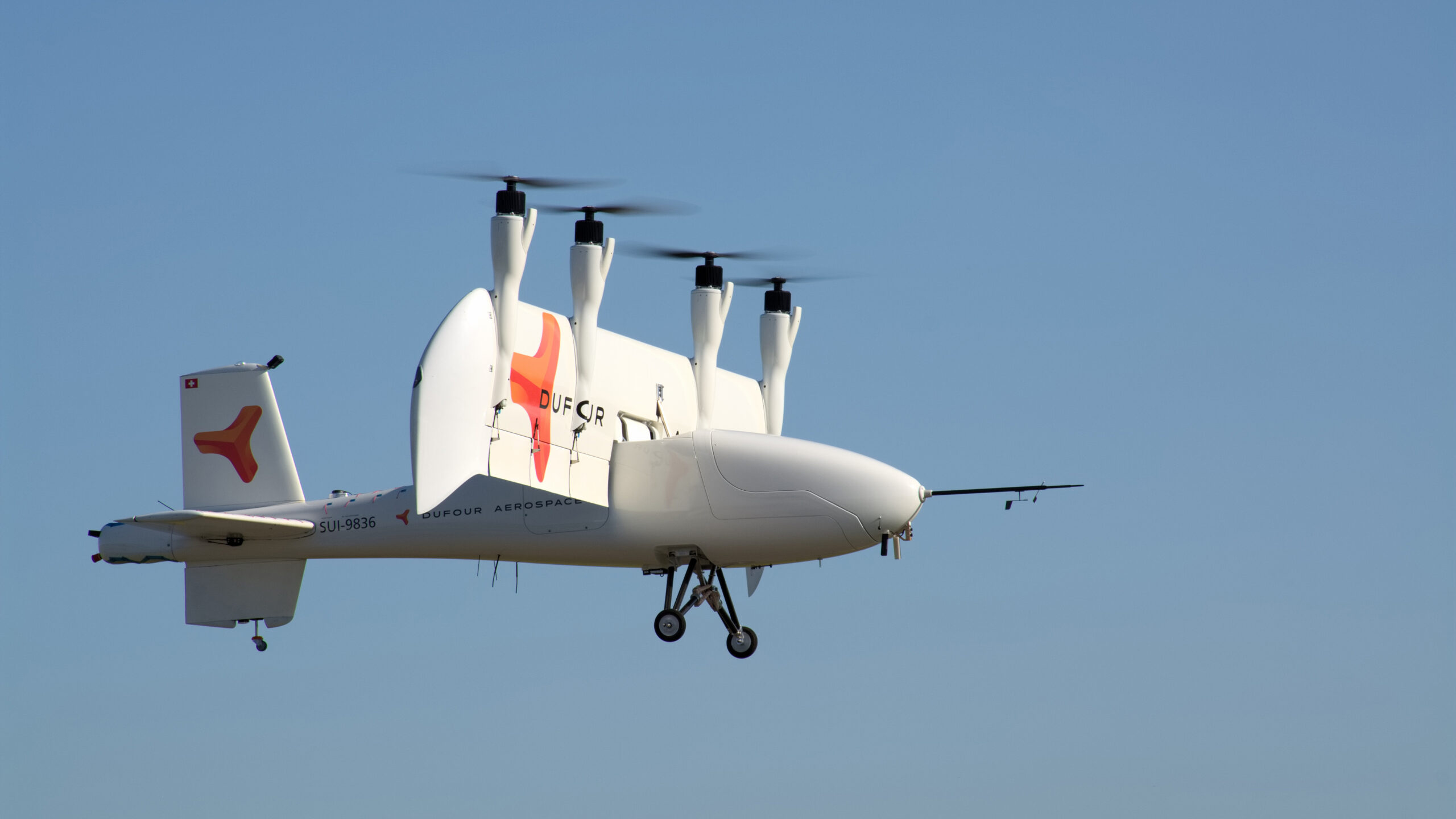
Dufour Aerospace will contribute its AeroMini and Aero2 drones, which boast wingspans of 3 and 6 meters, respectively, to the project. RIEGL is set to supply the laser scanners and assist with their integration into the drones. BSF Swissphoto will play a critical role in validating the data collected and assessing the commercial viability of the technology. Meanwhile, the WSL Institute for Snow and Avalanche Research SLF will ensure the data quality meets the stringent requirements necessary for applied science, contributing its expertise in high alpine terrain.
The test flights are scheduled to commence this spring in Dübendorf, Switzerland, with basic functional assessments, and are planned to expand to the Alpine region throughout 2024 and 2025. The outcomes of these tests could herald a new era in aerial geo-data acquisition, supporting autonomous, large-area data collection for a variety of applications. This project receives backing from the Fondation The Ark and armasuisse, highlighting the broad support for pioneering such technological advancements in Switzerland.


