Beyond visual line of site restrictions (BVLOS) are the thunderheads of UAS flying, clouding the prospects of long-range flying. While not as sexy as sleek drones themselves, integrated components can help surmount BVLOS constraints.
A collaboration between two Spanish companies—flight control specialists UAV Navigation and UHF datalink provider WAVENET RF Engineering—recently tested missions extending beyond 300 kilometers (186 miles). While UAS Navigation’s systems allow for completely autonomous flights, continuous monitoring during these tests demonstrated reliable, seamless, secure data transfer between UAV’s VECTOR autopilot/Visionair ground control software and WAVENET’s radio datalink, and between the UAV and its ground control extension.
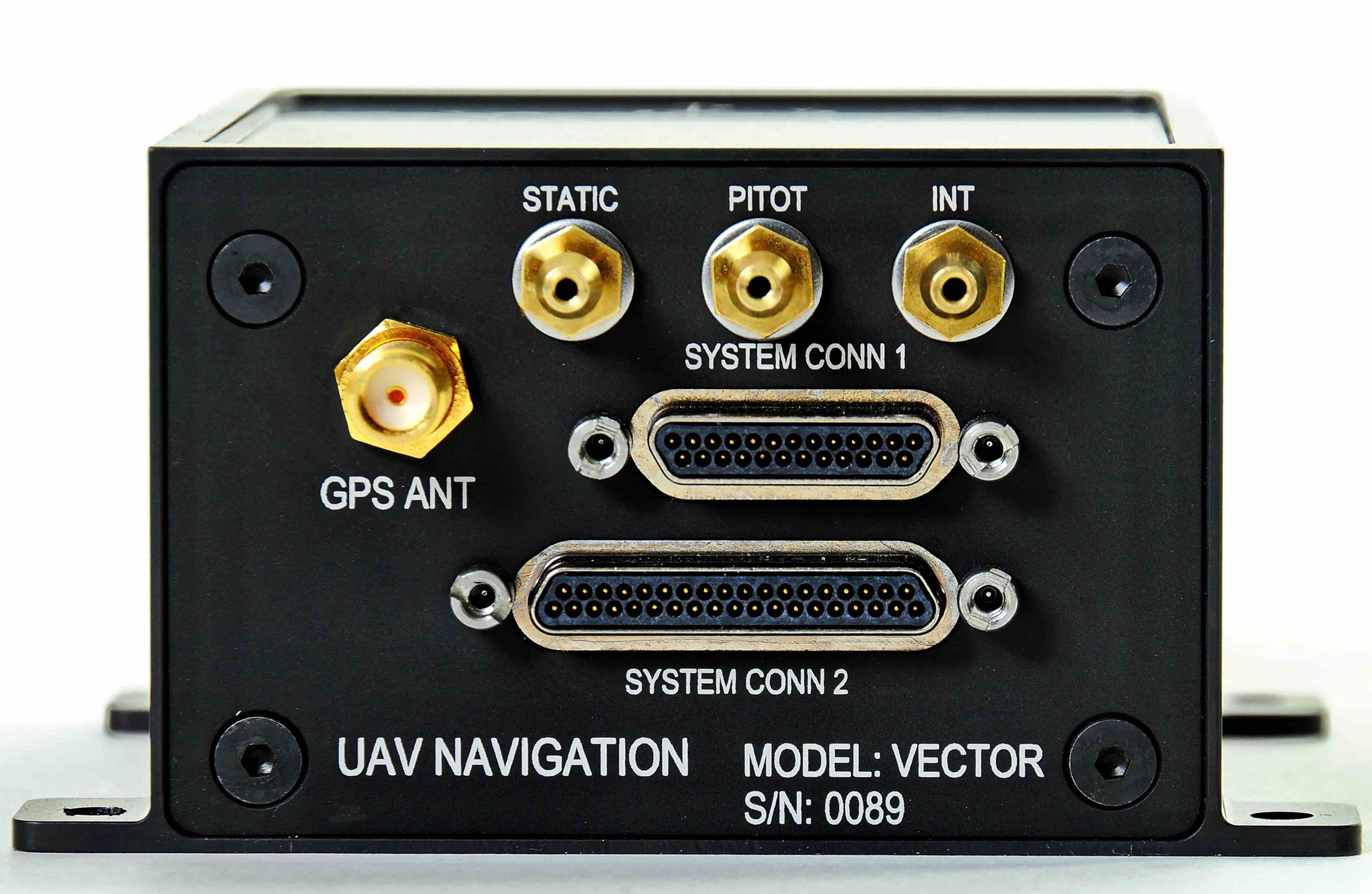
The VECTOR autopilot deliberately omits the internal data link found in the company’s older models. “Regulations regarding radio frequencies are very different,” noted David Pinta, UAV’s pre-sales & support engineer, “so we have designed our flight control solution to allow our clients to use the datalink solution they wish. WAVENET RF Engineering [which itself has two decades of experience] is one of the links we recommend to our clients in case they seek a radio link solution.”
“We are able to accept information from radio, and can provide distance information,” chief technology officer Miguel Angel de Frutos Carro added. “I can take that information and put it inside the estimator in order to improve my accuracy.”
Worldwide Reach
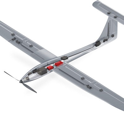
The 300-kilometer flight marked the latest milestone in Madrid-based UAV Navigation’s evolution. The company has been refining autopilots and flight control systems since 2004, logging 60,000 hours and selling 2,000 autopilots to leading (if often NDA-shy) fixed wing, rotary wing and target drone players worldwide. The fixed-wing drone used in the test has a 4 meter wingspan, is 3 meters long and registers a 50 kilometer maximum takeoff weight. For catapult-launched aerial target drones, additional applications provide attitude headings, offer precise altitude measurement for special maneuvers and guide parachute recovery. Whatever the platform, maintaining safety, even during adverse conditions, is the goal.
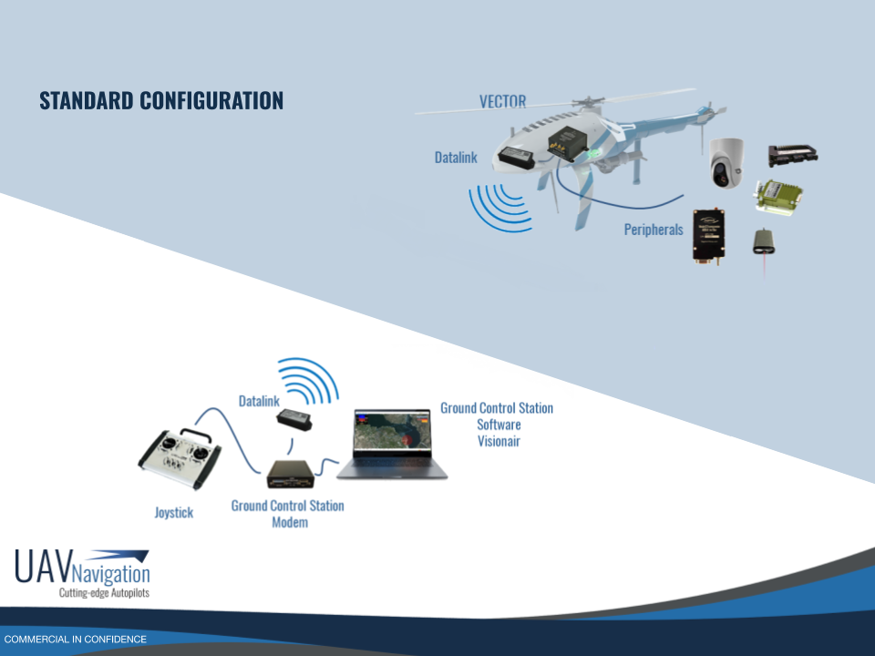
The extended-range test also informed UAV Navigation’s telemetry optimization. “This has been one of the efforts we have made during the last month to increase and ensure flight safety, which is our main concern,” said Pinta, who also serves as the company’s marketing manager. UAV Navigation’s systems are compact, with external sensors and IMUs (inertial measurement units) integrated into a Mission Management box. A magnetometer provides data on yaw angle regardless of vehicle orientation—which is especially critical for positioning helicopters for altitude protection, drift calculation and autorotation.
The company’s POLAR AHRS (altitude heading and reference system) estimator is at the heart of the VECTOR autopilot. It consists of an IMU, multiconstellation GNSS and an ADS (air data system), which combine to estimate inertial velocity, roll and pitch angles even when GNSS is unavailable. As a result, POLAR can provide the heading, attitude and velocity information required by the system’s twin redundant Flight Control CPUs, producing control in all flight modes to execute the flight plan. The system can detect unsafe situations, abort and return if needed (POLAR is available to developers as a standalone product).
Rolling Relativity
One of UAV Navigation’s unique applications offers a complete flight control solution for landing on a moving vessel. In that case, an additional IMU on the ship measures roll to send back to the UAV, adjusting for the height difference between a normal GPS tower antenna and the net on the deck. Another UAV Navigation application allow for flying 7 meters above sea level at 600 kilometers (about 375 miles) per hour. “That’s a really difficult and demanding maneuver but our flight control can do it,” de Frutos Carro continued.
What’s next? “We are working to go to higher markets, fuller redundant systems with several VECTORS,” he added. “We’re aiming to take all the experience from the VECTOR autopilot and put three autopilots together in one box so if one fails you have the two others.”
Eighty percent of the current customer base involves military providers, and UAV Navigation hopes to expand on that. “We are working on UAV certification,” de Frutos Carro concluded. “If we really want to go to the civil market, we need to go to the certified products.”