Test flights to show the benefits of the European GNSS Galileo and its satellite-based augmentation system, EGNOS, for drone operations recently took place in Villacarillo, Spain. Galileo-EGNOS as an Asset for Unmanned Aircraft System Traffic Management (UTM) Safety and Security (GAUSS) carried out more than one hundred drone flights, testing different navigation settings with the on-board sensors.
Six scenarios were simulated during the exercises, producing up to 600 data packets now under analysis to demonstrate proving the advantages of EGNOS and Galileo in terms of accuracy, integrity and availability. The simulated scenarios included delivering a package navigating obstacles, surveilling vast expanses of land, technical exercises and flight simulation in an urban area, among others. An urban simulation was also completed with flights in in Seville.
Project GAUSS employed three platforms to conduct the tests: two multi-rotor systems, one from the University of Seville and the other from Spanish company, SCR, and a fixed-wing drone, TUCAN, also from SCR. Septentrio, u-blox and NovAtel sensors were integrated.
GAUSS is a H2020 project supervised by the European GNSS Agency (GSA) and coordinated by everis Aerospace, Defense and Security, in which the Institut de Robòtica i Informàtica Industrial (CSIC-UPC), RINA Consulting, ARATOS, the University of Cranfield, the University of Seville (USE) and Satways also participate. The objective of the project is to develop a high-performance positioning system for drones within the U-Space framework focusing on VLL (Very Low Level) and UAS (Unmanned Aircraft System) operations.
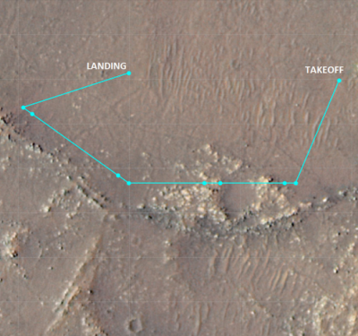
Photo courtesy GAUSS.