With the 2024 FAA Reauthorization Act and the UK CAA’s new BVLOS exemptions, drone regulations are shifting from restrictions to enablement. These legislative moves are accelerating the adoption of drones for infrastructure inspections, empowering utilities, transportation agencies and local governments to enhance efficiency as well as scale operations.
As drones have become an accepted part of the aviation landscape, their role and use in inspections has grown as well. Public sector investment and public/private partnerships for UAS inspections have expanded significantly in both the U.S. and the U.K.
It’s not surprising considering the advantages: UAS inspections are faster, more efficient, safer, more cost effective and more accurate. A 2019 study by the American Association of State Highway and Transportation Officials found that almost 75% savings could be realized by using drones for inspections instead of traditional methods. Drones are also more versatile; and these advantages are being recognized as both the U.S. and the U.K are working on regulations, such as enabling BVLOS to expand capabilities.
LEGISLATION MOVES DRONES FORWARD
In the U.S., the 2024 FAA Reauthorization Act contained provisions that moved the drone industry forward, such as the Drone Infrastructure Inspection Grant (DIIG) program, which is the first grant program that helps local governments create and expand drone inspections. The act also created a $20 million program to build on previous drone workforce education programs that lacked funding; as well as requiring the FAA to issue new BVLOS rules by last September.
In the U.K., the Civil Aviation Authority (CAA) will now allow remote piloted UAS to bypass BVLOS in so called “atypical” operations, including where drones can fly at low heights near infrastructure or buildings where it is highly unlikely for any other aircraft to be operating. This includes inspection of power lines for damage, maintenance checks of wind turbines and drones used for site security.
UTILITIES LEVERAGING DRONES
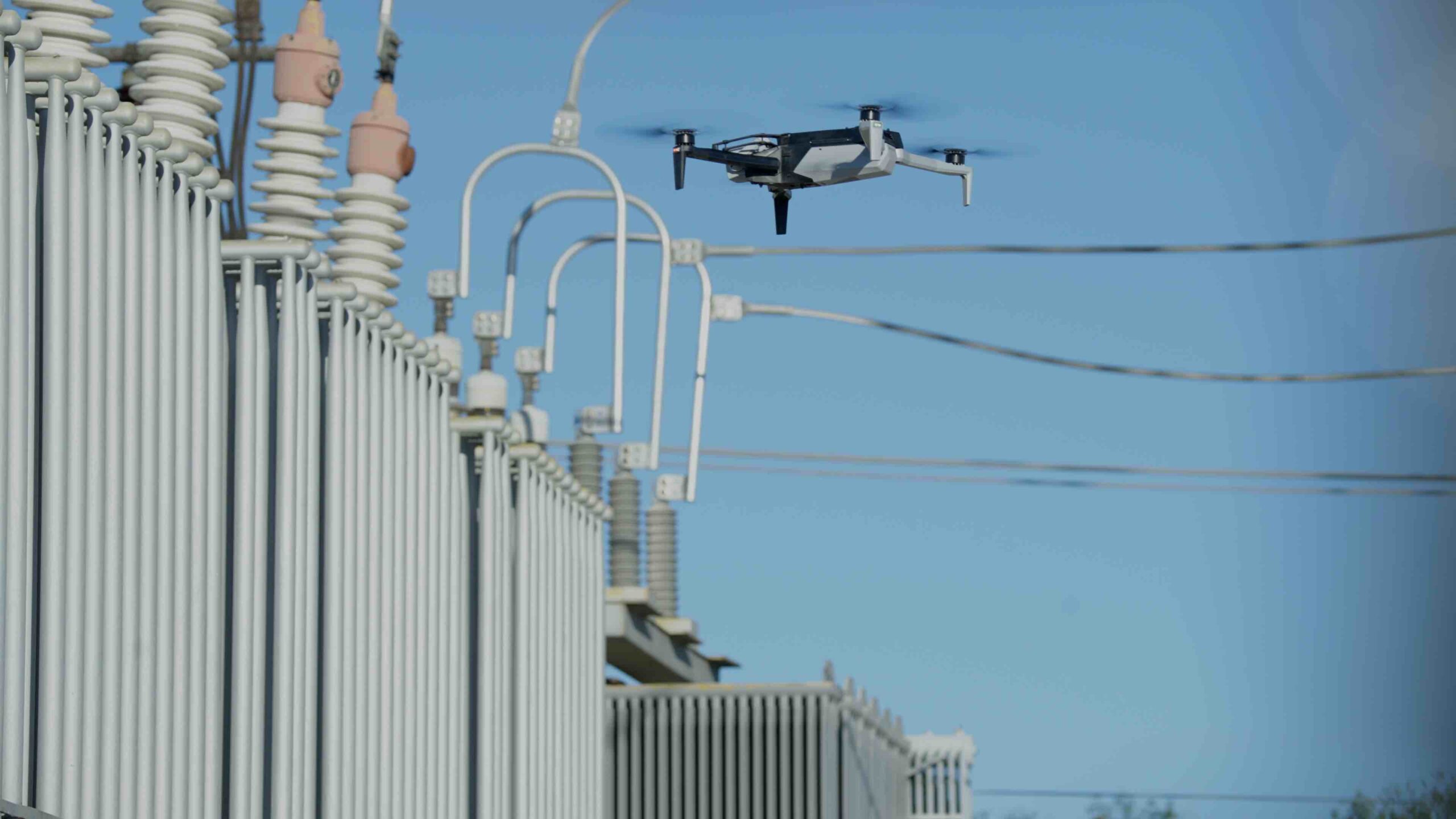
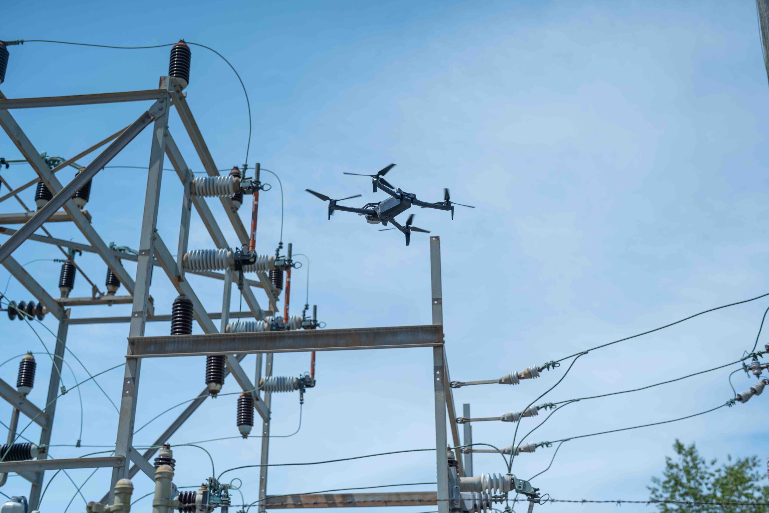
Heath McLemore, senior manager smart grid and innovation for Florida Power and Light (FP&L) said, “We are heavily leveraging drones today to do all of our overhead equipment inspections. We started leveraging drones back in 2018, and now, not only are a majority of those inspections done by drones, we’re starting to leverage what we consider highly automated drone systems to do that work for us as well.
FP&L uses various manufacturers. “It depends on what drone fits the job,” he said. Their major concern is service reliability, “How do we inspect our equipment, our overhead lines and poles and all of the attachments on those poles to ensure that reliability. I like to say we want to predict pieces of equipment that may soon fail before they become outages for our customers. So, we’re able to leverage drone technology to get better images. It’s a much safer solution, much more effective and faster at conducting these inspections so we can kind of stay ahead of any customer outages that occur and help reduce or eliminate customer outages that may come along.”
“Before,” McLemore said, “it was all driving or walking based assessments. For years and years, before we had drones, we had crews that would go out and walk and drive these lines and notate with pen and paper what conditions or issues they saw.” Operators are now able to get time back which was once spent tackling the manual effort of these tasks. McLemore commented on the visibility gains, as well. “A big thing we found early on is when you’re doing walking assessments from the ground, you’re only looking up and a lot of times you can’t get to the back side of the pole because of trees or property lines or fences. So, what drones will allow us to do is really get that 360° view from all sides and above the pole to get a more detailed and much better inspection.”
It’s not just the poles and pole defects that happen from weather conditions, he said. “We’re looking at all of the attachments. So, it could be the lighting arresters, it could be switches, it could be the transformers that are attached to the poles that we’re able to condition assessments on to see if there are any failures current or pending, failures we need to address before they cause an outage.”
With the drones, he said, “We’re taking two different types of pictures. “With the visual pictures we can see if there are any items of concern, and with the thermal imagery, we can see if there are any heat signatures that are higher than they should be on certain pieces of equipment that we need to address.”
“Every item or piece of equipment should have a typical operating temperature, just like a car. If we can pull heat signatures off of our equipment, we can see if this transformer, or this component is hotter than it should be, which would indicate there is something that needs to be addressed.
FP&L uses several types of drones, each with its own use case, including its capability to hold needed sensors, including different types of drones that hold the visual or thermal cameras. “It depends on the type of data we’re collecting,” McLemore said. “I like to think that a drone is just a flying camera, but it’s up to us to put the right camera, the right sensor on that drone to get the data we’re looking for.”
McLemore said that in addition to cameras, “We also leverage LiDAR sensors which allow us to create 3D point cloud visualizations to pinpoint where infrastructure is. In addition, it shows where there might be vegetation concerns, such as trees or bushes growing nearby so we can get really good and accurate measurements and data to see where we should be trimming trees near our power lines as well.”
One factor that is particularly in issue in Florida is vegetation. “In Florida our vegetation and growth is year round. It never stops,” he said. “So whatever tools that we can use to monitor and manage the vegetation growth around our power lines and poles is valuable in planning a lot of the vegetation trimming that goes on year-round. We have pine trees, palm trees and all kinds of vegetation. It’s not seasonal growth—it’s year-round for most of it.”
In addition to utilities like FP&L, many state Departments of Transportation (DOTs) and related agencies have also seen cost savings through drone inspection programs.
SURVEY DEPARTMENT IMPETUS FOR DRONE USE
Patrick Thompson, director of infrastructure management for the New York Thruway Authority, recounted how the authority’s history with drones began in 2021. The survey department was very interested in UAS for surveys, and the executive management team was interested in using drones for inspection, he said. “We applied for and were awarded a million and a half dollars from the U.S. Department of Transportation to develop a prototype inspection system for the Thruway Authority at the end of 2022. So, in 2023 and last year, we learned about drone systems and stood up a drone system in conformance with that grant. Recently, we were awarded a $14.8 million stage two grant to implement systems and processes we learned about in stage one.”
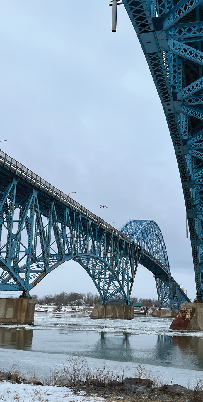
The New York Thruway is a 570-mile super-highway system with more than 2,800 lane miles of pavement and more than 800 bridges, Thompson said. “Even though we see so many incredible uses for drones right now, we’re really targeting inspection of our bridges and overhead sign systems. We’re using the drones to inspect the bridges, the overhead signs, toll gantries, lights and radio towers.”
On bridges, for example, they are using the drones as a supplemental tool for inspections, he said. They still need to have licensed, professional engineers perform inspections as well. “The drones are extremely helpful in two ways. First, if you have a bridge that’s very difficult to access, you can fly the drone first and perform a visual inspection to prepare yourself for that bridge inspection. So, when you go in there, you’ll understand what equipment you may need and timing. The drone systems also provide the photography that will be inserted into the drone inspection report and uploaded to the systems. The drones take the pictures and save the inspector’s time, which is critically important because the less time we have people on site, the greater the safety benefit, both for the inspectors and the traveling public.”
“Another of the key factors of our drone program is the back-office work because the drones allow you to download data into systems. We’re developing apps that will automatically populate those bridge inspection reports. And as much as that’s an efficiency thing, it’s also an accuracy benefit, and so we’re working on those apps and those techniques.”
“So, what we’re doing at this point is we’re replicating the inspection process as much as possible with drones. And there is some movement within the federal highway department that might allow greater use of drones, and so we want to be at the forefront of that opportunity once it occurs.”
“But even that said, the benefits we’re obtaining just from design information, from the bridge inspection information is so significant that we’re just realizing incredible benefits from the technology.”
Thompson noted there are still some inspections that are literally “hands-on” because the inspector has to, for example, hit an element with a hammer to hear the sound that results. That, he said, cannot be done by a drone, at least for now.
“But the actual video cataloging, the fact that we’re using drones to get a digital twin model of the bridge, we’re going to be using that information to inform the deterioration rate of the bridge and ultimately what we need to spend on it,” he said.
Thompson noted the drones are not allowed to fly over traffic, but they can access a good part of the structure outside of those limits. “If you think about going underneath a bridge, the travel lanes only take up a small portion of the overall structure. So, we can inspect a great deal of bridge without any impact to traffic. Actually, the components directly over the traffic are often the easier parts of the bridge, time wise, to inspect. It’s the ends of the structures that usually take more time anyway so we can do a great deal of work without any impact on traffic whatsoever.”
Thompson added they are connected with their Department of Homeland Security, which is providing their drone training. “We have a very robust system for training our pilots, for keeping them trained, for documenting all their flights and our equipment. I would say we’re very much on the vanguard of that,” he said.
The Thruway uses the X2 Skydio drone and they’re in the process of buying the X10, he said. “These are really great for us because of their ability to fly in GPS denied environments,” he said. “Underneath a bridge, you lose signal.”
As for any BVLOS issues. “We make sure we have a spotter in the line of sight,” he said. He explained that for bridge and other similar inspections, the inspector does not fly the aircraft. There is a pilot who flies and they have a large digital screen for the inspector to observe. “That’s purposeful,” Thompson said, “because we want our bridge inspector focused on what’s being seen, rather than trying to fly and see,” at the same time.
They team has successfully tested performing in bridge inspections and live streaming in various live feed formats. “We think that’s going to have significant utility,” Thompson said. “Say you have a bridge hit by a car or over height vehicle and we can get somebody out there right away to look at it, and we want to convey that information to a structural engineer who’s not on site. That can give us a heads up to what the damage to that particular structure might be. There is no substitute for video or pictures, and the drones are giving us that capability.”
Thompson said the sensors they’re using are mostly optics and zoom lenses. “We’re looking into some thermal imagery that will let us pick up moisture areas,” he said, “but we haven’t really investigated the instruments a great deal yet. It’s kind of on our to do list.”
“Right now, we’re focusing on keeping our focus very tight, on the actual visual inspection processes,” he said. They do use LiDAR and some thermography, so the LiDAR and pictures are their primary resource. They also have nighttime certified pilots for dark under-bridge work. The darkness has been one of their more difficult issues, he said, although with improved quality of cameras, it’s become a little more manageable.
All of which contributes to successful inspections as drones take on an ever bigger share of the work.