At INTERGEO 2025, Phase One rolled out a suite of new innovations explicitly aimed at aerial mapping and inspection applications.
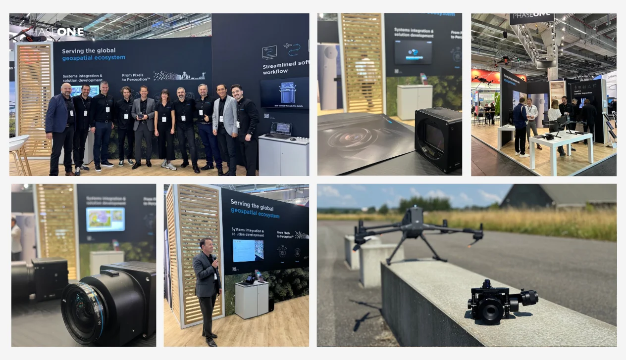
The upgrades, including a next-generation flagship camera, new drone integrations, and smarter processing software, underscore how imaging technology is becoming increasingly tuned for unmanned systems workflows.
Key Unmanned Advances
iXM-RS250 Aerial Camera
Phase One’s flagship iXM-RS250 brings ultra-high resolution with broad coverage while remaining compact and efficient—ideal for UAV operations. Its support for IIQ-X compression (reducing file sizes by up to 90% vs. TIFF) helps lighten data burdens in drone missions without sacrificing image quality.
Seamless Drone Integrations
- DJI M400 + P3: Phase One now supports direct camera control and real-time data flow from the P3 series through the DJI M400 platform. This plug-and-play pairing lets mapping and inspection teams swap in Phase One sensors without rebuilding control systems.
- P5 + Abris Platforms: The P5 camera can now be integrated into Abris drone systems, giving operators flexibility across mission scales—from infrastructure inspections to large-area surveys—with consistent imaging quality.
iX Process 3.0
Phase One’s next software iteration brings enhanced QC tools that validate data in near real time. Features like automatic checks on overlap, ground sampling distance (GSD), and acquisition metrics allow UAS operators to detect mission issues immediately, reducing the risk of re-flights. The improved filtering and inspection tools also help tighten the loop between capture and deliverable outputs.
Ecosystem & Partner Platform Extensions
At INTERGEO, Phase One and its partners showcased how their imaging modules integrate into larger drone and mapping systems:
- IGI’s CM-1 compact aerial system using a Phase One camera
- HELIUX XL, a new 4-band imaging payload for utilities, forestry, mining, and urban mapping
- Embedding IIQ processing within partners’ pipelines (Bentley, Trimble Applanix, Skyline, etc.), smoothing the flow from raw image to digital twin or GIS output
- Lower data burden: The IIQ-X compression means UAS operators can capture more with less storage, easier downlink, and faster post-processing.
- Modular flexibility: The ability to mix and match Phase One sensors with DJI, Abris, HELIUX, and other platforms minimizes redevelopment and accelerates adoption.
- Quality assurance at the edge: With onboard QC in iX Process 3.0, drones can flag mission issues mid-flight, enabling decision-making and re-tasking in mission windows.
- Broader system compatibility: Integration into existing geospatial and mapping toolchains ensures that drone-acquired data drops cleanly into enterprise pipelines — a critical step for commercial and defense-grade UAS programs.
Phase One’s INTERGEO portfolio aligns imaging technology with the operational realities of unmanned mapping systems.