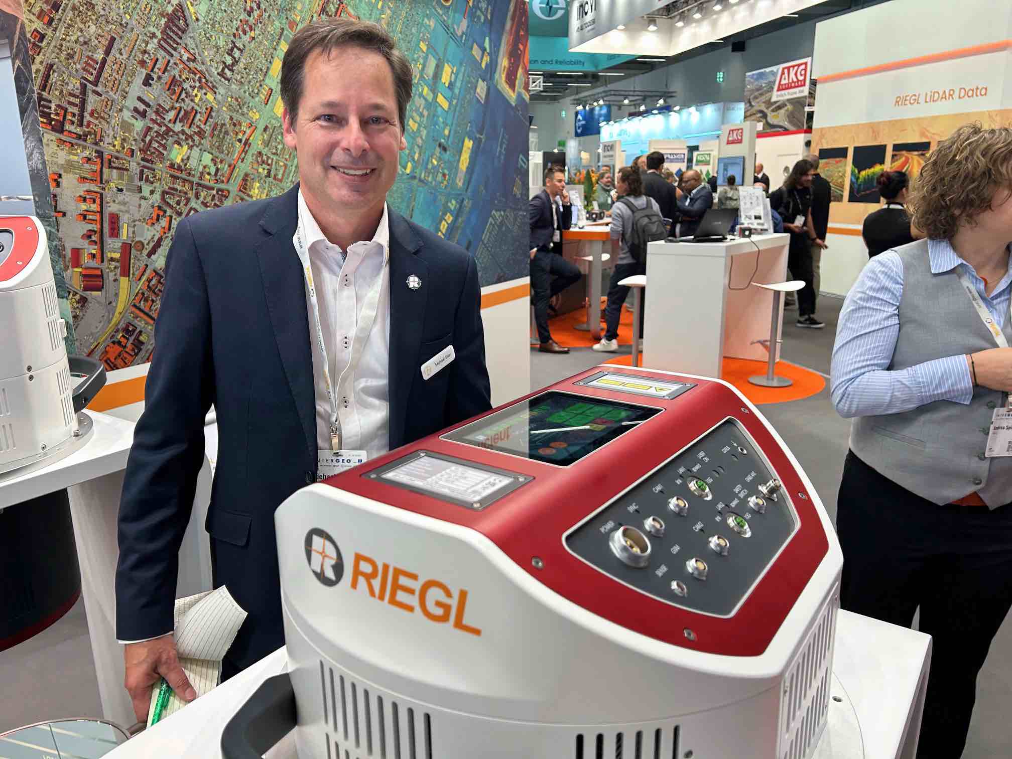
RIEGL’s newly released VQ-1060 marks a significant evolution in airborne LiDAR for corridor mapping. Unveiled at InterGEO 2025 in Frankfurt, the system is purpose-built for applications such as power line, pipeline, and highway mapping, where dense, accurate data must be collected efficiently at altitude.
Utilities and large infrastructure operators, including power and energy companies, face a mounting challenge: obtaining helicopter-level data quality while moving to lower-cost fixed-wing operations. “Tier 1 utilities are moving away from helicopters because of the cost of running those platforms,” said Michael Sitar, Managing Director of RIEGL Canada. “But they demand the same deliverables.”
That demand – high-density data, orthometric imagery, and oblique angles – drives the innovation behind the VQ-1060. The new system uses a unique scanning pattern that captures targets from multiple angles, taking in complete asset geometry, with minimal occlusion.
“It fires ahead of, below, and behind as you pass,” said Sitar, “so you get very good detail up the asset, down into building canyons, and then back the other side, which is unique on the market.”
The VQ-1060 delivers measurement rates up to 2 million points per second with a 60-degree field of view. Its flexible scan geometry enables efficient corridor coverage while maintaining consistent point density. The system also supports gyro-stabilized mounts, ensuring, Sitar said, “it’s always pointing at the ground. That way your data’s not moving around.”
Right for systems and needs
Integration and reliability are central to all RIEGL designs. Previous systems with similar capabilities required separate data recorders for LiDAR and cameras, introducing extra cables and failure points. “We got rid of both of those,” Sitar said. “Now it’s all on board. Everything’s integrated. So this unit has fewer components, fewer cables, and higher reliability.” This all-in-one architecture simplifies installation in aircraft sensor bays and reduces operational downtime.
The VQ-1060 also integrates oblique and nadir cameras to meet modern utility deliverables. While similar in appearance to Riegl’s high-altitude flagship sensors, such as the VQ-1560 series, the VQ-1060 is optimized for mid-altitude, wide-area corridor missions, striking a balance between range and detail.
Designed through direct collaboration with U.S. Tier 1 utilities, the VQ-1060 responds precisely to industry feedback on image resolution, point density, and operational cost. Sitar said, “We wanted to leverage the multidirectional scanner against our competition to come up with a truly dedicated system for that specific application.”
With its integrated design and purpose-built scan geometry, the RIEGL VQ-1060 reflects a practical evolution in airborne LiDAR, focused less on flash and more on meeting real operational demands in the utility and infrastructure sectors.