
To the casual observer, Agritechnica 2023 probably looks a lot like the last edition of the Hanover, Germany agricultural equipment…
Trimble
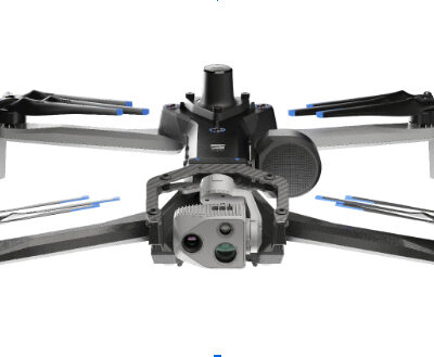
Trimble, Skydio Integrate GNSS Technologies for Construction, Utilities, Transportation Agencies
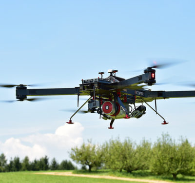
Skydio announced a strategic collaboration with Trimble creating an integrated workflow of accurate data capture, data visualization and data analytics addressing the needs of critical infrastructure industries in their surveying, mapping and inspections.
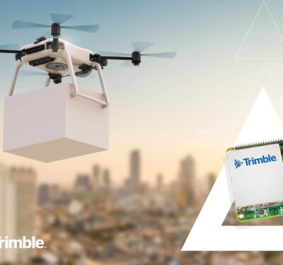
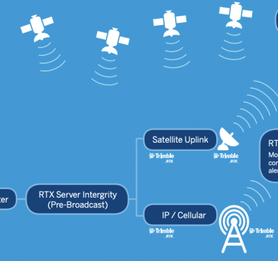
Trimble Launches RTX for Drone Package Delivery
Provides Integrators with Hardware and Software as a Service for Unparalleled Accuracy and Performance Trimble announced today the Trimble PX-1…
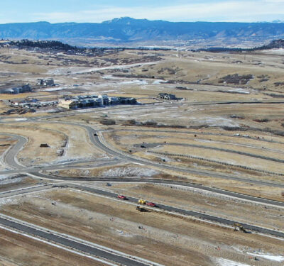
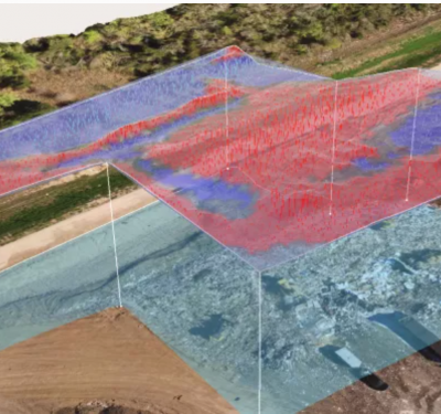
Indispensable Data Points
Drones and data processing software are becoming indispensable tools for the construction industry, saving time and giving company officials unprecedented insight into progress on work sites.
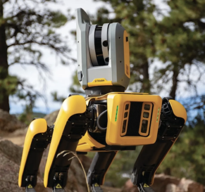
See Spot Scan
Builders See Bright Future for Boston Dynamics’ Quadruped Robot Two major construction companies have added Spot the robot dog to…
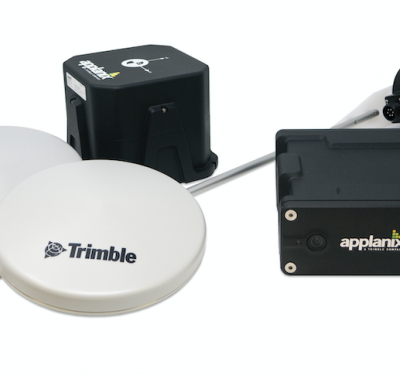
Applanix Tells You Where Things Are
Richmond Hill, Ontario-based Applanix, a subsidiary of Sunnyvale, California-based Trimble, talked about its Direct Georeferencing Unit at the recently concluded Commercial UAV Expo last week.
Trimble sets Ambitious Goals to Reduce Greenhouse Gas Emissions
Science-Based Targets Across Trimble Operations and Value Chain Accelerate Company’s Efforts to Combat Climate Change Trimble announced today its commitment…
Trimble Announces New Deployment of Applanix’s POS LV to Enable Broader Autonomy Capabilities for IHI Corporation
Customizable System Provides Robust Positioning Without Added Site Infrastructure Trimble announced today the first deployment of its map-based localization system…
Propeller Aero, Quantum-Systems Partner
Propeller Aero’s site surveying and 3D mapping software is now compatible with the Trinity F90+ drone from Quantum-Systems, streamlining data…
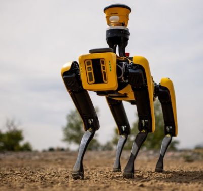
Trimble, Boston Dynamics Ally for Autonomous Robots in Construction
Trimble and Boston Dynamics announced a strategic alliance to integrate a variety of construction data collection technologies with Boston Dynamics’…
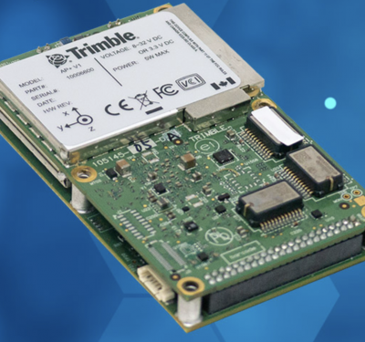
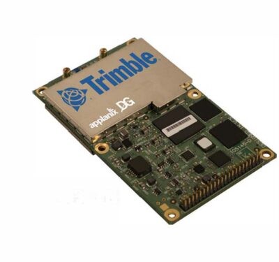
New OEM Hardware/Software for Direct Georeferencing of Airborne Sensor Data
Applanix and Trimble showcase the Trimble AP+ Air OEM solution for Direct Georeferencing of airborne sensor data at the recent…
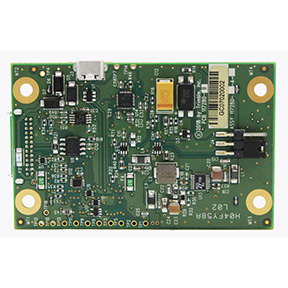
Trimble Launches UAS1 High-Precision GNSS Board
Trimble has introduced a compact, high-precision GNSS board designed for unmanned aerial systems (UAS): the Trimble UAS1.
Trimble, Qualcomm Partner on High-Accuracy Positioning for Connected Vehicles
Trimble and Qualcomm Technologies plan to provide sub lane-level accuracy to automotive OEMs, Tier 1 suppliers and other stakeholders considering…
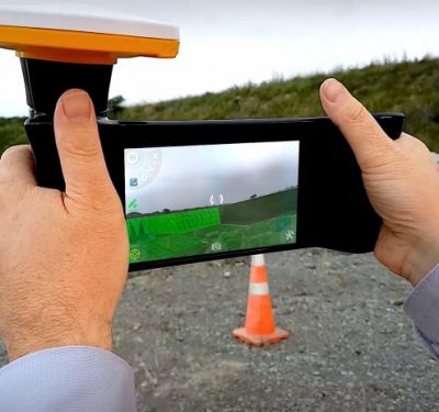
Augmented Reality System from Trimble Brings Data into View
Trimble’s new SiteVision system uses augmented reality (AR) to visualize 2D and 3D data on outdoor project sites with cellular…
Webinar: LiDAR and BVLOS UAVs: Enabling the Ultimate Solution for Highly Efficient Mapping
Registration is still open for this Free Webinar on Tuesday, April 16, 2019 from 1:00 PM – 2:30 PM ET….
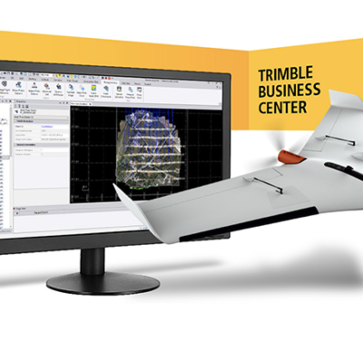
Delair Announces Interoperability of High-Precision PPK Drone Data from Delair UX11 UAS with Trimble Business Center v5.0
Commercial drone solutions supplier Delair this week announced interoperability of high-precision data acquired from the Delair UX11 drone with version…

Barcelona the Site for Applanix Airborne User Group Event
Applanix, a Trimble company, invites you to its 2018 Airborne User Group Meeting in Barcelona, Spain, Nov. 27-29, 2018. Come…
