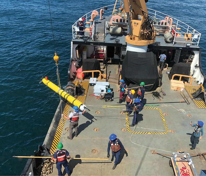
An AUV is launched to test the vehicle’s oil spill detection capabilities for rapid response during a real-world maritime incident. Photo by Amy Kukulya, courtesy of WHOI.
More than 80 percent of the ocean is unexplored, according to the National Oceanic and Atmospheric Administration (NOAA). In fact, leading marine scientists often claim we know more about the surface of the moon than the deep waters of Earth.
That’s a staggering reality. The ocean supports the greatest amount of life on our planet, offering a key source of protein for a third of our population and providing passageways to ship most of our international goods.
Much like space, the deep ocean can be a dangerous, expensive and challenging place to work. Yet, scientists and researchers believe understanding it is crucial—impacting everything from human and marine health to safe transportation and even national security.
Advancements in artificial intelligence (AI), autonomous underwater vehicles (AUVs), surface gliders and aerial drones are offering a more reliable and cost-effective way forward than the crewed ships that have been relied on for marine and fresh water research in the past.
Programmed to operate for long periods of time, they’re equipped with sensors, cameras and acoustics that collect a range of environmental indicators: salinity, biogenetics, Arctic changes, coral reef degradation, fisheries health and more.
To better understand how the ocean influence climate and to learn how to tap its ecological and economic potential, scientists are collaborating in unprecedented ways. That teamwork is allowing swarms of drones to dive deeper, help explore uncharted waters and unlock some of the greatest scientific mysteries of our world.
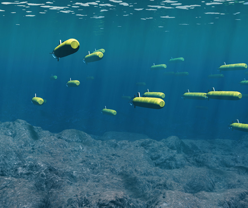
WHOI scientists envision using hundreds of smaller, low-cost robots that work in sync to give a more complete picture of the ocean. Illustration by Tim Silva, courtesy of WHOI.
Autonomous Expeditions
Drawing on 90 years of leadership in ocean discovery and exploration, Woods Hole Oceanographic Institution (WHOI) scientists are engaged in an array of research projects using autonomous systems to advance their understanding of marine environments.
Jim Bellingham, founding director of WHOI’s Consortium for Marine Robotics, is one of them, and he’s spent his career researching and developing marine robots.
“Many think of the ocean as just water and salt,” he said. “Our ocean is alive with seemingly otherworldly microorganisms, and you don’t have to go to another galaxy to explore them. The whole chemical makeup of the ocean—and, indeed, the planet—is determined by them. And without them, we’d be an entirely different place. Yet, we don’t understand them at all.”
To change that, Bellingham believes it’s important to start with something foundational: obtaining high resolution imagery of the sea floor. “It’s like Louis and Clark—the first thing you do is start to map, and then everything else follows,” he said.
It’s no surprise, then, when asked about exciting research projects, he points to WHOI’s sea floor mapping proposal, proposed by WHOI Systems Architect Mike Jakuba. While it’s not yet funded, the project proposes the use of three autonomous platforms that work together as a team to pioneer this exploratory work.
The platforms include WHOI’s Hydroid REMUS 600 equipped with a multibeam sonar, a long-range AUV (LRAUV) developed by Bellingham and former colleague Brett Hobson during his time at the California-based research center Monterey Bay Aquarium Research Institute (MBARI), and a Liquid Robotics autonomous surface vessel called the Wave Glider that can communicate acoustically with the underwater vehicles to keep them navigationally on track.
This is just one of many projects WHOI scientists believe can be conducted using teams of autonomous platforms. “We envision a future in which a swarm of underwater robots are in communication with one surface vessel, all working in tandem,” Bellingham said. “To me, the real story of AUVs in the future is less about one vehicle out there working on its own and more about how a system of vehicles come together to accomplish sophisticated tasks.”
Bellingham also points to the importance of focusing this exploration on the rapidly changing Arctic, and calls the challenges scientists are observing there the “canary in the coal mine.”
“That’s where we’re seeing changes in the climate first,” he said. “Those changes are happening faster than most models even predict, and for reasons not well understood. There’s a whole set of phenomenally interesting science problems to work on in the Arctic, and AUVs are the key technology that lets us do that successfully.”
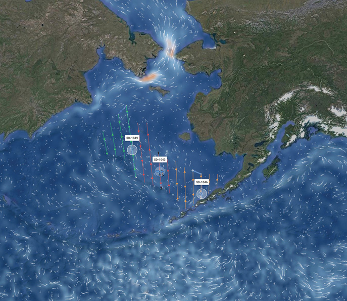
An acoustic survey map showing three Saildrones working in the Bering Sea during a 2020 Alaska pollock survey. Photo courtesy of Saildrone.
Midwater’s Microbial Mysteries
While many ocean scientists are drawn to the deep ocean, MBARI mechanical engineer Hobson gets excited about exploring midwater—the area where he jokes many simply pass through on their way to the sea floor.
Hobson has spent a lot of time there developing tools and techniques to follow and collect tiny, gelatinous animals that have to be viewed in situ because they’re too fragile to be scooped up. These larvaceans, he said, filter and excrete the carbon in the water through a natural process, and the sequestered carbon sinks to the sea floor, fertilizing marine plants.
“They’re really important animals that everyone else just kind of flew by,” he said. “There’s this recurring theme that anywhere in the ocean, if you look at it in higher resolution, you’ll make discoveries. I realized we needed to observe these overlooked hot spots.”
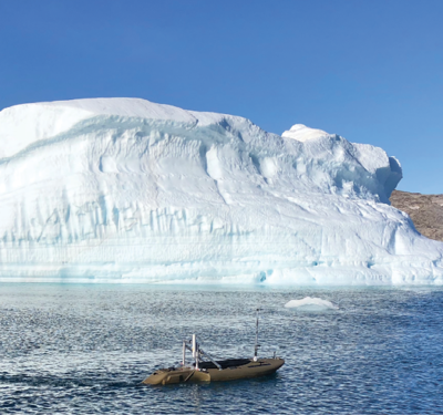
The only way to observe those constantly changing environments, Hobson said, is to track and sample them over time with AUVs. In 2018, MBARI scientists and the University of Hawaii deployed a trio of autonomous vehicles to investigate microbial communities in an ocean eddy. These communities form the base of the marine food web, help shape open-ocean ecosystems and influence global climate.
“One of the biggest variables of climate change is carbon cycles, and how much carbon is reaching the sea floor and being sequestered,” he said. “The ocean is absorbing huge amounts of our excess carbon. What’s the fate of it? We needed a fleet of robots able to exchange key information about where they are but also what they’re seeing.”
The research was carried out by Schmidt Ocean Institute’s research vessel Falkor, two LRAUVs and a Wave Glider. Both LRAUVs carried sensors to measure water temperature, salinity, chlorophyll and other properties of seawater. One was also equipped with a miniature robotic laboratory—MBARI’s third-generation Environmental Sample Processor (3G-ESP), creating a mobile sample eDNA collection and analysis system.
While the 3G-ESP LRAUV carried out its sampling, the second LRAUV swam around it to characterize the surrounding water properties using acoustic ranging. As the two LRAUVs performed their underwater mission, the Wave Glider at the sea surface acoustically tracked the 3G-ESP LRAUV to alert the team of its whereabouts below.
“Oceans are the largest buffering system on our planet,” said Jim Birch, who manages the ESP project at MBARI. “It’s the sink that absorbs everything and keeps the earth livable. So, it behooves us to understand how the ocean works and what its limits are so we don’t destroy it. Autonomy is critical to helping us achieve that.”
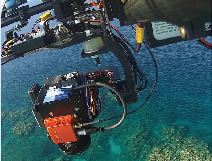
Advances in UAS sensed imagery, sensor quality and geospatial image processing enable UASs to rapidly monitor coral reefs. Photo courtesy of Felipe Gonzalez, Queensland Institute of Technology.
Saildrones’ Search for Data
When it comes to keeping the earth livable, the COO of Alameda, California-based company Saildrone, Sebastien de Halleux, cuts to the chase: “Our planet is changing, and that rate of change is accelerating. Whether it’s the study of ice edge, hurricanes or fisheries, all reports sound off the same alarm bell: we need more data to understand what’s happening.”
The challenge, he said, is the ocean’s vastness. At nearly 140 million square miles, how do scientists obtain the data they need? That, he said, is why Saildrone was born.
“At the heart of it, it’s an energy problem; the energy it takes to bring a sensor to collect data in an ocean far away,” he said, referring to cost-prohibitive ships that are slow, expensive and limiting.
Enter Saildrone’s 23-foot wind and solar-powered unmanned surface vessels (USV), which consume less electrical power than a refrigerator lightbulb. Equipped with a 15-foot wing that acts as a sail, it’s capable of up to 12-month data collection missions on the open ocean.
The vessel uses GPS and an onboard computer to navigate waypoints autonomously, and is monitored by a human in the loop. The system’s AI is informed by 360-degree cameras that take photos around the Saildrones, alerting mission control in the event it detects a hazard.
Each Saildrone carries a suite of science-grade sensors that measure atmospheric and oceanographic variables down to 1,000 meters. It’s what de Halleux calls a powerhouse of data collection.
“Machine learning is not new, of course, but this challenge is completely new at sea because the pixel moves with every frame,” he said. “It’s been a multi-year effort to train the AI.”
Those efforts have paid off. Recent warming events in the Bering Sea are accelerating ecosystem changes throughout the Arctic region and that’s putting pressure on marine resources. With many large-scale ship-based surveys canceled because of COVID-19, scientists at the Alaska Fisheries Science Center (AFSC) and NOAA turned to Saildrone to help perform an Alaska pollock survey. “If you miss a year in counting fish, it has a dramatic impact on fish stock management,” de Halleux said.
Three Saildrones were deployed in mid-May from San Francisco for the 2,000 nautical mile transit to the Bering Sea. They successfully completed an acoustic survey at a time when it otherwise would not have been possible.
“It was an amazing feat of engineering in terms of autonomy,” de Halleux said. “All the while, we were sending data to NOAA to calculate biomass in the Bering Sea and calculate next year’s catch image. It’s a cool story from so many aspects, and we’re very proud of the work.
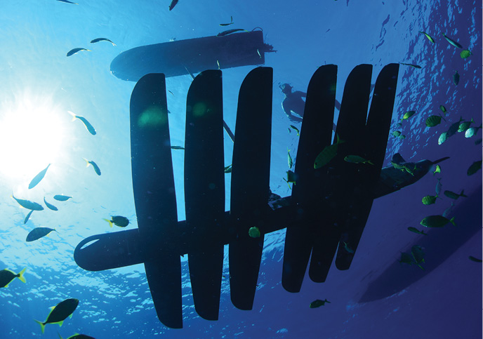
Wave Gliders are long-duration autonomous surface vehicles that provide an essential communication link between sea, air and space platforms. Photo courtesy of Liquid Robotics.
High-Flying Hyperspectral Imaging and AI
Drones assisting with ocean research aren’t always underwater—they come from the sky as well. For example, in Brisbane, Australia, a team of researchers at Queensland University of Technology (QUT) is using drones, AI and specialized hyperspectral imaging cameras to develop new environmental monitoring methods and speed responses to coral bleaching on the Great Barrier Reef.
“The world is seeing rapid advancements in cloud and AI solutions that are unlocking new possibilities to solve the world’s most challenging problems,” QUT Associate Professor Felipe Gonzalez said. “But the uptake of those solutions to understand and protect the planet is proceeding slowly, and as such, we are essentially flying blind when it comes to understanding how our planet is changing and how to best solve environmental challenges. AI can change that.”
The team recently received funding from Microsoft as part of its $50 million AI for Earth Program, a grant that will allow the team to quickly process reef data using cloud computing, saving weeks or perhaps months in data-crunching time. “On a regular desktop PC, processing the data will take months,” he said. “You really need to scale up.”
Since the first flight project 18 months ago, in which the drones analyzed the health of four coral reefs in the Great Barrier Reef Marine Park, the team has processed 30 percent of the data the drones collected.
According to Gonzalez, autonomous technology has been an essential tool in reef monitoring, helping researchers cover larger areas than in-water surveys, and in ways not hampered by cloud cover, which can impact plane or satellite surveys. “You could never get this level of resolution with a satellite or an aircraft,” he said.
NOAA received funding to fly a hyperspectral camera over municipality water intakes in Lake Erie to monitor for harmful algal blooms. Photo courtesy of Zachary Haslick, Aerial Associates Photography Inc.
Great Expectations in the Great Lakes
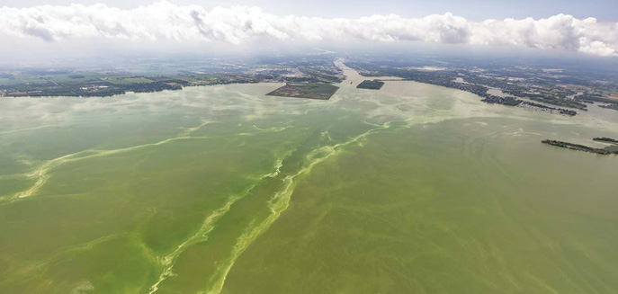
Autonomous exploration underwater isn’t limited to oceans, of course. Andrea Vander Woude, a research scientist at NOAA Great Lakes Environmental Research Lab (Ann Arbor, Michigan), is turning to aerial drones to help monitor harmful algal blooms (HABs) in the Great Lakes.
In 2014, HABs were found in a Toledo, Ohio, drinking water intake system, shutting down water in the area for days. As a result, NOAA received funding to fly a hyperspectral camera over municipality intakes in Lake Erie to collect the data local drinking water managers needed to ensure safe drinking water.
In the Spring of 2021, Vander Woude and her team will be complementing their crewed Cessna flights with a DJI Matrice 600 hexacopter outfitted with a Resanon Pika II to assist with rapid monitoring. The drone will augment the limited 50 crewed flight hours they’re allotted a year to monitor HABs, and will cost much less than the $500 an hour required to fly a Cessna.
“This technology really fills in the gaps because we can easily take the M600 into the field and rapidly fly areas where we see an issue,” she said. “It’s like being able to fly your own little satellite from land. To be able to deploy it quickly and process the data quickly is fantastic.”
With time, Vander Woude said the goal is to have a fleet of uncrewed systems.
“My dream is to create a three-dimensional picture of what’s happening in the water column as the HABs move throughout the columns throughout the day, so having a drone and an autonomous glider will help us achieve greater insights,” she said. “We get info on what’s on the surface usually, but we really need to know what’s happening underneath.”
Monitoring HABs is not the only application for these drone flights. Vander Woude noted they can be used to assist with the detection and rapid response of future oil spills, dangerous ice areas for freighters and even drowning deaths.
“That’s what I love about this research, is that piece of service,” she said. “We’re constantly looking at how we can use our research and this technology to provide a greater service to our community and to our world.”