Drones Provide Critical Insights on the Impact of Climate Change
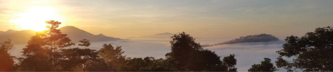
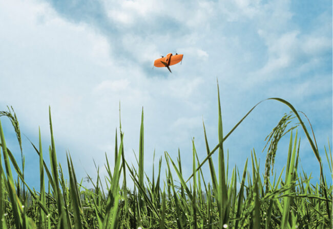
Scientists are increasingly leveraging drones for climate-related research, with the systems making it easier to monitor environmental changes over time in coastal areas, tropical rain forests, glaciers, wetlands and other remote locations that are difficult to study.
Environmental scientists are known to travel to remote, dangerous locations in the name of climate research, gathering as much data as possible on the ground, by boat or from the air. They’re using various instruments to monitor coral reefs, tropical rain forests, coasts and glaciers, all in an effort to learn more about how rising temperatures might be impacting the Earth.
This is important yet difficult work, with researchers always looking for ways to cut costs and improve efficiencies. As drones become both more affordable and user friendly, they’re filling that need. UAS are now a common observation tool deployed on science missions, obtaining critical data from areas once deemed unreachable.
“Drones are being used in a huge number of research fields to help with monitoring because they make it more accessible,” said Catherine Waite, who has flown drones to map bird habitats and study lianas in tropical rain forests through research with the University of Nottingham in the United Kingdom. “It’s easily repeatable and more cost effective than sending people on the ground for surveying, and it provides a long-term data repository that makes it possible to look at changes over time.”
Drones carrying multispectral cameras can identify tree species from the air for species mapping, for example, or researchers can track animals with thermal sensors, Waite said. Drones also can be deployed to study coastlines, rivers, streams and glaciers and track changes year over year, helping scientists determine how changing temperatures are altering those environments.
Drones are also being flown to measure C02 and methane emissions, said Erik de Badts, AgEagle Aerial Systems’ sensor channel sales manager for Europe and Latin America. They’re flying over waste dump sites in big cities, for example, to measure the amount of methane released. These systems are also monitoring for and tracking the forest fires that rising temperatures are making more common.
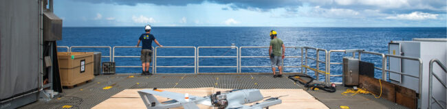
UAS are providing researchers with measurements they didn’t have access to before, which is why Christopher Zappa, a seagoing observational physical oceanographer, has been using the technology since 2010. He studies the boundary layers on both sides of the dynamic air-sea interface.
“Drones are essentially where underwater vehicles were 20 to 30 years ago,” said Zappa, who is a Lamont Research Professor and the associate director of ocean and climate physics at Columbia University. “It’s an incredible platform, and we are just starting to build the sensor payloads required for scientific research. There is a proliferation of uses, whether it be monitoring coastal erosion, studying sea ice dynamics in the Arctic, methane and CO2 outgassing in the Arctic ecosystems, understanding volcanology, or studying the impact of receding glaciers in Greenland and Antarctica on sea level rise.”
PROTECTING CORAL REEFS
Coral reefs represent one of the “two alarm points” for climate change (glaciers being the second), de Badts said, making monitoring, and ultimately protecting, them critical. Coral is the main substrate that maintains these sensitive ecosystems, but when the water temperature rises, they begin to die off—and so do the species that rely on them. AgEagle sensors measure both coral bleaching, an indication they’re dying, and diversity to deliver multispectral maps.
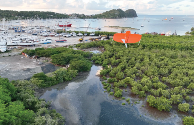
Steve Schill, lead scientist for the Caribbean Division of The Nature Conservancy, designed and built his first multi-rotor in 2014 to monitor mangroves, coral reefs and seagrass, important coastal habitats. He now uses a Wingtra One fixed-wing drone to quickly map even larger areas at the centimeter level, an excellent complement for validating broader scale satellite imagery. The team has monitored several areas around the Caribbean for the past six years and have been able to quantify restoration success.
“Drones are now an essential tool for monitoring very small changes.” Schill said. “We’re using drones not only above water but below as well. We’re creating 3D models of coral reefs and measuring growth and erosion, prevalence of disease and monitoring threats.”
Drones fill an important monitoring niche, answering research questions at the local scale. Surveying within centimeter level accuracy is key, Schill said, and from that they can use multi-temporal datasets to detect change in coral growth over time. In clear, shallow water, they use drones to count thousands of coral colonies via machine learning.
To determine habitats in deeper areas, Schill uses tethered drop video cameras that can reach 100 feet in depth. These video transects provide valuable information for mapping algorithms that are used to detect habitats across broader scales using satellite imagery that can map to 100-foot depths in clear waters.
For mangrove projects, the team uses centimeter level photogrammetrically-derived point clouds and orthomosiacs to measure ground biomass for carbon estimations, he said, and works with scientists who take soil samples to analyze the carbon. By combining the data, they can create 3D models of the mangrove canopy and calculate more accurate measurements of carbon storage and sequestration estimates.
When mapping seagrass, species and density measurements are collected in the field, then coupled with drone data and extrapolated to larger areas using satellite imagery. Different seagrass types have different spectral characteristics and ecological roles, so they’re also creating a machine learning library to help quickly recognize various species and density patterns.
“Each project has a specific research question, whether we’re looking at climate change adaptation, climate change mitigation or coral restoration,” Schill said. “We have to match the appropriate technology to the scale of the project area.”
STANDARDIZING THE DATA
STANDARDIZING HOW DRONE DATA IS COLLECTED, STORED AND USED is a challenge that still needs to be overcome, as scientists use different drones, sensors and processing techniques, Catherine Waite said. THAT MAKES DATA DIFFICULT TO COMPARE. The goal is to eventually integrate standardized workflows and move from small scale studies to large scale studies.
“If we can work together rather than conducting separate studies,” Waite said, “We can come together and look at global changes through time and understand better what’s happening in our world.”
STUDYING THE OCEAN-AIR INTERFACE
In climate sciences, UAS are often used to measure the phenomena at the interface between the ocean and the atmosphere, said Michel Gavart, CTO of BOREAL SAS. Little is known about this area because it’s difficult to study via traditional methods. But, because it’s the seat of energy exchanges between the ocean and the atmosphere, it plays an important role in climatic processes. Unlike manned aircraft, drones can safely sample close to the ocean surface, giving scientists access to critical data.
Drones also can sample certain areas with higher temporal and spatial resolution than manned aircraft, Gavart said, where it is important to measure small-scale phenomena.
The ocean-atmosphere interaction is Zappa’s area of focus. He studies how the wind generates waves, how waves grow and eventually break, how they transport heat exchange between the ocean and the atmosphere. He also traces gases like CO2 and sea spray from breaking waves.
Before drones, he typically collected data from ships and towers, but these massive structures contaminate the measurements. Drones allow him to get more pristine data. He also can take measurements not possible before, such as how much radiation goes in and out of the ocean at any given time.
His team collects visible images via drones, Zappa said, and uses infrared cameras to measure the ocean temperature. With a hyperspectral, near-infrared camera, they can identify objects like algae blooms in the open ocean and continually monitor their evolution.
“These algae blooms would be difficult to find without a UAV,” Zappa said. “We’re studying how cyanobacteria algae blooms impact the upper ocean heat budget. Blooms that are closer to the surface absorb more heat, and that changes the heat budget. So rather than going deeper in the ocean they’re absorbed near the surface, and that may have implications for climate models.”
Zappa flies a fixed-wing L3 Latitude from L3Harris. The drone has a range of 50 nautical miles, 12 hours of flight time and a 15 pound payload capacity. It also can transmit data back wherever he is in real time, allowing for mission control and tasking.
Once the drone spots something, the team can take the monitoring equipment out of the water, head to where it is and put everything back, Zappa said, a more efficient and cost effective way of conducting research.
Eventually, drones will be integrated with other unmanned systems and will carry additional sensors for an even more sophisticated approach.
“If we can put the right sensor on the aircraft, we’ll measure it, but the biggest thing is size, weight and power,” Zappa said. “The next big leap will be when CO2 systems or any kind of large atmospheric chemistry measurement systems will be small enough to put on drones.”
STUDYING WEATHER
DRONES ARE INCREASINGLY BEING FLOWN TO MONITOR WEATHER, helping to better predict and track severe storms like cyclones and hurricanes (See Unmanned Systems In the Air and on the Water Help Study Rapid Hurricane Intensification on page 52 for more on hurricanes). For example, Meteo France and BOREAL SAS conducted a scientific measurement campaign from Reunion Island along with the University of La Réunion, BOREAL SAS CTO Michel Gavart said. The goal was to sample the atmosphere over the Indian Ocean in areas of cyclone formation to understand the mechanisms and to improve their forecast.
THE UAS CARRIED SCIENTIFIC SENSORS TO MEASURE ENERGY FLOWS AND PARTICLE CONCENTRATIONS. THE SATCOM/IRIDIUM SYSTEM SUPPLIED BY ATMOSPHERE MADE IT POSSIBLE FOR THE DRONES TO TRAVEL MORE THAN 200 KILOMETERS FROM THE GROUND STATION FOR MORE THAN SIX HOURS AT A TIME. Researchers followed the drone in real time and modified the flight plan as necessary.
BOREAL drones were also involved in the meteorological EUREC4A Campaign in the tropics, Gavart said. They flew almost eight hours a day, helping researchers understand the effects of climate change on the tropical zone at the level of trade wind clouds. This is critical, as even the slightest changes show the imbalances in heat exchanges that control climate.
MORE THAN 10 INTERNATIONAL LABORATORIES AND HUNDREDS OF SCIENTISTS WERE INVOLVED, with oceanographic vessels, instrumented floats, land-based observation means, meteorological research aircraft and drones all operating from the cost of Barbados.
The BOREAL fixed-wing UAV flew long range in coordination with other meteorological aircraft to collect radiometry, aerosols, temperature, humidity and turbulence measurements in the lower layers of the atmosphere.
TROPICAL RAIN FORESTS AND WETLANDS
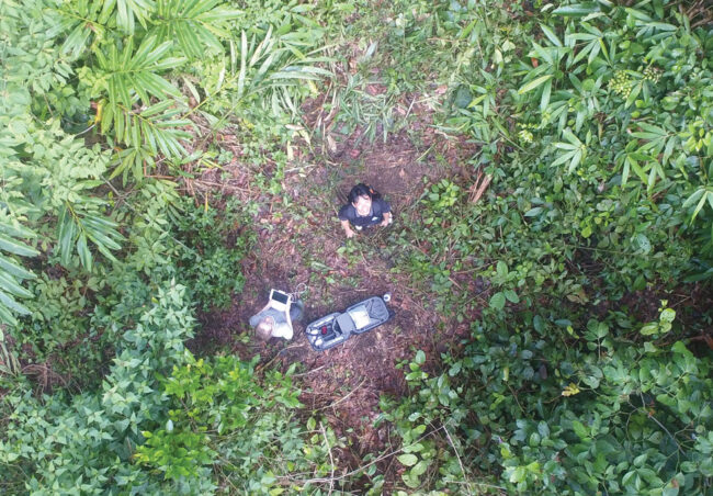
While it comes with its challenges, drones are increasingly being deployed in tropical rain forests. Waite recently used the technology as part of her study on lianas, a woody climbing plant found in tropical rain forests, and the impacts they can have on trees. She led the study while at the University of Nottingham; she’s now at the University of the Sunshine Coast in Australia.
Lianas twine around tree trunks, using them for structural support so they can reach the canopy. Lianas have been increasing in recent years, competing with trees for water and sunlight, which can result in reduced tree growth and even cause trees to die—lowering carbon uptake and storage in tropical forests, posing a threat to the global carbon cycle.
Lianas are difficult to measure from the ground, which is what gave Waite the idea to fly drones. With aerial imagery, Waite can see liana leaves, where they’re spreading and how they’re affecting trees. The first piece of research was a proof of concept to show it’s possible to fly through canopy gaps to collect imagery of lianas. In the most recent study, the team combined drone and ground data to look at where lianas are spreading in the tree canopy, what factors influence where they spread and what makes them more likely to infest a tree. This information can help researchers predict where the lianas will end up and how they’ll impact the carbon cycle.
“When trees die, carbon stored in those trees is released back into the atmosphere,” Waite said. “And because we depend on rain forests for carbon storage to mitigate carbon emissions, if they lose enough carbon and become a source of carbon to the atmosphere, that is bad for the global carbon cycle and climate change. Lianas can affect trees and reduce the amount of carbon being stored in the forest, and that can have quite a big impact.”
One of the main effects of climate change is the collapse of biodiversity, de Badts said, which is why there’s a focus on studying the untouched wetlands where most biodiversity is concentrated. These remote areas are covered in vegetation and mostly inaccessible, so drones like the AgEagle eBee X are being deployed with multispectral cameras to map plant species and monitor their evolution—a challenging application that requires long range radio contact.
“They want to understand vegetation, do health monitoring of the plants and be able to understand the topography and how it’s changing,” Wingtra Product Manager Julian Mackern said, noting it’s also important to monitor invasive species and their impact. “And they want to have an accurate map, and to be able to map these areas even when the tide goes out and they’re under water.”
IMPACTS AND DISRUPTIONS
Researchers are flying drones to identify how ecosystems respond to various forest disturbances, like the drier environment caused by climate change, and their outcomes, said Nayani Ilangakoon, a remote sensing scientist with the Cooperative Institute for Research in Environmental Sciences (CIRES) Earth Lab, a partnership between the University of Colorado Boulder and the National Oceanic and Atmospheric Administration (NOAA).
The disturbance could be anything, maybe a forest fire or a drought. The drone collects imagery with a multispectral camera and creates indexes to identify if the vegetation that comes in after the disturbance is the same or something new. The orthomosiacs generated identify what’s in the landscape and 3D point clouds show where an object, like a tree, is in space and its height.
Every ecosystem is unique, Ilangakoon said, and if anything changes so do the functions. Some vegetation can adapt, but others need help to grow back to their original state. After a wildfire fire, for example, the trees killed may not regenerate on their own, leaving room for other species to invade.
“These climate related ecosystem changes happen very slowly,” she said. “We can’t identify it in months. Drones allow us to monitor over time in large areas and compare data to other airborne surveys.”
Paul Bealing, who flies most of the drone missions for the University of Canterbury in New Zealand, and Marwan Katurji, also with the university, fly infrared cameras and various meteorologic sensors to study Antarctic microclimates and wildfires. They’ve flown multiple drones equipped with infrared cameras through fire fronts to measure spread rates, temperatures, direction and wind turbulence. In March, the pair plan to conduct a wildfire tornado experiment, using the same technique as past studies but increasing the size of the fire.
Above Sensing, a startup drone service provider out of Canada, recently flew multispectral cameras on a Wingtra fixed-wing to track burn severity of a fire, CEO Vadim Stolyarov said. The team flew about 700 acres to help the client, who harvests burnt logs, see what could be salvaged.
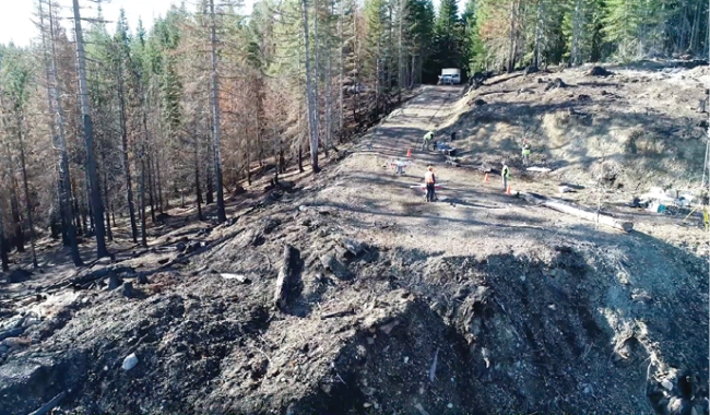
UAS are increasingly being used to fly over post-wildfire landscapes for analysis and seeding. DroneSeed, a climate tech company, is working toward “removing bottlenecks from the reforestation pipeline,” using drone swarms to get seeds in the ground faster.
Landowners affected by wildfire typically wait two to three years for seedlings, DroneSeed CEO Grant Canary said, and that’s something the company aims to change.
The drones are 8 feet in diameter and can carry a 57 pound payload, Canary said, dropping seed pucks that are a mixture of nutrients, moisture-retaining substances and pest repellents. The team collects LiDAR and aerial imagery to identify which areas need regenerated, and work with local forestry experts to analyze soil type, water features and sun exposure to map out optimal planting patterns. Three to five drones fly site-specific routes to drop the pucks. The team returns the following planting season to measure the number of seedlings that took root and to plant more if necessary.
“We are currently in a reforestation deficit,” Canary said. “On a 10-year rolling average, roughly 7 million acres burn in the U.S. alone each year. Climate change is making high-intensity wildfires more prevalent and without the technology to scale along with them, we will never outpace the amount of acreage necessary to reforest each year.”
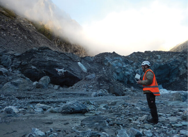
GLACIER MELTING AND SNOW DEPTH
Glacier melting is the other alarm point for climate change, de Badts said, and many eBee drones are used to measure glacier ice in 3D to calculate ice mass volume.
Glaciers are large and difficult to map, Mackern said, but it’s important to understand how they’re changing. Glaciers have many crevices and tunnels, making it dangerous for humans to take on this task. Drones enable researchers to safely map glaciers and overlay them over time to see how they’re moving and how much height and width they’re losing.
Heather Purdie, an associate professor for glaciology at the University of Canterbury, is among scientists deploying drones for this purpose. Drones make it possible to access areas of the glaciers they couldn’t reach before and to get an accurate rate of glacial retreat. They’re best if the area that needs surveyed isn’t too large, as battery life is still a limitation. Purdie mainly uses optical photography to generate digital elevation models and thermal cameras to map surface temperature.
Accurate positioning and speed are critical, she said, which is why they now use RTK GPS.
“If you want surveys to be repeatable, you need to reduce errors as much as possible,” she said. “We repeat the surveys every year, so we’re looking at change over time. Before we had to spend a lot of time in post processing because the onboard GPS was sufficient to fly but it wasn’t survey grade. We had to put down ground control points, which isn’t easy to do in the places we’re surveying.”
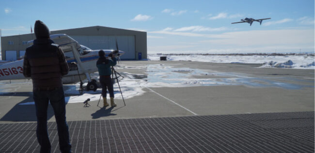
Bealing also has deployed an octocopter with small radars to measure snow depth on sea ice in the Antarctic. The measurements help predict avalanche risk, monitor the impacts of climate change and validate reference measurements from satellites.
Antarctic sea ice is difficult yet important to measure, said Wolfgang Rack, associate professor of remote sensing and glaciology at the University of Canterbury, as its seasonal extent and thickness influences climate. Satellites altimeters are typically used, but without reliable information on snow depth, the measurements aren’t reliable.
The radars send signals to the ground, which then bounce back with information on snow thickness. The data, accurate to a few centimeters, can be combined with satellite imagery to generate 3D maps of snow load.
“With satellites, we have very limited knowledge of how thick sea ice is,” Rack said. “We know the area but not the thickness, and that’s why we want to use snow radar.”
Other researchers are deploying gravimeters and LiDAR, Zappa said, to tell them how thick glaciers are and monitor how receding glaciers are impacting sea levels.
Zappa is also deploying drones to understand how climate change is impacting the traditional ways of life for ingenious communities in Kotzebue, Alaska, specifically sea ice melt seasons. They hunt two types of seals in April, ringed and bearded, and each has a different way of using the ice. The ring seals den while the bearded seals sit on the ice after it breaks up to sunbathe. The ice breaking is critical to the start and end of hunting season, with both happening earlier over the last 20 years.
Using visible and infrared cameras and other sensors, Zappa is looking at how the ice evolves within a season. For example, the color of the ice can tell a lot about whether the ice is ponding or has snow. The infrared sensors also tell them how many and where the seals are, allowing them to build a map of their location.
Mapping large rivers is another application gaining interest, Mackern said, showing changes in the water over time. “This gives you very good information about what’s happening upstream with a glacier or mountains or lakes,” he said. “Based on how much water there is, the rivers change direction. So tracking this helps scientists have a good understanding of how climate is affecting water flow in rivers.”
LOOKING AHEAD
Drones will continue to play a growing role in climate research, with scientists developing the specialized platforms and payloads they need to answer the most pressing questions, Zappa said.
Study campaigns will become more sophisticated, integrating planes, boats, floats and drone swarms, Gavart said, operated from remote sites for even better sampling.
AI and ML will improve our ability to answer ecological questions and monitor our success in restoring nature, Schill said. Technology will become more plug and play, and multi-temporal data processing more available, streamlining information extraction for decision support.
Sensors will continue to shrink and become more affordable opening up more research opportunities, Waite said. Information collected from drones, manned aircraft and satellites will be routinely integrated together, offering a more complete picture.
Drones will be deployed more in dangerous environments like the Antarctic, Bealing said, for safer, more cost effective research. Bigger drones that can carry more equipment will fly autonomously from their nesting location to glaciers to complete mapping missions. A similar scenario will unfold for wildfire monitoring as automation continues to develop, de Badts said.
Drones will likely be used more for air quality monitoring, Stolyarov said, maybe even making it possible to create a global database. Remote soil sensing is another area drones could impact.
Drones will start doing more on their own, collecting the pristine measurements required for climate science.
“I envision both surface vehicle, airborne and underwater vehicles as an ubiquitous part of ocean observing, out there all the time measuring the ocean processes and changes,” Zappa said of what he expects to see in his field. “And having super sites where you can dock platforms to recharge and then go back out. In general, oceanography is moving toward autonomous workflows because going to sea is very expensive. The more autonomous things can become, the more we can accomplish and understand about the oceans.”