Air pollutants known as particulate matter are a complex mixture of microscopic solids and liquid droplets with some particles—such as dust, dirt, soot or smoke—large enough or dark enough to be seen with the naked eye. Other particulates are so small they can only be detected using an electron microscope. Now researchers are expanding their ability to study even the smallest particulates using unmanned aircraft systems (UAS) to carry such instruments into the sky and analyze what is in the air we breathe.
Once inhaled, particulate matter can damage the lungs and heart and cause serious health effects, “even cancer,” said Aydogan Ozcan, a professor of electrical and computer engineering and bioengineering at the University of California, Los Angeles.
Ozcan’s lab has long worked on imaging techniques for environmental applications. Their research yielded novel lens-less microscopes, where samples are directly placed over imaging chips with no optical components between them for compact, high-throughput and cost-effective imaging, Ozcan said.
Current monitoring techniques for aerosols of this particulate matter “are either bulky or low-throughput,” Ozcan said. For instance, air sampling stations typically use beta-attenuation monitoring or tapered element oscillating microbalance instruments that usually weigh roughly 30 kilograms, cost about $50,000 to $100,000, and require specialized personnel or technicians for regular system maintenance every few weeks. Although commercially available, portable particle counters only cost roughly $2,000 to $8,000, they sample the air at rates of less than 2 to 3 liters per minute, and accurate measurements of either very-high or very-low concentrations of particles is challenging for these devices. Moreover, neither of these options provides microscopic images of captured particulate matter for detailed analysis, Ozcan added.
“We thought this very light-weight and versatile microscope platform would be a good fit as a payload for a drone to perform three-dimensional air quality monitoring—to see the particles in air that people do not normally see with their bare eyes,” Ozcan said.
Airborne Microscopes
In the beginning, Ozcan said, he and his lab had no experience with drones.
“A major effort of ours for this application with drones was to reduce the weight of the device so we can fit it into a smaller, more portable and cheaper drone,” he told Inside Unmanned Systems.
Their efforts have resulted in a mobile imaging system they call c-Air. “So far the c-Air device weighs about 600 grams,” Ozcan said.
The device can screen 13 liters of air per minute and generates microscopic images of scanned particulate matter, providing statistics of particle size and density distribution with a sizing accuracy of roughly 93 percent. They also integrated the device with a smartphone application to control c-Air and display results.
The device relies on cloud computing to remotely, rapidly and accurately analyze acquired images of particulate matter. Artificial-intelligence machine-learning algorithms can be used, said Ozcan and his colleagues, to adaptively tailor c-Air to identify specific particles in the air, such as various types of pollen and mold. It won the Vodafone Wireless Innovation Project prize in 2016.
The device uses a pump to drive air into a nozzle, inside which particulate matter can latch onto a sticky coverslip. Red, green and blue LEDs then illuminate this coverslip so a color CMOS (complementary metal-oxide semiconductor) image sensor—the same kind used in most digital cameras—can take pictures of the particles from a distance of just 400 microns, a span about four times the average width of a human hair.
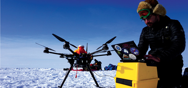
The researchers are currently using c-Air with a DJI Flame Wheel, a roughly 1-kilogram quad-rotor drone. However, “any medium-sized drone—for instance, the DJI Phantom—should satisfy our application,” Ozcan said.
They tested the c-Air by measuring the air quality over an Environmental Protection Agency-approved air-quality monitoring station for several hours. The researchers confirmed that the c-Air’s measurements closely matched those of the station. They also used c-Air to map the air quality around Los Angeles International Airport (LAX) over 24 hours, and confirmed that the impact of LAX on particulate matter concentrations was detectable even 47 kilometers away from the airport, especially along the direction of landing flights. A field test on the University of California, Los Angeles campus also detected a significant increase in ambient particulate matter caused by the so-called Sand Fire near Santa Clarita, California, on July 23, 2016.
Regular pollution sources such as highways, airports, factories and buildings are places c-Air can target, as well as events such as fires, explosions and accidents. The aim is to “enable dynamic mapping of air pollution in 3-D at a much higher efficiency than a human operator,” Ozcan said.
Currently, the image resolution of c-Air is limited to about 1.74 microns. The researchers noted they could achieve resolutions of less than 0.5 microns with better CMOS sensors in the future. Ozcan also hopes to cut the weight of c-Air “by at least half and make it fit into a smaller drone.”
Urban Air Quality
Researchers worldwide are using drones to detect air pollution. For instance, after a villager reported a foul odor in Zhancui in south China’s Guangdong province, environmental authorities in Dongguan City, a leading production center for smartphones and sweaters, dispatched a drone equipped with several high-precision sensors, according to Xinhua, China’s official press agency.
The Chinese drone, co-developed by Shenzhen-based SciflyTech and Guangdong IntelFlight UAV Ltd., was capable of detecting eight air pollutants, such as volatile organic chemicals, sulfur dioxide and nitrogen dioxide. Hovering roughly 100 meters from the ground, the drone transmitted real-time contaminant and geographic data. Within 30 minutes, the drone reportedly produced a map showing abnormal levels of volatile organic chemicals in the area. Law enforcement officers then located the source of the pollution and punished three factories that had directly discharged waste gas into the air. In September, Xinhua noted that Dongguan started using drones to assist law enforcement for environmental monitoring in 2016.
U.S. researchers also aim to build drones to analyze pollution in cities. Chunrong Jia, an associate professor of environmental health at the University of Memphis, and his colleagues are developing drones to help test the air quality in Memphis, which has struggled with air quality issues.
Jia and his colleagues plan to use a Parrot Bebop 2 quad-rotor drone, which is equipped with GPS, a high-definition camera, pressure sensor, ultrasound sensor, and WiFi communications. They also plan to add ozone, nitrogen oxide and particulate matter sensors from England-based firm Alphasense and a temperature and humidity sensor from Finland-based firm Vaisala. They plan to test their drone near two air monitoring stations in Memphis to compare results.
The research team will focus on the air quality at varying distances from two highly congested roads in Memphis. They noted the transportation sector is the largest emitter of nitrogen oxide in the United States, as well as a major source of particulate matter and volatile organic compounds.
Jia and his colleagues will also work to address environmental disasters, when local communities and healthcare providers will want to rapidly know what might be in the air, how high contaminant levels are, and what to do to protect people’s health. They plan to deploy the drone when crises are reported on the local air pollution emergency reporting phone line.
Scientists in New York are also adding unmanned aircraft to their environmental assessment tool kit. They are building a multi-rotor drone to measure air pollutants such as volatile organic compounds and particulate matter close to potential pollution sources such as smokestacks or pipelines.
“Unmanned aerial vehicles can be used to take air quality samples in places where it would be hazardous to collect yourself, such as with really toxic chemicals,” said Markus Hilpert, an associate professor of environmental health sciences at Columbia University. “You can also sample in all three spatial dimensions, which you cannot do with a ground-based sensor.”
Ideally, Hilpert and his colleagues would love to sample the quality of air in places such as the South Bronx, which has a notoriously high level of air pollution. “The problem is that FAA regulations currently limit flying above people, and there are typically five-mile buffer zones around airports, so flying in New York City will always be a problem,” Hilpert said.
Alaska
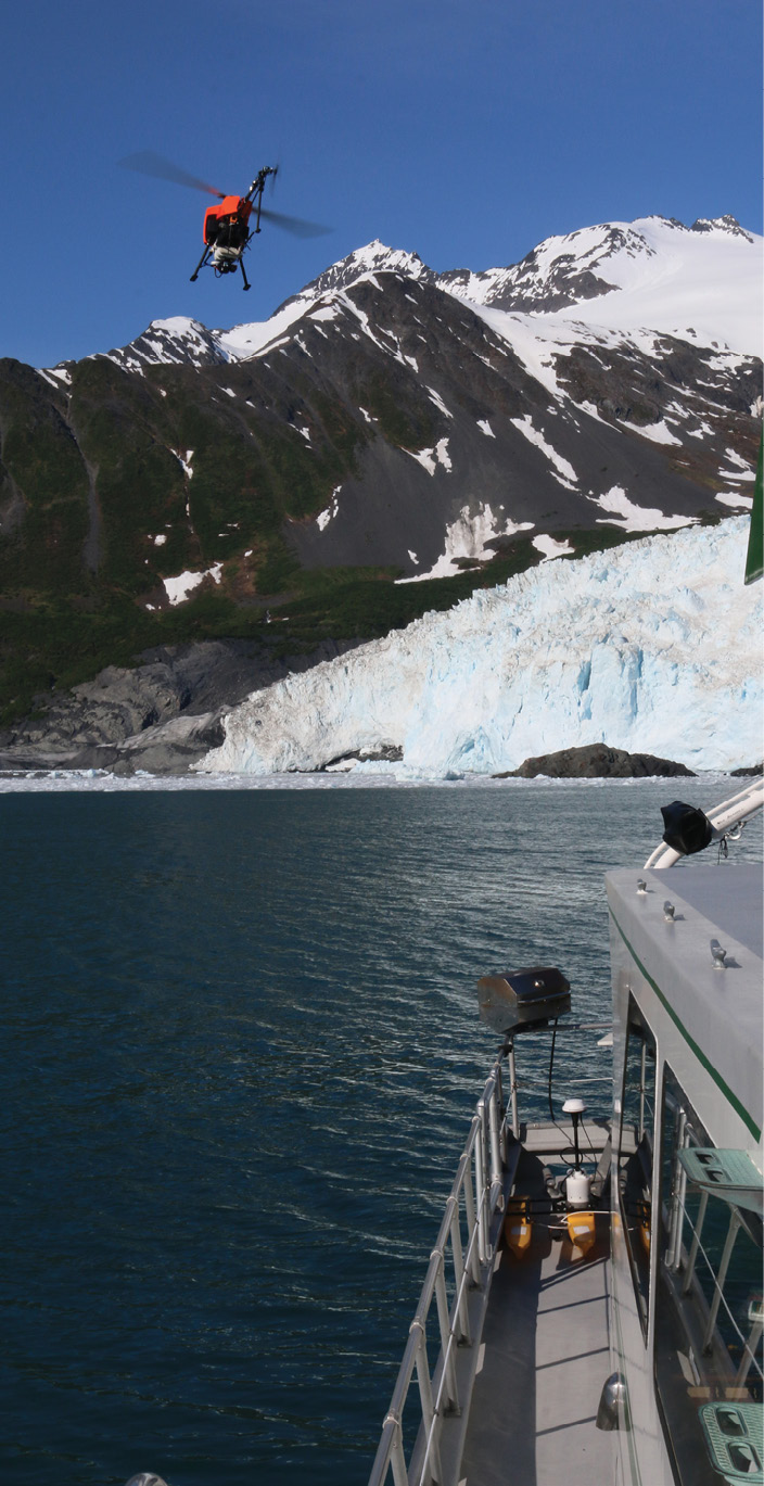
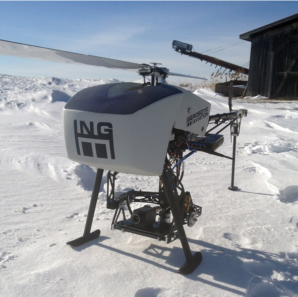
A variety of different UAS are being recruited in Alaska.
“Unmanned aircraft offer incredible possibilities for monitoring pollution,” said Catherine Cahill, a professor of atmospheric chemistry at the University of Alaska Fairbanks (UAF). Cahill runs the Pan-Pacific UAS Test Range Complex, one of the seven official Federal Air Administration (FAA) UAS test sites, and has more than 30 years experience analyzing particulate matter pollution.
“We can follow plumes, and fly out into the Arctic, and develop maps to improve models of pollution distribution,” Cahill said. “This data can help you know what your pollution sources are and how much each emits so you can put in mitigation measures before it gets bad and go after the one person who’s being the bad guy instead of penalizing everyone.”
Cahill is also the director of the Alaska Center for UAS Integration (ACUASI). Drones the center have developed or used include:
The Ptarmigan, a 31.5-inch-long single-operator hexarotor drone designed to operate for up to about 18 minutes carrying up to 1.5 kilograms of payload including instruments such as the FLIR Vue Pro infrared camera; a pair of Sony NEX 7 digital cameras for stereoptic imaging; a single fixed Sony NEX 7 camera mounted to a high-precision NovAtel GPS that notes the exact location of when each image is taken for survey-grade mapping and 3-D terrain modeling; and a GoPro Hero 3 Silver for high-speed video.
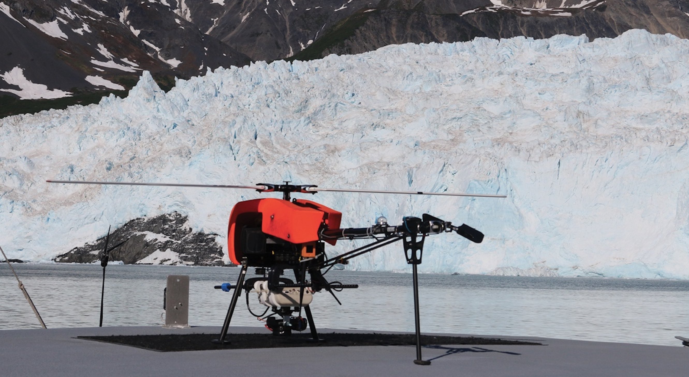
The Responder, a 75-inch-long two-operator single-rotor drone able to carry up to 3 kilograms of payload for up to 35 minutes. This aircraft is capable of fully autonomous flights from takeoff to landing, including everything to do with navigation and flying of the aircraft as well as payload commands and heading changes for payload alignment. Flight routes can be updated on the fly, resumed and started at any place as well as saved and retrieved for later, repeatable flights.
The ScanEagle, a roughly 10-foot wingspan fixed-wing drone designed to carry up to 3.3 kilograms of payload for up to 18 hours. The ScanEagle requires one operator to pilot and manage the aircraft and payload and two additional crew members for ground operations. The ScanEagle does not need a runway and so may be launched or recovered in a land or maritime environment.
Sensors that Cahill and her colleagues equip these drones with include optical particle counters to measure particulate matter, as well as gas sensors for nitrogen oxide and other compounds. “We can use a long-endurance aircraft like ScanEagle to circle over a fire for 18 hours and measure what’s coming off it and how it evolves over time, which helps refine models of plumes of smoke that can be hazardous to people’s health,” Cahill said. “We can see what kind of smoke we’re getting and model where it’s going and what its potential health impact might be.”
One area of focus for Cahill and her colleagues is the pollution choking Fairbanks, Alaska’s second-largest city. Fairbanks experiences what are known as temperature inversions, where a layer of warmer air overlies a layer of cool air at the surface. (Under normal conditions, air usually gets colder with height.) Fairbanks’ low-level inversions can trap air pollution close to the ground, “giving it some of the worst air in the country,” Cahill said.
“We’ve had trouble monitoring and modeling the inversions in the past, so one thing we hope to do in the winter is to use unmanned aircraft, most likely the Ptarmigan, to take vertical profiles of the atmosphere at low altitudes during the worst periods, when people are burning wood and a lot of smoke is getting trapped,” Cahill said. The hope is to predict “when an inversion sets in and how it sets up so you can maybe tell people to stop burning to protect people’s health,” she said.
The advantage of using unmanned aircraft over manned aircraft or balloons to monitor the air are many. “A helicopter totally mixes up the atmosphere, disrupting what we want to sample,” Cahill said. “Balloons can sample the atmosphere going up and down, but they’re limited moving horizontally. Unmanned aircraft are a good option — we can vertically and horizontally map pollutants without disturbing the atmosphere too much. And unmanned aircraft are great in terms of safety aspects — you don’t need to stick a pilot over the heart of a forest fire.”
One concern when it comes to using UAS to search for air pollution is that the aircraft may disturb the very air they seek to analyze. “We don’t want the wash from the rotors to mix the atmosphere too much, so how do we get the air inlet that takes in the air away from the rotor wash?” Cahill said. “We don’t place it to the top or the bottom, but to the side. We see a lot of the same difficulties we encountered for years through air monitoring with manned aircraft.”
In addition, working in Alaska can pose a number of special challenges. “In the cold, plastic can get brittle, so you can shatter rotors—we go to carbon fiber instead,” Cahill said. “Icing is also a huge challenge for us, and we actually work with folks to put drones in an icing wind tunnel, doing experiments with de-icing coatings and active de-icing systems that get rid of ice in flight.”
And there are other problems that most researchers don’t face. “In the Arctic we have to guard against polar bears so we don’t get eaten,” Cahill said. In addition, “the runways we use are often gravel, and we have to be careful about what happens when the larger unmanned aircraft land and kick up gravel into instruments.”
Redundancy is key to successful missions with the drones. “Our largest unmanned aircraft have three different command and control links,” Cahill said. “If the 2.4 gigahertz radio channel goes out, we can fly using Iridium satellite communications and can still get the aircraft back.”
Right now, testing air pollution in cities remains a challenge because of FAA regulations concerning long-distance flights past line of sight, flights over people, and flights where unmanned aircraft might collide with manned aircraft. Still, Cahill noted that through work at their test site and others, the FAA is developing ways that may one day allow unmanned aircraft “to fly over cities safely, so that they can be used to their fullest potential,” she said. “That way we can get the information about the air that we need to protect people.”


