
INVOLI, a provider of surveillance data solutions, has announced the launch of an Altitude Surveillance Supplemental Data Service in Dallas, Texas….
Dronetag Introduces RIDER for Drone Safety in Response to Growing Airspace Concerns
With recent incidents such as unidentified drone sightings in New Jersey and across the US, and a drone collision with…

Policy Imperatives for U.S. Leadership in Drone and Autonomous Technologies
President Trump, the 119th Congress, and state legislators have taken office at a time when the U.S. is at a…
Teledyne FLIR Launches Prism Supervisor Software for Enhanced UAS Autonomy
Teledyne FLIR OEM, part of Teledyne Technologies Incorporated, today announced the release of Prism™ Supervisor, the latest addition to its Prism…
DroneDeploy Accelerates Construction of Critical U.S. Al Infrastructure with Nationwide BVLOS Waiver
DroneDeploy announced nationwide U.S. Beyond Visual Line of Sight (BVLOS) approval for critical infrastructure, including data center construction management. The…

Terra Drone Conducts UTM-Based Multi-Drone Flight Demonstration in Indonesia
Terra Drone Corporation, a drone and Urban Air Mobility (UAM) technology company headquartered in Japan, announced conducting Indonesia’s first demonstration…
Johnny Appleseeds of the Sky: UAS for Reforestation
In the popular legend, Johnny Appleseed went from place to place carrying a bucket of seeds and planting apple trees…

Kodiak Delivers RoboTrucks to Atlas Energy Solutions for Autonomous Trucking Service
Kodiak Robotics, Inc., an autonomous truck developer, and Atlas Energy Solutions Inc. announced that Atlas has completed the delivery of…

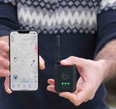
Waze for UAV Flights: Elsight HeatSight, a Cellular Coverage Mapping Tool at Drone-Flying Altitudes
Elsight, a provider of connectivity for unmanned and autonomous systems, announced the launch of HeatSight, a signal strength mapping tool…
Shield AI V-BAT Selected as Japan Maritime Self-Defense Force’s First Maritime ISR Platform
Shield AI, the defense technology company building an AI-powered autonomy software platform and tools for the world, announced that its V-BAT…
Redwire Corporation to Acquire Edge Autonomy for $925M
Redwire Corporation, a provider of space infrastructure, announced that it has signed a definitive agreement to acquire Edge Autonomy, a…
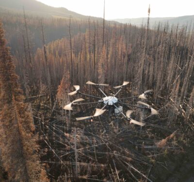
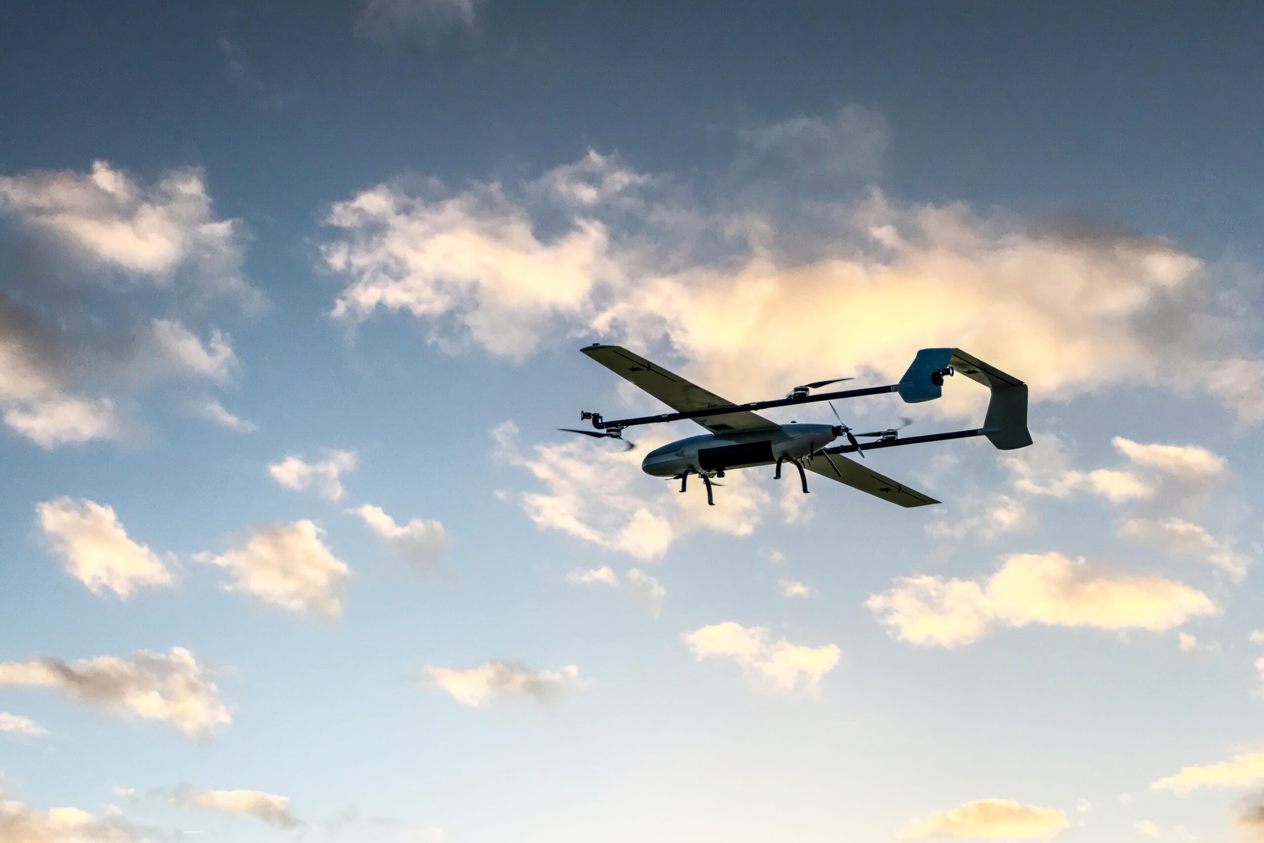
Wildfire Management and Monitoring through Long-Endurance UAS Solutions
As wildfires proliferate, the importance of prediction and monitoring using advanced long-endurance UAS grows. Equipped with high-resolution thermal imaging and…
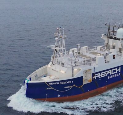
Kongsberg Maritime Delivers First REACH REMOTE USV
The REACH REMOTE 1 delivery follows a program of intensive sea trials, overseen by classification society Det Norske Veritas (DNV) and the…
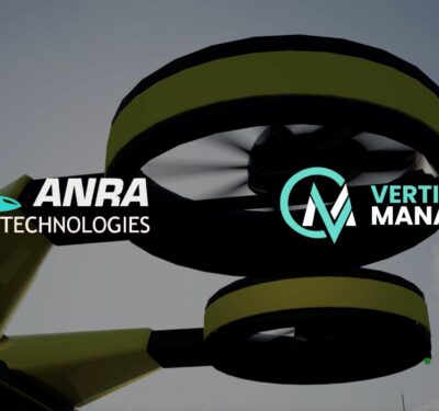
ANRA Technologies and Future Flight Global Partner to Build the Digital Backbone of Advanced Air Mobility
ANRA Technologies, a provider of autonomous aircraft traffic and fleet management, and Future Flight Global, an innovator in advanced air transportation,…

ResilienX Publishes White Paper Highlighting Results from FAA R&D Project to Advance BVLOS Operations
ResilienX, a provider of safety assurance solutions for autonomous ecosystems, has released a new white paper detailing the findings and…

Palladyne AI and Red Cat Achieve Successful Multi-Drone Collaborative Autonomous Flight
Palladyne AI Corp., a developer of artificial intelligence software for robotic platforms in the defense and commercial sectors, and Red…
Industry View: Failure of Remote ID in NJ Might Have Cost Us Years
Editor’s Note: As attention increases regarding aircraft activity in the eastern U.S., Inside Unmanned Systems will be providing substantive context…
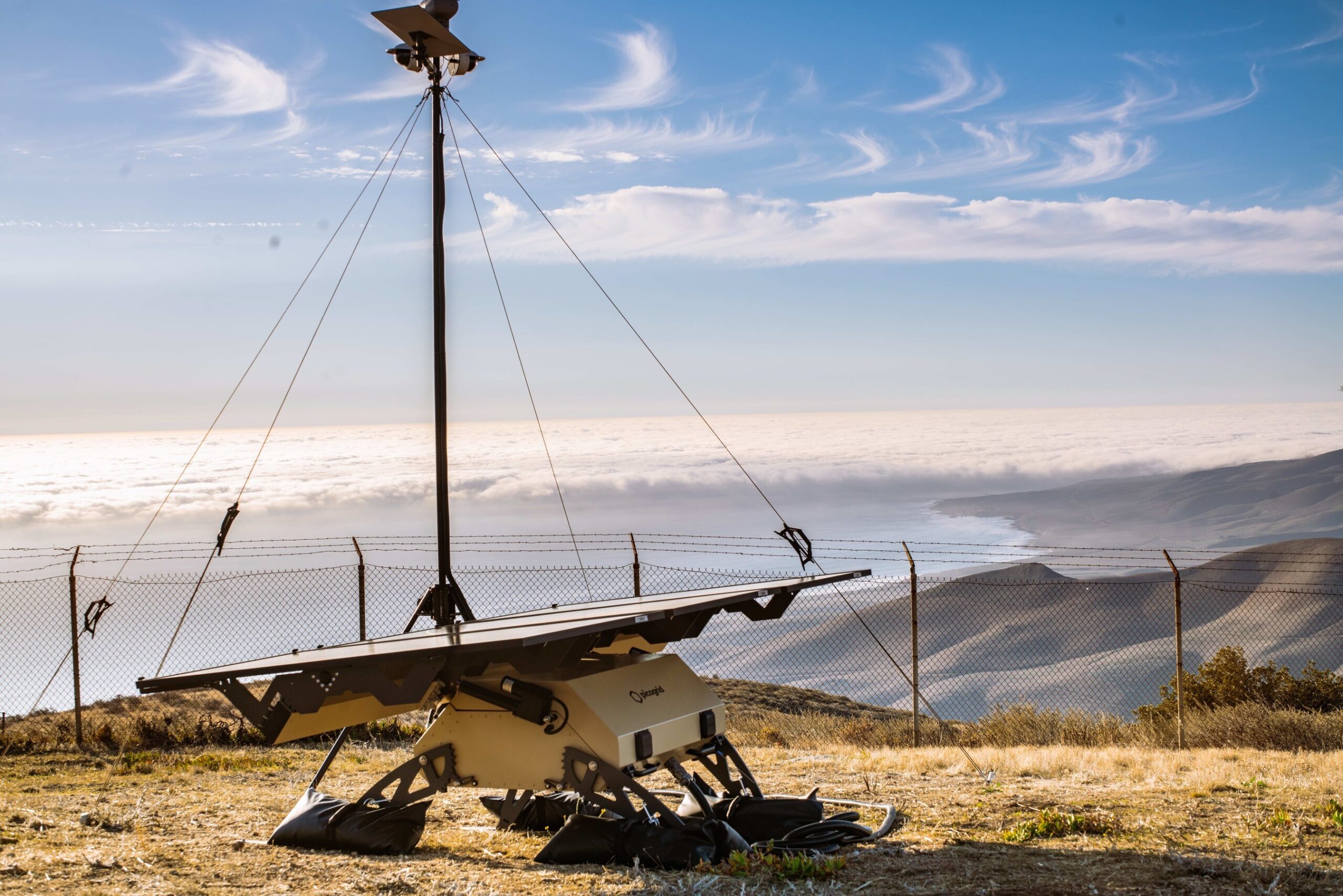
Picogrid and MIT MIx Awarded $1.75M Program for Wildfire Response
Picogrid and Massachusetts Institute of Technology (MIT) Mission Innovation X (MIx) announce they have been selected by AFWERX for an ...
DIU Selects Companies to Provide Long-Range, One-Way Unmanned Platform Prototypes for Evaluation
The Defense Innovation Unit (DIU) announced that four companies were awarded contracts for Artemis, a project to operationally evaluate long ...

ZeroAvia Flexible Fuel Cell Test Shows Expanded UAV & VTOL Capabilities
ZeroAvia has announced that its SuperStack Flex highly-customizable LTPEM fuel cell architecture has achieved over 1.0kW/kg specific net power at a full ...
Innovation Vanguard Awards – Deadline Extended to March 31
The debut Innovation Vanguard Awards from Inside Unmanned Systems highlights cutting-edge innovations, technological advancements, product design and breakthroughs across multiple ...
Saildrone and Palantir Announce Strategic Partnership to Advance AI-Powered Maritime Intelligence
Saildrone today announced a strategic partnership with Palantir Technologies set to revolutionize maritime intelligence capabilities. This collaboration will enable the ...

Anduril Awarded 10-Year $642M Program of Record to Deliver CUAS Systems for U.S. Marine Corps
Anduril Selected to Provide AI-Powered Counter Unmanned Aerial System (CUAS) Technology to Safeguard U.S. Marine Corps Installations Globally Image: Anduril ...
BVLOS Unbound: Taking Drone Inspections Nationwide
With deep roots in manned aviation, Phoenix Air Unmanned is at the forefront of BVLOS drone operations. Their nationwide FAA ...
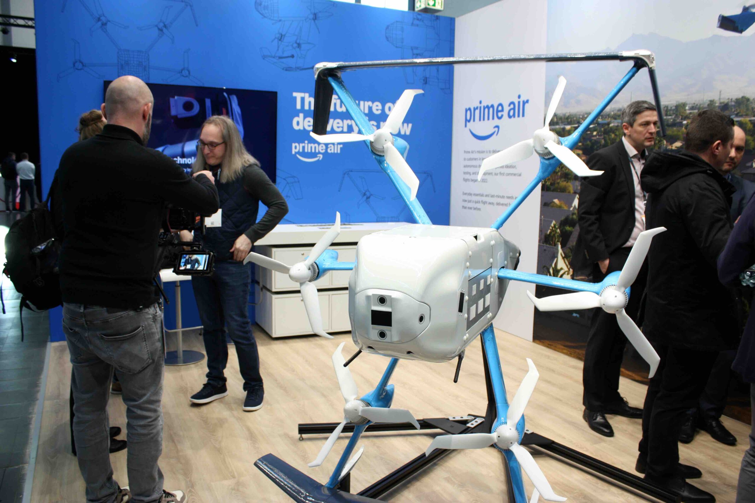
Amazon Prime Drone Delivery at XPONENTIAL Europe
Amazon is using drones to deliver packages in North America, and the company came to Germany to talk about it ...

UK Civil Aviation & Communications Authorities Make 978 MHz Frequency Available for UAS, Enabling BVLOS
Ofcom, the UK Communications Authority, and the UK Civil Aviation Authority (CAA) are making 978 MHz available for airborne transmission ...

Five Good Questions: Ethan Thornton, Mach Industries
Ethan Thornton is the CEO and founder of Mach Industries, a next-generation defense technology and manufacturing company. Thornton founded Mach by ...

The Next Wave: Transforming Maritime & Subsea Operations
From advanced unmanned surface vessels (USVs) to cutting-edge synthetic aperture sonar (SAS) systems, maritime robotics is rapidly advancing offshore energy ...
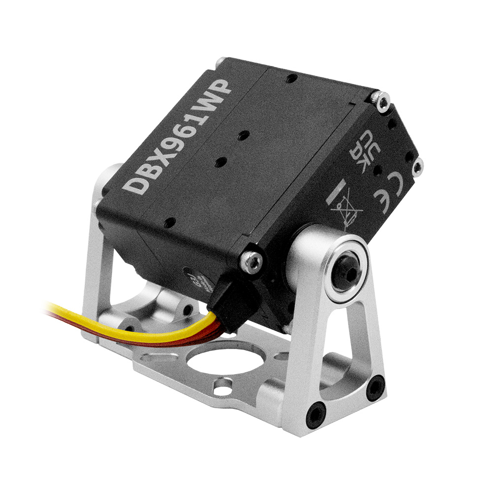
Hitec Releases DBX961WP Steel Gear Actuator
Engineered with hardened steel gears, dual ball bearings and a rugged aluminum alloy case, the DBX961WP with a bearing-supported robot ...
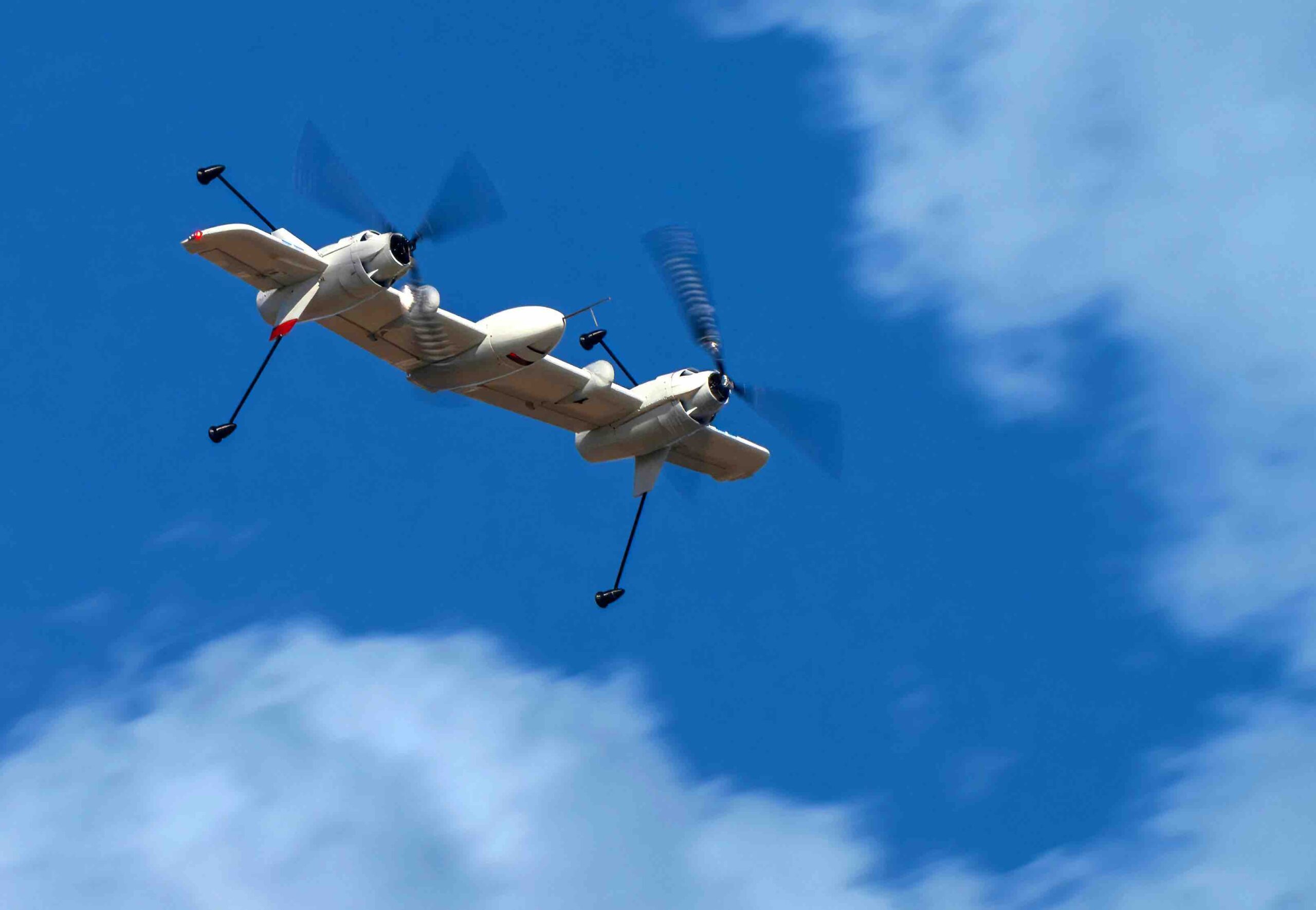
Sikorsky Successfully Flies Rotor Blown Wing UAS In Helicopter And Airplane Modes
Sikorsky, a Lockheed Martin company has successfully validated the advanced control laws to successfully fly a ‘rotor blown wing’ uncrewed ...
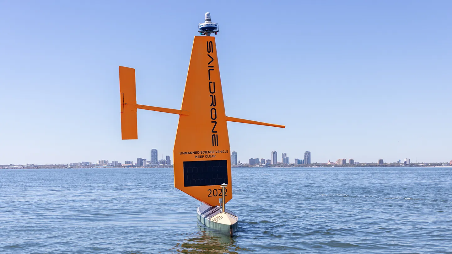
Saildrone Begins First Unmanned Survey of Florida’s Coastal Waters
Two Saildrone Voyager USVs have launched for the first time from St. Petersburg to map Florida’s coastal waters, supporting coastal ...
SightLine Applications Acquires Athena AI to Advance Autonomy Capabilities
SightLine Applications, a developer of video processing software for autonomous and uncrewed systems has announced the acquisition of Athena AI, ...
Anduril Wins $200 Million Contract to Develop CUAS for the Marine Air Defense Integrated System (MADIS)
Anduril has been awarded a $200 million, five-year Indefinite Delivery/Indefinite Quantity (IDIQ) contract by the U.S. Marine Corps to develop ...
WingXpand and Raytheon Collaborate on AI Solutions, Launches VTOL
WingXpand, a U.S. provider of autonomous smart planes using AI threat detection, is collaborating with RTX’s Raytheon, a provider of defense ...

Matternet Partners with ANRA to Enhance UTM Services for Urban Drone Networks
Matternet, an urban drone delivery company, has announced a strategic partnership with ANRA Technologies, a provider of Unmanned Aircraft Systems ...
AV Unveils Software Updates to Enhance Puma UAS Capabilities in Contested Environments
AeroVironment (AV) has announced a suite of software updates, called Project GOLD, that elevate the battlefield effectiveness of its Puma ...

Sikorsky And Rain Successfully Demonstrate Wildfire Mission Autonomy
Sikorsky, a Lockheed Martin company, and Rain, a provider of autonomous aerial wildfire containment technology, successfully demonstrated how an autonomous ...
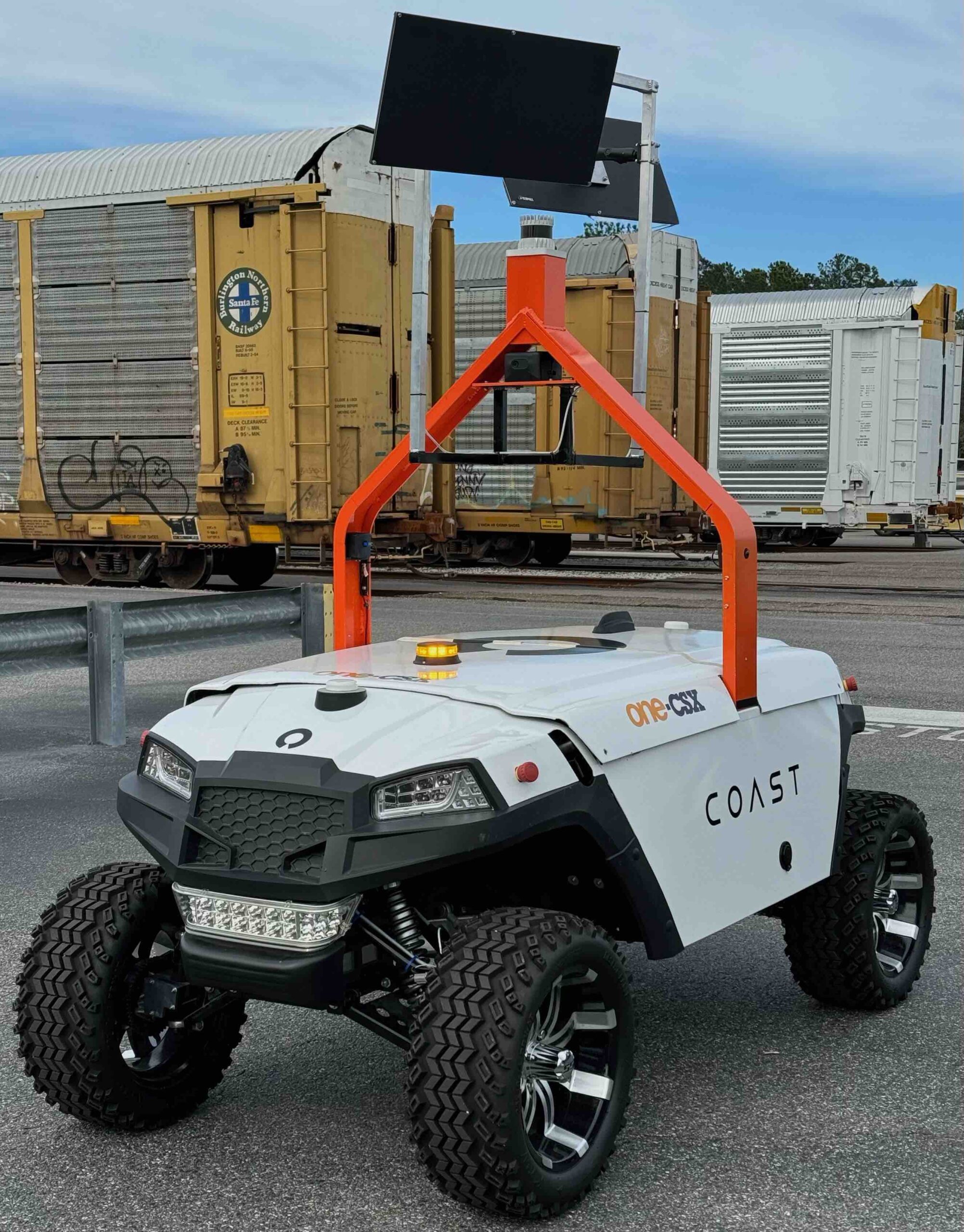
COAST Autonomous Enhances Robotic Intelligence with TorqueAGI’s Generative AI
COAST Autonomous, a provider of autonomous robotic systems, has entered into a strategic partnership with TorqueAGI, a Generative AI startup ...
DIU Blue UAS Refresh Challenge Tests UAS Platforms for DoD
The Defense Innovation Unit hosted the first annual Blue UAS Refresh event at the Marine Corps Air Ground Combat Center, ...

ANRA Technologies Secures FAA Approval for Non-Vertically Integrated UTM for Critical Infrastructure Operations
ANRA Technologies, a provider of airspace management solutions, has announced that it has received a Letter of Acceptance (LOA) from ...
Insitu Announces Proliferated-Low Earth Orbit Satellite Control for Integrator UAS with 2,000 Nautical Mile Range
Insitu, A Boeing Company, is now leveraging Proliferated-Low Earth Orbit (P-LEO) Satellite Communication (SATCOM) control for its Integrator Uncrewed Aircraft ...
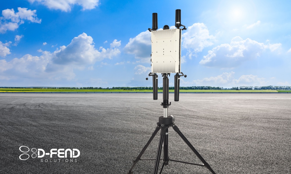
D-Fend Solutions Enters Agreement with Naval Surface Warfare Center for C-UAS Testing
The program is set to collect data and evaluate EnforceAir C-UAS system's capabilities in airport environments. D-Fend Solutions, a provider ...

Volatus Aerospace and Kongsberg Geospatial Collaborate to Advance RPAS BVLOS Operations
Volatus Aerospace Inc., a provider of advanced aerial solutions, and Kongsberg Geospatial, specializing in geospatial software and situational awareness solutions, ...
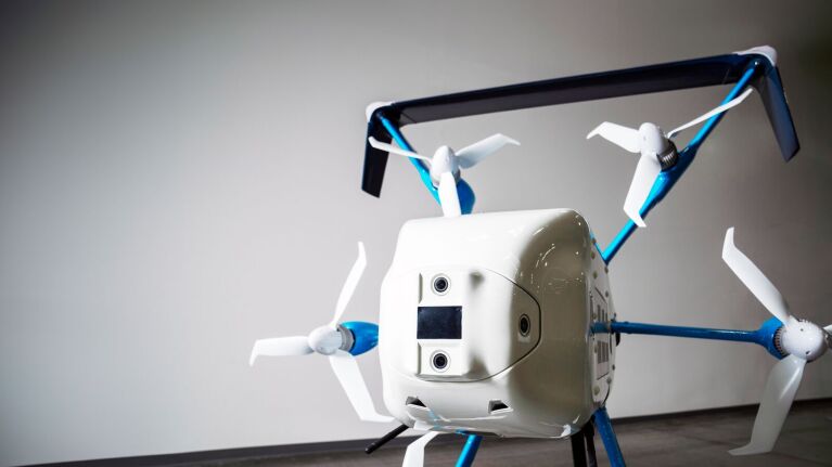
Amazon Announces BVLOS Drone Delivery in Phoenix Metro Area
Amazon has announced the launch of Prime Air drone delivery in the West Valley of the Phoenix Metro Area in ...

SkySafe and Fortem Technologies Announce Partnership for Counter UAS
SkySafe, a provider of radio frequency-based drone detection, and Fortem Technologies, specializing in airspace intelligence, security, and defense for detecting and ...
General Atomics and BAE Systems Collaborate on Autonomous Electronic Warfare Link 16 Capabilities
General Atomics Aeronautical Systems, Inc. (GA-ASI) collaborated with BAE Systems to demonstrate unique electronic warfare (EW) capabilities remotely controlled via ...
Kraus Hamdani Wins $20 Million Contract to Deliver Ultra-Long Endurance UAS to the U.S. Army
Kraus Hamdani Aerospace, a producer of ultra-long endurance Unmanned Aerial Systems (UAS) technology, has announced the award of $20 million ...
No posts found.
No posts found.