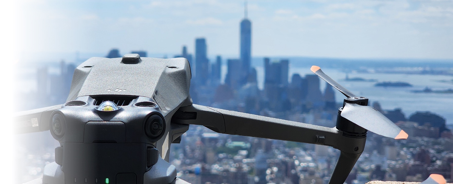
In 2023, a new permitting process opened the once closed skies over New York City to commercial drone operations. This development has potentially big impacts on the Big Apple’s construction sector—foremost by facilitating mandatory but costly façade inspections of high-rise buildings for public safety.
UAV flying above NYC. Image: AeroSpect
Inside Unmanned Systems (IUS) spoke with Edward Kostakis, a major figure in NYC’s growing drone services industry to discover the past, present and future of drone inspection in the city and how and why the drone builders and government regulators can sharpen their tools.
On a sunny day in July in 2023, New York City’s top officials assembled at a pier on Manhattan’s East River to gush about new regulations to bring drones to the iconic East Coast city.
“With these rules, we are paving the way for drones to help in New Yorkers’ everyday lives—not just in emergency situations,” intoned Mayor Eric Adams. “Drones are going to allow us to make façade inspections faster and safer, help us inspect and maintain our bridges, tunnels and critical infrastructure, and allow us to monitor our beaches more easily for unauthorized swimmers and hazardous conditions, among other things.”
Commissioners from the departments of buildings, transportation and parks and recreation all weighed in turn about the virtues of drones for bridge inspection and surveying for construction and maintenance projects.
The splashy event marked the inauguration of a new permitting regime for drone flights over the five boroughs. But there was nary a hint from the officials that the city government itself until recently had posed the chief obstacle to private companies using UAVs for those purposes in NYC—and that changes were only initiated following a court ruling.
“They’re trying to spin it like it was their idea. They didn’t invite us,” said Edward Kostakis, a former Marine Corps air intelligence officer who’s now CEO of Xizmo Media and drone inspection company AeroSpect.
“I can imagine why,” he adds—likely referring to the fact he successfully sued the city government, compelling the rule change. “The only reason there is a drone economy in NYC is because of our lawsuit.”
When affordable commercial drones first exploded in popularity, officials primarily saw them through a public security lens as threats to the city’s three airports, iconic architecture and pedestrians. The NYPD leveraged an old law from 1948, Section 10-126(C), intended to prevent World War II veterans used to taking off and landing light airplanes wherever they pleased from doing so anywhere outside of airports and heliports.
The city’s Department of Parks and Recreation further restricted operations by “toy or model aviation” in local parks, save for five designated air parks. Violations of these law could result in a $250-$1,000 fine and up to 15 days in jail. As a result, city services rather than commercial operators drove most drone adoption in NYC during the 2010s.
In practice, private drone deployment to support construction and inspect buildings did still take place discreetly. Architecture firms, for example, would hire freelance operators to insulate themselves from legal blow back.
“We would just do it,” Kostakis told Inside Unmanned Systems, “We were correct, from a legal standpoint, in not needing New York’s authority to takeoff for inspections as it wasn’t within the purview of New York City to enforce jurisdiction. We always knew the city would not stand a chance to go to court with this because it was illegal to have that law to begin with. But nobody wanted to go against city hall.”
Kostakis said drone manufacturing giants spent years and large amounts of money trying to convince city officials to change course to no avail. “We reached out to many councilmen, and no one would listen,” he recalls.
Finally in 2021, his company Xizmo decided to pursue a legal strategy.
“We [Xizmo] hired a law firm and sued the city on the basis of first amendment rights—not only for video and journalistic purposes but also to use the technology to help with the infrastructure here in New York City. City government tried to dismiss the case off the bat, claiming drones are too dangerous, there are too many skyscrapers, people could get hurt. But Judge Eric Vitaliano said ‘Absolutely not. This is up to the FAA.’ [The city] knew at that point they had no way to go, which brought them to the table negotiating to establish a permitted process.”
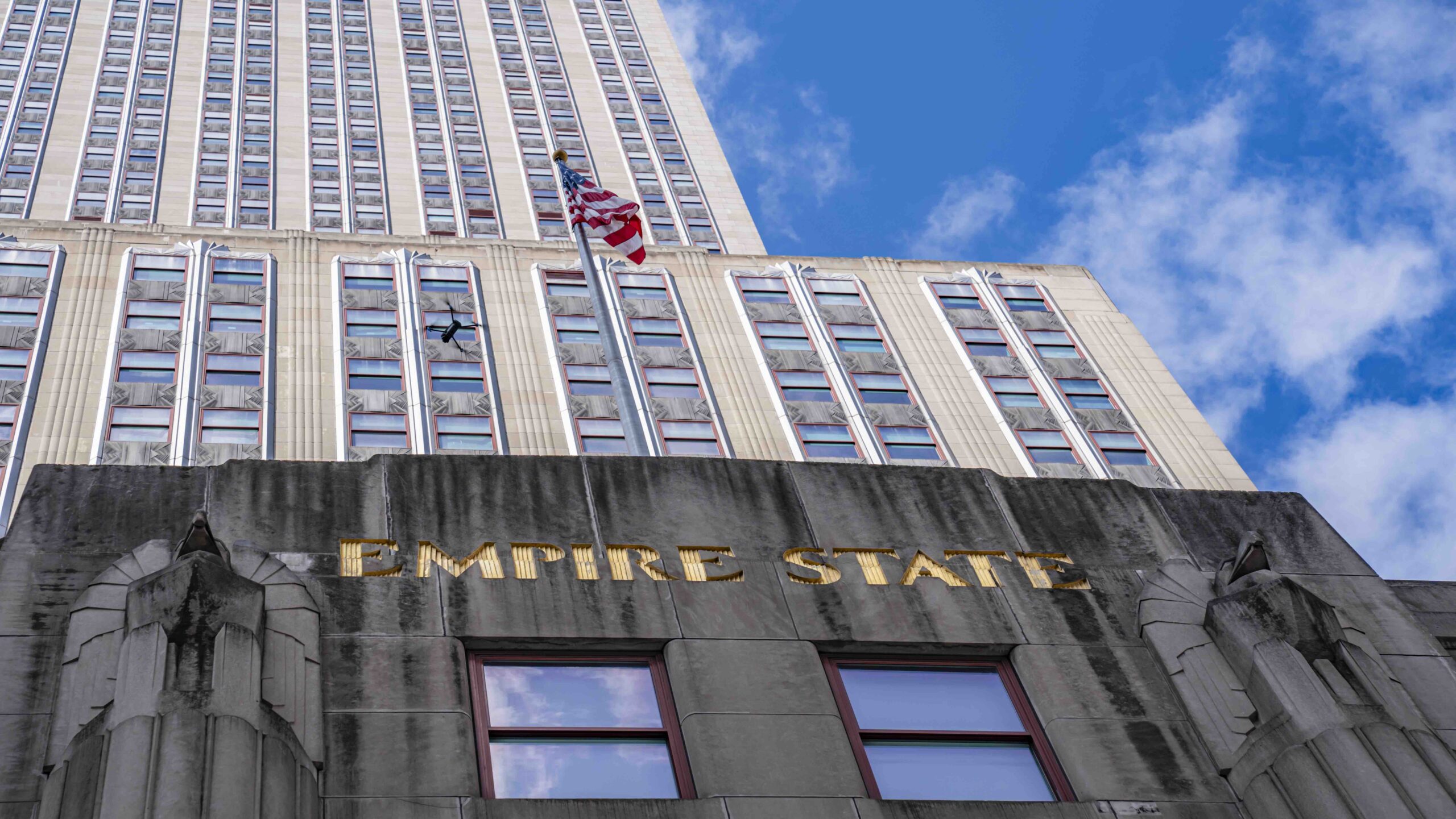
UAV flies alongside the Empire State Building. Image: AeroSpect.
NYC’S New Drone Permits
NYC’s new temporary drone permits cost $150 to apply for (whether granted or not) and have a maximum duration of five days. They are only open to applicants with a Part 107 certification from the FAA, not those with just a hobby license.
Kostakis sees such barriers to entry as reasonable to help gatekeep irresponsible operators. More troublesome for some industries, however, is the first issued permit must be requested 30 days in advance, and subsequent permits require two weeks advance notice.
“With architectural firms, that’s enough leeway,” Kostakis noted. “But that doesn’t work that well in the media production side of things—you usually just get 3-4 days notice, unless you’re doing a Type A film. The city needs to fix that. There are plenty of other cities that have a drone permitting process that just takes a day or two.”
Applicants also must inform all community boards and city council representatives and post public notices in the areas drones will be operating. These stakeholders also must be notified of the type and purpose of video imagery captured by the drones while operating in their area.
Another factor is airspace within a 5-mile radius of an airport is closed to drone operations, placing large swathes of Brooklyn and Queens out of bounds due to LaGuardia airport’s location.
But Kostakis said the process for obtaining a waiver from the FAA to operate is relatively straightforward and fast. “We contact the FAA, let them know we’d be launching a drone at a specific time and place, and within 24-48 hours we’d get permission and a certificate. The further out you go, the higher altitude the FAA is willing to authorize you. You can get an altitude of 100 feet from just a mile away from the airport.”
Despite its restrictions, the impact of the new process has been tangible. “Things have changed. There was a clear demand before, but clients hesitated because they thought it was illegal. [Now] business has gone up 30-40% and it’s only been a few months. And that’s despite many people still being under the impression it’s illegal.”
UAV’s will perform expanded services within NYC in 2024. Image: AeroSpect.
Heat-seeking Drones On the Hunt For Building Renovation
NYC’s ongoing initiatives to reduce climate impact create opportunities for the construction industry to retrofit old buildings—if it can identify trouble spots efficiently.
In Fall 2023, the city’s Office of Technology and Innovation (OTI) funded a testbed program in collaboration with NYU and city administrative services seeking to deploy drones with multispectral sensors to do precisely that. The drones utilize thermal imagers and ‘through-wall’ radar to generate GPS-localized data on buildings generating especially high levels of emissions. A deep-learning AI processes the data into map which can then be used to offer suggestions on which buildings to renovate.
The inspection frontier: Acoustic Sensors
We don’t have mallet-wielding flying drones able to perform sounding yet, but a solution similar to and potentially more effective than human workers has already been deployed.
Already, some drones used for surveying and dam inspection are equipped with a tethered acoustic sensor designed to capture profiles of the surface below. The data is collected and analyzed by machine-learning AI to detect and measure the size of defects.
Admittedly, the surfaces measured by such drones tend to be thick and less materially complex. By contrast, building walls tend to be thinner (voids are closer to the surface) and be composed of multiple different materials, complicating analysis.
The DOB’s 2021 study concludes “…although [acoustic] technology may not be ready for use today, it is worth watching how it develops and if it can become a tool for façade inspections.” By 2024, it appears such tech has at least begun to see operational testing.
Façade Inspection: Rules for Preventing Senseless Tragedy
In 1979 a piece of crumbling terracotta masonry fell off an apartment building in the Upper West Side and fatally struck a 17-year-old college freshman. In reaction, the following year city government passed Local Law 10 mandating any building with six or more floors must receive an inspection of its street-facing façade every 5 years by a Qualified Exterior Wall Inspector (QEWI). In 1998, this Façade Inspection Safety Program (FISP) was expanded by Local Law 11 to apply to all facings of a building.
NYC famously has a lot of tall buildings—with more than 16,000 buildings subject to FISP regulations by 2024. But the Big Apple’s pioneering inspection regime was eventually imitated by 12 other major American cities: Boston, Chicago, Cincinnati, Cleveland, Columbus, Detroit, Jersey City, Milwaukee, Philadelphia, Pittsburgh, and St. Louis, with San Francisco the lone west coast city in the club.
Façade inspection, however, is costly and disruptive because of the requirement for hands-on or close inspection of every 60 foot-length of wall. Sometimes fire escapes, bucket trucks, or industrial rope provide access. This usually requires dropping scaffolding onto adjacent streets with all the hassle that implies. IUS contributor Dawn Zoldi wrote in 2023 that a scaffold drop typically averages “$3,500 to $7,000 to install, operate and dismantle.”
Another tragic death—that of architect Erika Tishman in December 2019 to a falling piece of plywood near 7th Avenue from a 17-story building already condemned as unsafe—highlighted the shortcomings of the FISP regime. The incident led to wider calls for the city to adopt drone inspection.
The reason? The costs of conducting inspections with full-scale ‘wrap-around’ scaffolding followed by implementing repairs are so high that many building owners may prefer to pay fines than the double whammy of inspection and repairs. Furthermore, clambering around tall buildings is dangerous with 200 injuries and nine deaths in NYC’s construction sector in 2022 due to falls. And pedestrians too come under risk of equipment falling from the scaffolding.
Just as UAS have proven highly useful for inspection of remote and tall energy assets (see the IUS Energy Issue, August/September 2022), they also suggest themselves as means to inspect hard-to-get-to places quickly and safely.
Even though a 2021 study by NYC’s Department of Buildings (DOB) found advantages in using drones for façade inspection, it crushingly concluded they had “no tangible direct cost savings.”
Why? Because drones couldn’t satisfy regulatory requirements for ‘hands-on’ inspection by humans. Admittedly, a worker can do certain things a drone can’t, notably ‘sounding’ the surface with taps of a mallet to listen for indications of cavitation or internal damage, and physically removing loose or damaged pieces of the façade.
Thus, according to the report, firms could only use drone inspection to supplement traditional inspections, not instead of them. The report also cites the ‘flattening’ effect of inspection by video monitor, a problem the Air Force discovered while trying to replace manually operated air-refueling booms with remotely controlled ones.
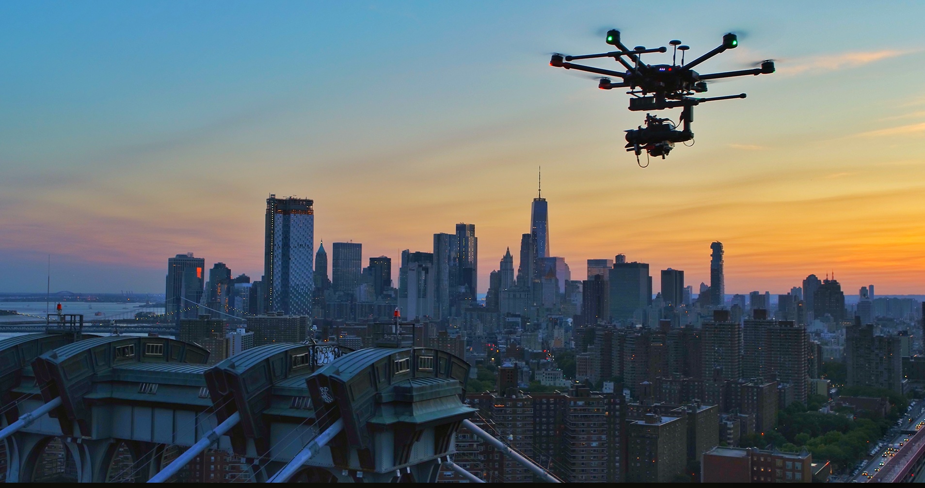
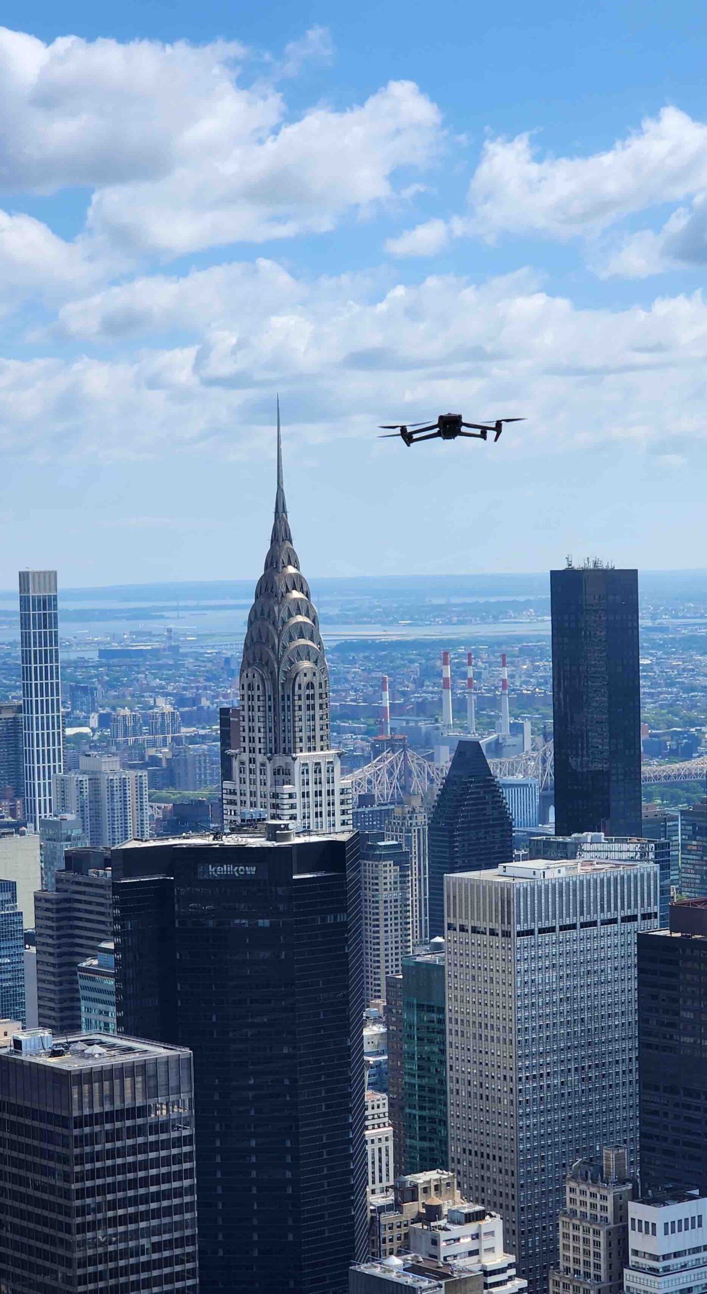
Drone flight near NY Harbor. Image: AeroSpect.
Pushing Façade Inspection to the Next Level
“We right now are dealing mainly with the visual aspect using current sensors,” Kostakis concedes. “The way the law is written, there’s no substituting hands-on inspection with drones.”
Even without fully eliminating close-on inspection, drones could in theory render it much more time- and cost-efficient. “The drone method lets us go there, scan the entire façade, look at what needs more attention and just erect scaffolding there,” Kostakis points out. “And you’re saving money, thus incentivizing repairs to the building.
But to fully close the close inspection gap, inspection drones must deploy additional, more sophisticated sensors.
“These are things that within the next 3-4 years drones will be able to do themselves with sensors mounted on front of them,” Kostakis said. “These can actually park onto or push against the sides of buildings and do a non-destructive test or have a telescoping camera that comes out from the drone to see into the wall cavity.” Kostakis particularly cites the Voliro-T drone equipped with multiple contact-sensors as a capability AeroSpect plans to deploy in the future (see Automating Building Inspection sidebar, p.50).
“It will be interesting to see whether laws will be modified,” he adds, acknowledging the tricky relationship between developing a capability of doing something and getting regulators to recognize it as a viable alternative to traditional methods. “Eric Adams two days ago did a press conference and [wants to] get rid of/limit scaffolding, and a good answer for all this is to use drone technology.”
Photogrammetry/Orthomosaics
One way to surpass the limitations of two-dimensional imagery is to use them to generate three-dimensional maps, a technique known as photogrammetry and production of orthomosaics. Drones have made photogrammetry more practical than before, while advances to processors and AI have rapidly decreased the processing time needed to generate data products such as 3D Maps.
DOB’s report characterizes photogrammetric methods as “relatively accessible” and observes “With the use of commercial drones, thousands of images can be quickly captured for processing, allowing for regular monitoring and document of large-scale sites.”
LiDAR
“Laser Radar” uses pulses of light to measure distances to a nearby surface, allowing generation of precise 3D maps of an object or area. Topographic LiDAR using near-infrared lasers can map large areas even at night as it doesn’t require visible light. Bathymetric LiDAR using water-penetrating green light can map riverbeds and seafloors (though only effectively in daylight.)
The DOB’s report observes “When combined with drones, LiDAR technology allows for quick deployment in situations where three-dimensional mapping and geospatial data capturing are needed.” Compared to airplanes or satellites, the report observes drones “…make surveying and management of vast terrain more efficient.”
Already, some drone services offer photogrammetric data products and LiDAR maps as part of their services. While LiDAR can generate more precise and detailed models than photogrammetry, the LiDARs themselves are pricy, with costs upwards of $40,000, four times those of high-end cameras.
Thermal Sensors
Thermal cameras bring more than just night vision to the table. Temperature data from surfaces scanned can help identify defects such as water penetration or areas where heated or cooled air are leaking from buildings—and thus warrant installation of additional insulation or weather seals to reduce energy costs. While some of the flashy reflective surfaces New York is famous for can challenge cameras, the DOB assessed that “experienced thermographers” can calibrate their thermal cameras to compensate.
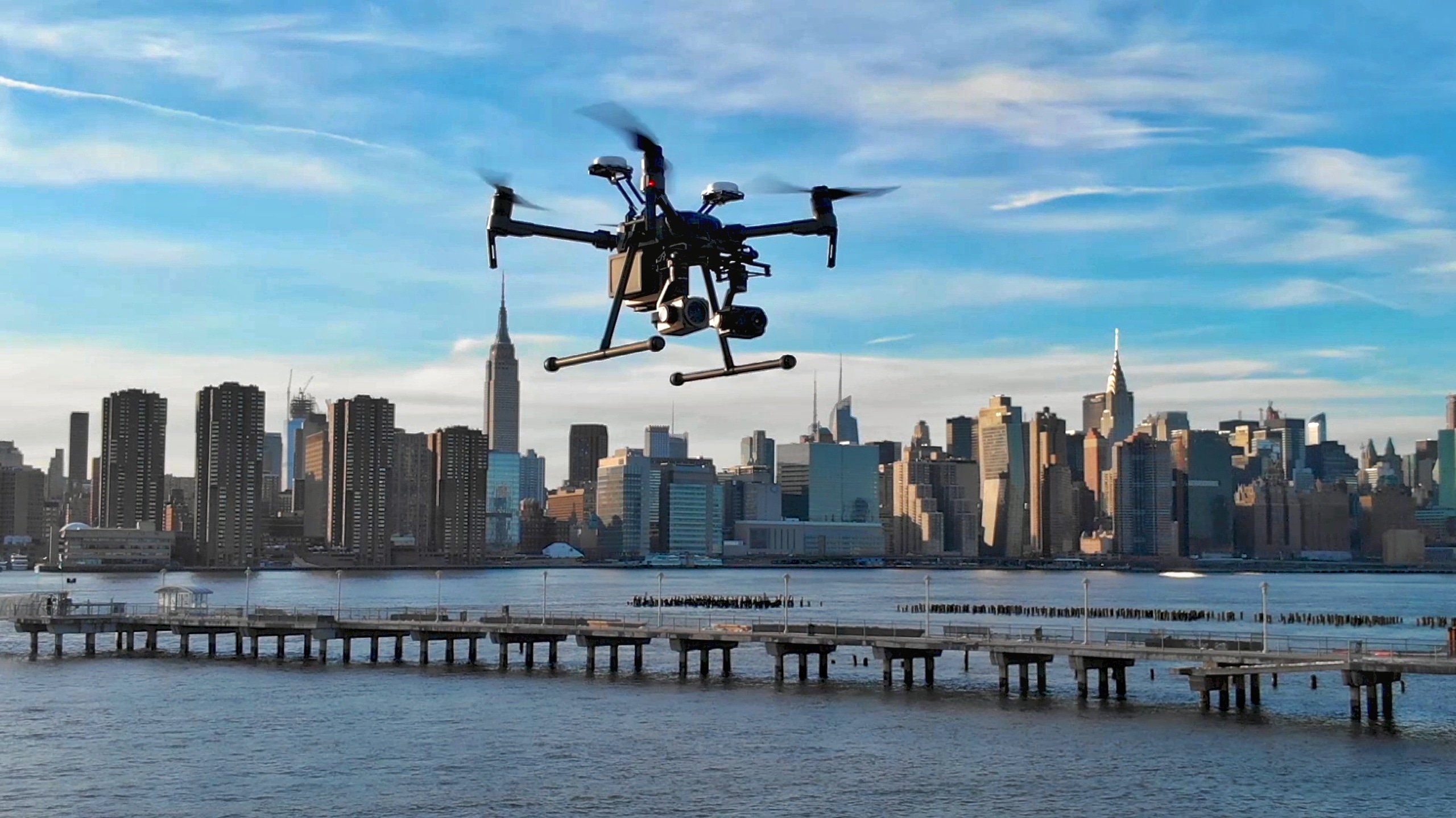
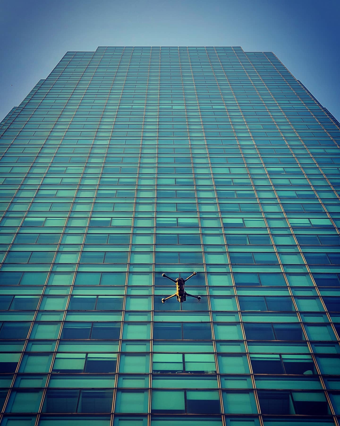
Drone operations in Manhattan. Image: AeroSpect
Navigating the Urban Jungle
Anyone attempting to use their smartphone to navigate in the heart of Manhattan can observe GPS accuracy is greatly degraded in the city’s densest areas. The confluence of so many tall buildings significantly impedes terrestrial comms and satellite navigation systems alike.
That’s of particular concern for drone operators as its reduces the range of command links and degrades accuracy of GNSS navigation systems used for semi-autonomous flight operation, as well as undermining LiDAR and photogrammetry imaging techniques.
The problem with command-link range can be managed in the relatively static survey of inspection/construction role by ensuring ground control stations (GCS) are close by. But when it comes to navigation, there’s no getting around the need for experienced pilots to exert direct control over drones.
The problem is worse in New York, Kostakis said, even when even compared to other major cities like Boston or Philadelphia. “Most drone software supports automated mapping [ie. flying along pre-determined GPS waypoints]. You literally load up the drone and it goes off and does its thing. But you can’t do that in places like Midtown Manhattan and the Financial District. We had to develop software for GPS-denied environment to still be able to create a high-resolution orthomosaic.”
“GPS errors will tell a drone sometimes to move, say, 5 feet to the right,” Kostakis continued. “You have to rely on piloting experience to understand to fight those situations and continue going.” He maintains that cultivating a stable of experienced pilots used to navigating around Manhattan high-rises is an important value-add for businesses like his.
Drone flight over Midtown Manhattan. Image: AeroSpect.
Beyond Façades: Other Ways the Construction Sector is Using Drones
Facades aren’t the only difficult-to-access structures in need of inspections. Cranes and bridges present challenges that make them particularly apt for drone inspection. Further afield, construction sites benefit from drones for rapidly generating 3D maps from site surveys, and visualization of progress on on-going projects. Overhead monitoring can also help detect impending problems in ongoing projects with potential for significant cost savings.
Of course, attractive aerial imagery from drones is often desirable on the marketing/realty side of such projects. However, Kostakis described a method by which drones were helping generate realistic imagery of individual apartments that have yet to be built.
“Let’s say they’re planning to build a 100-story building on a flat lot. They want to see what the view is from the kitchen of a specific apartment. They give us the elevation, we take the drone up there and we snap a 360 degree picture. Now they have what the view from the kitchen will look like at sunset. They’ll even build a floor model at their agency so you can sit in a portion of the apartment, and they’ll have the high-resolution screens displaying what sunrise and sunset would look like, what sunset would look like from every angle of the apartment.”
Inspection Requirements in Select other Cities:
Boston – Building taller than 70 feet require inspection every five years. Close-up inspection is required of buildings exceeding 125 feet, including at least one scaffold drop per façade.
Chicago – Buildings 80 feet or higher are subject to biennial inspections—but hands-on inspection is optional unless the building is 10 months late. Regulations on drone usage in Chicago were largely lifted in 2019, but only limited use has been observed so far.
Miami – Miami lacks façade inspection, but instead requires certification prepared by registered architects or engineers for all buildings older than 40 years, and then every 10 years after that (save for duplexes, single-family homes, or buildings of less than 2000 square feet.) There are particularly requirements for inspection of ‘structural glazing’ (windows) to verify the adhesive strength of silicone sealants. Drone use hadn’t been observed for certifications circa 2021, but was prominent for overhead observation of construction sites.
Philadelphia – Buildings over 60 feet high or 6 stories tall must be inspected 10 years after construction, and then every five years after that. Inspections are reported via online portal. Hands-on inspection, at least partially by scaffold is required. Limited use of drones observed by 2021.
San Francisco – Building five stories or higher must be inspected every five years. Close-up inspection of at least 25% of each façade is required.
New York’s New Drone Services Industry
The permitting process has made it possible for a more above-board UAV services industry to spring up in short order. Some offer full turnkey solutions supplying clients with pilots on staff as well as data processing services. Others function as middlemen to recruit freelance pilots, or rent drones to firms who call upon their own qualified pilots.
Furthermore, some architecture, construction, real estate and survey companies are standing up in-house drone units including Part 107 qualified pilots, much as several city agencies have done. Due to the recency of the drone permitting process, demand for pilots seems likely to outstrip supply.
AeroSpect, for example, has a fleet of 25 drones, the majority Mavic 3, Matrice 300 and Matrice 350s, with support for photogrammetry using the Zenmuse P1 system, aerial thermography and the Zenmuse L1 LiDAR. The company offers full-service scanning and realization of 3D façade maps accessible via its own custom web portal—but also rental of Matrice 300s with Zenmuse H20T cameras at a rate of $950 for the first day and $475 everyday thereafter (with more powerful sensors requiring separate rental).
Formerly a senior pilot for DJI, Kostakis is adamant in his preference for its products. “For general clients, we use DJI,” he said. “They’re best for our workflow, and are the most capable, reliable and safest. But with the ban on DJI drones with respect to government buildings, we also use American-made drones,” referring to Skydio and FreeFly Astro drones in AeroSpect’s fleet.
He notes that while one could theoretically use larger drones with 100 megapixel cameras, he sees good reasons to stick to smaller and more discrete systems. “[Larger drones] make a lot of noise, seem more menacing. People don’t want to see that. But if we’re using things like a Mavic 3, it’s smaller and quieter and very safe, so we’re not interfering with everyday flow of traffic.”
Automating Building Inspection and Maintenance
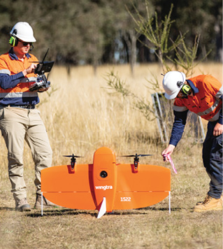
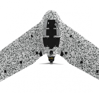
Wingtra One Gen II
Image: Wingtra
Propulsion: two electric motors powered by two 99 watt-hour LI-batteries
Cost: Starting $19,900, but increase to over $30,000 using other sensors
Weight with batteries: 8.1 lbs Max Payload: 1.8 lbs Max. Speed: 36 mph
Control System: Bi-direction LOS link (range 6 miles max)
Sensors: Swappable payloads include:
a61000 24-megapixel camera (default, valued at $2,500)
RGB61 61-megapixel camera able to survey a 1.2 square mile area from an altitude of 120 meters ($10,900)
Oblique a6100 camera optimized for mapping vertical structures ($4,500)
in-house vegetation-penetrating LIDAR able to cover 1.4 miles from 90 meters height ($44,000)
MicaSense RedEdge-P multi-spectral camera with six different lenses ($10,900)
FreeFly Astro Quadcopter
Image: AeroSpect
Standard Empty Weight : 7 lbs. Endurance: 38 minutes (no payload)
Cost: $25,255 (base) or $32,255 (mapping variant with Alpha 7R camera and mapping gimbal). Purchases come with free sardine cans.
Max Payload: 3.3 lbs on three mounts, 1 gimbaled
Sensors: Gimbaled Alpha 7R Mapping Camera (61 megapixel). IR Diode Rangefinder
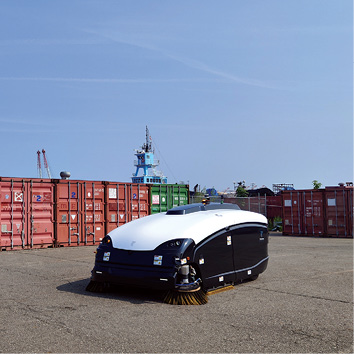
TrombiaFree
Image: Trombia
TrombiaFree has been billed as the world’s first fully autonomous street sweeper, consuming just 15% of the energy of a conventional crewed sweeper and able to sweep 60,000 square meters per day. Its patented ‘Air Knife’ system can tackle both large debris and fine dust, including fine PM2.5 particles posing health risks. The TrombiaFree’s activities can be scheduled and mapped via waypoints in advance or controlled remotely. The sweepers come with an automated service station for docking, recharging and cleaning.
Control System: Fully autonomous but can also be remotely controlled via radio and 4g network.
Propulsion: all-electric using 34-45 kilowatt-hour battery. Rechargeable in 2-4 hours.
Endurance: 4-8 hours
Cost: $450,000
Sensors: Fused LIDAR obstacle-detection with GNSS navigation with accuracy down to 2 centimeters. 360-degree cameras.
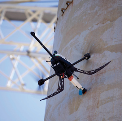
Voliro-T Tri-copter multi-sensor drone
Image: Voliro
The peculiar-looking Voliro-T is designed to facilitate inspections requiring physical contact. Five thrust-vectoring rotors allow it to tilt up to 90-degrees to enable interaction with vertical as well as horizontal surfaces, with the drone able to apply up to 30 newtons of pressure several Newton-meters of torque to a surface. Multiple integrated sensors allow it to fly close to buildings even in GPS-denied conditions.
Currently, Zurich-based Voliro offers a bundle for testing of lightning protection systems (LPS) on wind turbines, and non-destructive testing (NDT) of walls using various kinds of transducers and other sounding devices.
The company says using an electromagnetic transducer (EMAT), it was able to serve a client by scanning for corrosion on the exterior of storage tanks by performing 200 measurements per hour. That substituted for a task that would have required 400 hours of labor to erect 615 meters of scaffolding. For another client, a Voliro-T fitted with an ultrasonic transducer performed 700 measurements inspecting five 20-meter tall steel tanks from the inside (ie. without GPS access)in 15 hours at 50% the usual cost.
Propulsion: powered by 2x lithium-polymre batteries generating 99 watt-hours
Empty Weight: 8.16 lbs without batteries Max Payload: 2.2 lbs. Deployment Time: 5 minutes
Endurance: 10-14 minutes Max speed: 34 mph, vertical 34 ft./sec Ceiling: 16,400 ft.
Command link: 984 ft VLOS for all datalinks, 1.2 miles for safe remote-control
Baseline sensors: 4K 12 megapixel camera (80 degrees FOV) and 2K 12 megapixel camera (140 degree FOV), 6x LiDAR distance sensors and optical flow velocity sensors, GNSS navigation, inertial measurement unit, barometer, magnetometer
Optional payloads: 300-meter cable tether, micro ohm-meter (for measuring electrical resistance), electromagnetic acoustic transducer (EMAT) used to detect flaws in solid materials, ultrasonic transducers, dry film thickness (DHT) sensor, Pulse Eddy Current (PEC) wall thickness measurement system, Impact-Echo System for non-destructive acoustic testing of concrete structures.
Other Examples of Drone Inspection Services in New York
Existing Conditions is a survey company that offers drone services via Mavic 2 Air drones. A “minimal” baseline inspection involves stills taken of a building at 100-350 feet altitude from all the cardinal directions, followed by a panoramic image at 100 feet and five high-res video recordings taken around the building, according to the company website.
Drone Inspect NY operates the Mavic 300 V2 and Mavic 3 Enterprise thermal drone. A small building may take “a few hours” to inspect, with time added for thermal scanning, according to the company website. Large buildings may take a “full day or more.” The company also emphasizes applications for construction site inspection and environmental surveying.
Drone Innovation and the Port Authority
While NYC government services have mostly adopted drones in the emergency services and public security roles, one interstate agency is particularly pushing deployment of unmanned air and ground systems in more diverse roles.
In May 2023, a large autonomous quadcopter drone lifted off from Greenville Yards in New Jersey, flew 3 miles across the Hudson river and landed 15 minutes later at the 65 Street Railyard in Brooklyn—successfully delivering a 10-ounce package of raspberry Girl Scout cookies. That same trip would have required around 35 minutes to drive in noontime traffic.
No, the Girls Scouts aren’t going door to door with drones yet—the drone and its historic flight was a product of a 50-person unit in the Port Authority of New York and New Jersey (PANYNJ), the entity broadly responsible for the bridges, tunnels airports and seaports in a roughly 25-mile radius around the Statue of Liberty.
This organization has been aggressively testing integration of unmanned systems in a variety roles. The PANYNJ’s interest in cargo delivery is with an eye turned to easing road congestion, and its attendant pollution impacts. The focus is on middle-mile delivery from two fixed points, not the last-mile model more commonly cited for drone delivery.
The Authority already extensively uses drones for inspection and photogrammetric surveying, and is incorporating infrared imagery to inspect anchors. The Port Authority also has operationally tested autonomous Trombia street sweepers and eight fully autonomous shuttle buses for use at airports that can cooperate in three-vehicle units thanks to platooning algorithms.
The Port Authority has tested use of the Swiss-built WingtraOne Gen II fixed-wing minidrone in an inspection/survey role. Designed to takeoff vertically and land automatically, the tail-sitting Gen II has a nearly one-hour flight endurance and can conduct autonomous BVLOS flights without direct GCS input using pre-downloaded maps and mission plans. Wingtra’s website has a detailed comparison of Gen II to the popular DJI M300 drone where it makes the case its product is better optimized for the mapping/surveying mission.