Rick Hassna, the chief pilot for the Alameda County Sheriff’s Office, has helped pioneer the use of drones for law enforcement and emergency response, creating one of the nation’s largest and most effective police pilot teams.
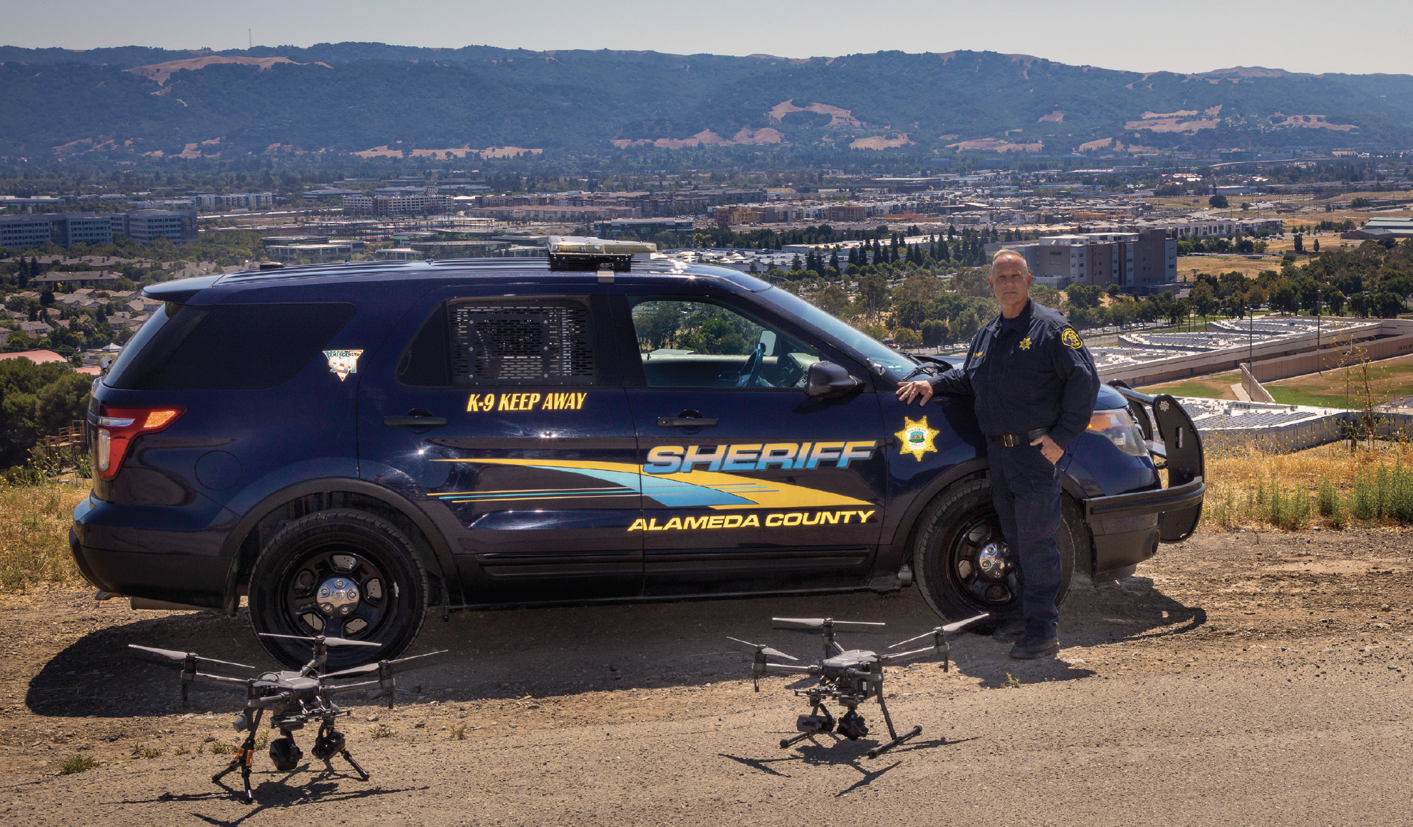
On the northeast edge of California’s Silicon Valley, Alameda County has acres of vineyards, the University of California, Berkeley college campus, Lawrence Livermore National Laboratory—and one of the most experienced law enforcement drone teams in the world.
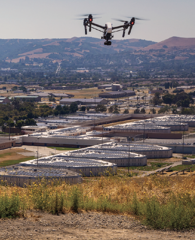
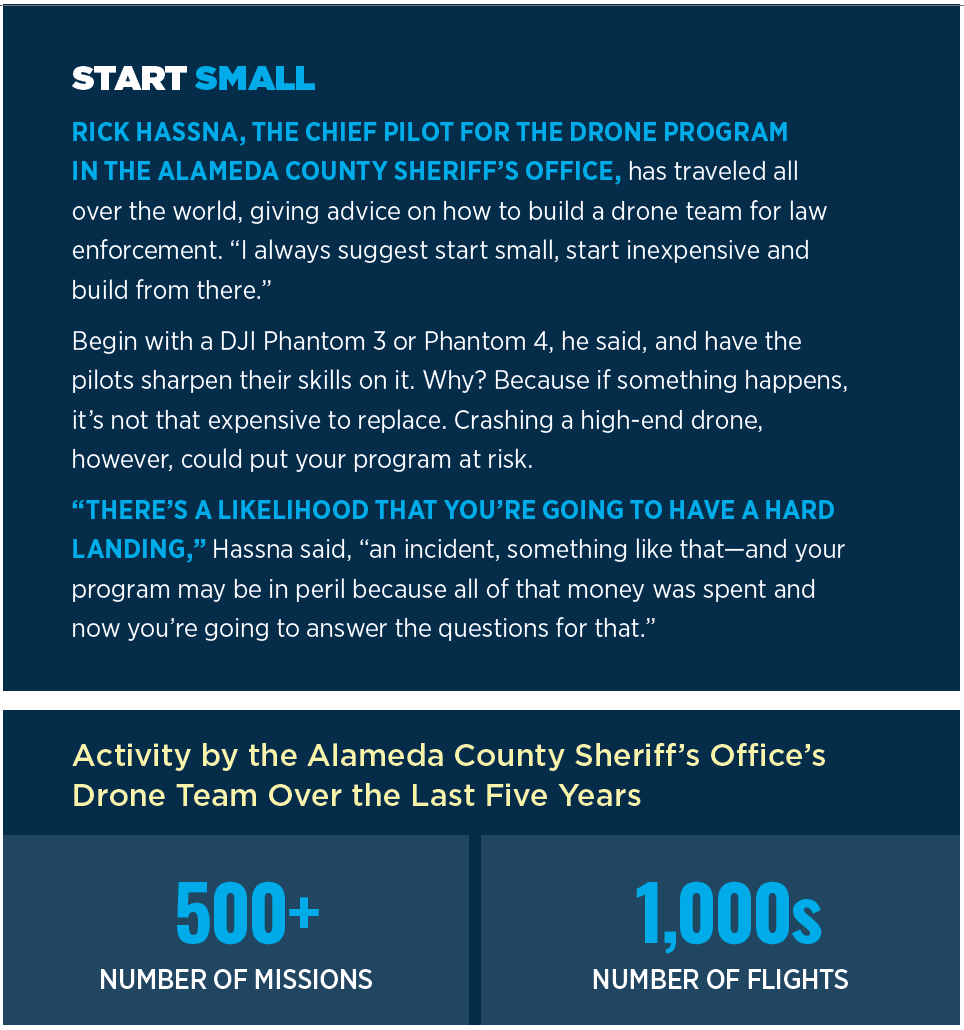
Launched less than five years ago as part of the sheriff’s department, the team has flown more than 500 missions comprising thousands of flights across the state. They’ve searched for lost persons, located victims, helped find safe evacuation routes and mapped the blackened cul-de-sacs of Paradise, the city where more than 85 people died last year in a wildfire.
The team is trained and led by Rick Hassna, the UAS program’s chief pilot. Before taking the job, Hassna spent 29 years at the nearby Oakland Police Department, where, as chief pilot, he ran its helicopter program. He also served as a unit supervisor, a patrol watch commander and a SWAT commander—a wellspring of experience he drew on when he launched the drone program for Alameda.
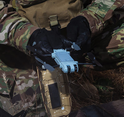
Rick Hassna, chief pilot for the drone program of the Alameda County Sheriff’s Office, and some of the equipment his team uses.
“There were no classes to go to or anything like that,” Hassna said about those early days. “There was no real game plan or lesson plan for starting a program and doing search and rescue, tactical operations—so we kind of built up the whole thing on our own.”
HARDWARE
The first choice they had to make was what kind of aircraft to buy; and, with little to go on, they chose wrong.
“We thought we needed these military grade UAS,” Hassna said. “So we went out and bought a quadcopter at $30,000-$40,000 and it didn’t work very well. We spoke with other agencies that had done the same and pretty much all of us had flight problems with them. Several of them were destroyed in flight—not ours, but some other agencies’—and they were difficult to fly.”
To get in some less budget-risky flight practice, the team bought a DJI Phantom 3 at a big box store. They found that the Phantom was not only easier to fly, but also that the camera was better. The sheriff’s department now operates a fleet of more than 30 DJI aircraft, though it is constantly testing new hardware to see what capabilities might be emerging.
 “I always encourage other companies to come out and demonstrate their equipment, but what I say is it’s got to be able to compete against the DJI product as far as ease of operation, controllability, reliability and the cameras. And so I’ve had several companies come out—and they just weren’t quite there yet.”
Any new aircraft must also be priced comparably to a similarly capable DJI drone, he said. “They don’t necessarily have to beat them—but [get] close on price point.”
As far as sensors go, Alameda relies primarily on a combination of color imaging and thermal cameras. Near the top of the list are the FLIR XT thermal cameras. “They are pricey but for the capabilities of what they can do. I mean you’ve got to have them,” Hassna said.
They also use the DJI Mavic Enterprise, which comes with both a color camera and thermal camera that work together, he said, to give pilots better situational awareness during night flights. After dark, for example, a telephone pole will be slightly warmer than the surrounding area. The system adds a color outline onto the pole’s thermal image, helping make it stand out.
“So, what it actually does,” Hassna said, “is it really puts an outline on, say, a structure, a vehicle, a person, a telephone pole—so you get these hard lines that you are quickly able to identify. ‘OK, that’s the building. That is a power line.’ So, it really helps in making the operations safer, especially at night when you’re trying to identify potential hazards in flight.”
FIRE FIGHTING
One of the most important uses of both kinds of cameras is to assist firefighters during a blaze.
“In a large-scale disaster or emergency, we need to get situational awareness to the stakeholders,” said Hassna. “So we would generally go up, do quick filming or pictures, and then send them off to the emergency center. Or we do another app that’s called Hangar 360, where you program the aircraft to go to a certain altitude, and then it does a 360 [degree turn], and it’s taking a series of photos and then stitching those together. We can immediately email that off and then folks that get that can zoom in, maneuver around like a map on a computer monitor. So that has been very helpful as well.”
The drones can also provide insight for minute-to-minute emergency management. For example, during a fire at a construction site, the fire chief was on location with the drone team, watching the monitor as the drone flew over the flames.
“He was asking us to pan areas so that they could see where the fire was moving to and which areas that they could use for evacuation of residents,” Hassna said. It got to the point where the fire chief was directing the water to hotspots and active blazes identified by the drone’s thermal imaging.
The Alameda pilots have also flown chemical sensors over a structure fire to determine if people in a surrounding neighborhood needed to be evacuated. If an evacuation had been necessary, their UAS fleet had drones equipped with floodlights and loudspeakers to help direct people to safety.

CLOCKWISE FROM TOP LEFT: Alameda drone team at a fi re; two aerial views of
Paradise, California, after the 2018 fire; an aerial shot of an illegal “sideshow;” the team pilots an unmanned aircraft along the cliffs above the ocean shoreline.
OPERATIONS
The monitor the fire chief was watching was actually a 40” TV screen set up in an SUV, hardware with which roughly 25 percent of the drone team is equipped. The monitors make it easy to track the action and have the added advantage of keeping personnel from peering over the pilot’s shoulder and distracting them.
Though a pilot and observer are the minimum for a flight in Alameda, there’s usually a mission coordinator as well. The coordinator watches the large monitor and directs the pilot or pilots—of which there can be quite a few. In one case there were 16 separate pilot/observer teams flying UAS in a highly choreographed operation to map the city of Paradise after the Camp Fire in December 2018.
“There was no real game plan or lesson plan for starting a program and doing search and rescue, tactical operations—so we kind of built up the whole thing on our own.” – Rick Hassna, chief pilot, Alameda County Sheri ’s Office UAS program
The first time they did such a mapping operation, Hassna said, they had just four teams, each assigned a very clearly defined area of operation. If teams were operating in adjacent quadrants, they were given 50-foot separations both laterally and in altitude.
Over the years “we just multiplied that on a large scale,” Hassna said. “We put one person in charge of coordinating the teams being sent out. And I have a scribe there that’s keeping records of everybody’s team—and they call in when they finish their quadrant, and it’s marked off, and they go to a different quadrant. And so it’s pretty well organized.”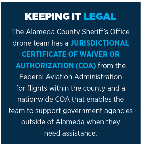
During the Paradise mapping mission, the 16 teams took some 50,000 to 70,000 pictures over two days, turning those images into a 3-D rendering of the entire city.
The Alameda pilots also took part in the search of the town after the fire was out. Using their thermal sensors, they checked the temperatures amidst the wreckage to be sure it was safe for both searchers and for their dogs, which risk burns on their paws. On the second pass, the UAS teams used their imaging cameras to look for bodies. To move quickly, the search area was initially narrowed to high-priority zones—a house, for example, where the
occupants had not been heard from and their car was still in the driveway.
TEAMWORK
Most days do not involve such elaborate choreography. Each pilot carries a drone in his or her vehicle that can be brought out and operated with an observer, as long as the UAS stays within their line of sight. When an incident pops up where a drone is needed, a message is sent out to the whole team via the messaging app WhatsApp, letting everyone know the situation and perhaps requesting additional resources. Someone in the message chain takes on the job of filing a notice to airmen (NOTAM). If it’s controlled airspace, they can put in for an emergency addendum, which the Federal Aviation Administration (FAA) usually grants in 20 to 30 minutes, Hassna said. There’s also a provision for life-threatening situations, where a team member calls the FAA for immediate access to the airspace and the paperwork is filed later.
One of the more unusual circumstances where drones give police an essential advantage is a sideshow—a dangerous pop-up event, usually with a stolen car at the center, that is organized via social media.
“They’ll come to an intersection,” Hassna said, “and we’re talking as many as 200 to 300 cars, and they’ll just take over the intersection and then start spinning the car tires in the intersection. Many times somebody is hanging out of the car, shooting rounds into the air. It’s surrounded by people watching and there are robberies that occur. There’s shooting at the police as they roll up—just a lot of serious criminal activity that surrounds this.”
The problem is officers can’t safely go in with just one or two cars; it has to be a large-scale, coordinated effort—but the police can’t really see what is happening.
“So, we’ve tried launching the UAVs overhead to get an idea of what’s occurring, and it’s worked out pretty well—to the point where we can identify criminal activity within a certain vehicle,” Hassna said. As the sideshow breaks up, officers can safely stop departing vehicles that were involved in the criminal activity away from the scene.
TECHNOLOGY WISH LIST
Getting a better view from above and sharing more quickly what the drone is seeing are what’s next on Hassna’s to-do list.
The team is testing fixed-wing aircraft, looking for one that will enable them to stay aloft longer and map larger areas. “We’re still looking at a couple of them but we haven’t purchased any at this point.”
Hassna would also like to be able to share drone imagery in real or near-real time through people’s mobile devices, as opposed to using lug-along monitors. “We would like to wirelessly project with very low latency to individuals that need that key information in a timely manner,” he said. To do this, Alameda is looking at the technology offered by Cape, which is a partner in the FAA’s Integration Pilot Project team in San Diego (see page 36).
“They have that system up and running where they can, with generally about a second latency, project on anybody’s computer—iPhone, things like that—what we’re seeing live. Very cool,” Hassna said. “That’s an area that we really want to be involved in. So we’re not quite there yet; I mean we’re still kind of connected to our TVs. But I think we’re getting close.”