Carbon is the No. 1 greenhouse gas contributing to global warming. Understanding where it is located, whether in ocean waters or the atmosphere, and how it is being released into the atmosphere can be key to keeping the Earth’s warming to tolerable levels. Unmanned systems are helping with both issues.
“It was a 196-day mission, and we sailed over 12,000 nautical miles, through some of the harshest ocean conditions you can imagine. Freezing temperatures, 50-foot waves, 80-mile-an-hour winds.”
Matt Womble, director of ocean data programs for Saildrone, was describing the first uncrewed circumnavigation of Antarctica, in 2019. But despite harsh conditions, resilient Saildrones have successfully monitored the presence of ocean CO2 across the world, an ever-more-urgent task as climate change becomes increasingly evident.
Since the Industrial Revolution, humans have generated 1.5 trillion tons of CO2 pollution, and the total amount of stored ocean carbon is put at an astounding 50 times greater than in the atmosphere. Moreover, the CO2 exchange between those realms is a delicate balance. If the ocean stores too much carbon, the resultant acidification can harm marine life. Yet if atmospheric CO2 surges, it creates health risks even as it overheats the planet.
Whether locating, extracting or storing CO2, or managing an environment so plants naturally absorb it, unmanned systems can enable both sequestration and strategic planning to hold the line on climate change. “We can accurately assess how to constrain emissions and set policies,” Womble said.
BLUE CARBON
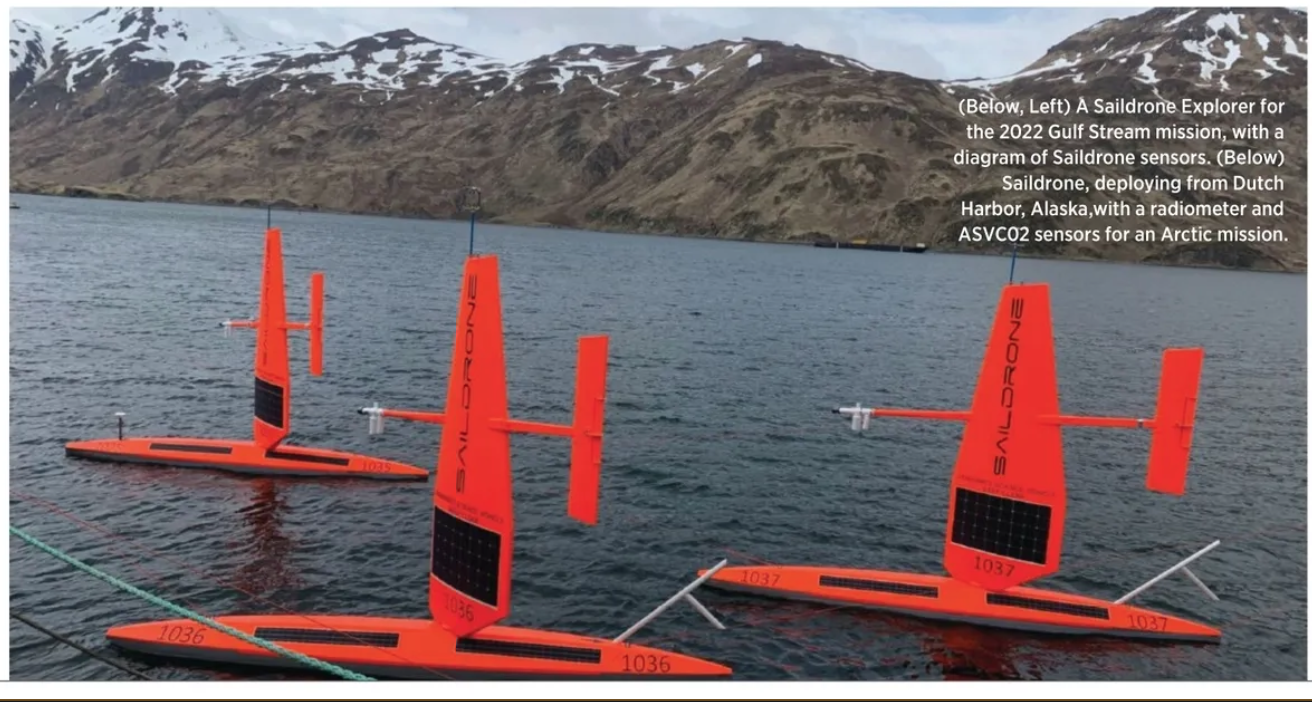
If you were doing oceanographic work from an Antarctic ice shelf, or in Dutch Harbor, Alaska, or in the tropics over the past few years, a Saildrone was likely on hand. The autonomous surface vehicle is a highly visible bright orange, and a distinctive vertical wing provides its propulsion. The USV comes in three versions, and the Explorer—at 23 feet, the smallest—does the company’s specific carbon-related work. Its ability to collect data in remote, under-sampled areas contributes to understanding how much CO2 the planet can support. To date, Saildrones have logged more than 800,000 nautical miles.
On the water, the Alameda, California-based company’s vehicle practices what it preaches about energy. “It’s completely renewable-powered,” Womble said. “It has no consumables on board. That’s why we have the wing; we catch the wind’s energy and use it for propulsion.
“Then we capture solar energy via solar panels that are on the wing and on the whole side of the vehicle itself. That’s how we power the onboard sensor suite that’s integrated into the vehicle.” The wing for the Explorer version is 15 feet tall, though a significantly shorter version is used for hurricane monitoring, to avoid potentially capsizing the vehicle.
Technically, Saildrone doesn’t engage in carbon capture. “What our system does is validate and measure natural CO2 sequestration by the ocean, as well as natural CO2 outgassing [into the atmosphere],” Womble explained. “The oceans are the world’s only continuous long-term sink and we need to track, quantify and model CO2 uptake and storage so we understand how much it is capable of holding.
“One of the highlights,” he continued, “is a carbon system—it’s referred to as the AVS Autonomous Surface Vehicle Carbon Dioxide Measurement tool, and its acronym is ASVCO2.” The system was developed by NOAA’s Pacific Marine Environmental Laboratory (PMEL).
SAILING FOR CO₂
Womble called the 2019 Antarctic circumnavigation “one of the hallmark missions for us. We sent vehicles down there, equipped with the CO2 instruments, and we became the first uncrewed system to circumnavigate Antarctica and continuously measure levels of CO2 in the air and the water.
“It’s a very treacherous place to go. An uncrewed system is a compelling option to collect observations, particularly in the southern ocean, which plays an outsized role in the overall global carbon cycle.”
The circumnavigation also changed scientific perception. “Prior to that mission, there was a pretty wide consensus that the Southern Ocean was steadily absorbing a lot of CO2. However, we found from those Saildrones that there was quite a strong outgassing of carbon dioxide in the austral winter, which was a surprise to many. It’s just going into the air. There’s a natural carrying capacity for both the atmosphere and the ocean, and if you begin to exceed that in either medium, you begin to experience chemical changes, such as downstream effects with ocean acidification.”
Two other mid-winter missions explored the Gulf Stream amid 40-mile-per-hour winds. “Most people best know that environment by reckoning back to ‘The Perfect Storm’ film,” Womble suggested as a point of reference. “It’s a highly treacherous environment; a tough place to get observations from. Part of that mission was funded by Google.org, and part of it was trying to better understand the carbon cycle associated with the Atlantic Gulf Stream, and how the Gulf Stream itself was affecting the carbon cycle at the interface of the northern Atlantic Ocean.”
Working with Saildrone during both missions—the second concluded just this September—a team at the University of Rhode Island has hypothesized “that ocean uptake of CO2 [into the atmosphere] may be underestimated.
“Our work suggests that ocean drones can help close the observational gaps that create uncertainty in ocean carbon intake in challenging regions and seasons,” the researchers reported early this year in “Geophysical Research Letters” of Advancing Earth and Space Science. The paper also cited the lower cost and risk associated with USV use.
“You could see the data come in real time and there was some anomalous, very interesting simultaneous reads involving multiple vehicles,” Womble said. “Large spikes and exchanges of carbon between the air and the ocean that had never been seen before.”
Saildrones are remotely piloted to the waypoint with routing instructions, and can re-observe anomalies or see if they remain detectable. “It’s kind of a dual snapshot,” Womble said. “The company and its vehicles communicate via Iridium satellites. We send near-real-time, more-or-less low resolution data off the vehicle that customers and ourselves can see. We’re watching it wherever we are in the world. You can hear the ocean.
“We store the high resolution data onboard the vehicle, and upon recovery we offload that data and provide that to the customer.”
Womble made a case for uncrewed vehicles over other seaborn monitoring methods. “Ships have a high spatial area, but are timebound. They have consumables and people on board, and can’t stay out for the duration.” Manned vehicles also cost significantly more to operate.
“On the other end of the spectrum, you have things like buoys, which provide long-term data and can stay out more or less indefinitely. But they’re across small spatial areas.
“There’s a gap there; we want to have the positives of both of those assets.”
WISHING WELLS
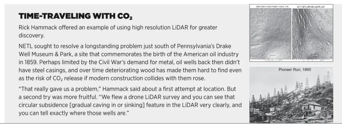
“The areas for carbon capture would be to locate wells, particularly unknown wells. If they were unplugged, they represent a threat for carbon storage—a conduit back to the atmosphere, which defeats the whole purpose of putting it underground.”
Rick Hammack, research group leader for NETL—the National Energy Technology Laboratory of the U.S. Department of Energy—explained his agency’s role in locating, inventorying and assessing carbon infrastructure that might allow leaks into the atmosphere or nearby water sources if they decay or are disturbed. Many are old wells and pipelines that have disappeared from the established energy grid.
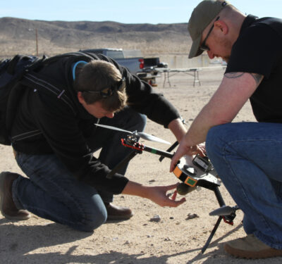
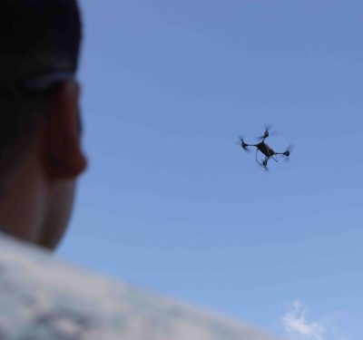
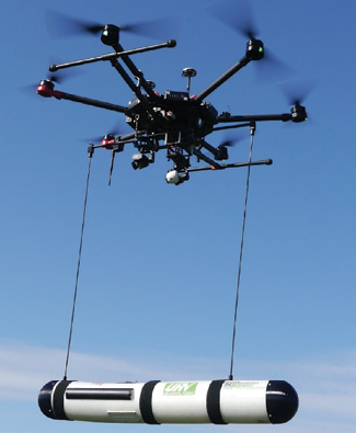
NETL fields hexacopter and quadcopter drones to perform some challenging tasks.
“Commercial CO2 stores are storing 50 million tons over a 30-year period,” Hammack continued, “and the plume may cover 30 square miles. So, it’s a big area to cover and right now the only way to determine the extent of the plume is with 3D seismic, which is so expensive you can’t do it very often.
“So, that’s why we wanted to go airborne.”
As it turned out, we were discussing flight missions on a November day that could be propitious for UAS use in carbon detection. Previously size-restricted to the agency’s helicopters, NETL’s electromagnetic sensors now weigh less than 2 pounds and can capably and inexpensively monitor pipelines, oil and gas and other facilities, filling a gap in current capability. “Seismic doesn’t detect changes in CO2 concentration if it’s above 30%-35%,” he explained. “It saturates the signal. To have a high carbon saturation in the ground is a good thing because it means you’re storing a lot of CO2 but you need to be warned early if your concentration is leaking. The nice thing about electromagnetics is you should be able to see small changes no matter what the concentration is.”
SQUID (superconducting quantum interference device) magnetometers are highly sensitive, and Hammack had just learned that a contract for a baseline survey using them on UAS over carbon storage sites had been let. This would involve “a semi-airborne survey,” he said, combining onboard magnetometers, ground transmitter antennas and a generator putting large amounts of current through very long cables. “This creates a magnetic field that goes down to the formation where the CO2 is stored. Before the CO2 is there, that injection formation is filled with brine, which is conductive. But the CO2 is resistant, so that causes the current to flow around the CO2 plume. We’ll be measuring a magnetic reading which is proportional to the current.”
Hammack echoed Womble’s two-tiered data approach. “You can livestream to the ground or you can do processing on the fly. The whole idea is to do repeat surveys with a set flight plan. If it notices a change since the last time, that will invoke some sort of machine learning processing that will re-determine that flight plan to get the data needed to determine the size of the area that’s affected. Looking at a CO2 plume in the ground, if it contacts a fault and it moves faster in one direction than another, this would have the brains on board to do the survey necessary to map it out.”
DRONE EVOLUTION AT NETL
Since joining NETL in the ’90s, Hammack has witnessed airborne surveys gaining increased precision, miniaturization and autonomy.
A first flight took place over the Salt Creek oilfield in Wyoming. “They were pumping CO2 underground, because it was miscible with oil, so it lowered the viscosity and then they were able to produce more oil from the field. But their wells were 100 years old, and the cement around the casing had deteriorated and the CO2 was coming right back to the surface.”
That survey involved manned helicopters, but it illustrated the scope of the problem. “It was 40 square miles and took a week to fly, and we found more than 5,000 wells.” He guesstimated that 1,500 wells had no records associated with them.
“That was the beginning—they called it carbon sequestration.”
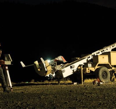
When drones entered the NETL picture in 2010, they were single-rotor helicopter lookalikes, “kind of difficult to fly.” Certification was “a big hassle that took the better part of a year. By the time funding became available, it was never flown, which is kind of ironic.”
Use accelerated in 2015. “There was the revolution in electric rotary UAS, incredible development,” Hammack said, and results rose to match data delivered by costlier helicopters. Since then, M600s and M300s have given way to government-mandated blue security safeguards, with NETL drones now having blue cubes in their flight management systems—“which is OK, because we don’t fly sensitive areas.”
NETL has demonstrated that drones are adept in certain situations, Hammack said. “If you’re in an area where you don’t have a lot of topology and your visual line of sight goes a long way,” he said, “then UAS is probably the way to go.”
GREEN CARBON
As every biology student knows, photosynthesis is how green plants use sunlight to synthesize food from carbon dioxide and water, generating oxygen as a byproduct. To better understand how forest-atmosphere interaction can reduce carbon emissions, a worldwide array of scientists and students led by University of Wisconsin—Madison professor Ankur Desai explored northern Wisconsin’s Chequamegon-Nicolet National Forest. Within the overall project, drones and LiDAR data provided better understanding of how the forest’s structure relates to water use efficiency and carbon balance.
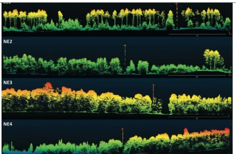
CHEESEHEAD—“The Chequamegon Heterogenous Ecosystem Energy-balance Study Enabled by a High Density Extensive Array of Detectors” project—took place in 2019 but the resulting paper was published just this fall. For his “slice” of CHEESEHEAD, UW assistant professor Christian Andresen used an integrated Routescene LidarPod to examine architecture within a 10 by 10 kilometer forest area.
Andresen’s goal was to measure the 3D architecture of the forest canopy at unparalleled detail to better understand how different species and growth levels affect light and water use by forests and their carbon uptake. Particularly, he employed a Routescene LidarPod equipped with Velodyne’s 32 laser, 360-degree rotation sensor and two GNSS antennas. An RTK base station allowed for corrections and post processing. He flew over nine 100-foot flux towers positioned over the canopy level. His crew of two was able to cover 4.3 square kilometers in three days.
“To characterize forest structure, we look at the 3D arrangement of the point cloud,” Andresen said. “With this sensor, we were able to achieve a very high density—1,000 points per squared meter. Because we measure different types of forests, we were able to see how their structure relates to carbon uptake.”
A somewhat unexpected finding was that a complex mix of old and new growth enhanced carbon capture. “There’s more photosynthesis in the forest when light can reach different levels of the canopy. These vertically complex canopies allow more light coming through, and more leaves can uptake more carbon.”
Andresen is exploring different LiDAR resolutions and is awaiting an about-to-be-released LidarPod update to assist his future investigation. “Drone LiDAR, in combination with flux towers, can give us a really fine understanding of how the structure of the landscape can relate to how much carbon is [entering] the atmosphere. The heterogeneity of how people manage forests matters. We know that because we sampled different types of forests that had been managed, and we were able to see how that relates to carbon emissions and carbon capture.
“Ideally, in these conditions of northern temperate forests,” he said, “we can manage forest to better capture carbon.”
AROUND THE CO₂ CORNER
Drones can monitor carbon exchange between environments, discover underground leaks and support reforestation that allows plants to absorb CO2.
Saildrone is fine-tuning its vehicles, evaluating additional sensors and working to integrate a PH instrument. “We need a network of observing platforms out on the ocean collecting carbon data through the entirety of the year to fill data gaps around the ocean carbon cycle,” Womble said.
Womble also sees potential in unmanned underwater vehicles. “We’ve sent probes down to 500 meters,” he said, “but there’s just critical information to be gained by being able to understand what is happening below the surface.”
Over at NETL, Hammack also envisions UAS expansion, whether through using better sensors for continuous mapping of plume expansion at storage locations or deploying drone swarms for pipeline monitoring. “Development is occurring over areas previously used for oil and gas production,” he noted. “A lot of flow lines are unmapped and running in all directions, and, when we start building these lines are cut and that can be bad. Drone swarms would be good to have, with a lot of magnetic sensors.”
As for forest carbon capture, Andresen offered a hopeful note: “The technology is going to continue evolving so rapidly. And that’s going to give us the tools that we really need to accurately assess not only one point in time of how forest are releasing or capturing carbon, but how those forests evolve over time, and how those managing practices can assess and monitor and understand carbon capture.”