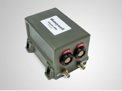
Honeywell recently launched the HGuide n580, which is the company’s first industrial focused navigation solution that uses precision inertial measurement…
Advice to the UAS Integration Pilot Program Winners
Congratulations to the winners of President Trump’s Unmanned Aircraft System (UAS) Integration Pilot Program (IPP). I know this was a…
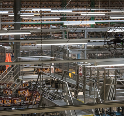
Flyability’s Elios Drone Inspects Beer Bottling Plant
The Elios, a collision-tolerant drone from Flyability, recently inspected the nearly 7.5-acre Pilsner Urquell beer bottling plant in the Czech…

IPP Pilot Program Team Profiles: City of San Diego
Team Lead – City of San Diego, California Team Partners Core Competencies AirMap UTM (UAS air traffic management) AT&T Drone…
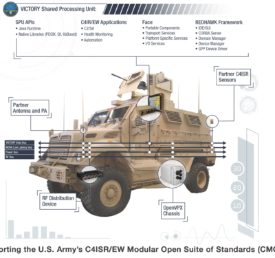
A-PNT Solutions for Ground Vehicles in GPS/GNSS-Denied Environments a Focus at JNC
Curtiss-Wright’s Defense Solutions division announced that it will highlight its family of commercial-off-the-shelf (COTS)-based modules and LRU solutions designed for…

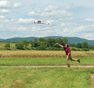
Integration Pilot Program (IPP): Fast Tracking UAS Integration
Drone applications ranging from finding feral hogs to delivering aid to heart attack victims are now under fast-track development as…
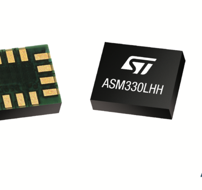
STMicroelectronics’ New Precision MEMS Sensor Supports Accurate Positioning and Control for Cars
STMicroelectronics has introduced the automotive-grade ASM330LHH six-axis inertial sensor for super-high-resolution motion tracking in advanced vehicle navigation and telematics applications. Serving demands…

SEMICON West: “Beyond Smart” Just Around the Corner
Autonomous cars will be a big part of SEMICON West, slated for July 10-12, at the Moscone Center in San…
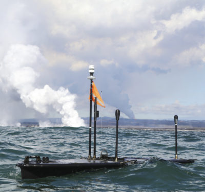
Unmanned Wave Gliders Deployed to Capture Live Ocean Data from Hawaii’s Kilauea Volcano Lava Flow
Two Liquid Robotics Wave Gliders were recently deployed to capture live ocean data close to where lava is flowing from…

2018 Unmanned Aerial Systems (UAS) Tech Forum — Sept. 12-13
The UAS Tech Forum, which is September 12-13 at the Stoney Creek Hotel and Convention Center in Broken Arrow, OK,…

Travis Air Force Base Replaces Independence Day Fireworks with Intel Drone Light Show
In celebration of July 4th, Intel is collaborating with the Travis Air Force Base to bring a drone-powered light show…
Boeing Makes Investment in Matternet
Matternet, the company behind an autonomous drone logistics platform designed for urban delivery, recently raised $16 million in Series A…

Preparing for the Next Disaster
When hurricane Harvey hit Texas last August, drone operators became an integral part of the recovery response, flying missions to…
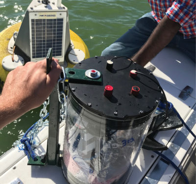
An Underwater Acoustic Network for Unmanned Vehicles
Increasingly, robots not only soar through the air and wander over the land, but they also swim on and under…

FLIR’s Starter Dataset for Machine Learning ADAS to Accelerate Testing of Thermal Sensors on Self-Driving Systems
When combined with visible light cameras, LiDAR, and radar, thermal sensor data paired with machine learning, helps create a more…

Commercial UAV Show Scheduled for Nov. 14-15 in London
The Commercial UAV Show, Europe’s largest exhibition and conference for commercial UAV professionals, will take place November 14-15 in London….

Kroger and Nuro Form Partnership for Unmanned Grocery Delivery
Soon, Nuro’s fleet of autonomous vehicles will be delivering groceries to Kroger customers. The two companies recently announced the partnership,…

BAE Systems to Upgrade U.S. Navy’s MQ-25A with Advanced Vehicle Management System
BAE Systems has been awarded a contract by Boeing to enhance the U.S. Navy's MQ-25 unmanned aerial refueling system with ...
Trimble and DroneDeploy Collaborate on Drone Mapping with High-Precision Positioning Service
Trimble announced a collaboration with DroneDeploy to integrate Trimble's Applanix POSPac CloudⓇ post-processed kinematic (PPK) GNSS positioning service, featuring CenterPointⓇ ...
CDA and MIT Lincoln Laboratory Partner on Drone Research to Support BVLOS Operations
The Commercial Drone Alliance (CDA) and the Massachusetts Institute of Technology Lincoln Laboratory (MIT LL) have initiated a research collaboration ...
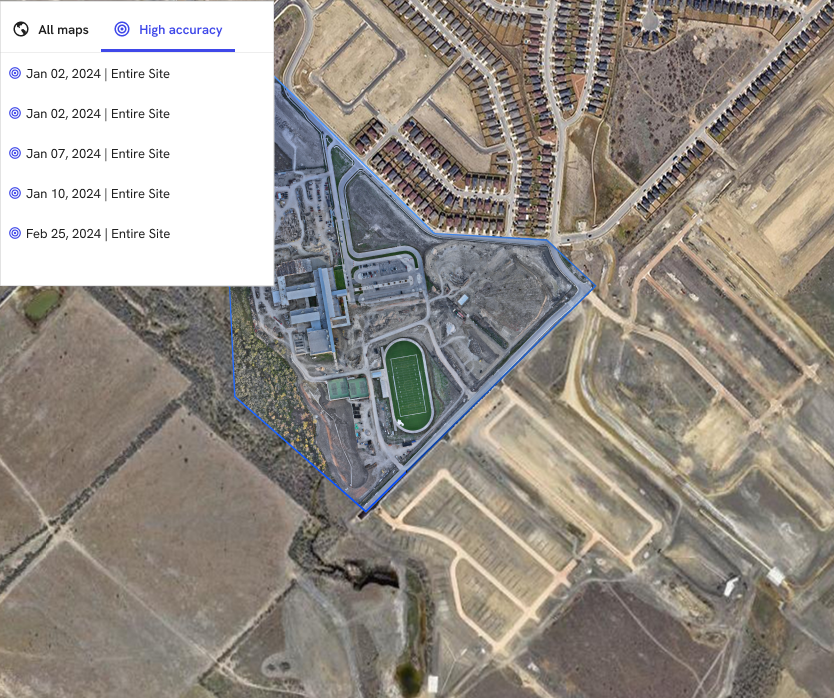
Exyn Technologies Releases Nexys for 3D Mapping in Complex Environments
On February 9, 2024, at GeoWeek, Exyn Technologies announced the launch of Exyn Nexys, a new 3D mapping solution designed ...
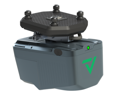
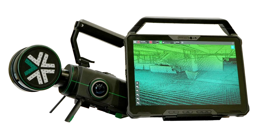
GeoCue and CHC Navigation Introduce TrueView 540 LiDAR System
GeoCue, a provider of geospatial hardware and software, in collaboration with CHC Navigation, a company known for its precision positioning ...
No posts found.
No posts found.
No posts found.