Laser scanning is becoming an instrumental part of the transportation industry, with agencies, local governments and OEMs among those leveraging…
Air
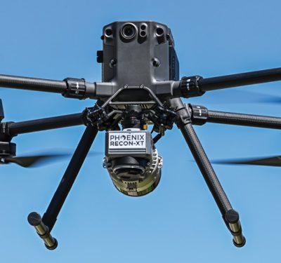
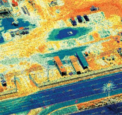
Use Case: Phoenix LiDAR RECON-XT
MORE-AFFORDABLE LiDAR SENSORS: A Real–world Deep Dive Explores Whether Smaller, Lighter LiDAR Solutions Deliver

Teledyne FLIR Develops and Collaborates on Bringing AI to the Edge
By Arthur Stout “Overcoming the Challenges of Bringing AI to the Edge” is a new, insightful paper authored by Arthur…
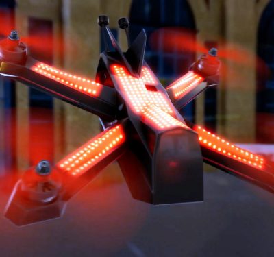
Draganfly Racing to Test New Drone Technologies
Long-time drone manufacturer Draganfly recently announced a multi-year partnership with the Drone Racing League (DRL), the world’s premier professional drone-racing…
Mapping the Landscape for Drone Surveying
As with so many other market applications that require extensive data collection and precise measurements, drones have radically changed the…

The Domestic Counter-Unmanned Aircraft Systems National Action Plan
Over the last decade, unmanned aircraft systems (UAS or “drones”) have become a regular feature of American life. We use…
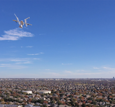
Wing Launches Drone Delivery in North Texas Metro Area
Earlier this month, Wing began delivering goods via drone to residents in Frisco Station, a mixed-use development in Frisco, Texas,…

A Risk-Based Approach: The UAS BLVOS Arc Final Report
The flight path toward normalizing and integrating UAS into the National Airspace System begins to clear. The long-awaited Unmanned Aircraft…
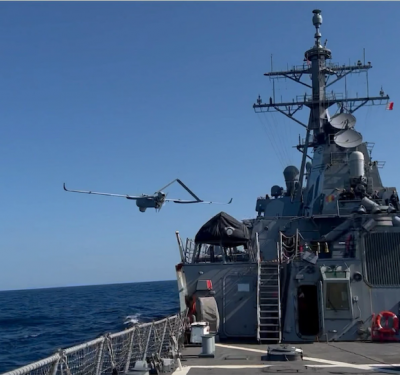
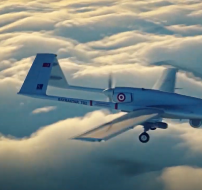
Textron Systems’ Aerosonde® Small Unmanned Aircraft System Takes First Flight from U.S. Navy Guided Missile Destroyer
Textron Systems Corporation has announced the successful first flight and maritime integration of the Aerosonde® Small Unmanned Aircraft System (SUAS) on…
AeroVironment Donates Over 100 Quantix Recon Unmanned Aircraft Systems to the Ministry of Defence of Ukraine and Territorial Forces
Donation is independent of other AeroVironment systems already being provided to Ukraine by the United States Government Donated Quantix Recon…

Remote ID Meets Airspace Management
Pierce Aerospace, of Indianapolis, announced a partnership with Vigilant Aerospace Systems today to integrate Pierce Aerospace’s Flight Portal Remote ID…
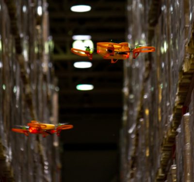
At UVL Robotics, A Stock-Taking Solution Takes Off
Like many companies, UVL Robotics began with a problem: Eugene Grankin hated stock-taking. When he worked in logistics for Royal…
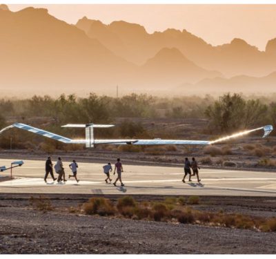
Zephyr Continues to Ascend
Airbus’s high altitude sustainable flight entry glides toward deployment. Although Airbus’ Zephyr is still in development, the high altitude platform…
No-Fly with No Crews
Russia’s invasion of Ukraine is full of lessons for the US. New ones like the lethality of modern anti-tank missiles…

In Pursuit of Pests
From plant-juice sucking psyllids to rampaging pachyderms, drones and sensors are combatting food pests.
Feeding the Needy: Getting Beyond First Gear
A limited but growing number of unmanned systems are demonstrating how to deliver food to the hungry and homeless.

AUVSI Xponential 2022
Orland, FL | April 25 – 28 XPONENTIAL is a yearly gathering for global leaders and end users of uncrewed…
