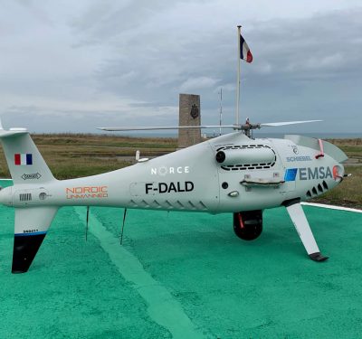
Schiebel’s CAMCOPTER S-100 recently began monitoring ship Sulphur emissions for the European Maritime Safety Agency (EMSA). Monitoring for the French…
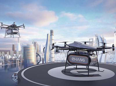
EHang Introduces EHang 216L Logistics Drone
EHang now has a logistics version of its EHang 216 autonomous aerial vehicle (AAV) that will be deployed for short-to-medium-haul…
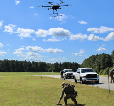
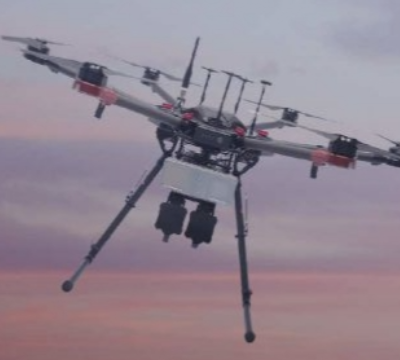
DroneUp Completes Autonomous Resupply Experiment
Using its patent-pending delivery solution, Combat Drone Services, DroneUp recently demonstrated how UAS can be used to deliver specific payloads…
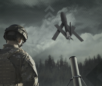
AeroVironment Grows Its Loitering Missile Systems
“Precision strike capabilities at the battlefield’s edge” was the mantra at AeroVironment’s September 30thannouncement of the its new Switchblade 600…
Industry Groups Push for Remote ID Standards
The Department of Transportation should encourage the FAA to issue its final rule of Remote Identification in accord with a…
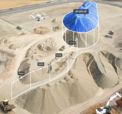
Building On Data
Drone data processing in the construction industry continues to become more integrated and sophisticated.
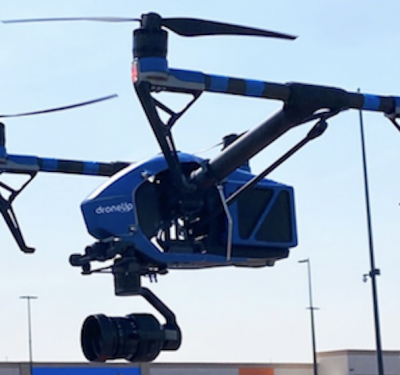
Walmart Deploying Drones to Deliver At-Home COVID-19 Collection Kits
Walmart has formed partnerships with Quest Diagnostics and DroneUp to begin delivering at-home COVID-19 self-collection kits. Drone delivery trials recently…

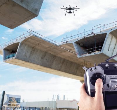
High-Resolution 3D Modeling For Bridge Safety Inspections
Collins Engineers, Inc. is using the latest drone technologies in the inspection and modeling of bridge structures.
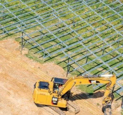
Drones Increase Efficiency In Solar Plant Construction
Major solar energy plant builder Enerparc AG is integrating high-end unmanned aerial vehicles into its operations.
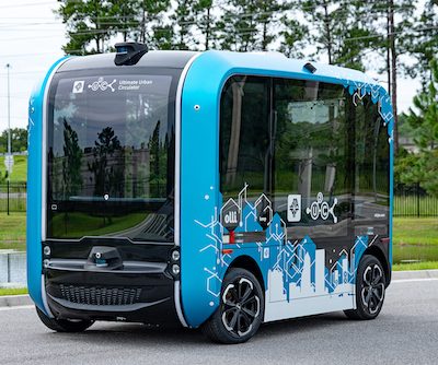
JTA Receives First Olli 2.0 Autonomous Shuttle in the U.S.
The Olli 2.0 is now part of the Jacksonville Transportation Authority’s (JTA) Ultimate Urban Circulator (U2C) program, marking the first…
Simplifying Surveys
SAIN Associates used the Microdrones mdMapper1000DG to quickly gather data for an updated survey and to track progress of a project in Birmingham’s Red Mountain Park.
Propeller’s UAS Perspective
Rory San Miguel is the CEO of Propeller, a 3D cloud-based visualization and analytics solution, who launched some certitudes about…
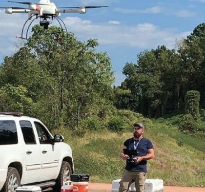
Technology Catch-Up: Construction Industry Strives to Adapt, Adopt, Reshape
Drones that tie rebar. Robots that make roadway repairs. Machines that perform earthwork with little or no human intervention….
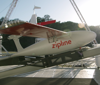
Walmart and Zipline Offering On-Demand Drone Delivery
Zipline drones will soon begin delivering health and wellness products to Walmart customers on demand through what is being described…
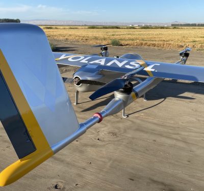
Northern Plains UAS Test Site Selects Volansi for BVLOS Testing
Volansi’s VOLY C10 UAS will be part of beyond visual line of sight (BVLOS) testing at the Northern Plains UAS…
Imagination Meets Innovation: AeroVironment’s 50 Years Leading the Way, Pt. 4
PURPOSE-DRIVEN SUCCESS – THE ART OF THE (IM)POSSIBLE “We have the fortitude to stick things out and understand that the…

Imagination Meets Innovation: AeroVironment’s 50 Years Leading the Way, Pt. 3
CEO Q&A: INNOVATION, CULTURE AND EXECUTION Witty, wry and informative, sporting a neat but substantial shelter-in-place beard when we speak,…

TERMINUS: A Climate Research Expedition
The TERMINUS expedition to Greenland is uncovering critical data on glacier-ocean interactions and sedimentation at glacier termini, offering new insights ...

AUVSI Applauds Legislation Supporting Drones Grants for Law Enforcement
On behalf of the Association for Uncrewed Vehicle Systems International (AUVSI), President and CEO Michael Robbins issued the following statement ...
TEKEVER Partners with IMSAR to Advance Radar Technologies and Data Processing Solutions
TEKEVER, a European provider of unmanned aerial systems (UAS), has announced a two-year partnership agreement with IMSAR, a US-based company ...
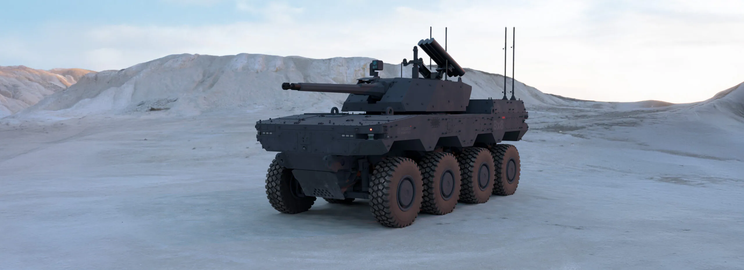
Milrem Robotics Debuts HAVOC Robotic Combat Vehicle (RCV) at IDEX 2025
Milrem Robotics, an Estonian robotics and autonomous systems developer, launched its 8×8 Robotic Combat Vehicle (RCV) at IDEX 2025. The ...
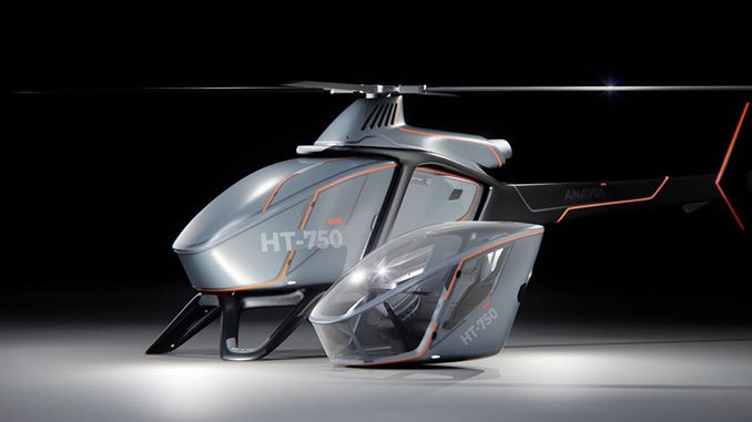
EDGE Launches ANAVIA HT-750 UAV at IDEX 2025
Among several new EDGE solutions being launched in the air domain is the ANAVIA HT-750, a high-technology rotary-wing unmanned heavy-lift aircraft ...
No posts found.
No posts found.
No posts found.