RoboMaster, a yearly robotics competition for aspiring young engineers and university students, concluded its 2018 competition at the Shenzhen Bay…
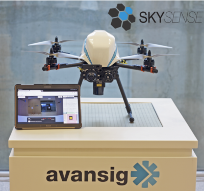
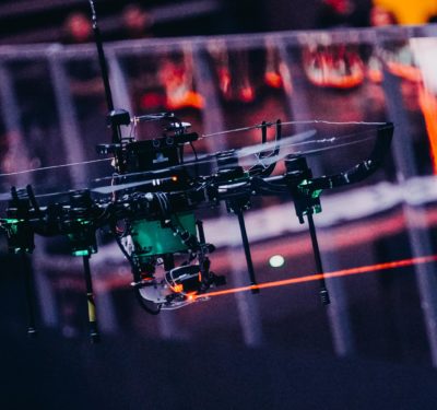
Skysense and Avansig Partner to Develop Drone for Indoor Surveillance
Skysense and Avansig, a Spanish information and communication technology developer, are working together to power the first indoor surveillance drone…

Boeing, SparkCognition Collaboration to Focus on Next-Gen Airspace Management for Autonomous Air Vehicles
Boeing recently announced it is collaborating with artificial intelligence (AI) technology leader, SparkCognition, to deliver unmanned aircraft system traffic management (UTM)…

Intel Breaks Guinness World Records Title for Drone Light Shows in Celebration of 50th Anniversary
In celebration of Intel’s 50th anniversary, the company flew 2,018 Intel Shooting Star drones over its Folsom, California, facility on July…
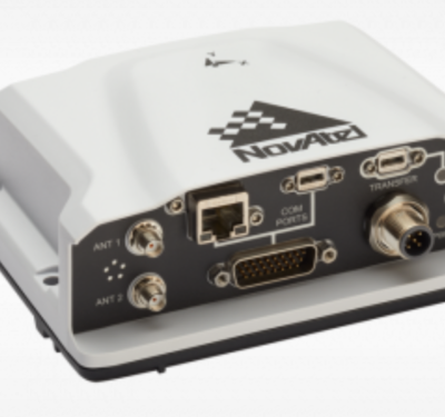
NovAtel Offers New High-Performance Positioning Solutions for Space-Constrained Systems
NovAtel recently introduced several new precision positioning solutions for space-constrained applications. With enhanced positioning accuracy in a compact form, the…

Aston Martin Announces Plans for a Luxury Concept UAS
Aston Martin, a British luxury brand, recently announced plans to develop the Volante Vision Concept, a luxury concept aircraft with…
Terabee Introduces TeraRanger Tower Evo Solid-State LiDAR System
Terabee’s new TeraRanger Tower Evo solid-state LiDAR system features 4 or 8 detection zones monitored simultaneously at high speeds. With…
Airbus Partners with International SOS to Study the Use of Drones for Medical Delivery
Airbus and International SOS, a medical and security risk services company, recently signed a Memorandum of Understanding (MOU) to study…
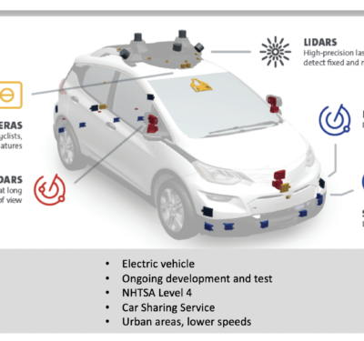
Experts to Share Insight on the Latest in Driverless Cars, Robotics During Wednesday’s Webinar
The connected car is a reality, as are robotics playing a critical role in just about every industry in which…
Microdrones Expands into Second Facility in Siegen, Germany as Part of Global Growth Project
As part of its rapid global sales growth, Microdrones has completed the first phase of an ambitious expansion of its…

IPP Pilot Program Team Profiles: Kansas Department of Transportation
Kansas Department of Transportation Team Partners Core Competencies Aerotenna Detect and avoid, autopilots Ainstein, Inc. Precision agriculture AirMap UTM…

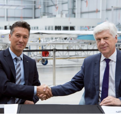
New Jaguar Land Rover Engineering Center Designed to Help Make Ireland a Big Player in Autonomous Cars
With a splashy new software engineering center now open in Shannon, Ireland, Jaguar Land Rover (JLR) is preparing to play…
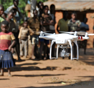
UNICEF Looks to Fund Drone Start-ups with Potential to Benefit Humanity
The UNICEF Innovation Fund is looking to make up to $100,000 equity-free investments to provide early stage (seed) finance to for-profit technology start-ups that…
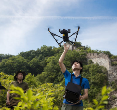
Intel Drones Helping to Preserve the Great Wall of China
Intel is working with the China Foundation for Cultural Heritage Conservation (CFCHC) to keep the Great Wall on the top of world…

ITS World Congress: Connected and Automated Vehicles
Connected and Automated Driving (CAD) a key topic for discussion at the 25thITS World Congress Connected and Automated Driving (CAD)…
IPP Pilot Program Team Profiles: Alaska/Hawaii
Team Lead – University of Alaska – Fairbanks Team Partners Core Competencies Alaska Aerial Media Inspection, surveying/mapping, cinematography Alyeska Pipeline…
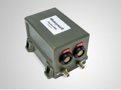
Honeywell Introduces HGuide n580 Inertial Navigation Unit
Honeywell recently launched the HGuide n580, which is the company’s first industrial focused navigation solution that uses precision inertial measurement…
Trimble and DroneDeploy Collaborate on Drone Mapping with High-Precision Positioning Service
Trimble announced a collaboration with DroneDeploy to integrate Trimble's Applanix POSPac CloudⓇ post-processed kinematic (PPK) GNSS positioning service, featuring CenterPointⓇ ...
CDA and MIT Lincoln Laboratory Partner on Drone Research to Support BVLOS Operations
The Commercial Drone Alliance (CDA) and the Massachusetts Institute of Technology Lincoln Laboratory (MIT LL) have initiated a research collaboration ...
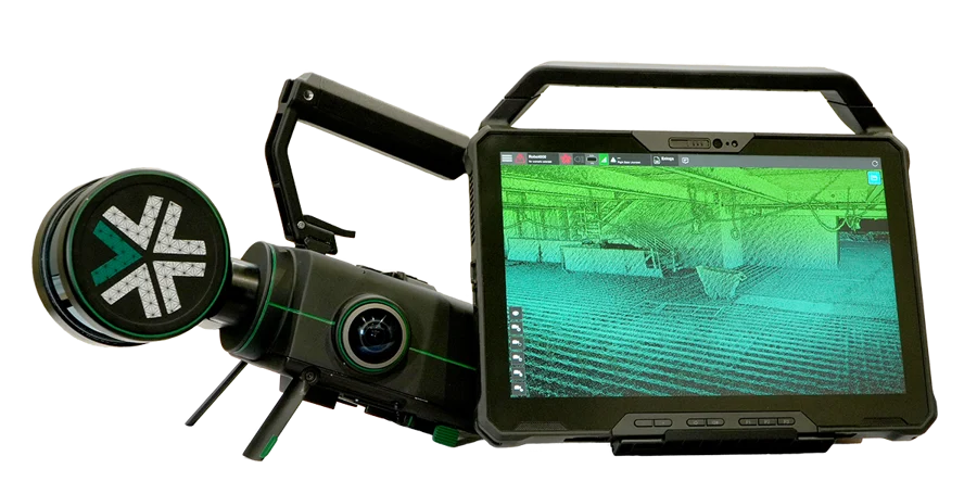
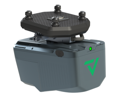
Exyn Technologies Releases Nexys for 3D Mapping in Complex Environments
On February 9, 2024, at GeoWeek, Exyn Technologies announced the launch of Exyn Nexys, a new 3D mapping solution designed ...
GeoCue and CHC Navigation Introduce TrueView 540 LiDAR System
GeoCue, a provider of geospatial hardware and software, in collaboration with CHC Navigation, a company known for its precision positioning ...
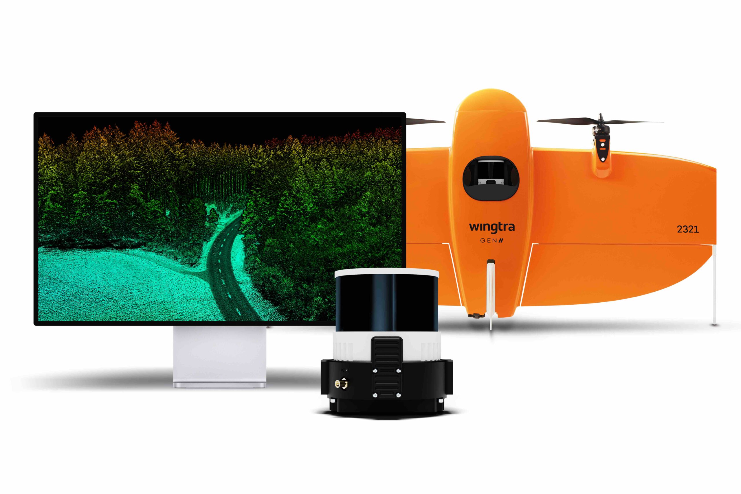
Wingtra Launches Advanced LiDAR Drone Solution
Wingtra, a drone technology company based in Zurich, has introduced a new LiDAR drone mapping solution that combines the WingtraOne ...
No posts found.
No posts found.
No posts found.