ANRA Technologies, a provider of autonomous aircraft traffic and fleet management, and Future Flight Global, an innovator in advanced air transportation,…
ResilienX Publishes White Paper Highlighting Results from FAA R&D Project to Advance BVLOS Operations
ResilienX, a provider of safety assurance solutions for autonomous ecosystems, has released a new white paper detailing the findings and…

Palladyne AI and Red Cat Achieve Successful Multi-Drone Collaborative Autonomous Flight
Palladyne AI Corp., a developer of artificial intelligence software for robotic platforms in the defense and commercial sectors, and Red…
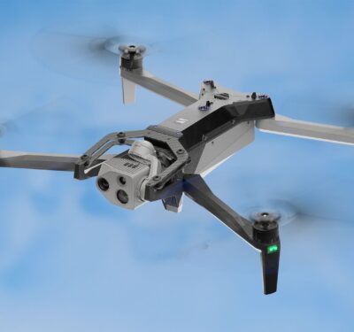
Industry View: Failure of Remote ID in NJ Might Have Cost Us Years
Editor’s Note: As attention increases regarding aircraft activity in the eastern U.S., Inside Unmanned Systems will be providing substantive context…

Phoenix Air Unmanned Achieves Single-Day Pipeline Patrol Milestone
Phoenix Air Unmanned (PAU) has achieved a milestone by completing 320 miles of aerial pipeline patrol in just 7.6 flight…

Pierce Aerospace Awarded $10M Contract for Remote ID Technology
Pierce Aerospace, a provider of drone Remote Identification technologies, announced that it was awarded a $10 million Indefinite Delivery Indefinite…
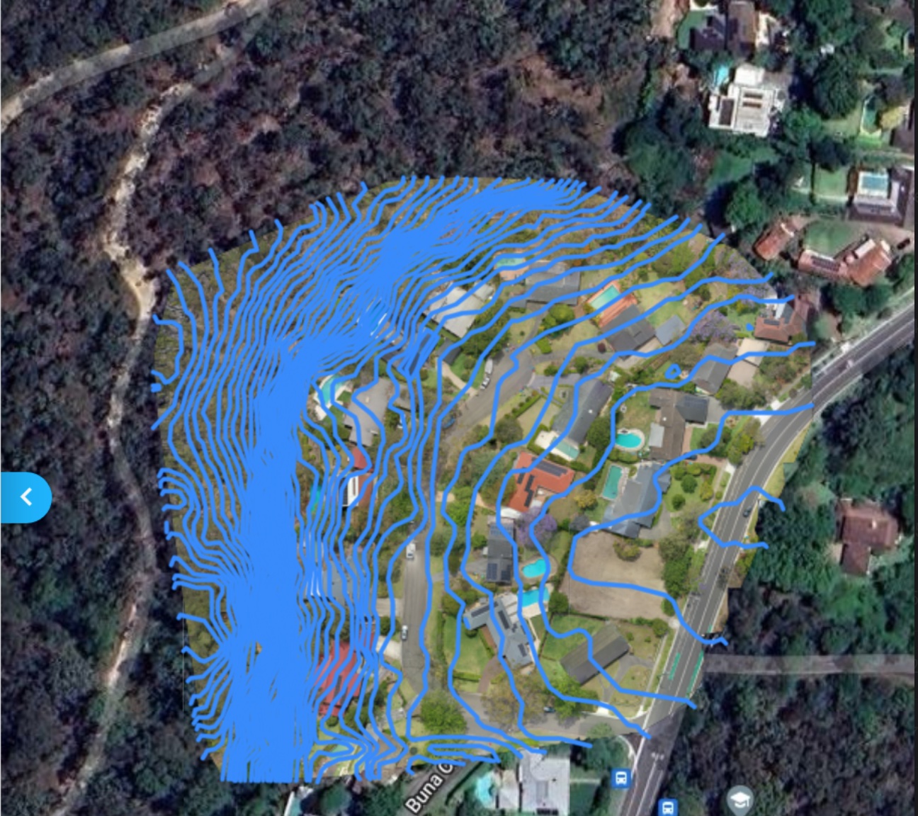
A2Z Drone Delivery Launches Multi-Use BVLOS Drone Dock Network
A2Z Drone Delivery, Inc, developer of commercial drone delivery solutions, has launched a multi-use drone dock network operating beyond-visual-line-of-sight (BVLOS)…

Honeywell and NXP Expand Partnership to Accelerate Autonomous Flight
Honeywell and NXP Semiconductors N.V. announced at CES 2025 an expanded partnership that will accelerate aviation product development and chart…
PABLO AIR Showcases Future Drone Technology and Global Vision at CES 2025
PABLO AIR, a company specializing in autonomous swarm control for unmanned aerial vehicles (UAVs), will participate in the world’s largest…
TSA Performs sUAS Assessment at San Francisco International Airport (SFO)
The Transportation Security Administration (TSA) used an agency-owned, small unmanned aircraft system (sUAS) to test the threat of drones over…

BlueHalo Awarded $49.9M Naval Information Warfare Center Contract for UAS Electronic Warfare Sensor Systems
BlueHalo, a provider of global defense Electronic Warfare (EW) capabilities, has been awarded a five-year contract valued at $49.9M by the Naval…
Hexagon to Acquire Septentrio, Revolutionizing Positioning in Mission-Critical Navigation and Autonomy Applications
Hexagon has announced an agreement to acquire Septentrio NV, a leading OEM provider of Global Navigation Satellite System (GNSS) technologies,…

Elbit Systems Awarded $60M CUAS Contract for NATO Member State
Elbit Systems Ltd. has been awarded a contract worth approximately $60 million to supply its multi-layered Counter Unmanned Aerial Systems…

AUVSI Applauds Department of Commerce’s Proposed Rulemaking to Secure UAS
The U.S. Department of Commerce’s Bureau of Industry and Security (BIS) has issued advance notice of proposed rulemaking (ANPRM) seeking…
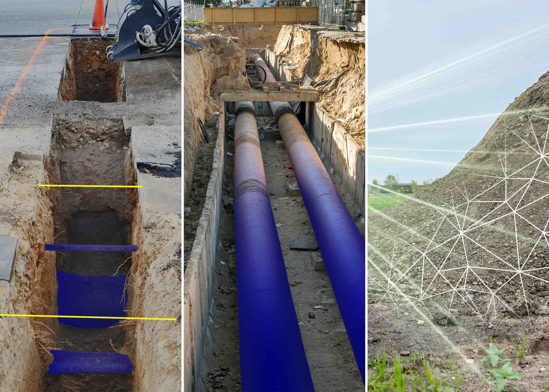
Drones Detecting and Sealing Greenhouse Gas Leaks
Drones are offering safer, faster and more accurate solutions to detect methane and other harmful greenhouse gases. With advancements in…
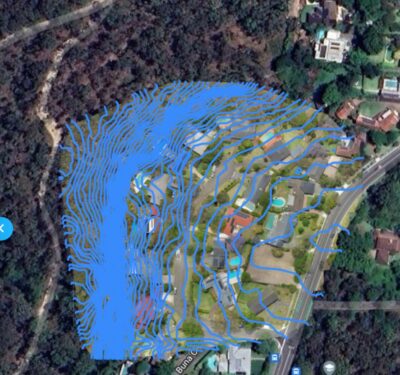
Aerologix and Soar Partner to Create Comprehensive Atlas of UAS Imagery
Australian drone technology provider Aerologix have announced a strategic partnership with digital mapping platform Soar to create an extensive library of high-quality drone imagery…
Hydrogen Fueling UAS for Sustainable Operations at Scale
Inside Unmanned Systems connected with two hydrogen fuel solution providers to explore the energy efficiencies, extended flight times and improved logistics…

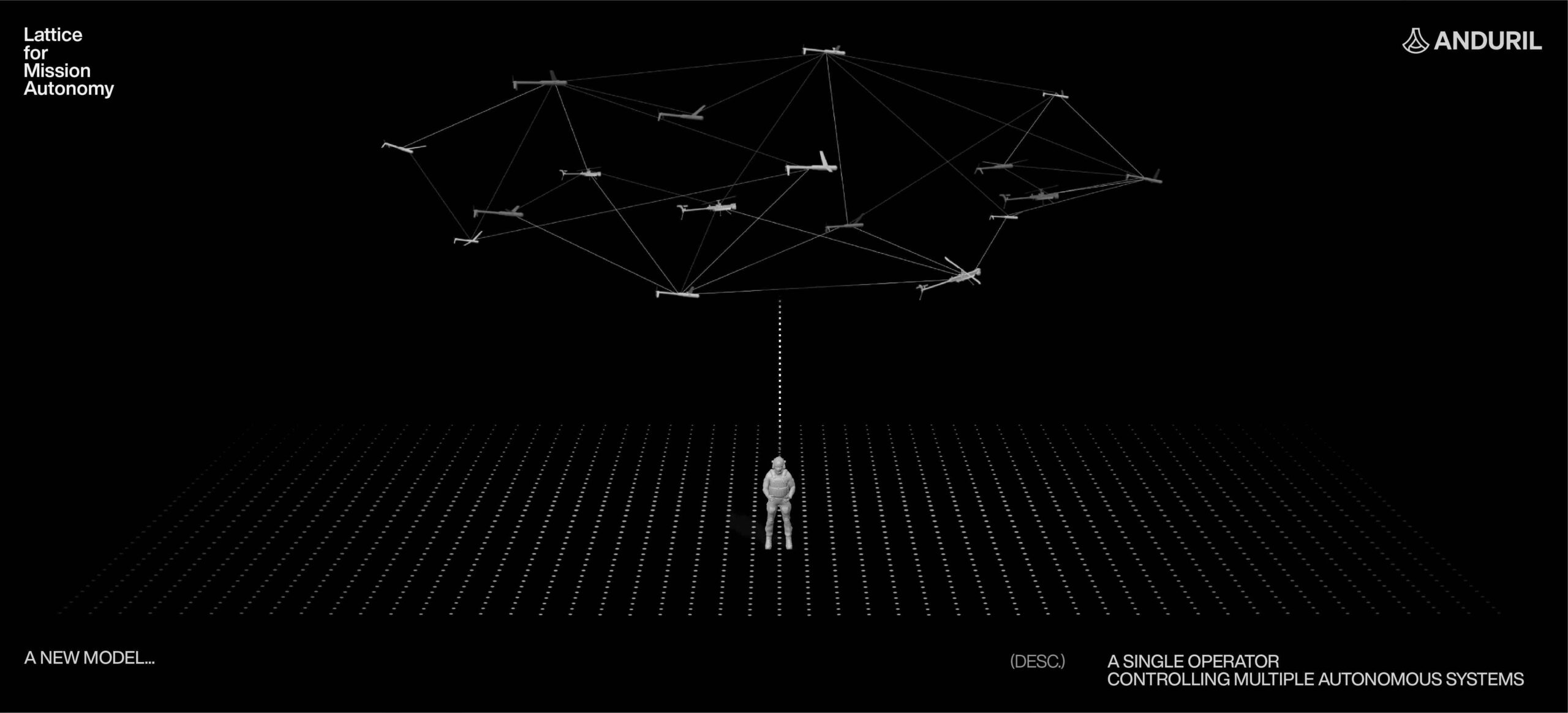
L3Harris Launches New Technology to Control Autonomous Swarms
L3Harris Technologies has introduced AMORPHOUS, its new software that features a single user interface to operate thousands of autonomous assets ...
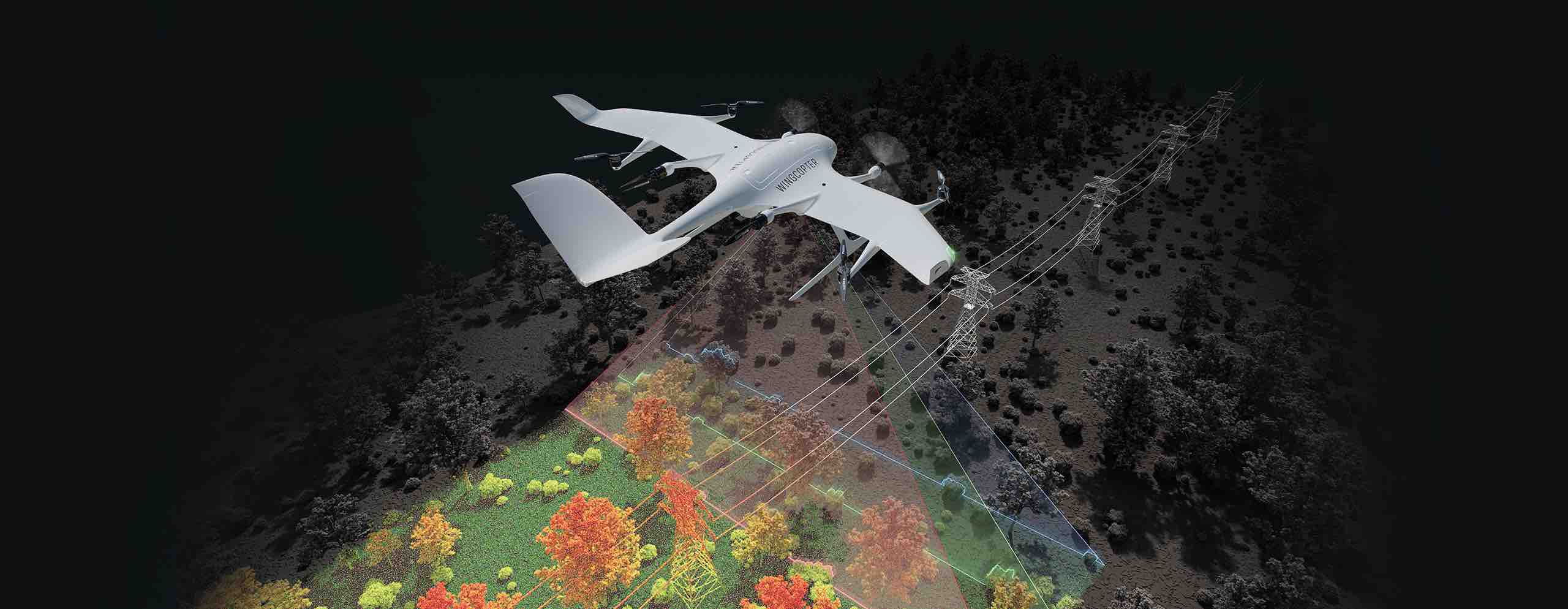
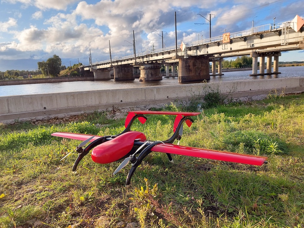
Wingcopter Extends Range of Applications to Long-Range LiDAR Surveying
Wingcopter, a German drone manufacturer, seller and service provider, has announced that it will expand its offering beyond cargo drones ...
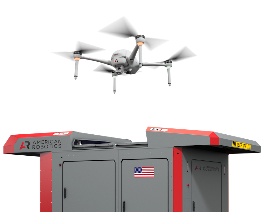
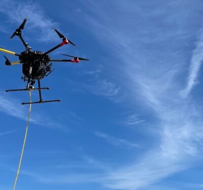
American Robotics Secures BVLOS Waiver for Remote Operations Center-Based Drone Flights
Ondas Autonomous Systems' subsidiary American Robotics has secured an additional FAA Beyond Visual Line of Sight (BVLOS) waiver, allowing for ...
Topcon and Pix4D Collaborate to Advance Photogrammetry Solutions
Topcon Positioning Systems and Pix4D have announced a strategic agreement that combines their expertise in geopositioning and photogrammetry solutions. Image: Topcon Positioning Systems ...
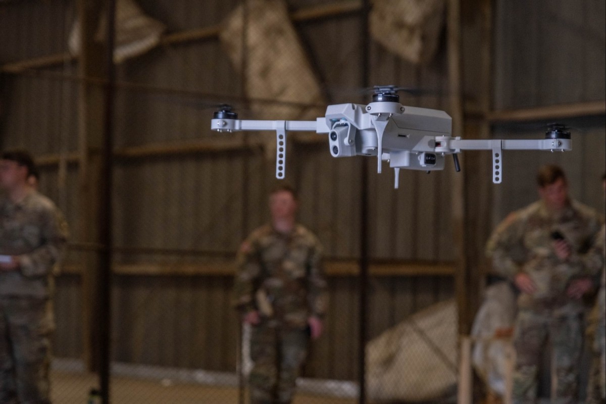
101st Airborne Division Takes Flight with 3D Printed Drones
The 101st Airborne Division has begun 3D manufacturing of small-unmanned aircraft systems (sUAS) at the EagleWerx Applied Tactical Innovation Center ...
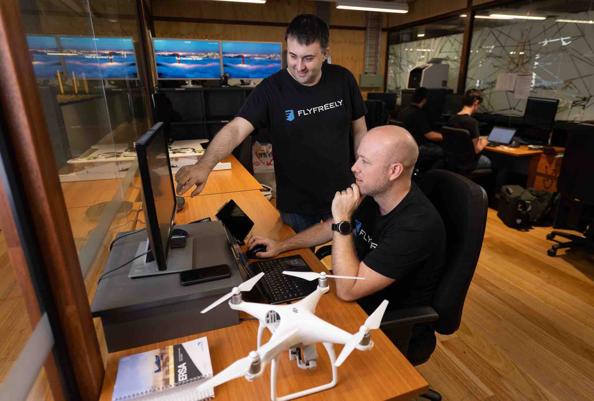
FlyFreely Extends into North American Market with FAA LAANC Approval
Drone management platform FlyFreely has announced its acceptance as a LAANC provider by the Federal Aviation Administration (FAA). FlyFreely can now ...

AURA Network Systems Awarded FAA Contract to Enhance UAS Integration in National Airspace
AURA Network Systems, a provider of secure and reliable communications solutions for the aviation industry, has announced that it has ...
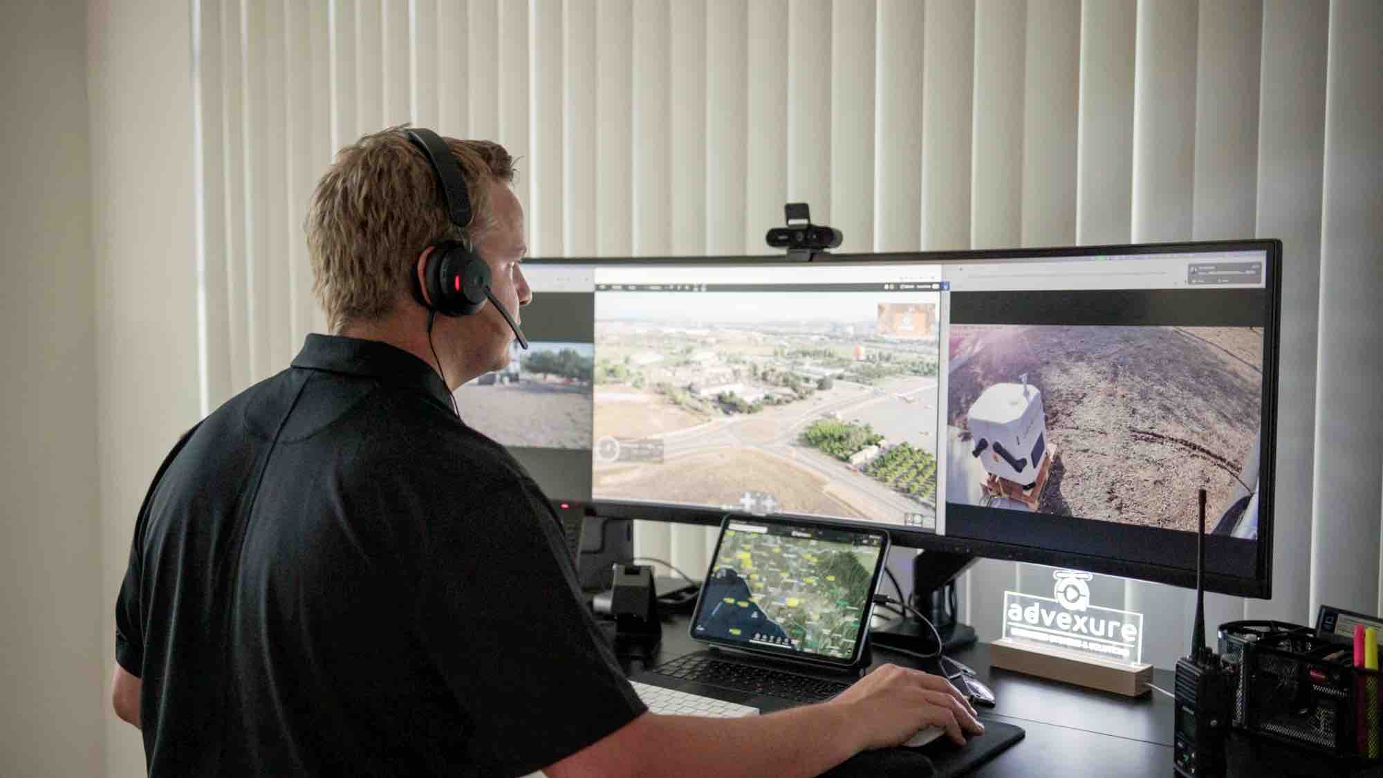
Advexure and MatrixSpace Partner to Provide Faster, More Accurate Detection at Scale
Advexure, one of the US's largest dealers, distributors and systems integrators for drone systems and technology solutions, has partnered with MatrixSpace to enhance its ...

Unusual Machines to Acquire Aloft Technologies for $14.5M
Unusual Machines has announced the signing of a binding agreement to acquire Aloft Technologies, Inc., FAA-approved provider of unmanned aerial ...

INVOLI Launches Low Altitude Surveillance Supplemental Data Service in Dallas
INVOLI, a provider of surveillance data solutions, has announced the launch of an Altitude Surveillance Supplemental Data Service in Dallas, Texas ...
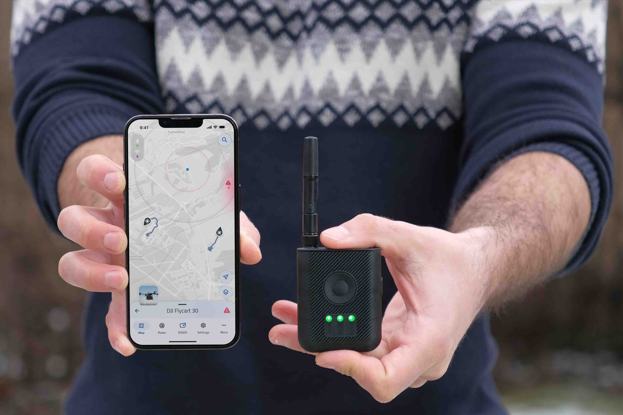
Dronetag Introduces RIDER for Drone Safety in Response to Growing Airspace Concerns
With recent incidents such as unidentified drone sightings in New Jersey and across the US, and a drone collision with ...

Policy Imperatives for U.S. Leadership in Drone and Autonomous Technologies
President Trump, the 119th Congress, and state legislators have taken office at a time when the U.S. is at a ...
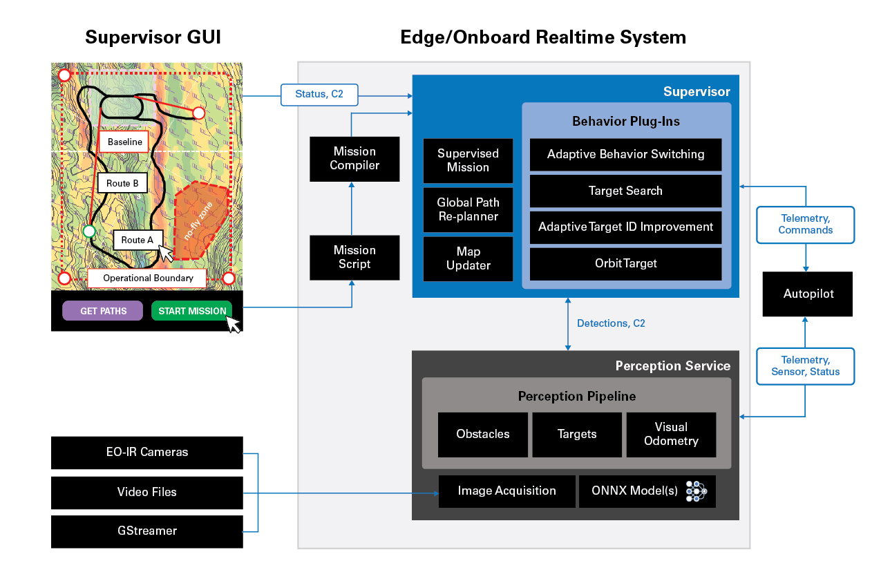
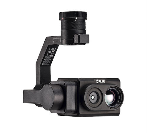
Teledyne FLIR Launches Prism Supervisor Software for Enhanced UAS Autonomy
Teledyne FLIR OEM, part of Teledyne Technologies Incorporated, today announced the release of Prism™ Supervisor, the latest addition to its Prism ...

DroneDeploy Accelerates Construction of Critical U.S. Al Infrastructure with Nationwide BVLOS Waiver
DroneDeploy announced nationwide U.S. Beyond Visual Line of Sight (BVLOS) approval for critical infrastructure, including data center construction management. The ...

Terra Drone Conducts UTM-Based Multi-Drone Flight Demonstration in Indonesia
Terra Drone Corporation, a drone and Urban Air Mobility (UAM) technology company headquartered in Japan, announced conducting Indonesia’s first demonstration ...
Aerologix and Soar Partner to Create Comprehensive Atlas of UAS Imagery
Australian drone technology provider Aerologix have announced a strategic partnership with digital mapping platform Soar to create an extensive library ...

Autonomous Solutions: Lockheed Martin Advances Uncrewed Capability for Combat-Proven HIMARS
Lockheed Martin has successfully demonstrated an uncrewed capability with a surrogate HIMARS launcher, developing autonomous systems that can operate collaboratively ...
U.S. Army Selects Textron’s MK 4.8 HQ Aerosonde System for FTUAS
The U.S. Army's Future Tactical Uncrewed Aircraft Systems (FTUAS) Product Office has officially taken receipt of the Textron Systems' MK ...
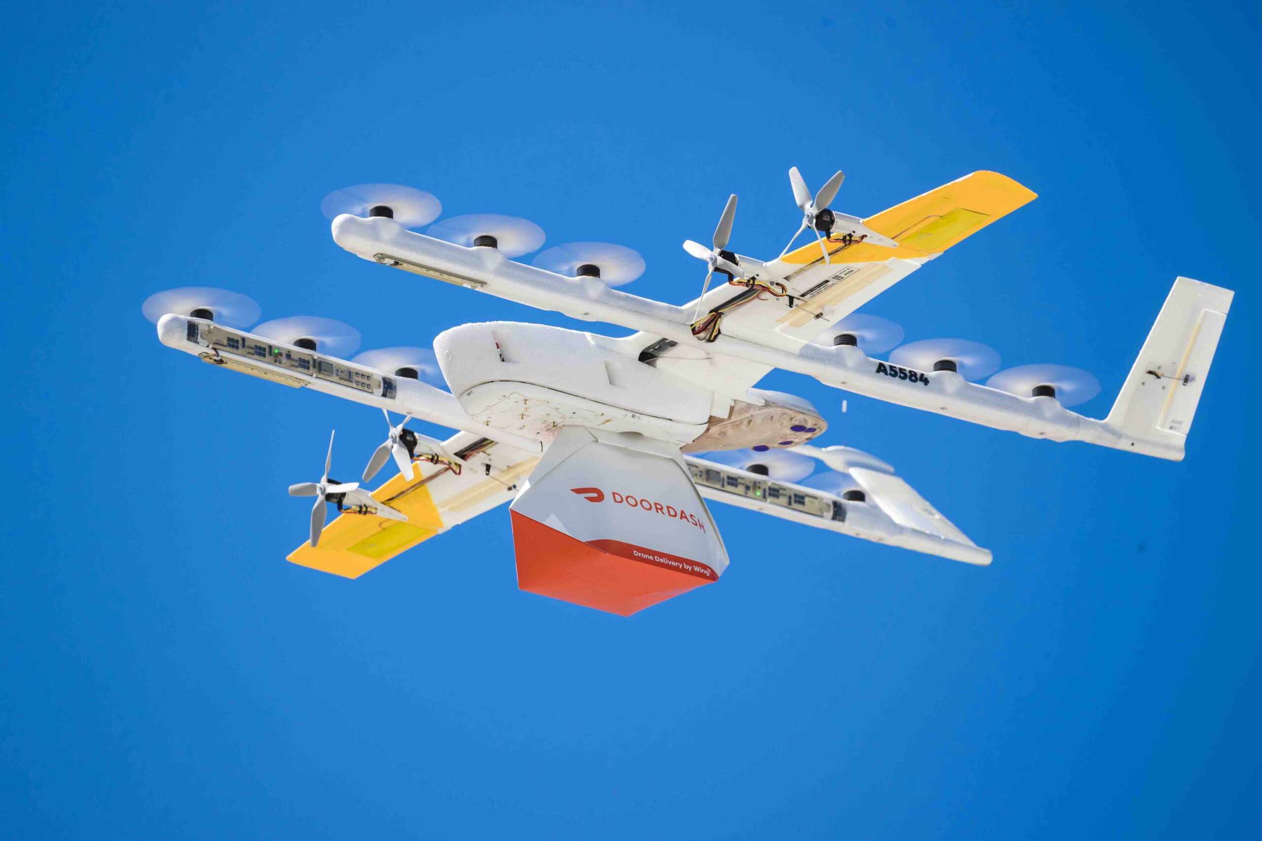
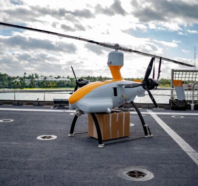
Wing Partners with DoorDash for Drone Delivery from Dallas-Ft. Worth Shopping Malls
Wing has announced a partnership with DoorDash and Brookfield Properties in the Dallas-Fort Worth Metroplex, offering drone delivery from local ...
Red Cat Partners with Palantir to Equip Black Widow with Autonomous Visual Navigation and Warp Speed for GPS-Compromised Environments
Red Cat Holdings has announced a strategic partnership with Palantir Technologies to integrate Visual Navigation software (VNav) into Red Cat’s ...

Hexagon | NovAtel Launches GAJT-310, Providing Jamming Protection for Small Platforms
Hexagon | NovAtel has announced its lowest SWaP (size, weight and power) GNSS Anti-Jam Technology (GAJT) with the launch of ...
AUVSI Announces Green UAS Certification for Ascent AeroSystems SPIRIT, AgEagle Ebee Tac, Inspired Flight IF1200A and IF800 Tomcat UAS
The Association for Uncrewed Vehicle Systems International (AUVSI) has announced that it has granted Green UAS certification to four new ...
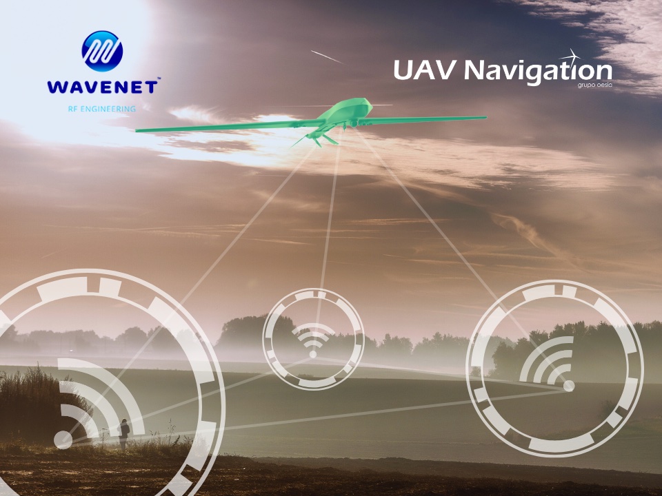
WAVENET RF Engineering and UAV Navigation-Grupo Oesía Achieve UAS Flight with Radio Positioning Alternative to GNSS
WAVENET RF Engineering, a Spanish company dedicated to the design and development of radio frequency systems and specializing in unmanned ...

Topcon: Transforming the World Through Precise Positioning and Automation
Precise positioning enables what was not possible before. As new Topcon Positioning Systems CEO Ivan Di Federico puts it, it ...

Avinor Selects Thales for Norway’s Nation-Wide UTM System
This strategic partnership with Avinor, the Norwegian air navigation service provider and airport operator, will enable the deployment of Norway’s ...
Anduril Partners with OpenAI to Advance CUAS AI
Anduril Industries and OpenAI, the maker of ChatGPT, have announced a strategic partnership to develop and responsibly deploy advanced artificial ...

D-Fend Solutions Raises $31M to Advance Cyber Counter-Drone Technology
D-Fend Solutions, a radio frequency (RF) cyber-based, non-kinetic, non-jamming, counter-drone – takeover technology, announced that it has secured $31M in a new ...
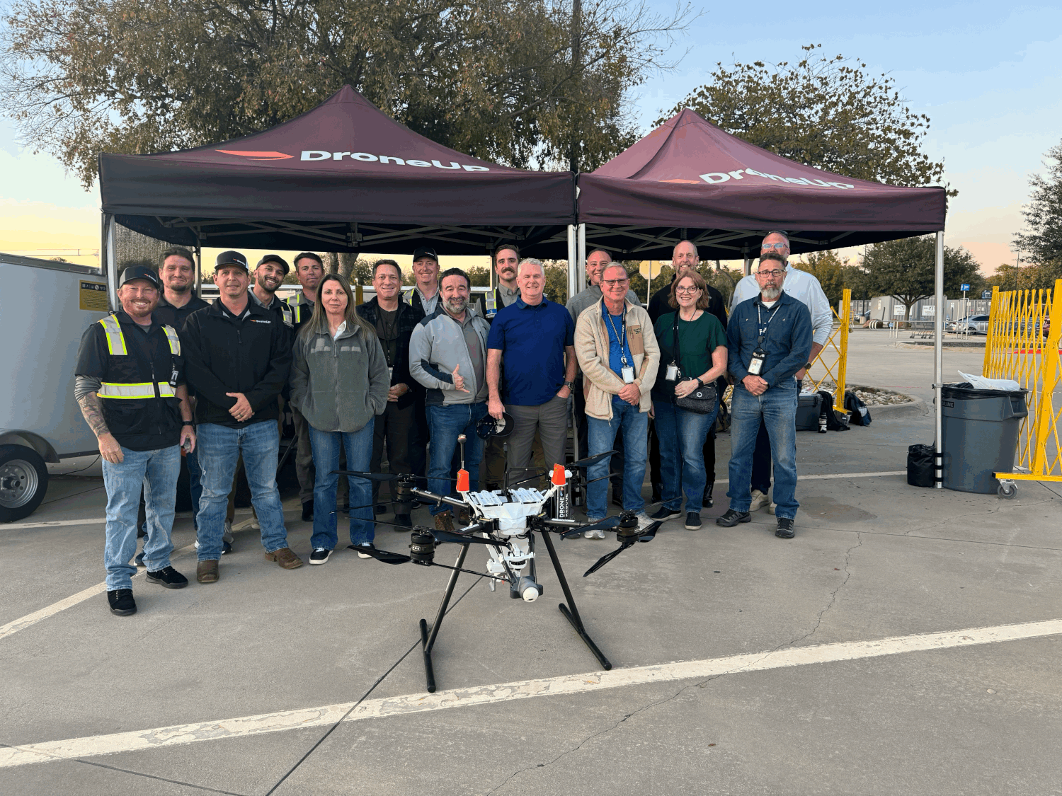
DroneUp Secures FAA Part 135 Certification
DroneUp has announced that it has received certification for commercial operation under Part 135 from the Federal Aviation Administration (FAA), ...

Northwest UAV Announces Distribution Partnership with Silvus Technologies
Northwest UAV has expanded its product offering to include the full family of StreamCaster MANET radios. Image: Northwest UAV. The ...

High Lander Vega UTM to Power Consortium for Canadian RPAS Traffic Management
High Lander, a provider of drone fleet management and unmanned traffic management solutions, will join a consortium of Canadian partners ...

The best thing in anti-jam technology just got better: Hexagon | NovAtel enhances the performance of the GAJT-710 product line
Today, Hexagon | NovAtel announced an update to their GPS Anti-Jam Technology (GAJT) portfolio. As the leading provider of assured ...
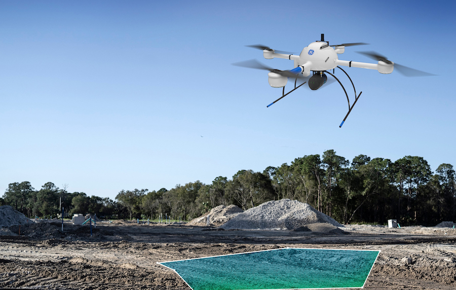
Cover More Ground
Microdrones is pleased to announce a special presentation on the newest member of the GE industrial drone line, the mdLIDAR1000LR ...
FIXAR equips outdoor UAVs with the BlackBox for safer sky
From September 2021, FIXAR is equipping all its outdoor drones with the additional FIXAR BlackBox system for UAV flight data ...
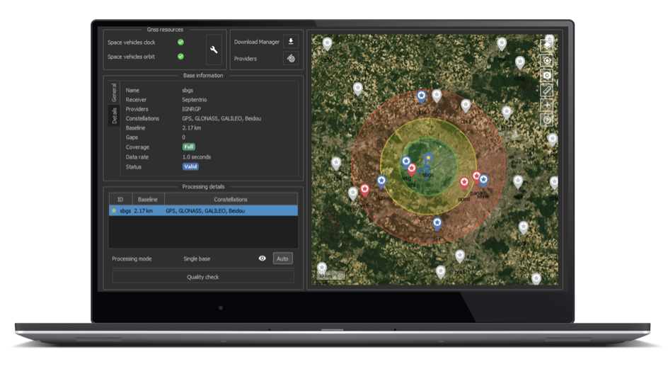
SBG Systems to partner with Septentrio to extend the use of Qinertia post-processing software to their mapping and surveying users
SBG Systems’ popular INS/GNSS PPK software called Qinertia is now available to users of Septentrio AsteRx-i3 D Pro+, AsteRx-i3 S ...
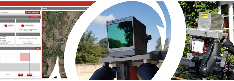
New LiDAR sensors added as OxTS release OxTS Georeferencer 1.5
Oxford Technical Solutions (OxTS) a manufacturer of survey-specific Inertial Navigation Systems has released the latest version of their LiDAR georeferencing ...

New Open-source Wireless GPS/GNSS Hardware for Autonomous and IoT Applications
Septentrio, a provider of high-precision GNSS positioning solutions, announced an open-source resources for its GPS/GNSS module receivers: mosaic wireless or ...
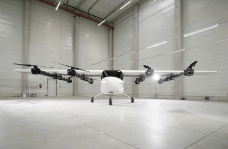
ZURI Hybrid VTOL Tech Demonstrator is Ready to Hover
The ground test of the VTOL ZURI concept has recently been carried out. The results of the trial allow ZURI ...

NVIDIA Announces New AI Perception Coming to ROS Developers
NVIDIA has announced new initiatives to deliver a suite of perception technologies to the Robotics Operating System (ROS) developer community ...

Hexagon | NovAtel GNSS SMART Antenna now the default receiver selection on Fendt machines in North America, Europe and the Middle East
Standard Fendt guidance packages now include NovAtel's SMART7 Hexagon | NovAtel is proud to announce that Fendt machines in North ...
INTERGEO 2021 Live + Digital, September 21-23, 2021: RIEGL Presents Their New Products 2021
INTERGEO is back LIVE in Hanover this year – and RIEGL presents the latest developments in hardware and software at booth 20C.22 ...
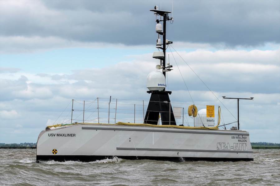
SEA-KIT wins funding to demonstrate zero emission hydrogen fuel cell technology for USVs
SEA-KIT International, leading designer and builder of Uncrewed Surface Vessels (USVs), has won funding to install an innovative PCB- based ...

Finnish MarshallAI wins U.S. Department of Defense-sponsored AI challenge
The European pioneer in machine vision, MarshallAI, won the international xTech Global AI Challenge, sponsored by the U.S. Department of ...
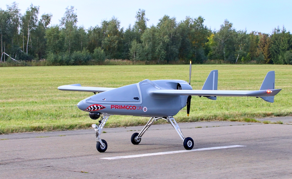
Testing of the Czech Primoco UAV One 150 for the Czech Army
Primoco UAV SE, the Czech company, and the Army of the Czech Republic successfully tested the Primoco UAV One 150 ...

Hexagon revolutionises autonomous reality capture with the launch of the Leica BLK ARC and Leica BLK2FLY
Hexagon AB, a global leader in digital reality solutions, announced the introduction of the Leica BLK ARC and the Leica BLK2FLY, extending ...
Teledyne FLIR Unveils Radiometric Vue TZ20-R Thermal Zoom Drone Payload
High-Resolution Radiometric Gimbaled Thermal Drone Payload for the DJI V2 Matrice 200 Series and Matrice 300 Offers Pixel-by-Pixel Temperature Measurement ...
No posts found.