
When it comes to drone applications, there’s no shortage of opportunities in the oil and gas space. Major players like Anadarko,…
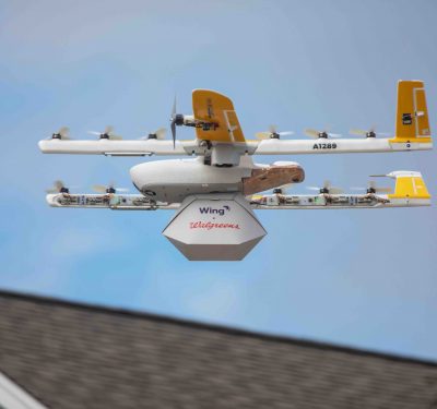
Alphabet’s Wing brings door-to-door drone delivery to the U.S.
Alphabet’s drone-delivery offshoot Wing launched its inaugural commercial drone air delivery trial in the United States last week, making it…
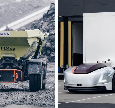
New Business Area Focuses on Autonomous Transport for Volvo
The Volvo Group recently added a new business area that will focus on developing and commercializing autonomous transport solutions. Volvo…
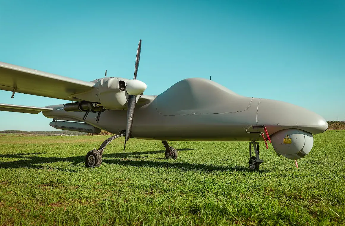
Edmonton International Airport using drones for safety
A different kind of aircraft landed at Edmonton International Airport this past weekend as a highly specialized drone was used…

Toyota Will Supply Up to 20 Autonomous Shuttles for the 2020 Olympics in Tokyo
During the 2020 Olympics in Tokyo, athletes will travel throughout the Olympic and Paralympic villages on low-speed SAE level 4…

Task Force: Federal Help Necessary to Keep Drones Safely Away from Airports
The federal government should devote more funds and manpower to preventing the kind of drone incursion that shut down London…

Ford creates drone research platform with suggested use cases
As the only automaker on the FAA’s Aviation Rulemaking Committee, Ford takes an active and engaged interest in drone development….
Hitec launches Xeno FX
Step aside, DJI and SenseFly—there’s a new player in the mapping and surveying drone market. Meet Hitec Commercial Solutions, the…

Industry Leaders Form Autonomous Vehicle Computing Consortium
Arm, Bosch, Continental, DENSO, General Motors, NVIDIA, NXP Semiconductors and Toyota are working together through a new consortium that’s dedicated…

Fleet of Baidu Self-Driving Taxis Begin Trials in China
The first fleet of 45 Apollo Robotaxis from Baidu recently began trial operations on urban roads in China. The L4…
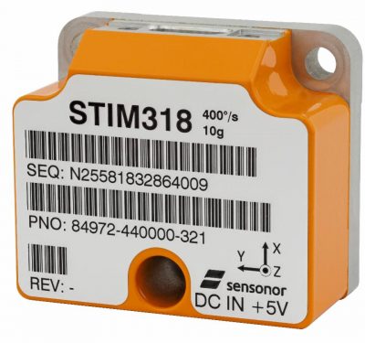
Sensonor Displays New Tactical Grade IMU at AUSA
Sensonor has announced at AUSA in Washington, DC, a new high-accuracy tactical grade Inertial Measurement Unit (IMU) — STIM 318….
Fly Pilotless Before Ride Driverless?
What’s up with that? Merely how one of the earliest pioneers of autonomous automobiles thinks it will all go down. …

Drone Racing League Unveils its First-Ever Autonomous Racing Drone
What do you get when you combine the thrill of Star Wars pod-racing with the adrenaline-filled speed of a Formula…
New Report Offers Insights into the Future of Global Drone-Powered Business Solutions
A new report by LP Information, Inc. (LPI) titled 2018-2023 Global Drone-Powered Business Solutions Market Report (Status and Outlook) offers…
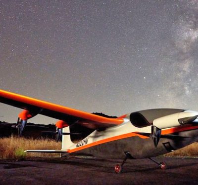
Autonomous Cargo Resupply Operations Meet Critical Milestone
After countless bumper-to-bumper commutes across California’s Silicon Valley, Charles Acknin arrived at the common conclusion that the transportation system is…
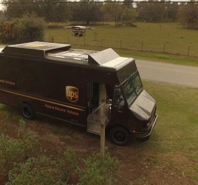
UPS Authorized for BVLOS, Effectively Launching Drone ‘Airline’
UPS, formerly known as the United Parcel Service, announced through its subsidiary UPS Flight Forward that it has received the U.S….

Updated LORD Corporation Sensing Software Offers Inertial Product Support for Optimal User Experience
LORD Corporation, a global provider of sensing systems, has released the latest version of its SensorConnect™ sensing software, featuring significant…

Monitoring Hurricanes, Protecting Our Coastlines
Unmanned platforms are capturing critical hurricane data forecasters haven’t had access to before, while drones are also being deployed to ...

Op-Ed: The Role of ADS-B in Preventing Mid-Air Collisions
Editor's Note: Christian Ramsey, uAvionix Chief Commercial Officer, provides context on existing technological safeguards that can help prevent aircraft collisions ...

TERMINUS: A Climate Research Expedition
The TERMINUS expedition to Greenland is uncovering critical data on glacier-ocean interactions and sedimentation at glacier termini, offering new insights ...

AUVSI Applauds Legislation Supporting Drones Grants for Law Enforcement
On behalf of the Association for Uncrewed Vehicle Systems International (AUVSI), President and CEO Michael Robbins issued the following statement ...
TEKEVER Partners with IMSAR to Advance Radar Technologies and Data Processing Solutions
TEKEVER, a European provider of unmanned aerial systems (UAS), has announced a two-year partnership agreement with IMSAR, a US-based company ...
No posts found.
No posts found.
No posts found.