A supply chain security framework that began with a sweeping December 2025 prohibition on foreign-produced UAS is now generating its…
Engineering & Design
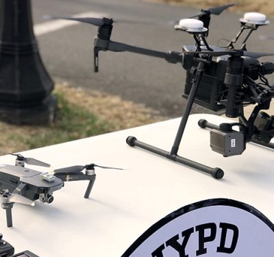
NYPD Stands Up Permanent Counter-Drone Unit Under Safer Skies Act
The New York City Police Department has stood up a permanent counter-unmanned aircraft system (C-UAS) unit with authority to electronically…
Drone Dominance Program Qualifies 48 Companies For Gauntlet 2 Trials
The Pentagon’s Drone Dominance Program (DDP) has issued a dramatically expanded list of participants for its second competitive Drone Dominance…
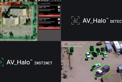
AeroVironment Expands AV_Halo Platform with INSTINCT and DETECT at SOF Week
AeroVironment used SOF Week in Tampa to announce two new additions to its AV_Halo unified mission software platform: AV_Halo INSTINCT,…

Teledyne FLIR Upgrades Rogue 1 Block 2 with Extended Range, Larger Warhead
Teledyne FLIR has unveiled an improved Block 2 variant of its Rogue 1 quadcopter enabling the loitering munition to strike…

Unmanned, Autonomy, and Counter-UAS on the Tampa Agenda: What to Watch at SOF Week 2026
Live demonstrations along the Riverwalk, an expanded outdoor program, and a session track built around autonomy and interoperability put unmanned…
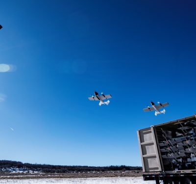
DZYNE Unveils Blitz Hand-Launch UAS With 93-Mile Strike Range
While America’s drone industry has fixated on first-person view quadcopters like those swarming Ukrainian battlefields, DZYNE Technologies is bucking the…

SOF Week 2026 Returns to Tampa as Acquisition Speed Becomes the Industry Test
USSOCOM’s annual gathering convenes May 18–21 at the Tampa Convention Center, with a program built around the affordable-mass, attritable-systems, and…

Anatomy of an American Autonomy System on a Chip
How Hyfix’s H1 brings the autonomy stack into a single architecture—making autonomous systems more trusted, more scalable, and better suited…

Shield AI, Thunder Tiger Sign MOU to Bring Hivemind to Taiwan USV Fleet
Shield AI and Taiwan-based Thunder Tiger Corp. have signed a memorandum of understanding to integrate Shield AI’s Hivemind autonomy software…

Trimble Targets Drone Delivery Integration with Smart Antenna Enclosure for PX-1 RTX
Trimble has released a smart antenna enclosure option for its PX-1 RTX positioning solution, packaging centimeter-level GNSS-inertial hardware with an…

Five Good Questions: MatrixSpace
Matthew Kling is VP and General Manager of AI Systems at MatrixSpace, leading development of the AiCloud and AiEdge platforms. He…

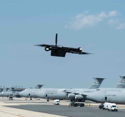
JIATF-401 Selects Five Installations for Directed-Energy C-UAS Pilot
Joint Interagency Task Force 401 has selected five military installations to host a directed-energy counter-UAS pilot program authorized under the…
Army Expands Company-Level SUAS Portfolio with Three Additional Systems
The U.S. Army has selected three additional vendor solutions for its company-level Small Unmanned Aircraft System portfolio, expanding the program…

Counter-UAS: The Price of the Shot
How Western militaries are trying to restore a sustainable cost-exchange ratio against cheap drones The announcement out of BAE Systems’…
Ukraine Building Drone Industry Under Fire
Four years of war have produced one of the most dynamic defense technology ecosystems in the world. Now Ukraine is…
FAA Releases Section 2209 NPRM, Two-Tier Framework for Drone Restrictions Around Critical Infrastructure
The Federal Aviation Administration on May 6 published a Notice of Proposed Rulemaking that would, nearly a decade after Congress…
