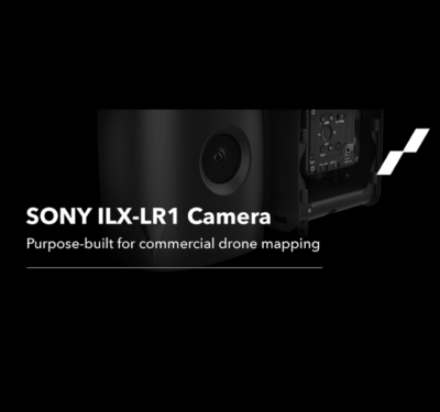
Munich-Based Drone Manufacturer Elevates Trinity Pro Capabilities with SONY’s ILX-LR1 Camera, Meeting Surging Demand for High-Resolution Aerial Imaging Quantum-Systems GmbH,…
Mapping
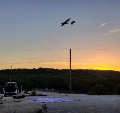
Event 38 Unmanned Systems Uses E400 Drone to Map Turks and Caicos Islands
Event 38 Unmanned Systems, which manufactures American-made mapping drones, said its E400 fixed-wing drone was used to collect aerial imagery and mapping data in Turks and Caicos.

Drones Mapping the Faces of America’s Buildings
Structural facades help buildings resist weather, fire, thermal and acoustic threats, but require regular inspections as they age—and drones can make that process safer and less expensive.

Mapping the Big Basin
The California nonprofit CyArk uses drones, LiDAR and GNSS equipment to 3D scan and model cultural heritage sites to help tell their stories. Increasingly, that mission means recording the effects of climate change.
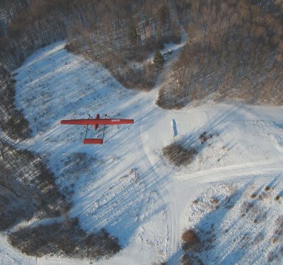
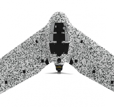
Event 38 Unmanned Systems Releases E400 Fixed-Wing VTOL Mapping Drone
Event 38 Unmanned Systems recently introduced the E400, a fixed-wing VTOL mapping drone with a payload capacity of 3 pounds….
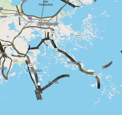
Direct Georeferencing Speeds Aerial Mapping Imagery for Hurricane Relief
Applanix and the National Oceanic and Atmospheric Administration (NOAA) recently collaborated to provide critical information to first responders in the…
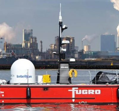
A New Generation of Uncrewed Surface Vessels Cruises the North Sea from the Netherlands
Fugro’s Blue Essence, an offshore certified uncrewed surface vessel (USV) with an electric remotely operated vehicle (eROV), will begin its…

Seeing the Forest AND the Trees: Drone Self-Navigation at Speed in Complex Environments
Harnessing onboard sensing and computing capabilities to autonomously maneuver at high speed in obstacle-laden environments constitutes the next major hurdle…
For PNT Integration, Timing Is Everything. Inertial Supplies It.
GPS + inertial + camera + LiDAR + baro-altimeter = a very precise measurement, right? Not when the respective sensor…

How to Take the Guesswork Out of BVLOS UAV Mission Planning
Situational awareness and risk assessment are key to UAV mission planning in both dense urban areas and, surprisingly, in open-sky…
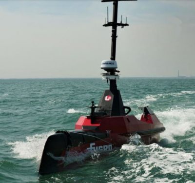
Blue Shadow Autonomous Hydrography Vessel
The Fugro Blue Shadow is a 9-meter long uncrewed surface vessel designed to increase data acquisition efficiency and accelerate hydrographic…
senseFly Releases eBee TAC UAS
The new eBee TAC fixed-wing UAS from senseFly is optimized for enhanced tactical mapping. The portable UAS weighs 3.5 pounds…
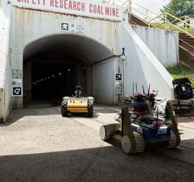
Multi-Million Dollar Subterranean Challenge for Autonomous Robots Training for Response
Eight teams have qualified for the DARPA Subterranean (SubT) Challenge Systems Competition Final Event. On September 21-23, 2021, the teams’…
senseFly Introduces eBee Geo Fixed-Wing Mapping Drone
senseFly recently launched the eBee Geo, an option for surveyors and GIS professionals who are new to deploying fixed-wing drones…

New OEM Hardware/Software for Direct Georeferencing of Airborne Sensor Data
Applanix and Trimble showcase the Trimble AP+ Air OEM solution for Direct Georeferencing of airborne sensor data at the recent…
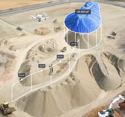
Propeller’s UAS Perspective
Rory San Miguel is the CEO of Propeller, a 3D cloud-based visualization and analytics solution, who launched some certitudes about…
