
Measure, an intelligent technological solutions provider headquartered in Belo Horizonte, Brazil, has announced they are now offering Microdrones Surveying Equipment…
Mapping
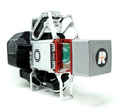
GeoCue Introduces New UAS LiDAR Systems
GeoCue recently released the True View 615 and True View 620 UAS LiDAR/imagery 3D imaging systems. Both are equipped with…
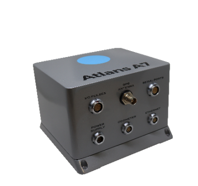
iXblue’s Atlans INS Selected for OGI’s Mobile Mapping LiDAR Solution
iXblue’s Atlans Inertial Navigation System (INS) will provide uninterrupted data georeferencing to Oceanographic & Geophysical Instruments Inc.’s (OGI) new mobile…

Microdrones aaS Offers Greater Accessibility, Affordability
Microdrones, the global aerial mapping technology company, is rolling out a major initiative. MdaaS—Microdrones as a Service—provides a broader market…

Satellite 2020 Covers GNSS, GPS, Geospatial Intelligence and More
The Satellite 2020 conference convenes March 9–12 in Washington, DC, with an industrial exhibition running March 10–12.

Reality Drones: Surveyors Rise to Work Challenges in Video Series
A new online video series and free webinar document the real-life challenges and hazards that professional surveyors encounter using drones…

New Companies Invest HERE for Asia-Pacific Autonomous Ventures
Two Japanese companies will jointly take a 30% ownership stake in Netherlands-based HERE.

Advanced LiDAR-on-Chip Builds HD Maps for Autonomy
Draper has advanced its development of a LiDAR-on-a-chip using patented, all-digital MEMS optical switches for light beamsteering to gather the…

Catalonia Gets Autonomous-Ready
Barcelona’s Autonomous Ready project takes advantage of a fleet of cars equipped with Mobileye driver assist systems to map its…
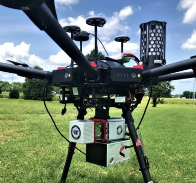
LiDARUSA Puts Safety First With Drone Rescue Systems
LiDARUSA has announced the option of the Drone Rescue Systems parachute system with all DJI M600 UAV sales. As UAV’s…

Army Wants a Tunnel Mapper Usable on an Unmanned System
The Army is looking for off-the-shelf technology able to produce real-time maps of tunnels where GPS signals cannot be counted…
DJI Introduces Software for 3-D Modeling, Mapping
DJI has introduced new data visualization software called DJI Terra, which can generate 3-D models and maps from raw data…

Quite a Summer for Embry-Riddle UAS Science Students
It was quite a summer for the Embry-Riddle Aeronautical University (ERAU) students, who traveled both to Oklahoma and to Kosovo…
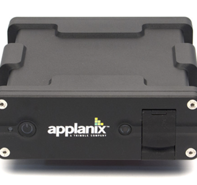
Linkfast to Provide Applanix Products, Solutions for Land and Air Mobile Mapping Customers in Taiwan
Applanix, a Trimble Company, announced last week that Linkfast Technology Co., has been selected to provide products, support and service…

Final Call for State & Future of GEOINT Abstracts
Today (June 29, 2018) is the deadline to submit an abstract to be considered for USGIF’s 2019 State & Future…

Airbus Aerial Conducts Runway Mapping at World’s Busiest Airport
Airbus Aerial, the commercial aerial services business launched by Airbus less than a year ago, continues to expand its market…
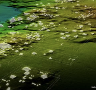
LiDAR Helps to Find Maya Civilization
DENVER—A lost civilization was found in the Guatemalan jungle recently with the help of LiDAR (Light Detection and Ranging) technology….
